Uploads by Neteler
Jump to navigation
Jump to search
This special page shows all uploaded files.
| Date | Name | Thumbnail | Size | Description | Versions |
|---|---|---|---|---|---|
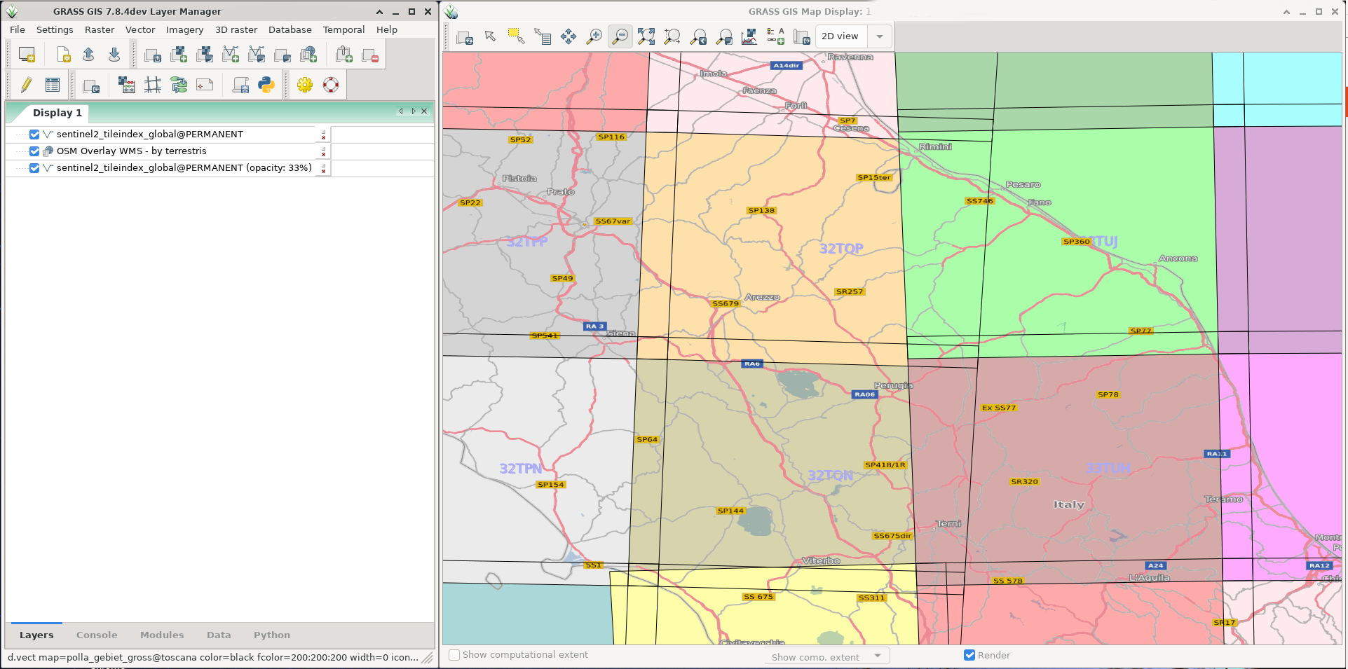
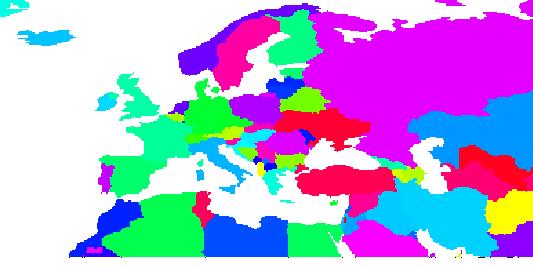
| 15:05, 8 June 2020 | Sentinel2 tiles.png (file) |  |
448 KB | 1 | |
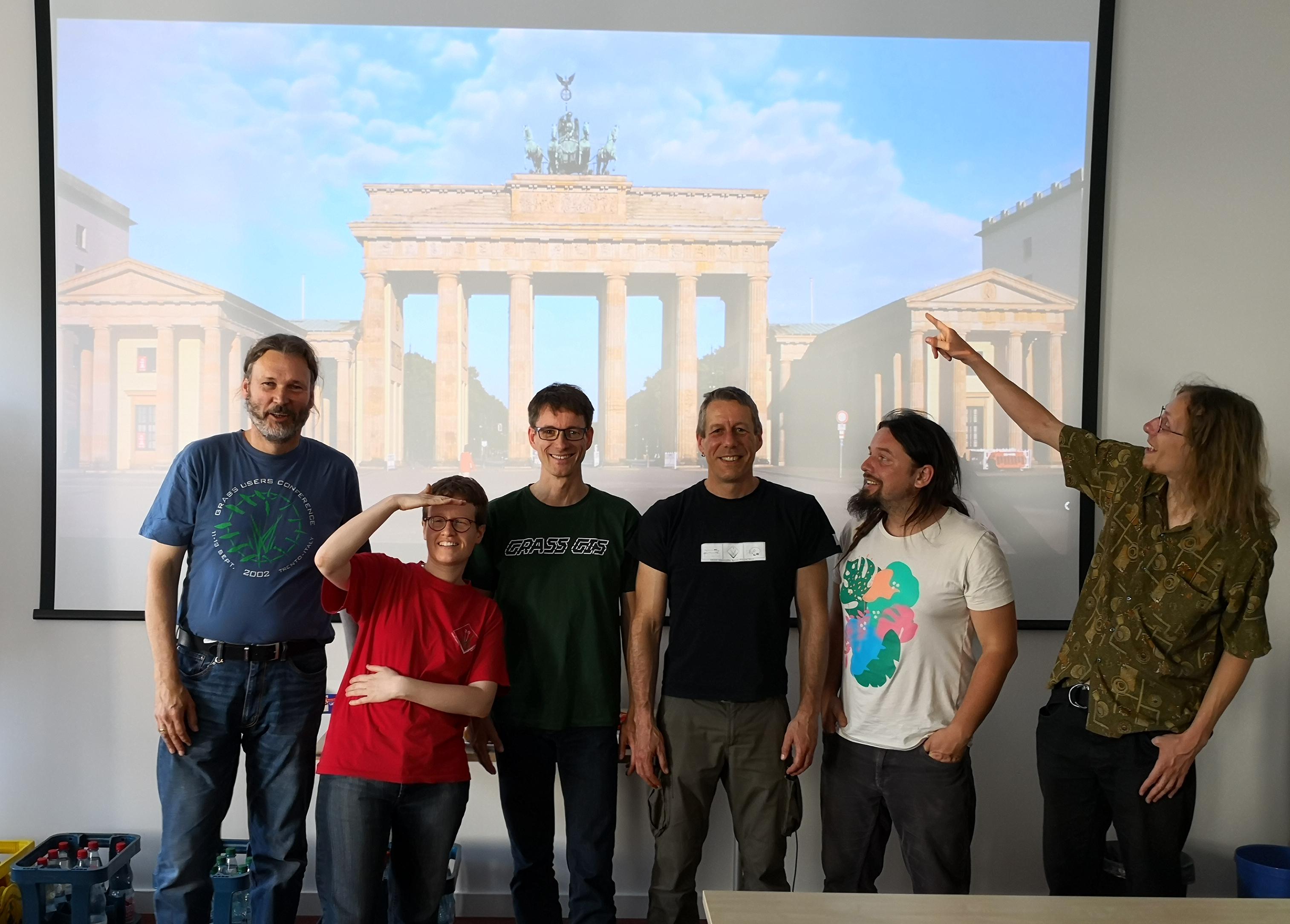
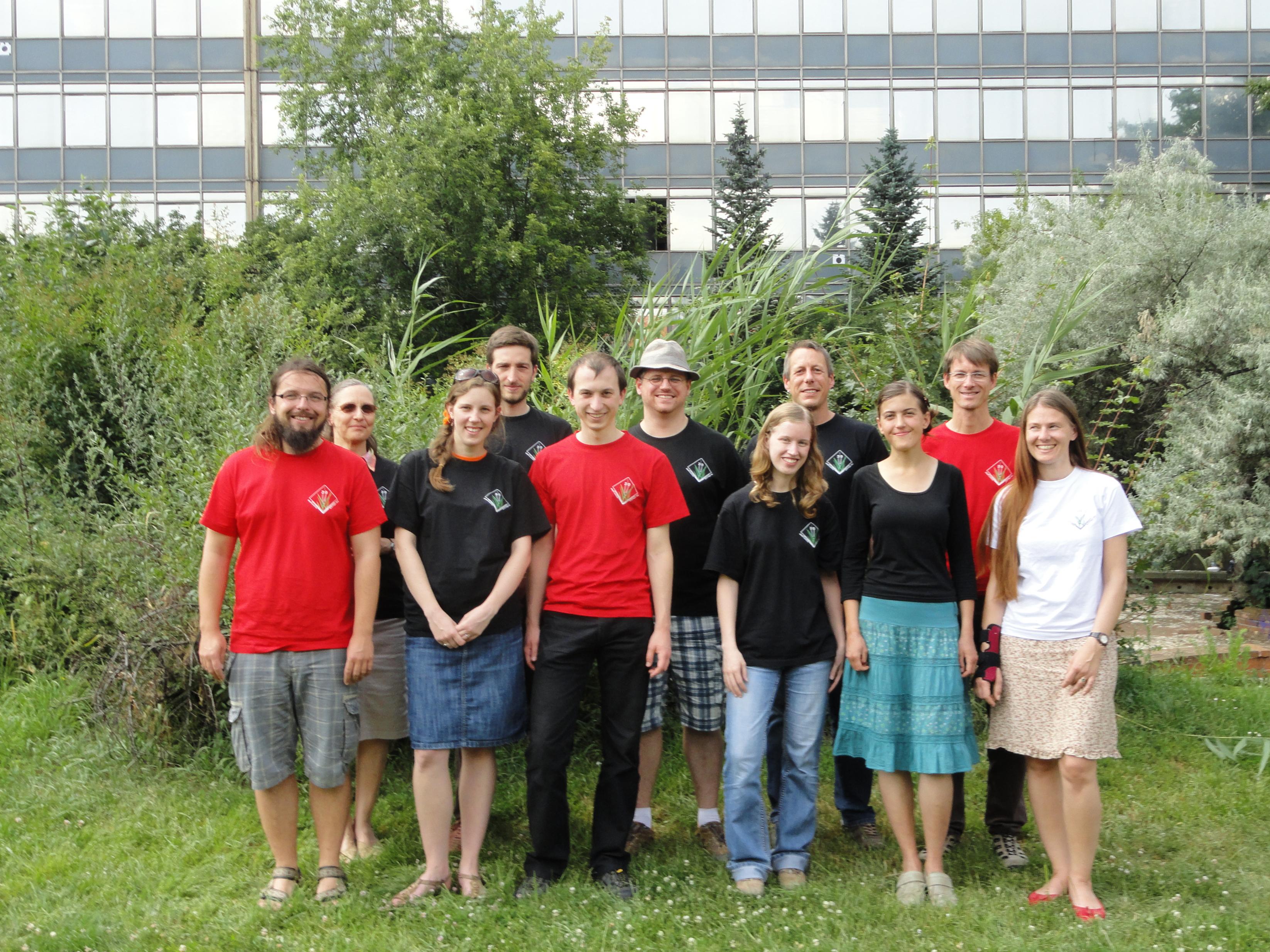
| 15:54, 19 May 2019 | Grassgis 2019 berlin sprint group photo.jpg (file) |  |
461 KB | GRASS GIS community sprinters at DIW Berlin, 2019 | 1 |
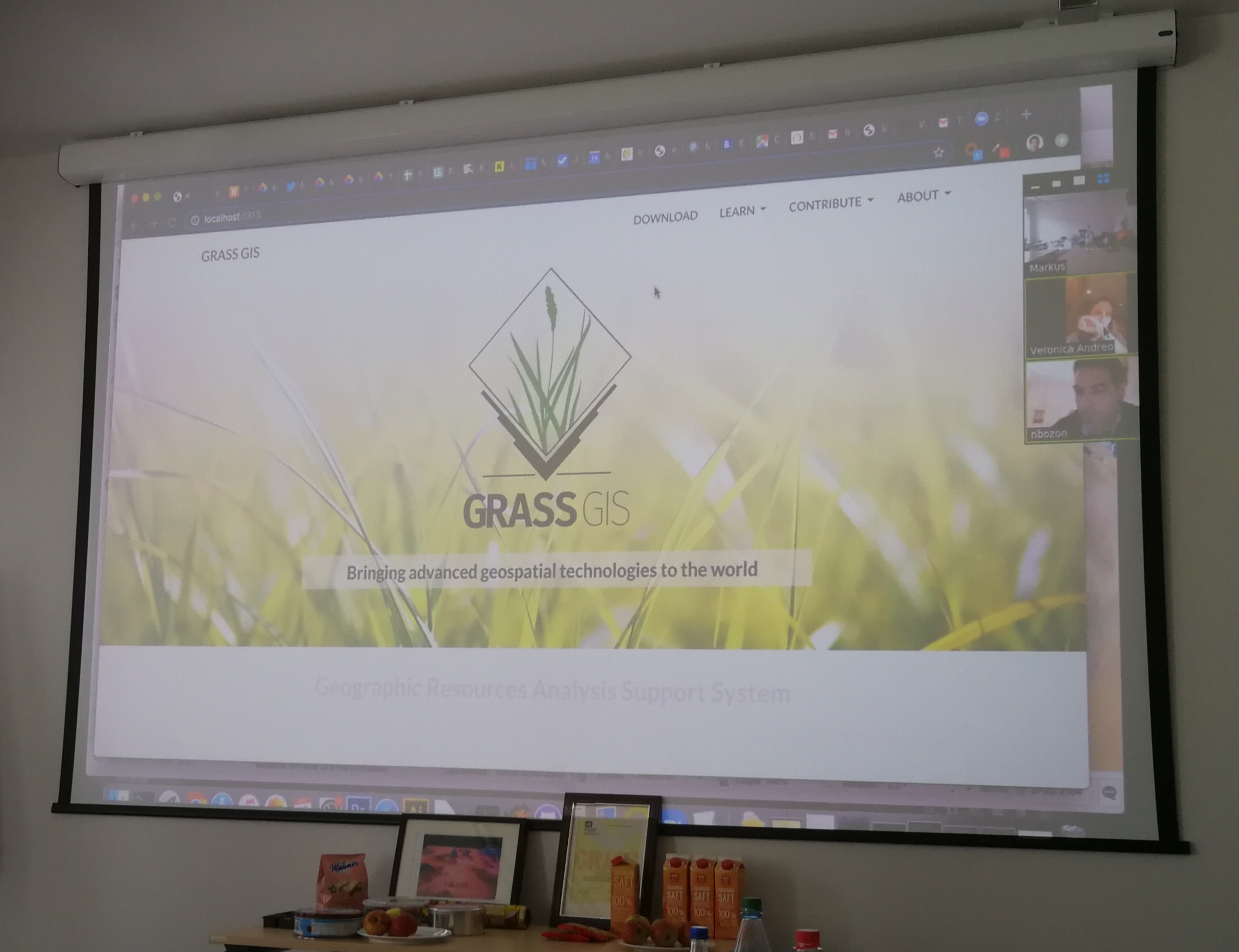
| 15:38, 19 May 2019 | Grass2019 berlin sprint new website.jpg (file) |  |
981 KB | A first glance at the upcoming new GRASS GIS web site, presented by Nicolas Bozon at community sprint 2019 Berlin | 1 |
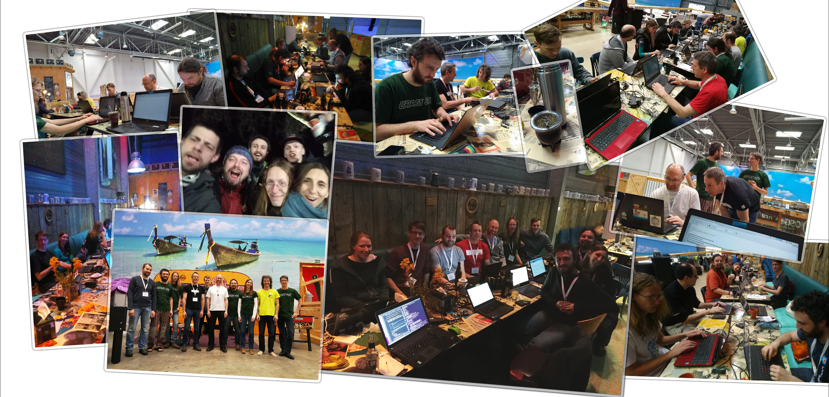
| 21:20, 15 April 2018 | Grass sprint2018 bonn fotowall.jpg (file) |  |
1.38 MB | 1 | |
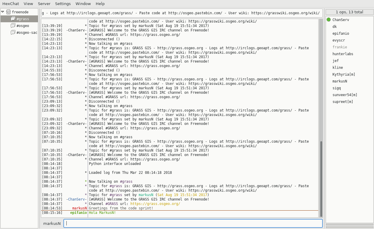
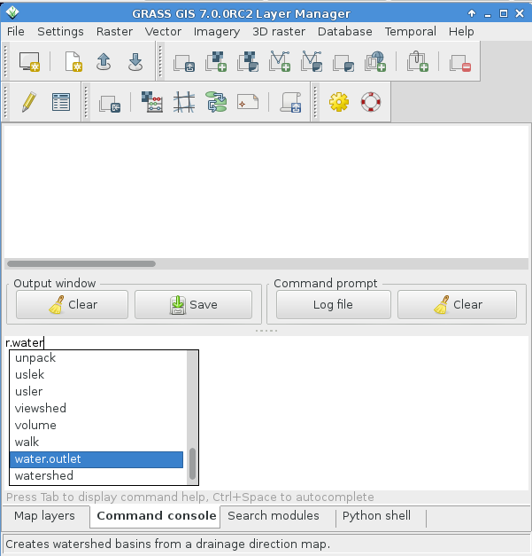
| 07:16, 22 March 2018 | Hexchat IRC client.png (file) |  |
171 KB | 1 | |
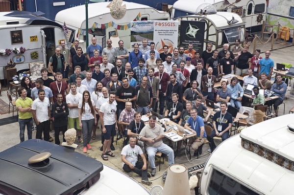
| 09:32, 20 September 2017 | 600px-FOSS4G OSGeo Code Sprint group photo.jpg (file) |  |
147 KB | FOSS4G 2016 Code Sprint, Bonn. Source: https://wiki.osgeo.org/images/thumb/a/a2/FOSS4G_OSGeo_Code_Sprint_group_photo.jpg/ | 1 |
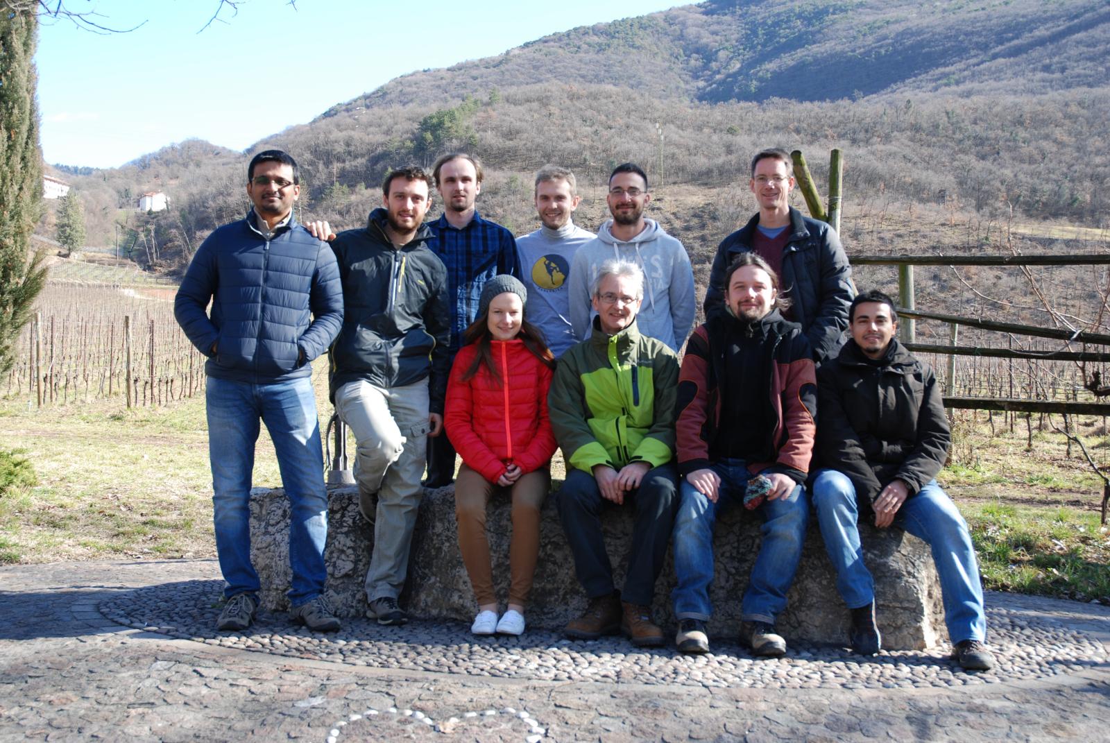
| 17:17, 23 February 2016 | GRASS GIS contributors meetings in San Michele February 2016.jpg (file) |  |
343 KB | 1 | |
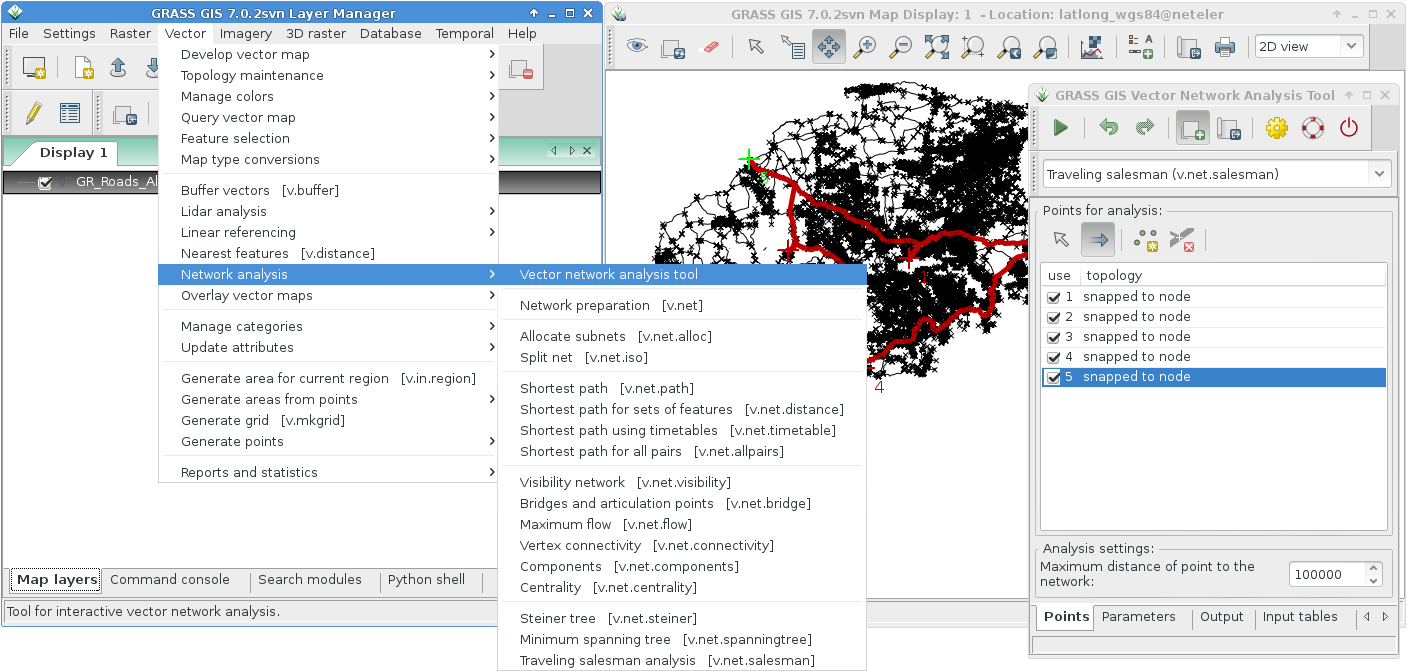
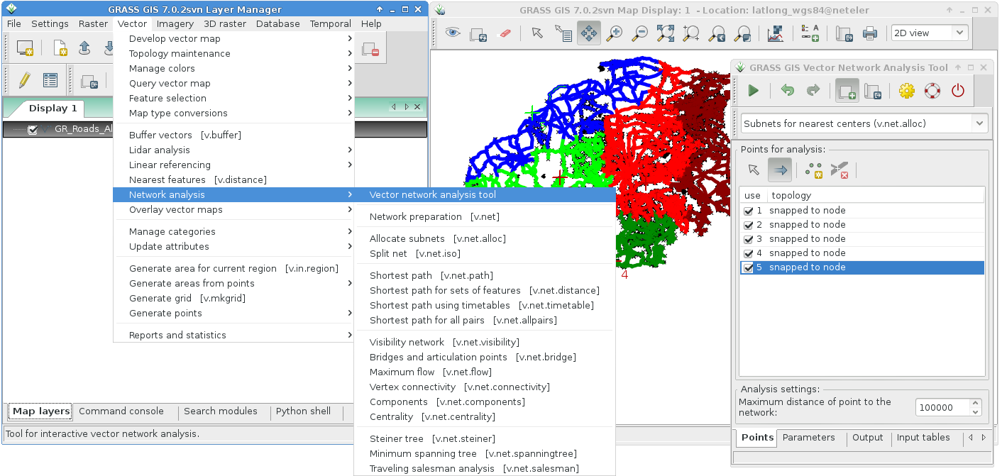
| 15:27, 18 October 2015 | Grass7 vector network tool salesman.png (file) |  |
216 KB | Network analysis tool | 1 |
| 15:26, 18 October 2015 | Grass7 vector network tool alloc.png (file) |  |
211 KB | Network analysis tool | 1 |
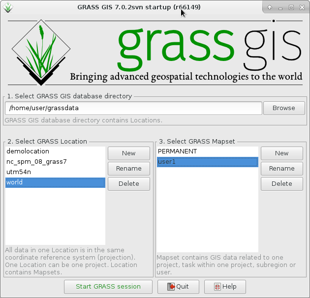
| 10:51, 8 September 2015 | GRASS GIS 70 startup.png (file) |  |
77 KB | udpated | 2 |
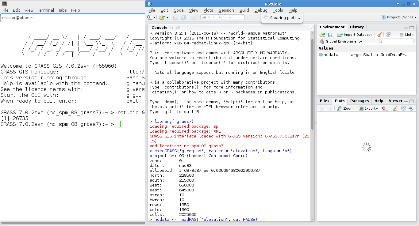
| 13:27, 18 August 2015 | Grass7 rstudio.png (file) |  |
145 KB | RStudio used in GRASS GIS 7 session | 1 |
| 17:47, 20 July 2015 | Community sprint2015 fotowall.jpg (file) |  |
151 KB | GRASS GIS Community Sprint 2015: Como, Italy | 1 |
| 14:52, 14 February 2015 | Wxgui command line.png (file) |  |
44 KB | wxGUI command line | 1 |
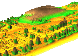
| 08:40, 10 November 2014 | NagsHead.gif (file) |  |
405 KB | ... from http://fatra.cnr.ncsu.edu/temporal-grass-workshop/NagsHead.gif | 1 |
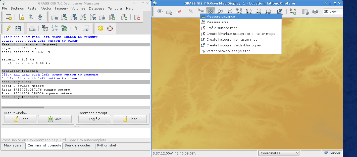
| 20:06, 13 October 2014 | Wxgui map measure tool.png (file) |  |
268 KB | wxGUI: Lines and area measurements | 1 |
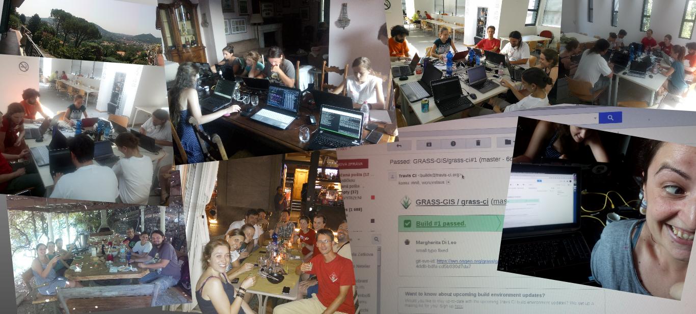
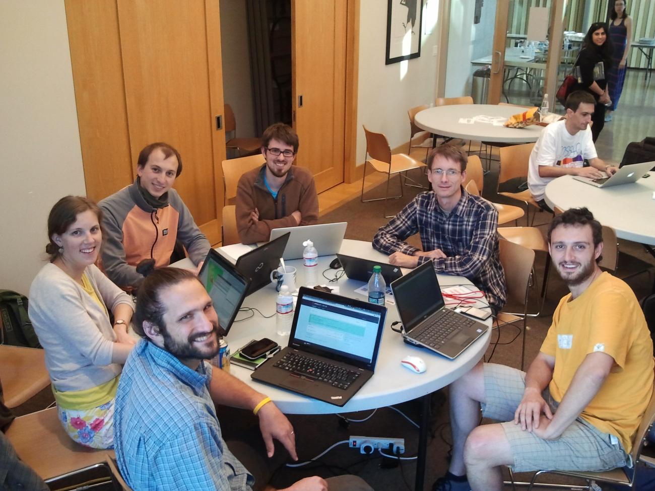
| 01:07, 14 September 2014 | Portland2014 grassgis7 code sprint.jpg (file) |  |
173 KB | GRASS GIS 7 sprint team at FOSS4G 2014, Portland (OR), USA | 1 |
| 11:26, 2 September 2014 | Contour lines from DEM.png (file) |  |
323 KB | 10m contour lines derived from elevation model (NC location) | 1 |
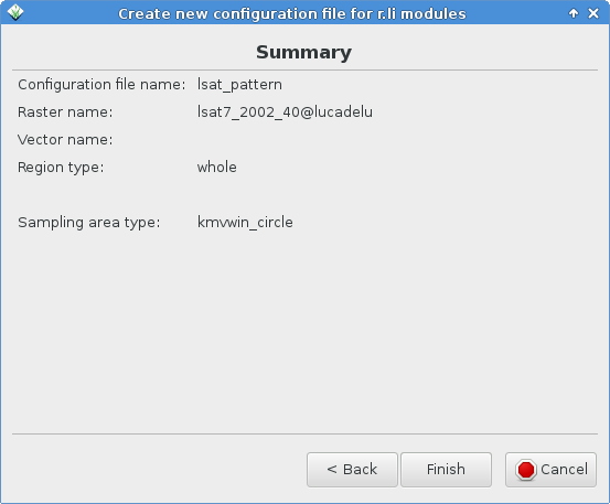
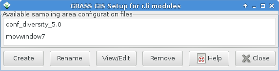
| 15:29, 23 August 2014 | G gui rlisetup 8.png (file) |  |
22 KB | g.gui.rlisetup: Summary frame | 1 |
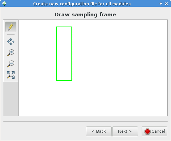
| 15:25, 23 August 2014 | G gui rlisetup 7.png (file) |  |
19 KB | g.gui.rlisetup wizard drawing sampling frame | 1 |
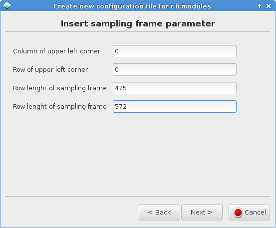
| 15:22, 23 August 2014 | Rlisetup wizard keybord sampling frame.png (file) |  |
23 KB | Updated to recent version | 2 |
| 15:21, 23 August 2014 | G gui rlisetup 5.png (file) |  |
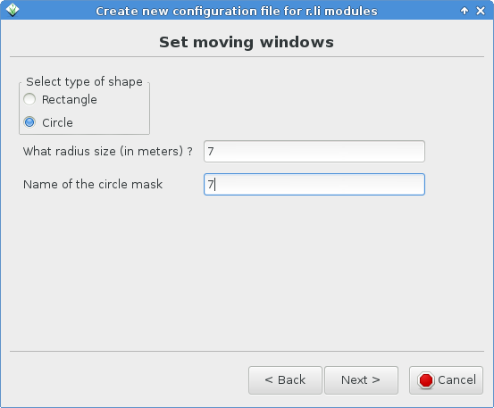
23 KB | g.gui.rlisetup: frame for defining circular moving window | 1 |
| 15:19, 23 August 2014 | G gui rlisetup 4.png (file) |  |
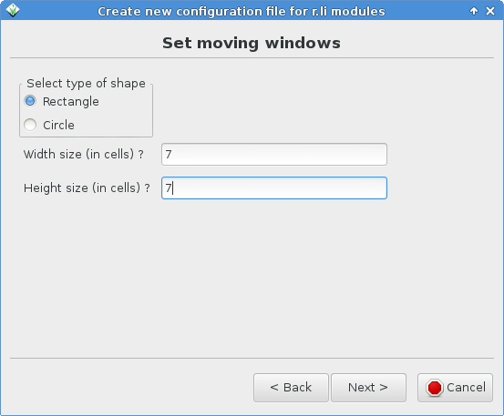
23 KB | g.gui.rlisetup: frame for defining moving window | 1 |
| 15:15, 23 August 2014 | G gui rlisetup 3.png (file) |  |
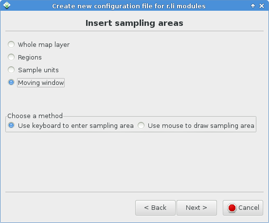
25 KB | g.gui.rlisetup: frame for inserting sampling areas | 1 |
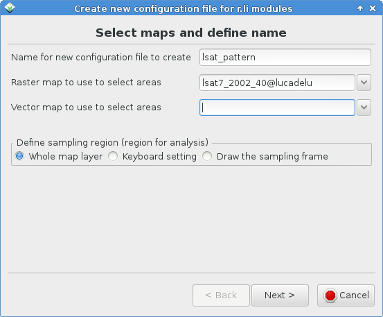
| 15:12, 23 August 2014 | Rlisetup wizard first page.png (file) |  |
32 KB | Updated to recent version | 2 |
| 15:07, 23 August 2014 | Rlisetup first frame.png (file) | 16 KB | Updated to recent version with more buttons | 2 | |
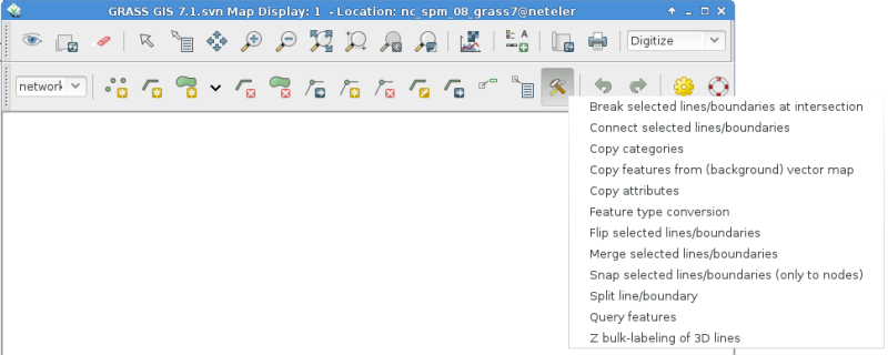
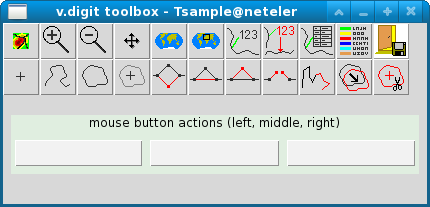
| 08:48, 6 June 2014 | Wxgui-vdigit-toolbar.png (file) |  |
69 KB | Updated screenshot | 2 |
| 22:39, 10 May 2014 | V proj result.png (file) |  |
125 KB | v.proj example: result of LatLong to EU LAEA (EPSG 3035) projection. Use of v.split is mandatory | 1 |
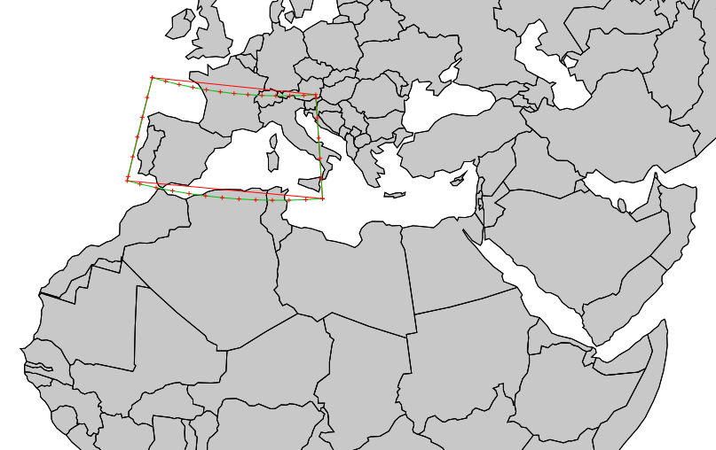
| 22:38, 10 May 2014 | V proj input split boundaries.png (file) |  |
107 KB | v.proj example: Input area data split with v.split to add more vertices (200km here) | 1 |
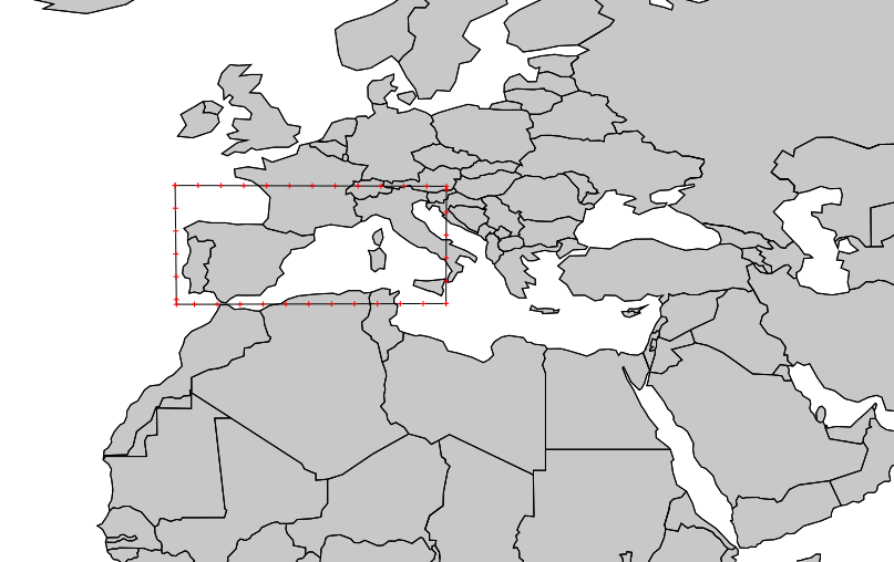
| 22:37, 10 May 2014 | V proj input unsplit boundaries.png (file) |  |
105 KB | v.proj example: Input area data (for this example: v.in.region generated) | 1 |
| 13:59, 27 March 2014 | Vienna2014 code sprint panorama tiny.jpg (file) | 15 KB | See also http://vienna2014.sprint.osgeo.org/2014/03/27/photos.html | 1 | |
| 17:32, 19 January 2014 | OSGeo code sprint2014.png (file) | 123 KB | 1 | ||
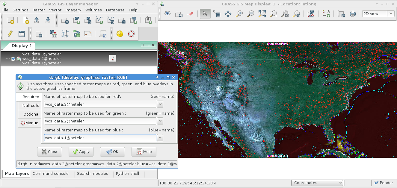
| 22:00, 4 January 2014 | WCS import with r external.png (file) |  |
604 KB | Import of WCS via r.external, display with RGB viewer | 1 |
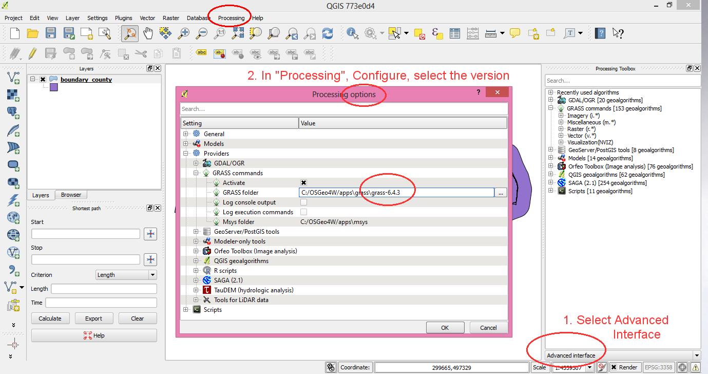
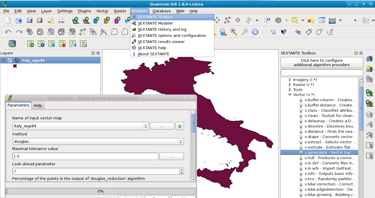
| 19:11, 2 October 2013 | QGIS2.0.1 processing grass version selector.jpg (file) |  |
150 KB | QGIS 2 with GRASS GIS support in "Processing" (former Sextante) | 1 |
| 00:01, 29 July 2013 | Grass gis 30 years logo 500px.png (file) | 50 KB | 30 YEARS OF GRASS GIS - Community Sprint Prague 2013 | 1 | |
| 15:38, 18 July 2013 | 2013-07-grass-community-sprint-prague.jpg (file) |  |
1.12 MB | GRASS GIS community sprint in Prague 2013 - 30 YEARS OF GRASS GIS! http://tinyurl.com/30-years-of-GRASS-GIS | 1 |
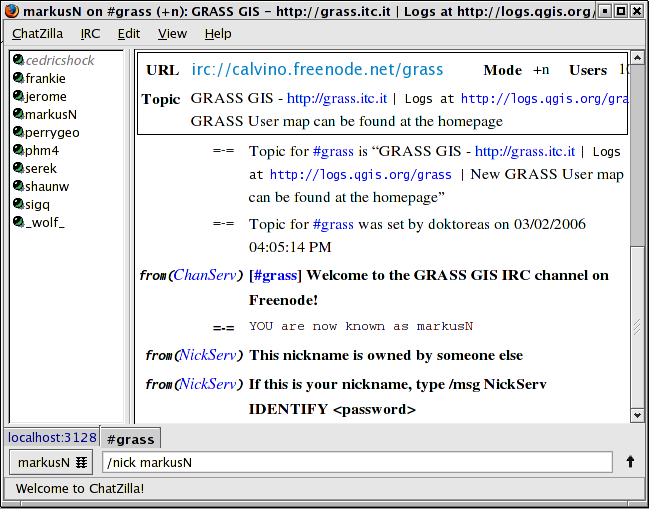
| 08:27, 20 June 2013 | Irc chatzilla.png (file) |  |
62 KB | IRC communication in chatzilla client (for Firefox) | 1 |
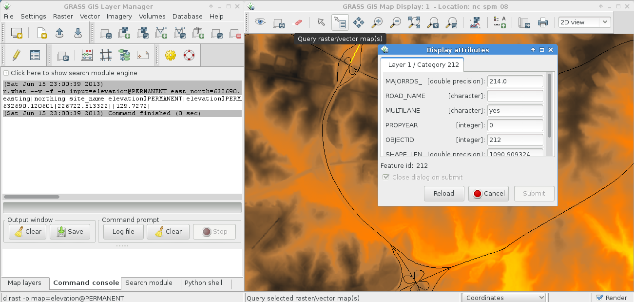
| 21:03, 15 June 2013 | Wxgui map query tool.png (file) |  |
256 KB | Raster and vector map query (select map to query in layer manager) | 1 |
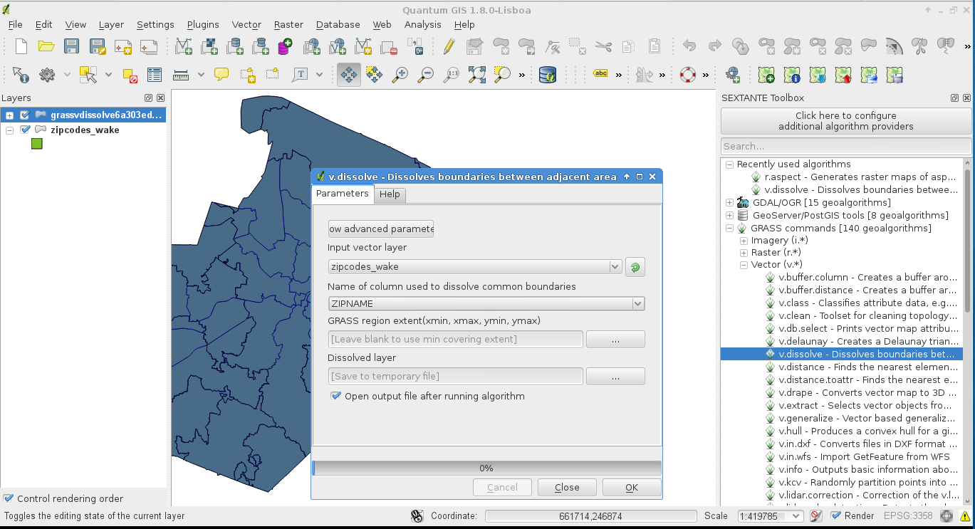
| 21:10, 24 May 2013 | Sextante grass v dissolve.png (file) |  |
211 KB | Vector map dissolving using a string attribute column (GRASS via Sextante in QGIS) | 1 |
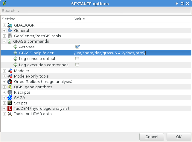
| 20:55, 24 May 2013 | Sextante grass help folder.png (file) |  |
48 KB | Setting the GRASS help manual folder in Sextante | 1 |
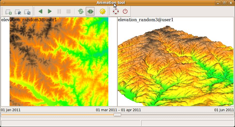
| 20:01, 5 February 2013 | WxGUI animation tool.jpg (file) |  |
85 KB | from manual page | 1 |
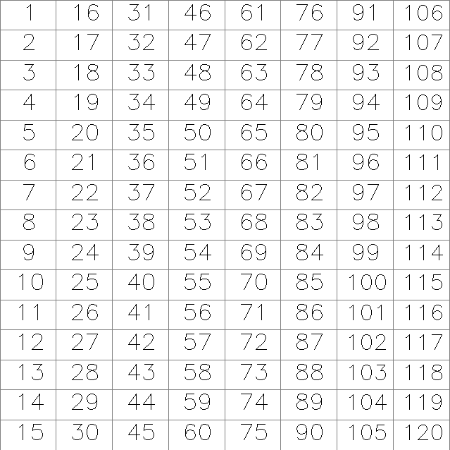
| 19:35, 17 September 2012 | Raster grid seq.png (file) |  |
13 KB | Grid with sequential numbers generated with r.mapcalc | 1 |
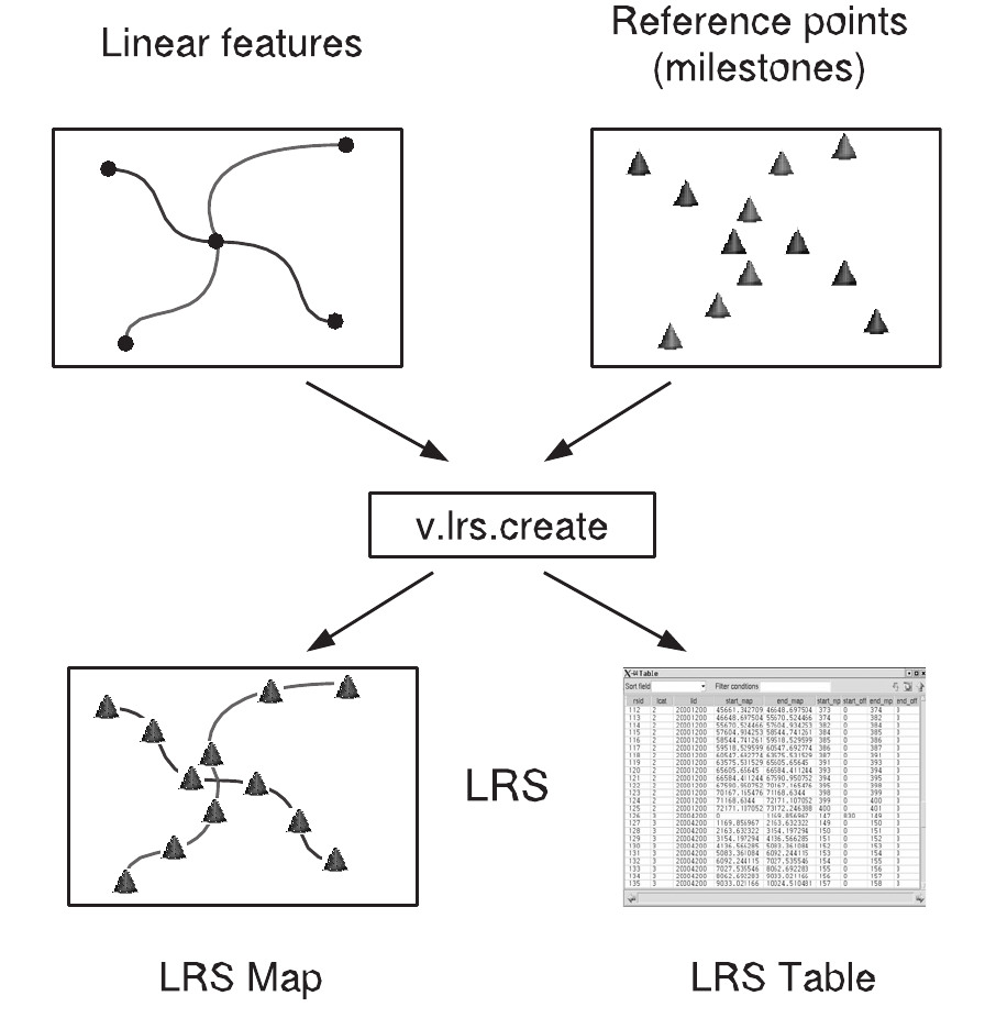
| 09:04, 12 September 2012 | Lrs creation.png (file) |  |
139 KB | Fixed figure | 2 |
| 17:46, 10 September 2012 | V digit tcltk.png (file) |  |
11 KB | Tcl/TK based digitizer (v.digit) in GRASS 6 (old digitizer as of GRASS 6.4) | 1 |
| 09:45, 5 September 2012 | Zones for zonal statistics.jpg (file) |  |
23 KB | Countries as zones for zonal statistics | 1 |
| 16:36, 1 September 2012 | Qgis sextante plugin grass gis.png (file) |  |
165 KB | Sextante-GRASS GIS support in QGIS | 1 |
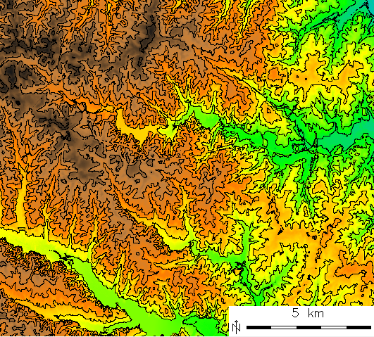
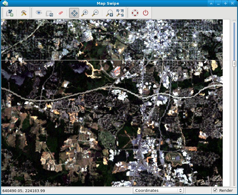
| 20:15, 16 August 2012 | NC landsat map swipe.jpg (file) |  |
189 KB | Comparison of Landsat5/1987 and Landsat7/2002 near Raleigh, NC, USA | 1 |
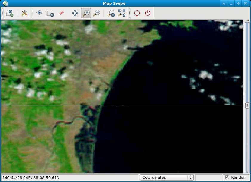
| 10:34, 13 August 2012 | Tsunami japan2011 sendai.jpg (file) |  |
99 KB | Pre and post disaster images of the tsunami in Japan in 2011. The MODIS image taken on February 26, 2011, shows the coastline under normal conditions while the MODIS image on March 13, 2011, shows a clear view of tsunami flooding along the coastline. Wate | 1 |
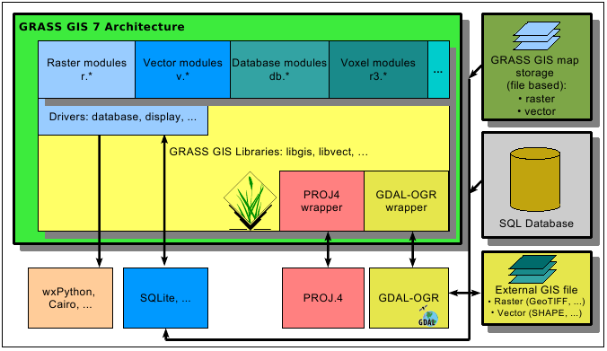
| 19:16, 10 August 2012 | Grass7 arch.png (file) |  |
35 KB | GRASS 7 architecture | 1 |
| 12:15, 16 July 2012 | Markus.jpg (file) |  |
2 KB | 2 | |
| 11:59, 16 July 2012 | Radim.jpg (file) |  |
3 KB | 1 |