Uploads by ⚠️Wenzeslaus
Jump to navigation
Jump to search
This special page shows all uploaded files.
| Date | Name | Thumbnail | Size | Description | Versions |
|---|---|---|---|---|---|
| 01:06, 8 March 2017 | Ncgis logo 2017.png (file) | 4 KB | NCGIS conference 2017 logo http://ncgisconference.com/ | 1 | |
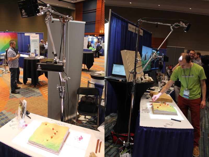
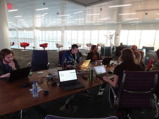
| 01:04, 8 March 2017 | Ncgis2017 ncsu booth tangible landscape.jpg (file) |  |
136 KB | North Carolina State University booth at NCGIS2017: Tangible Landscape (powered by GRASS GIS) Thanks to Anna Klevtcova for providing the photographs. | 1 |
| 21:22, 7 March 2017 | Us-iale logo.jpg (file) | 30 KB | http://baltimore2017.usiale.org/ https://usiale.org/ | 1 | |
| 20:49, 7 March 2017 | Foss4g boston 2017 logo.png (file) | 25 KB | http://2017.foss4g.org/ | 1 | |
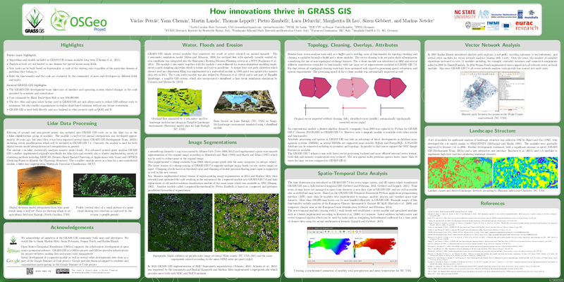
| 01:25, 26 February 2017 | How innovations thrive in GRASS GIS.png (file) |  |
331 KB | Capture from https://trac.osgeo.org/grass/browser/grass-promo/grassposter/2017_NCGIS_How_innovations_thrive/How_innovations_thrive_in_GRASS_GIS.pdf (provided by the author) | 1 |
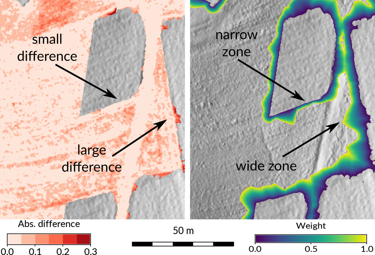
| 00:06, 26 February 2017 | Seamless fusion of high-resolution DEMs from multiple sources.png (file) |  |
718 KB | Taken from https://petrasovaa.github.io/dem-fusion-talk/#/17 (provided by the author) | 1 |
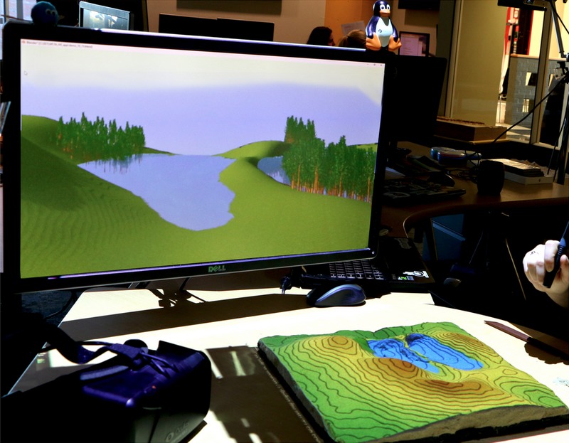
| 23:59, 25 February 2017 | Tangible landscape and blender with water and trees.jpg (file) |  |
121 KB | Taken from https://ncsu-geoforall-lab.github.io/tangible-landscape-talk/ncgis2017#/21 (provided by the author) | 1 |
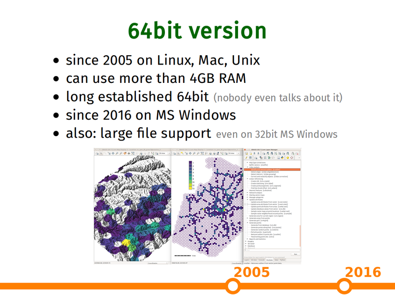
| 22:32, 25 February 2017 | Grass gis as platform presentation 64bit slide.png (file) |  |
271 KB | Capture of https://ncsu-geoforall-lab.github.io/grass-as-a-platform/ncgis2017.html#/15 (provided by the author) | 1 |
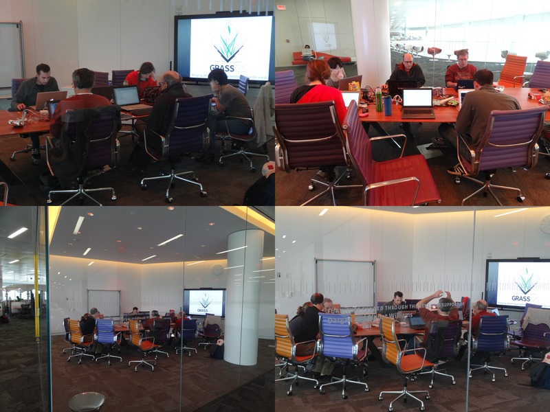
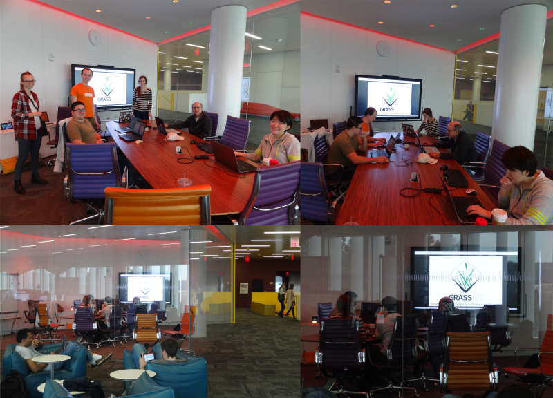
| 00:31, 6 November 2016 | Raleigh 2016 11 05.jpg (file) |  |
118 KB | GRASS GIS meetup, Hunt Library, Raleigh, NC, November 5, 2016 | 1 |
| 02:58, 25 September 2016 | Hunt Library with GRASS GIS logo.png (file) | 219 KB | Create XY location. r.import input=hunt.jpg output=hunt g.rename raster=hunt.1,hunt_red g.rename raster=hunt.2,hunt_green g.rename raster=hunt.3,hunt_blue g.region rast=hunt_red i.pca input=hunt_red,hunt_green,hunt_blue out=hunt_pca g.copy rast... | 1 | |
| 19:38, 5 August 2016 | Isprs prague meetup.jpg (file) |  |
63 KB | Photos taken during ISPRS Prague meetup 2016 in CTU FCE Atelier D and Pracovna Café | 1 |
| 01:07, 9 June 2016 | Grass meetup 2016 03 19.jpg (file) |  |
131 KB | GRASS GIS Raleigh meetup, March 19, 2016, The Hunt library | 1 |
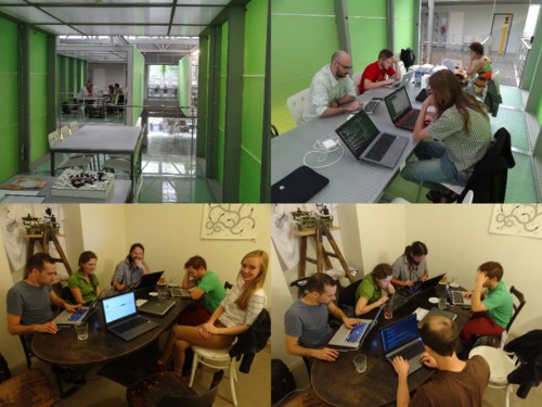
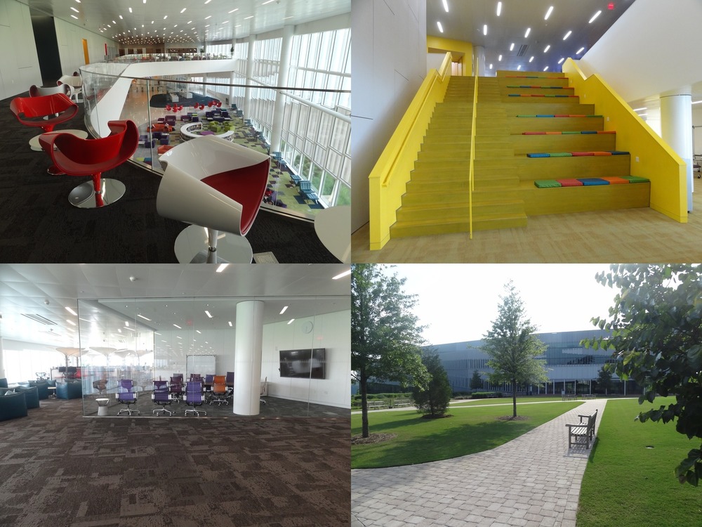
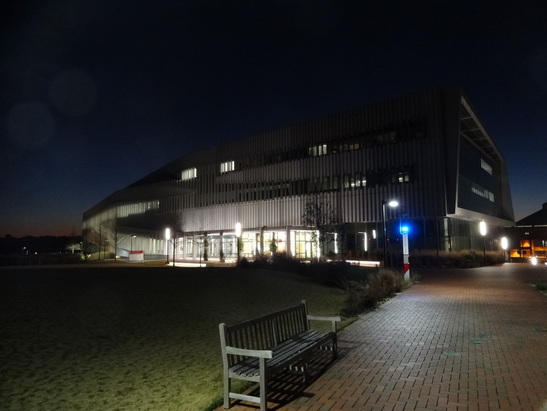
| 00:45, 9 June 2016 | Hunt library spaces.jpg (file) |  |
206 KB | Spaces in the NC State Hunt library and the building from outside. Empty Fish bowl after the GRASS GIS Raleigh meetup and almost empty library during the summer. | 1 |
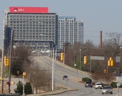
| 02:05, 21 April 2016 | Red hat raleigh.jpg (file) |  |
43 KB | Red Hat Tower in Downtown Raleigh | 1 |
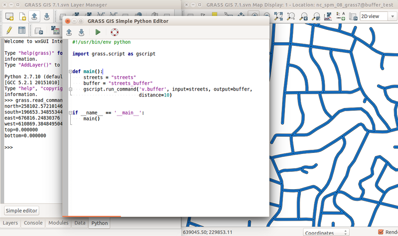
| 16:59, 29 February 2016 | Simple python editor v buffer.png (file) |  |
235 KB | Prototype of GRASS GIS Simple Python Editor with Python tab with interactive Python shell and computed buffer for streets vector (v.buffer) in the background. | 1 |
| 16:54, 29 February 2016 | Tangible landscape termite game.jpg (file) |  |
117 KB | https://geospatial.ncsu.edu/osgeorel/tangible-landscape.html | 1 |
| 16:49, 29 February 2016 | Range on ground from north.png (file) |  |
578 KB | Range of z coordinates displayed on ground Author: Vaclav Petras http://wenzeslaus.github.io/grass-lidar-talks/ Dataset: Nantahala NF, NC: Forest Leaf Structure, Terrain and Hydrophysiology http://dx.doi.org/10.5069/G9HT2M76 | 1 |
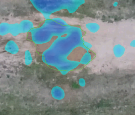
| 16:43, 29 February 2016 | Jeziorska uav grass puddle mar 18.png (file) |  |
207 KB | Comparison of simulated surface water flow and puddle in orthophoto Justyna Jeziorska, Helena Mitasova, Anna Petrasova, Vaclav Petras, Darshan Divakaran, Thomas Zajkowski (2016): Overland flow analysis using time series of sUAS-derived elevation model... | 1 |
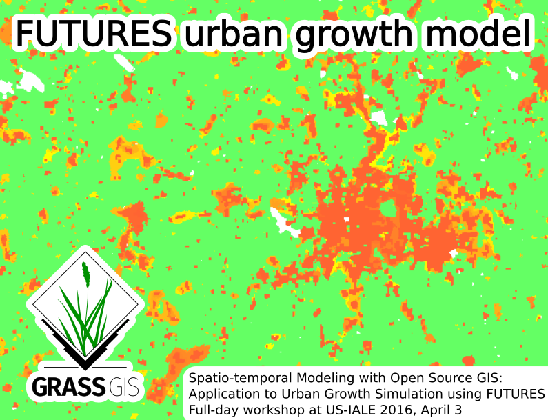
| 20:03, 24 February 2016 | Futures grass gis asheville.png (file) |  |
260 KB | Picture for Spatio-temporal Modeling with Open Source GIS: Application to Urban Growth Simulation using FUTURES workshop at US-IALE 2016 Annual Meeting in Asheville, NC, USA. | 1 |
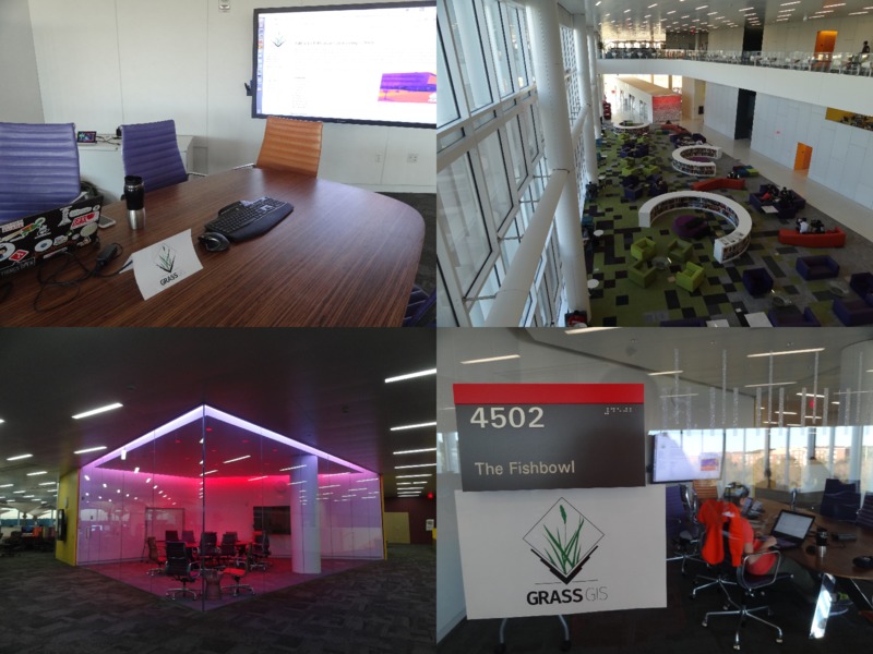
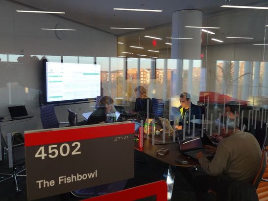
| 00:00, 21 February 2016 | Grass gis raleigh meetup feb20 2016.png (file) |  |
721 KB | Four photos from GRASS GIS Raleigh meetup, February 20, 2016. The Fishbowl room inside and from outside with the participants, visitors and people around in the Hunt library. | 1 |
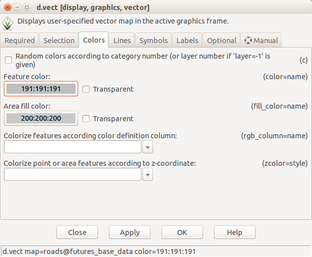
| 18:07, 12 February 2016 | Futures anim vector set color.png (file) |  |
47 KB | Set vector layer color using d.vect dialog | 1 |
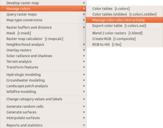
| 18:06, 12 February 2016 | Futures anim start raster color.png (file) |  |
43 KB | Manage color table interactively in the Raster menu | 1 |
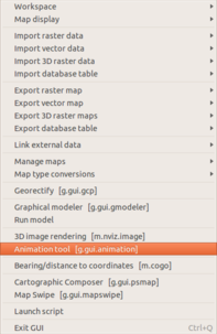
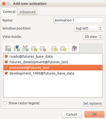
| 18:05, 12 February 2016 | Futures anim start animation tool.png (file) |  |
36 KB | Start animation from the file menu | 1 |
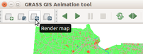
| 18:04, 12 February 2016 | Futures anim render animation.png (file) |  |
19 KB | (Re-)render animation in the animation tool | 1 |
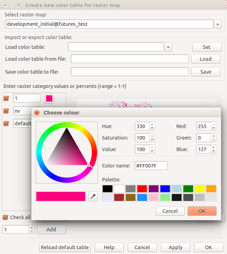
| 18:03, 12 February 2016 | Futures anim raster set color.png (file) |  |
63 KB | Set color for category using interactive color table editing tool | 1 |
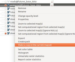
| 18:02, 12 February 2016 | Futures anim make copy.png (file) |  |
40 KB | Copy raster map to the current mapset using layer context menu | 1 |
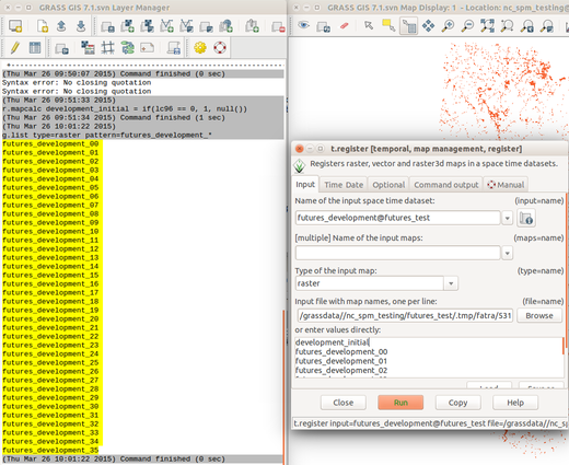
| 18:00, 12 February 2016 | Futures anim list maps.png (file) |  |
148 KB | List raster maps by patterns for t.register | 1 |
| 17:59, 12 February 2016 | Futures anim animation time series.png (file) |  |
14 KB | Animation tool: select time series | 1 |
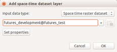
| 17:58, 12 February 2016 | Futures anim animation layers.png (file) |  |
30 KB | 1 | |
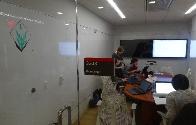
| 01:08, 31 January 2016 | Room3208 jan30.jpg (file) |  |
56 KB | GRASS GIS Raleigh meetup, January 30, Hunt lib, room 3208 | 1 |
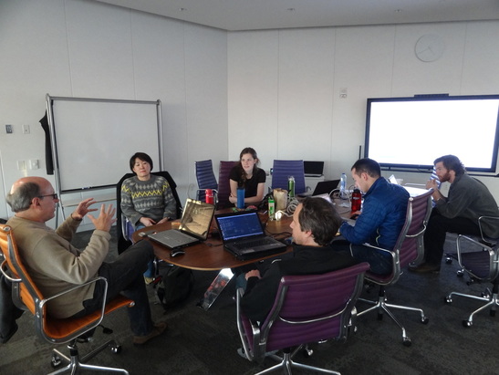
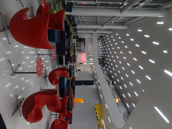
| 01:34, 20 December 2015 | Hunt fishbowl 2015 3.jpg (file) |  |
95 KB | Christmas GRASS GIS potential contributors meeting in Raleigh | 1 |
| 01:34, 20 December 2015 | Hunt fishbowl 2015 2.jpg (file) |  |
95 KB | Christmas GRASS GIS potential contributors meeting in Raleigh | 1 |
| 01:34, 20 December 2015 | Hunt fishbowl 2015 1.jpg (file) |  |
101 KB | Christmas GRASS GIS potential contributors meeting in Raleigh | 1 |
| 01:33, 20 December 2015 | Hunt 2015 2.jpg (file) |  |
80 KB | The Hunt library (Raleigh, NC) | 1 |
| 01:33, 20 December 2015 | Hunt 2015 1.jpg (file) |  |
98 KB | Inside the Hunt library (Raleigh, NC) | 1 |
| 16:26, 11 November 2015 | Three datasets with instructions.png (file) |  |
151 KB | Example analysis in three regions | 1 |
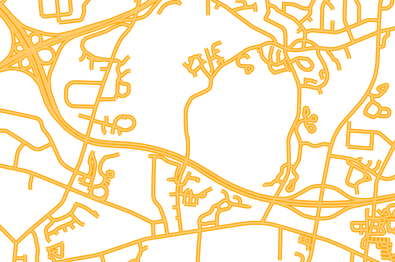
| 20:36, 21 August 2015 | Vector lines roads.png (file) |  |
149 KB | Display region: n=224288.405674 s=221466.163873 w=633175.457827 e=637430.201148 nsres=10.00794965 ewres=10.01116076 rows=282 cols=425 cells=119850 Commands: d.vect map=streets color=255:204:109 width=4 d.vect map=streets color=255:165:0 w... | 1 |
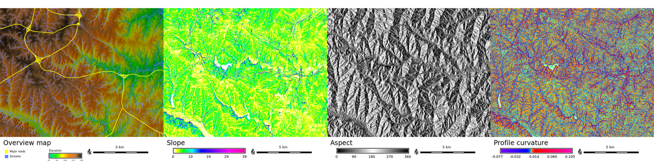
| 03:45, 12 June 2015 | Std dataset pr stripe.png (file) | 1.45 MB | 1 | ||
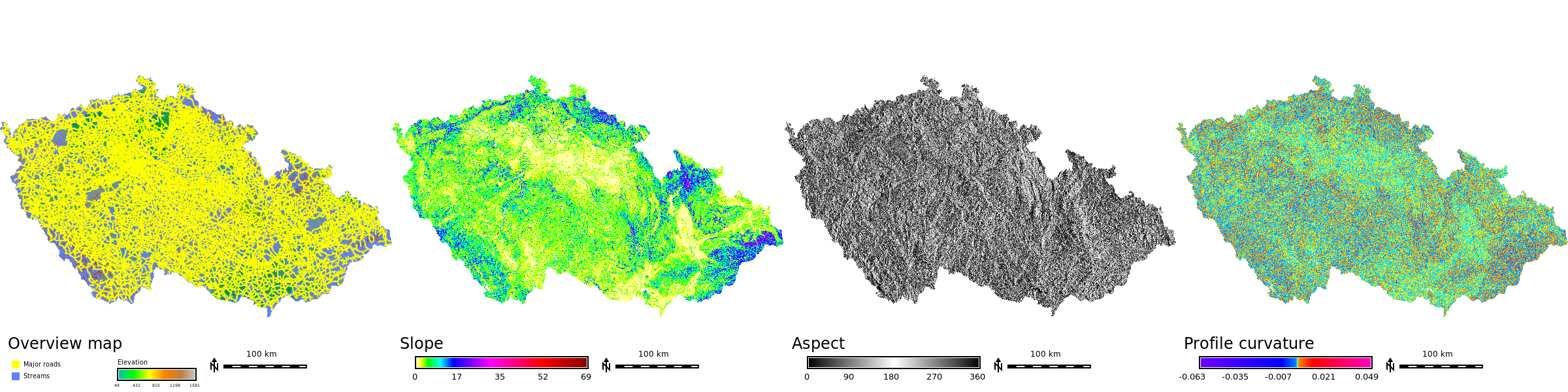
| 03:45, 12 June 2015 | Std dataset cz stripe.png (file) | 1.03 MB | 1 | ||
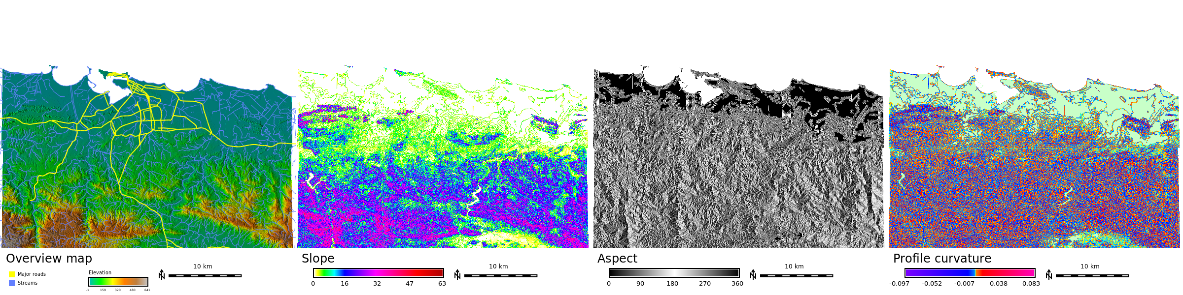
| 03:42, 12 June 2015 | Std dataset nc stripe.png (file) | 837 KB | 1 | ||
| 17:34, 25 March 2015 | Std dataset nc aspect.png (file) |  |
513 KB | http://grass.osgeo.org/download/sample-data/ r.slope.aspect elevation=elevation slope=slope aspect=aspect pcurvature=profile_curvature d.rast aspect d.out.file std_dataset_nc_aspect.png CC BY, GNU FDL | 1 |
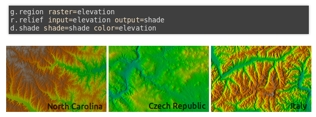
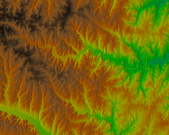
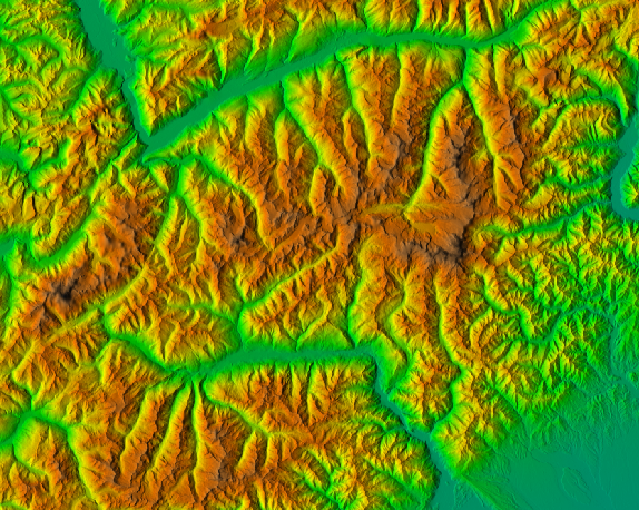
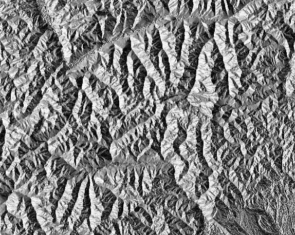
| 17:27, 25 March 2015 | Std dataset nc shaded elevation.png (file) |  |
399 KB | http://grass.osgeo.org/download/sample-data/ r.relief input=elevation output=shade d.shade shade=shade color=elevation d.out.file std_dataset_piemonte_shaded_elevation.png CC BY, GNU FDL | 1 |
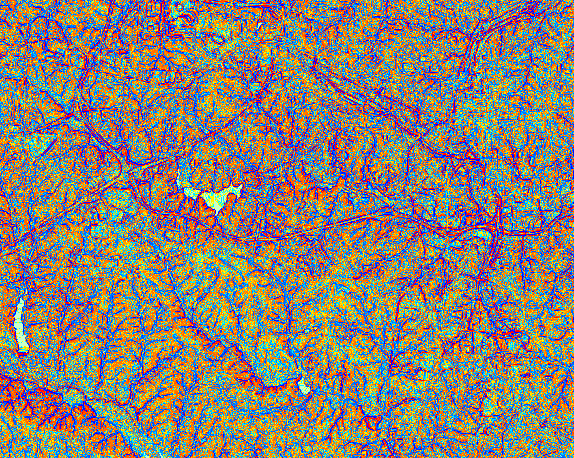
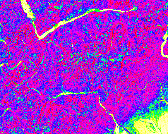
| 17:26, 25 March 2015 | Std dataset nc shaded aspect.png (file) |  |
513 KB | http://grass.osgeo.org/download/sample-data/ r.slope.aspect elevation=elevation slope=slope aspect=aspect pcurvature=profile_curvature d.rast aspect d.out.file std_dataset_nc_aspect.png CC BY, GNU FDL | 1 |
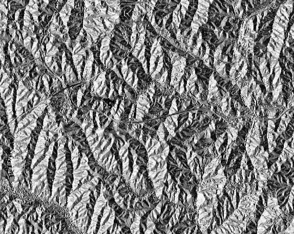
| 17:25, 25 March 2015 | Std dataset nc slope.png (file) |  |
416 KB | http://grass.osgeo.org/download/sample-data/ r.slope.aspect elevation=elevation slope=slope aspect=aspect pcurvature=profile_curvature d.rast slope d.out.file std_dataset_nc_slope.png CC BY, GNU FDL | 1 |
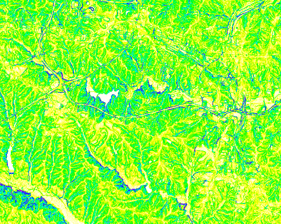
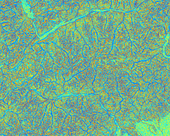
| 17:25, 25 March 2015 | Std dataset nc profile curvature.png (file) |  |
452 KB | http://grass.osgeo.org/download/sample-data/ r.slope.aspect elevation=elevation slope=slope aspect=aspect pcurvature=profile_curvature d.rast profile_curvature d.out.file std_dataset_nc_profile_curvature.png CC BY, GNU FDL | 1 |
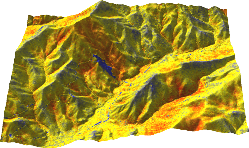
| 17:14, 25 March 2015 | Std dataset piemonte shaded elevation.png (file) |  |
490 KB | http://geodati.fmach.it/gfoss_geodata/libro_gfoss/ g.rename raster=srtm,elevation r.relief input=elevation output=shade d.shade shade=shade color=elevation d.out.file std_dataset_piemonte_shaded_elevation.png CC BY, GNU FDL | 1 |
| 17:12, 25 March 2015 | Std dataset piemonte slope.png (file) |  |
415 KB | http://geodati.fmach.it/gfoss_geodata/libro_gfoss/ g.rename raster=srtm,elevation r.slope.aspect elevation=elevation slope=slope aspect=aspect pcurvature=profile_curvature d.rast slope d.out.file std_dataset_slope.png CC BY, GNU FDL | 1 |
| 17:11, 25 March 2015 | Std dataset piemonte profile curvature.png (file) |  |
442 KB | http://geodati.fmach.it/gfoss_geodata/libro_gfoss/ g.rename raster=srtm,elevation r.slope.aspect elevation=elevation slope=slope aspect=aspect pcurvature=profile_curvature d.rast profile_curvature d.out.file std_dataset_piemonte_profile_curvature.p... | 1 |
| 17:03, 25 March 2015 | Std dataset piemonte aspect.png (file) |  |
494 KB | http://geodati.fmach.it/gfoss_geodata/libro_gfoss/ g.rename raster=srtm,elevation r.slope.aspect elevation=elevation slope=slope aspect=aspect pcurvature=profile_curvature d.rast aspect d.out.file std_dataset_piemonte_aspect.png CC BY, GNU FDL | 1 |
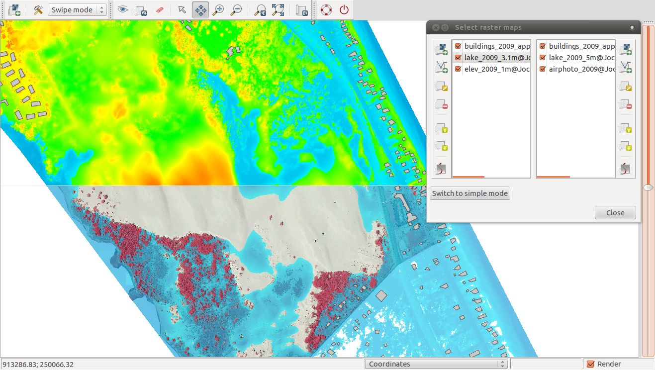
| 02:40, 12 November 2013 | MapSwipe multiple layers.png (file) |  |
752 KB | Multiple different raster and vector layers and their management through Simple Layer Manager. Created by r.lake with Jockey's Ridge data. | 1 |