Uploads by ⚠️Wenzeslaus
Jump to navigation
Jump to search
This special page shows all uploaded files.
| Date | Name | Thumbnail | Size | Description | Versions |
|---|---|---|---|---|---|
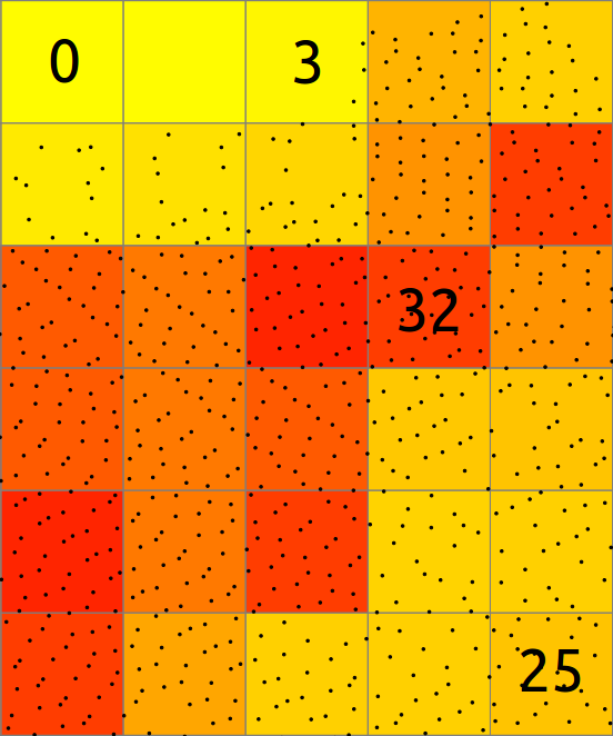
| 15:20, 19 July 2017 | Binning mean explanation.png (file) |  |
61 KB | Explanation of binning of points into a 2D raster map where resulting cell value is mean of point values. | 1 |
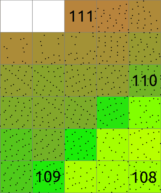
| 15:19, 19 July 2017 | Binning count explanation.png (file) |  |
54 KB | Explanation of binning of points into a 2D raster map. | 1 |
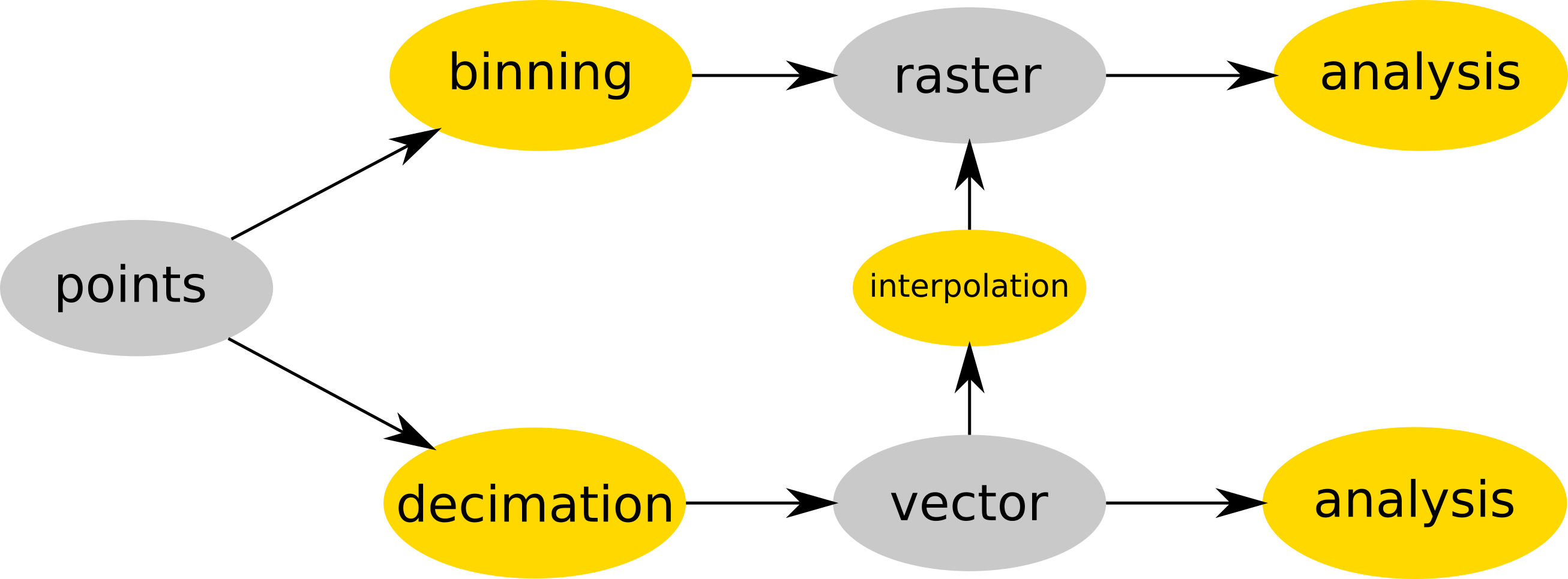
| 15:17, 19 July 2017 | Binning and decimation workflow schema for point clouds.png (file) |  |
127 KB | Point cloud is either binned into a raster map (e.g. r.in.lidar) and then analyzed (as raster) or (optionally) decimated (e.g. v.in.lidar), converted to vector map and then interpolated (e.g. v.surf.rst) into raster or analyzed as vector map (e.g. v.ve... | 1 |
| 15:14, 2 June 2017 | Icc2017 logo.png (file) | 64 KB | Logo of the 28th International Cartographic Conference of the International Cartographic Association, Washington, DC, July 2 to 7, 2017 http://icc2017.org/ http://icc2017.org/wp-content/uploads/2016/08/logo.png | 1 | |
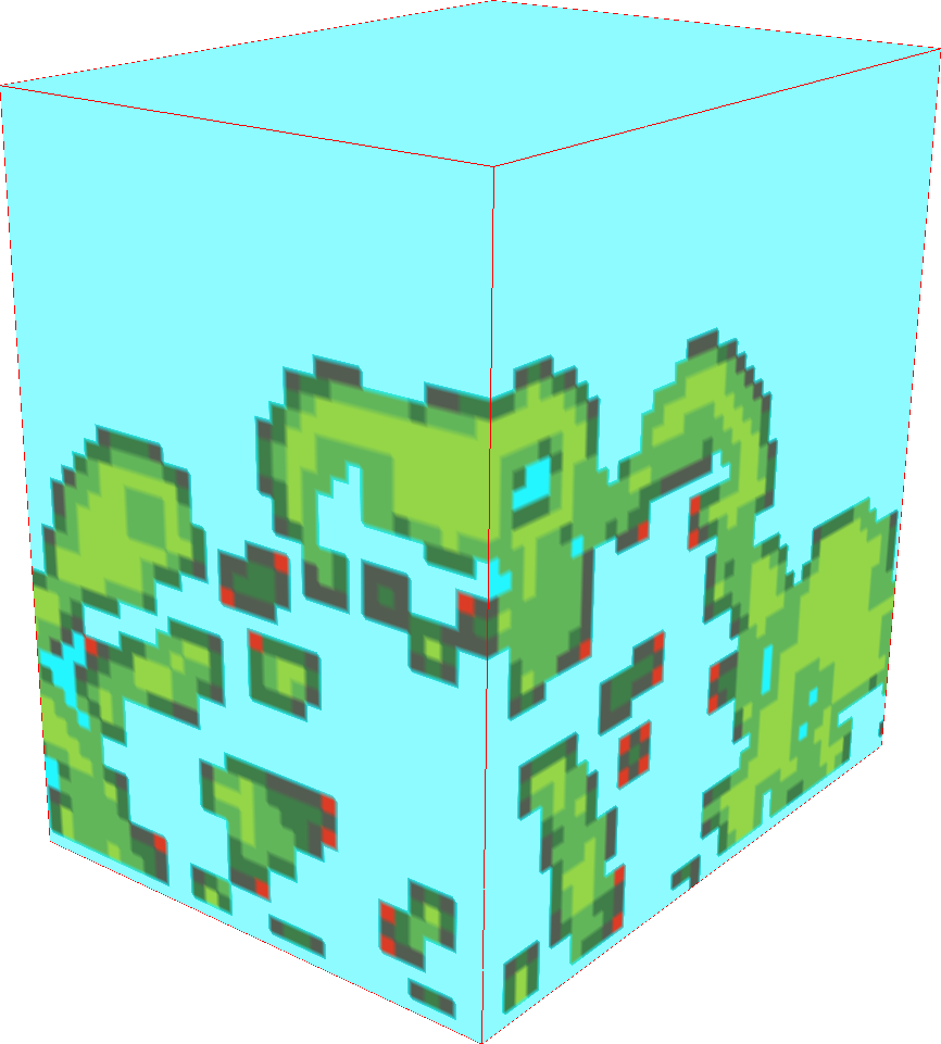
| 21:05, 24 March 2017 | Raster3d example small data.png (file) |  |
147 KB | Example of a 3D raster. Small data. Lidar-based presence/absence in 3D. r3.forestfrag. Using slices in 3D view (NVIZ). Modified colors. | 1 |
| 20:53, 24 March 2017 | Viewscape modeling with LiDAR.png (file) |  |
783 KB | Not seeing the forest for the trees: viewscape modeling with LiDAR by Jelena Vukomanovic (presenter), John B. Vogler, Kunwar K. Singh, and Anna Petrasova from North Carolina State University US-IALE 2017 Annual Meeting | 1 |
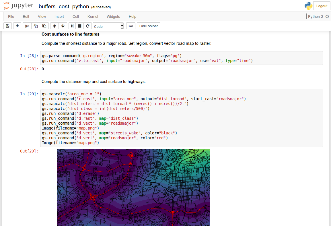
| 20:44, 24 March 2017 | Jupyter notebook with grass gis.png (file) |  |
221 KB | Jupyter Notebook with GRASS GIS Python code computing distance (with r.cost) from lines (roads) | 1 |
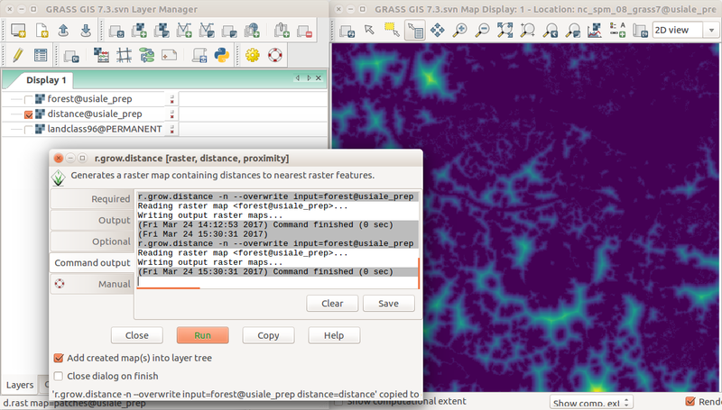
| 19:40, 24 March 2017 | Wxgui r grow distance from forest edge.png (file) |  |
318 KB | Screenshot of distance to forest edge computed with r.grow.distance in the wxGUI with Layer Manager, Map Display, and r.grow.distance dialog. r.mapcalc "forest = if(landclass96 == 5, 1, null())" r.grow.distance -n input=forest distance=distance (or... | 1 |
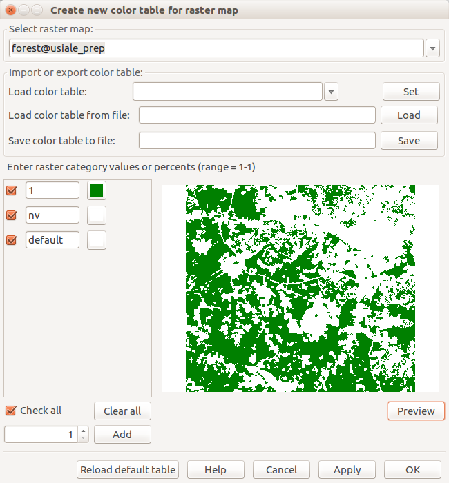
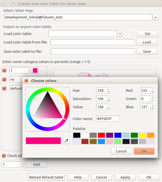
| 19:23, 24 March 2017 | Create new color table for raster map forest.png (file) |  |
53 KB | Dialog for interactive change of color table with preview r.mapcalc "forest = if(landclass96 == 5, 1, null())" | 1 |
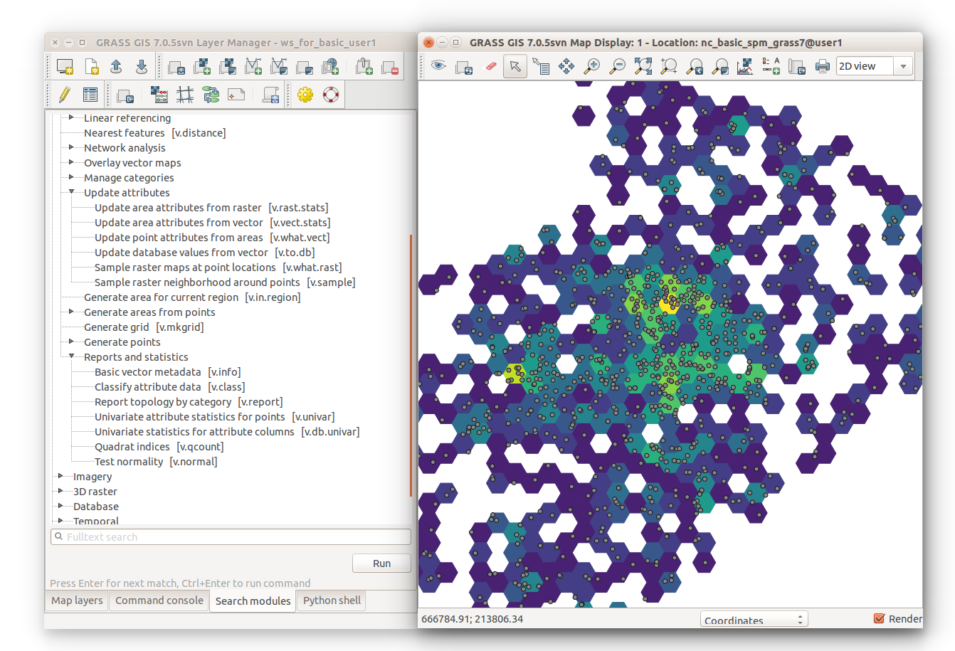
| 16:58, 24 March 2017 | V vect stats hexagons with module tree.png (file) |  |
386 KB | v.vect.stats result on v.mkgrid -h polygons showing point density with Layer Manager Modules tab on the left g.region vector=points_of_interest res=2000 -pa v.mkgrid map=hexagons -h v.vect.stats points=points_of_interest areas=hexagons count_column... | 1 |
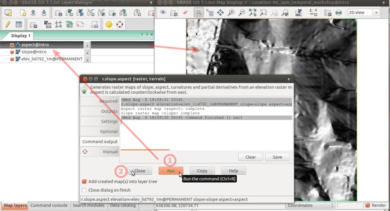
| 15:17, 24 March 2017 | R slope aspect 4 run.png (file) |  |
211 KB | r.slope.aspect Command output tab with Run, Close, and resulting raster map layer in the background | 1 |
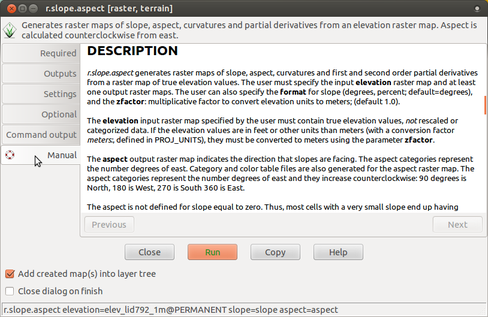
| 15:16, 24 March 2017 | R slope aspect 3 manual.png (file) |  |
130 KB | r.slope.aspect Manual tab | 1 |
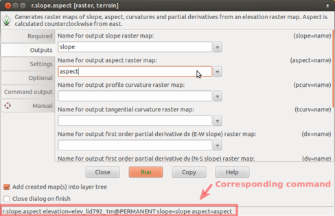
| 15:14, 24 March 2017 | R slope aspect 2 outputs.png (file) |  |
77 KB | r.slope.aspect Outputs tab (slope and aspect outputs) with corresponding command highlighted | 1 |
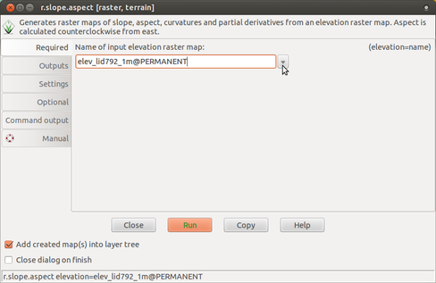
| 15:13, 24 March 2017 | R slope aspect 1 required.png (file) |  |
57 KB | r.slope.aspect Required tab (input elevation) | 1 |
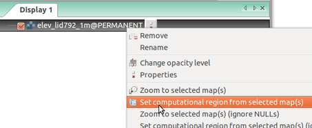
| 13:53, 24 March 2017 | Wxgui computational region set from raster.png (file) |  |
39 KB | Setting computational region (extent and resolution) based on a raster in Layer Manager in wxGUI (GRASS GIS 7.0) | 1 |
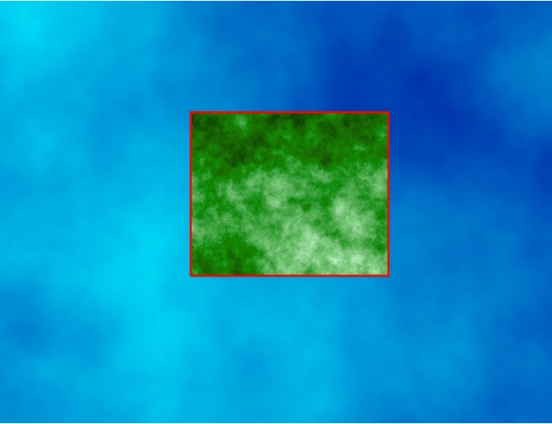
| 13:40, 24 March 2017 | Computational region two rasters.png (file) |  |
250 KB | Computational region concept showing one large raster (blue) and one other raster with smaller extent (green) which matches the current computational region (red). # larger region g.region raster=elevation # larger raster r.surf.fractal output=fra... | 1 |
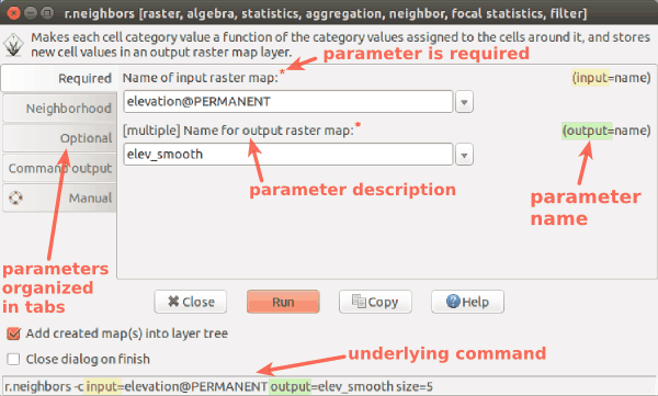
| 03:46, 24 March 2017 | Wxgui module parameters r neighbors.png (file) |  |
25 KB | wxGUI dialog/form for r.neighbors with descriptions and highlights | 1 |
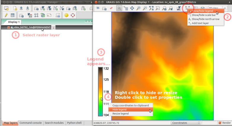
| 02:36, 24 March 2017 | Wxgui add legend elev lid.png (file) |  |
174 KB | Add raster legend in wxGUI screenshot with numbers and descriptions | 1 |
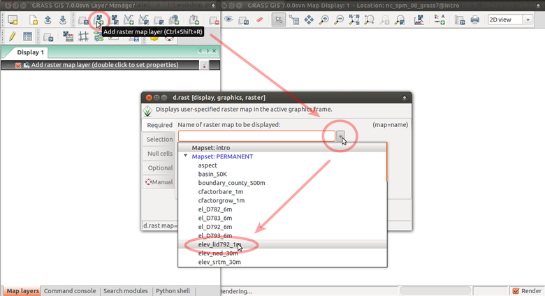
| 02:12, 24 March 2017 | Wxgui add elev lid.png (file) |  |
125 KB | Add elev_lid792_1m raster map layer using d.rast dialog from toolbar with arrows | 1 |
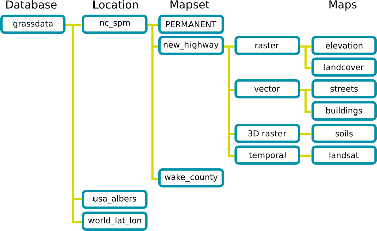
| 01:22, 24 March 2017 | Grass database.png (file) |  |
36 KB | GRASS GIS Spatial Database structure trunk/doc/grass_database.png r70793 | 1 |
| 01:59, 23 March 2017 | Grassgis logo colorlogo text whitebg.png (file) | 48 KB | GRASS GIS logo from https://grass.osgeo.org/download/logos/ Green color, white background, with text | 1 | |
| 01:06, 8 March 2017 | Ncgis logo 2017.png (file) | 4 KB | NCGIS conference 2017 logo http://ncgisconference.com/ | 1 | |
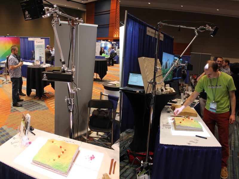
| 01:04, 8 March 2017 | Ncgis2017 ncsu booth tangible landscape.jpg (file) |  |
136 KB | North Carolina State University booth at NCGIS2017: Tangible Landscape (powered by GRASS GIS) Thanks to Anna Klevtcova for providing the photographs. | 1 |
| 21:22, 7 March 2017 | Us-iale logo.jpg (file) | 30 KB | http://baltimore2017.usiale.org/ https://usiale.org/ | 1 | |
| 20:49, 7 March 2017 | Foss4g boston 2017 logo.png (file) | 25 KB | http://2017.foss4g.org/ | 1 | |
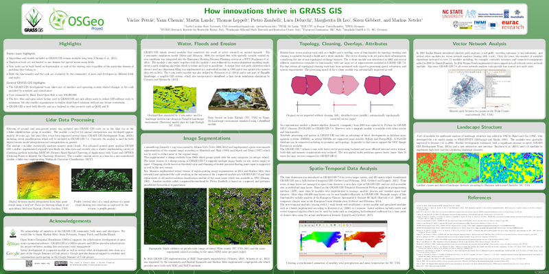
| 01:25, 26 February 2017 | How innovations thrive in GRASS GIS.png (file) |  |
331 KB | Capture from https://trac.osgeo.org/grass/browser/grass-promo/grassposter/2017_NCGIS_How_innovations_thrive/How_innovations_thrive_in_GRASS_GIS.pdf (provided by the author) | 1 |
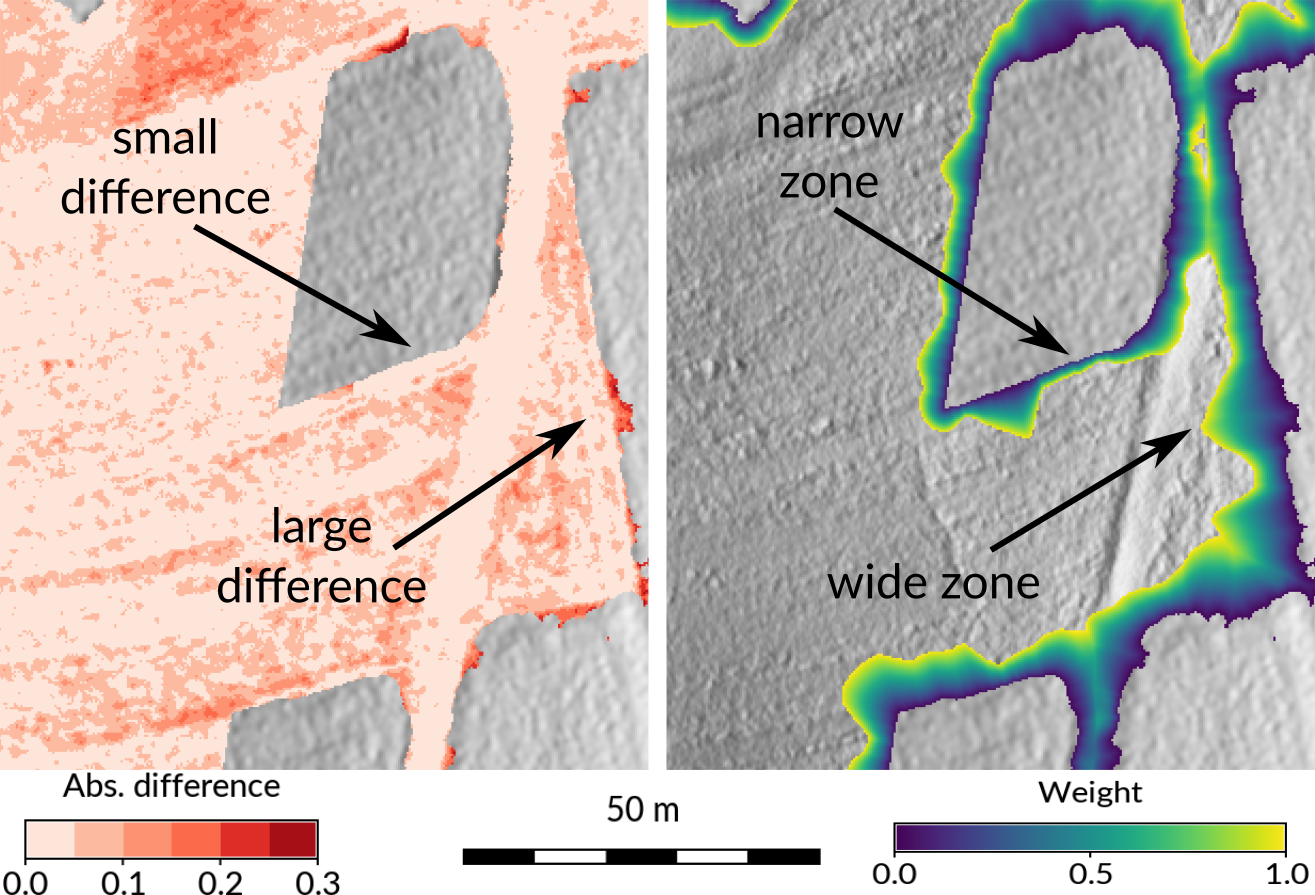
| 00:06, 26 February 2017 | Seamless fusion of high-resolution DEMs from multiple sources.png (file) |  |
718 KB | Taken from https://petrasovaa.github.io/dem-fusion-talk/#/17 (provided by the author) | 1 |
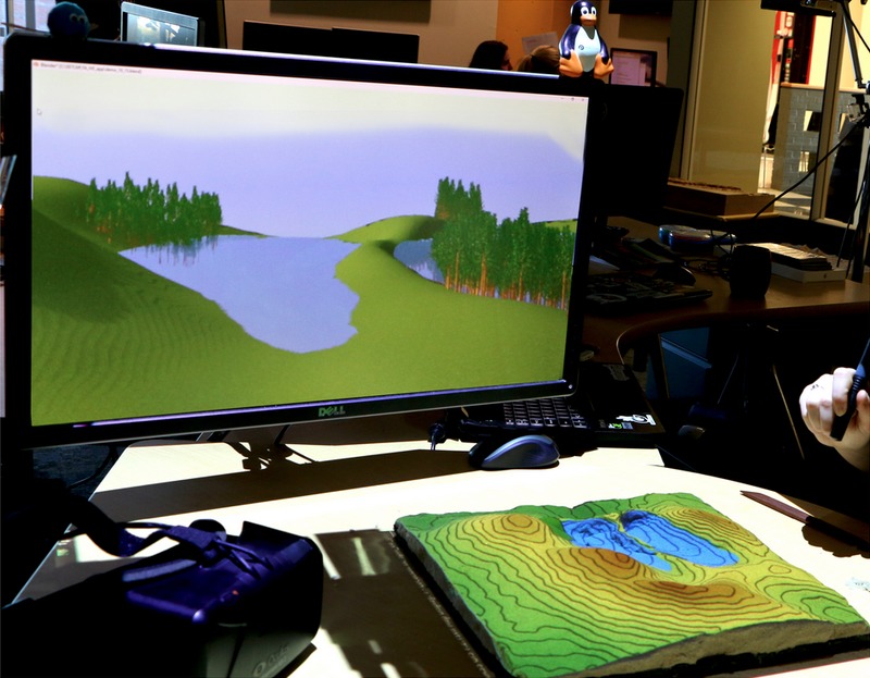
| 23:59, 25 February 2017 | Tangible landscape and blender with water and trees.jpg (file) |  |
121 KB | Taken from https://ncsu-geoforall-lab.github.io/tangible-landscape-talk/ncgis2017#/21 (provided by the author) | 1 |
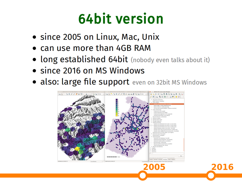
| 22:32, 25 February 2017 | Grass gis as platform presentation 64bit slide.png (file) |  |
271 KB | Capture of https://ncsu-geoforall-lab.github.io/grass-as-a-platform/ncgis2017.html#/15 (provided by the author) | 1 |
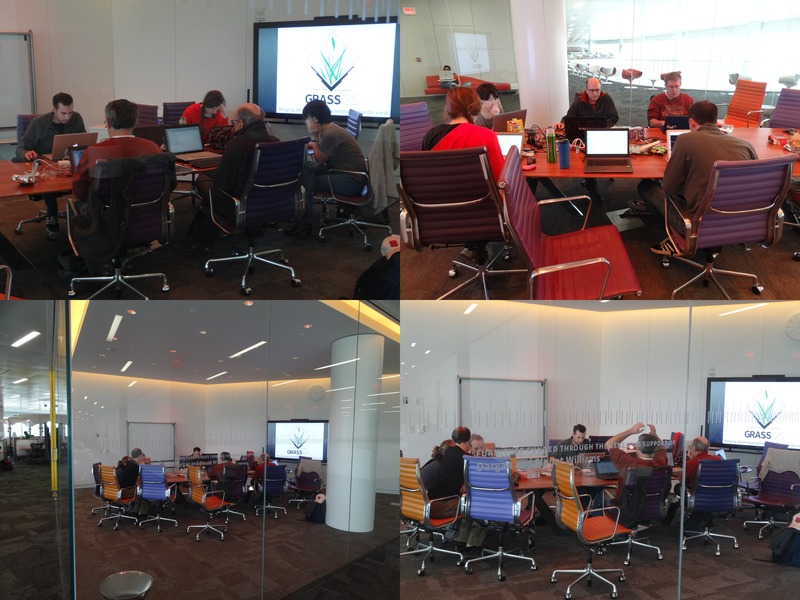
| 00:31, 6 November 2016 | Raleigh 2016 11 05.jpg (file) |  |
118 KB | GRASS GIS meetup, Hunt Library, Raleigh, NC, November 5, 2016 | 1 |
| 02:58, 25 September 2016 | Hunt Library with GRASS GIS logo.png (file) | 219 KB | Create XY location. r.import input=hunt.jpg output=hunt g.rename raster=hunt.1,hunt_red g.rename raster=hunt.2,hunt_green g.rename raster=hunt.3,hunt_blue g.region rast=hunt_red i.pca input=hunt_red,hunt_green,hunt_blue out=hunt_pca g.copy rast... | 1 | |
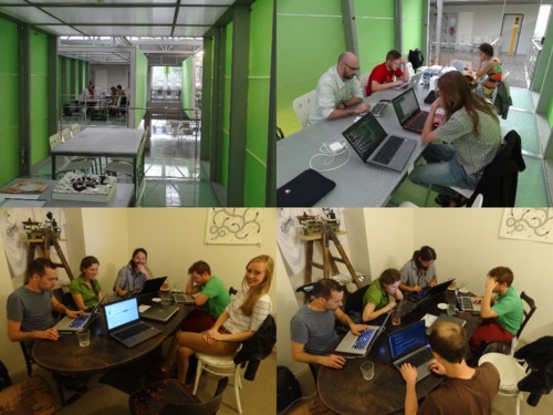
| 19:38, 5 August 2016 | Isprs prague meetup.jpg (file) |  |
63 KB | Photos taken during ISPRS Prague meetup 2016 in CTU FCE Atelier D and Pracovna Café | 1 |
| 01:07, 9 June 2016 | Grass meetup 2016 03 19.jpg (file) |  |
131 KB | GRASS GIS Raleigh meetup, March 19, 2016, The Hunt library | 1 |
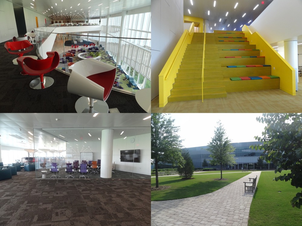
| 00:45, 9 June 2016 | Hunt library spaces.jpg (file) |  |
206 KB | Spaces in the NC State Hunt library and the building from outside. Empty Fish bowl after the GRASS GIS Raleigh meetup and almost empty library during the summer. | 1 |
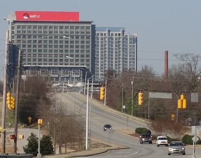
| 02:05, 21 April 2016 | Red hat raleigh.jpg (file) |  |
43 KB | Red Hat Tower in Downtown Raleigh | 1 |
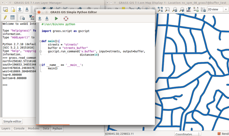
| 16:59, 29 February 2016 | Simple python editor v buffer.png (file) |  |
235 KB | Prototype of GRASS GIS Simple Python Editor with Python tab with interactive Python shell and computed buffer for streets vector (v.buffer) in the background. | 1 |
| 16:54, 29 February 2016 | Tangible landscape termite game.jpg (file) |  |
117 KB | https://geospatial.ncsu.edu/osgeorel/tangible-landscape.html | 1 |
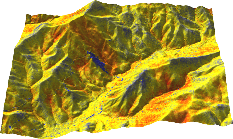
| 16:49, 29 February 2016 | Range on ground from north.png (file) |  |
578 KB | Range of z coordinates displayed on ground Author: Vaclav Petras http://wenzeslaus.github.io/grass-lidar-talks/ Dataset: Nantahala NF, NC: Forest Leaf Structure, Terrain and Hydrophysiology http://dx.doi.org/10.5069/G9HT2M76 | 1 |
| 16:43, 29 February 2016 | Jeziorska uav grass puddle mar 18.png (file) |  |
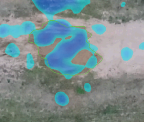
207 KB | Comparison of simulated surface water flow and puddle in orthophoto Justyna Jeziorska, Helena Mitasova, Anna Petrasova, Vaclav Petras, Darshan Divakaran, Thomas Zajkowski (2016): Overland flow analysis using time series of sUAS-derived elevation model... | 1 |
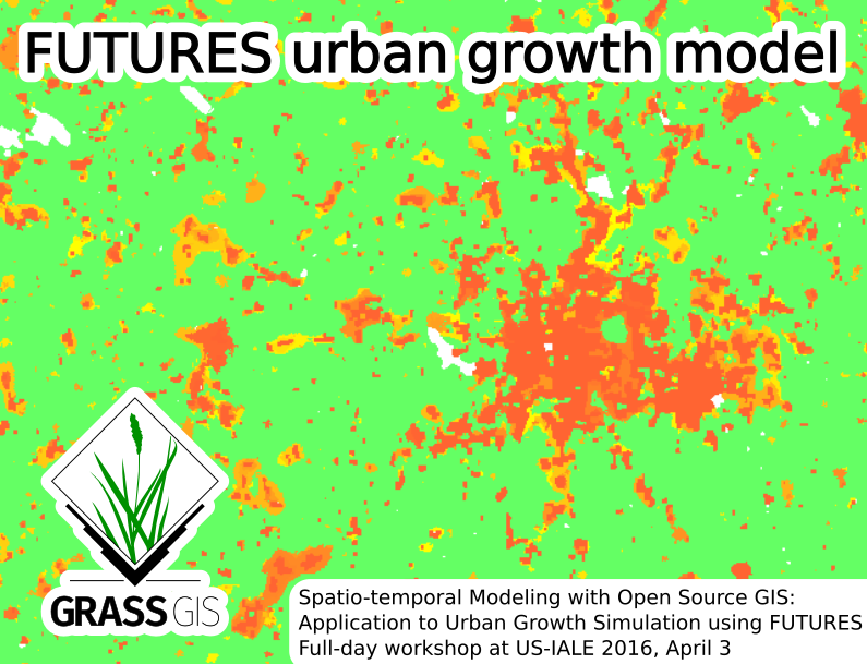
| 20:03, 24 February 2016 | Futures grass gis asheville.png (file) |  |
260 KB | Picture for Spatio-temporal Modeling with Open Source GIS: Application to Urban Growth Simulation using FUTURES workshop at US-IALE 2016 Annual Meeting in Asheville, NC, USA. | 1 |
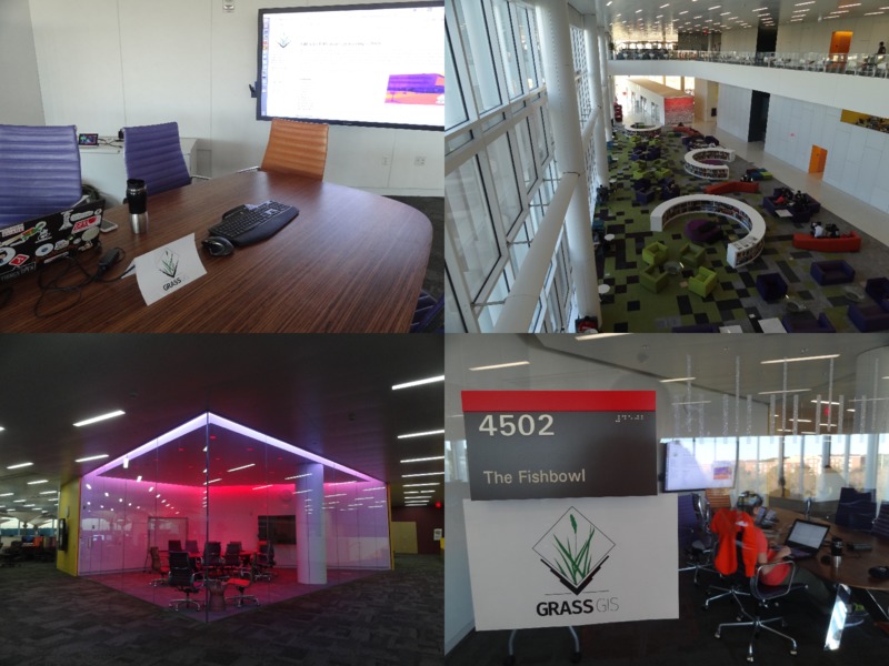
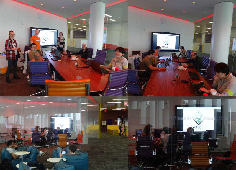
| 00:00, 21 February 2016 | Grass gis raleigh meetup feb20 2016.png (file) |  |
721 KB | Four photos from GRASS GIS Raleigh meetup, February 20, 2016. The Fishbowl room inside and from outside with the participants, visitors and people around in the Hunt library. | 1 |
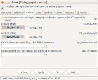
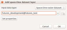
| 18:07, 12 February 2016 | Futures anim vector set color.png (file) |  |
47 KB | Set vector layer color using d.vect dialog | 1 |
| 18:06, 12 February 2016 | Futures anim start raster color.png (file) |  |
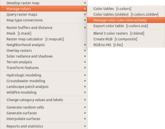
43 KB | Manage color table interactively in the Raster menu | 1 |
| 18:05, 12 February 2016 | Futures anim start animation tool.png (file) |  |
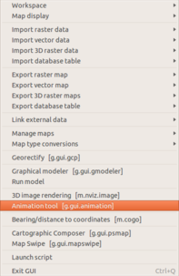
36 KB | Start animation from the file menu | 1 |
| 18:04, 12 February 2016 | Futures anim render animation.png (file) |  |
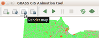
19 KB | (Re-)render animation in the animation tool | 1 |
| 18:03, 12 February 2016 | Futures anim raster set color.png (file) |  |
63 KB | Set color for category using interactive color table editing tool | 1 |
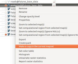
| 18:02, 12 February 2016 | Futures anim make copy.png (file) |  |
40 KB | Copy raster map to the current mapset using layer context menu | 1 |
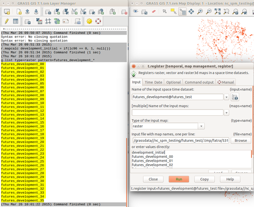
| 18:00, 12 February 2016 | Futures anim list maps.png (file) |  |
148 KB | List raster maps by patterns for t.register | 1 |
| 17:59, 12 February 2016 | Futures anim animation time series.png (file) |  |
14 KB | Animation tool: select time series | 1 |
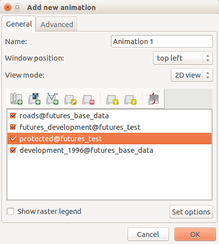
| 17:58, 12 February 2016 | Futures anim animation layers.png (file) |  |
30 KB | 1 |