Uploads by ⚠️Wenzeslaus
Jump to navigation
Jump to search
This special page shows all uploaded files.
| Date | Name | Thumbnail | Size | Description | Versions |
|---|---|---|---|---|---|
| 19:22, 21 January 2019 | AGU 2018 logo.png (file) | 13 KB | Logo of AGU 2018 American Geophysical Union, Fall Meeting 2018, Washington, D.C. https://fallmeeting.agu.org/2018/ For use at pages about AGU or mentioning AGU at this wiki. | 1 | |
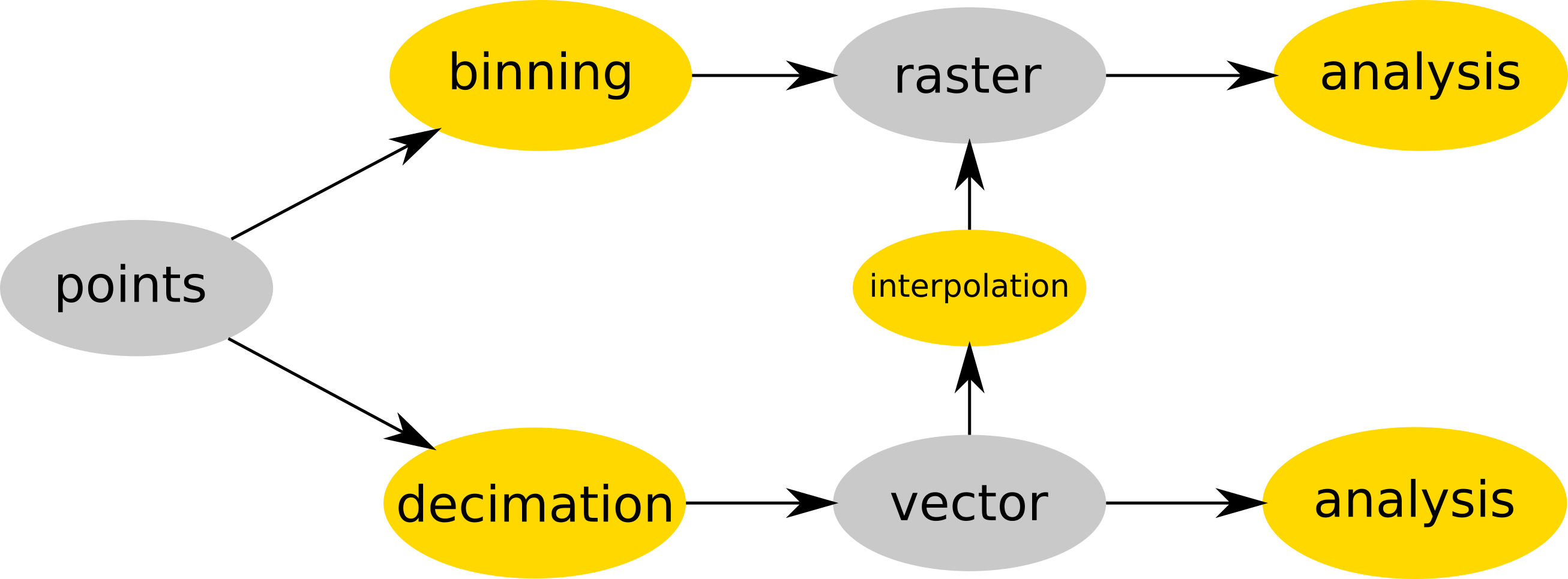
| 15:17, 19 July 2017 | Binning and decimation workflow schema for point clouds.png (file) |  |
127 KB | Point cloud is either binned into a raster map (e.g. r.in.lidar) and then analyzed (as raster) or (optionally) decimated (e.g. v.in.lidar), converted to vector map and then interpolated (e.g. v.surf.rst) into raster or analyzed as vector map (e.g. v.ve... | 1 |
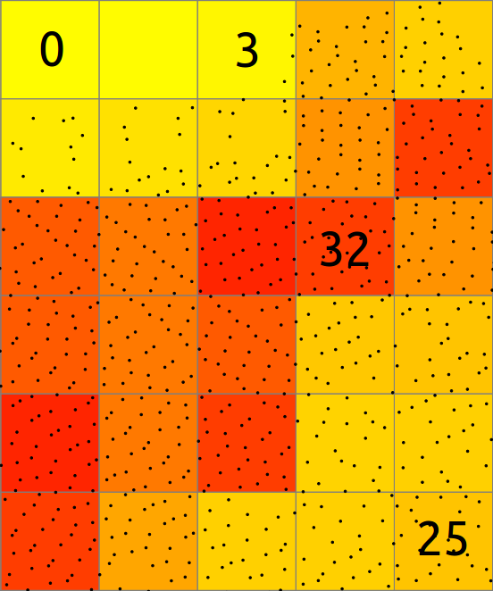
| 15:19, 19 July 2017 | Binning count explanation.png (file) |  |
54 KB | Explanation of binning of points into a 2D raster map. | 1 |
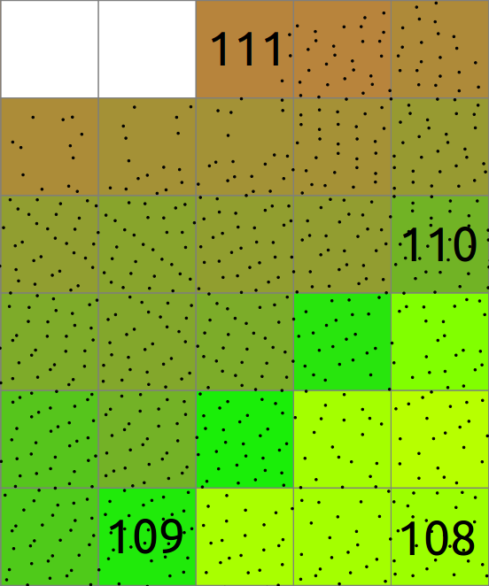
| 15:20, 19 July 2017 | Binning mean explanation.png (file) |  |
61 KB | Explanation of binning of points into a 2D raster map where resulting cell value is mean of point values. | 1 |
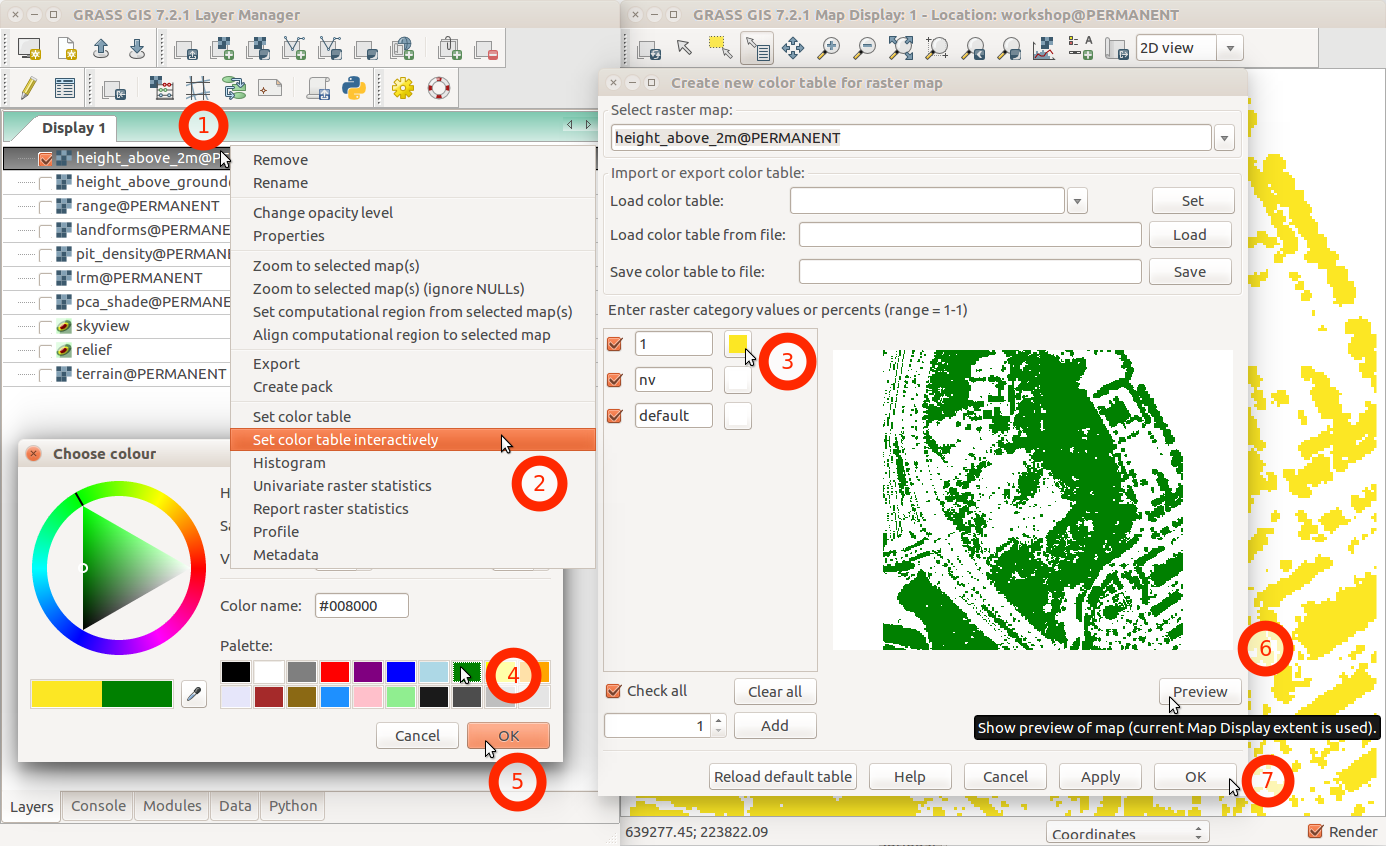
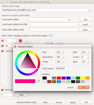
| 02:46, 1 August 2017 | Change color table interactively with menu and labels.png (file) |  |
231 KB | GRASS GIS 7.2 wxGUI dialog ''Create new color table for raster map'' started from layer context menu using ''Set color table interactively'' | 1 |
| 13:40, 24 March 2017 | Computational region two rasters.png (file) |  |
250 KB | Computational region concept showing one large raster (blue) and one other raster with smaller extent (green) which matches the current computational region (red). # larger region g.region raster=elevation # larger raster r.surf.fractal output=fra... | 1 |
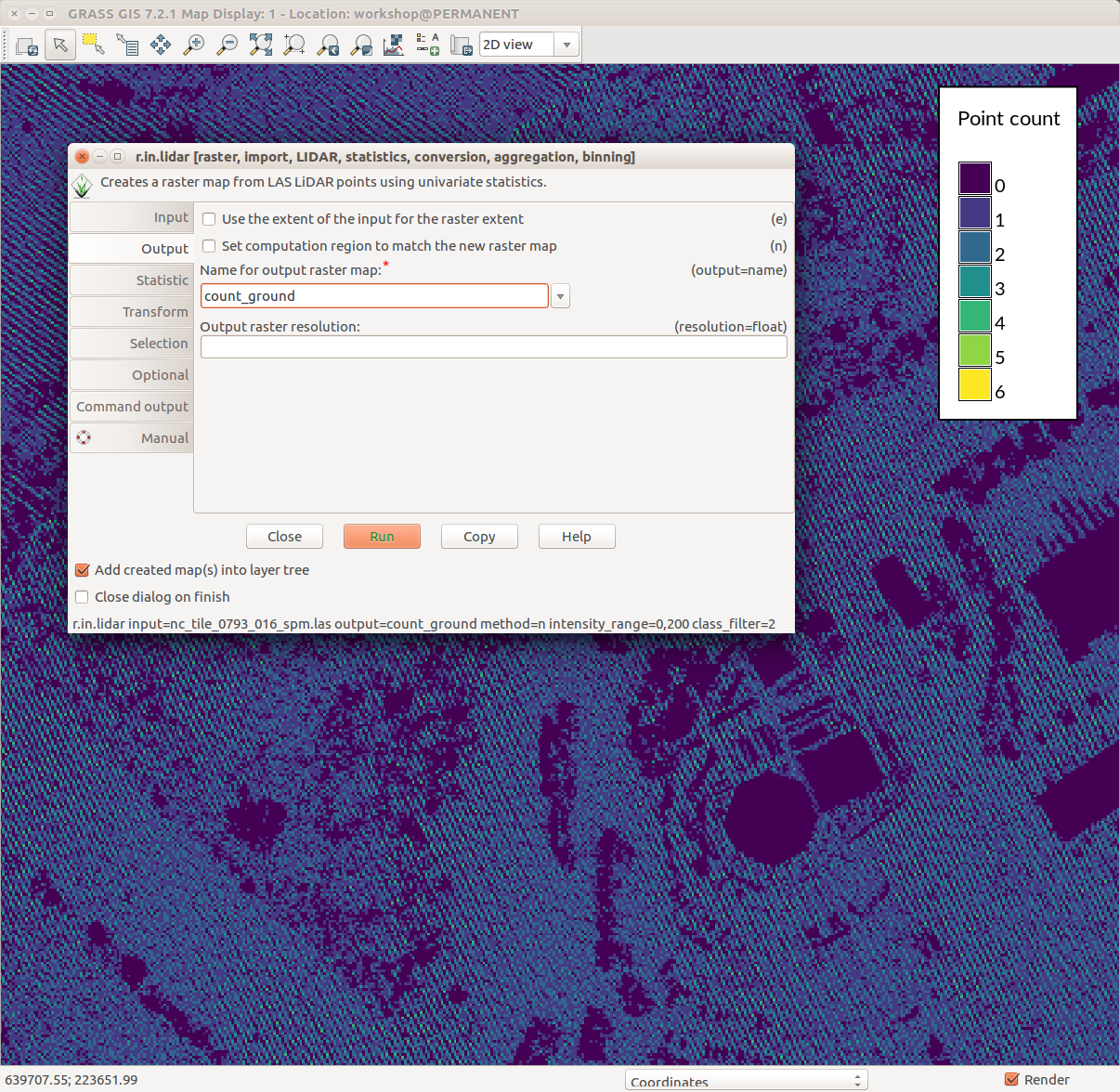
| 19:16, 1 August 2017 | Counting ground points per cell with r.in.lidar.png (file) |  |
231 KB | GRASS GIS 7.2 wxGUI Map Display, legend with d.legend, r.in.lidar dialog, ground point density pattern in the background | 1 |
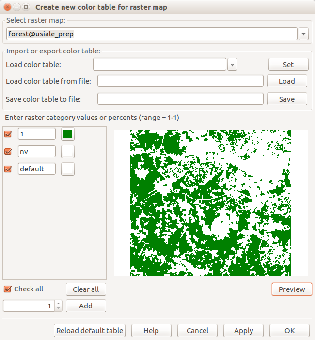
| 19:23, 24 March 2017 | Create new color table for raster map forest.png (file) |  |
53 KB | Dialog for interactive change of color table with preview r.mapcalc "forest = if(landclass96 == 5, 1, null())" | 1 |
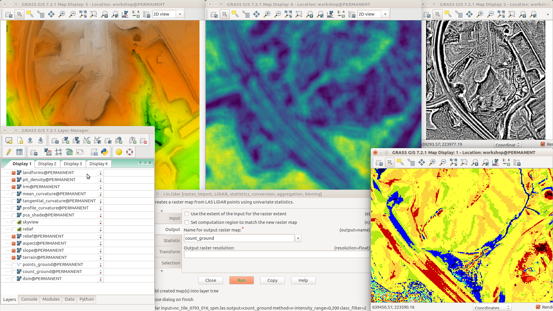
| 02:05, 1 August 2017 | Different terrain analyses and visualizations in multiple Map Displays.png (file) |  |
1,014 KB | GRASS GIS 7.2 with various addons r.skyview + d.shade (top left) r.terrain.texture (pit density, top middle) r.local.relief (LRM, top right) Layer Manager, Layers tab (bottom left) r.in.lidar (dialog, bottom middle) r.geomorphon (landforms, bottom right) | 1 |
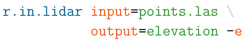
| 17:42, 19 July 2017 | Example r.in.lidar command in Bash.png (file) | 23 KB | Example r.in.lidar command in Bash with highlighted module name (blue), options and flags (red) and option values (green) | 1 | |
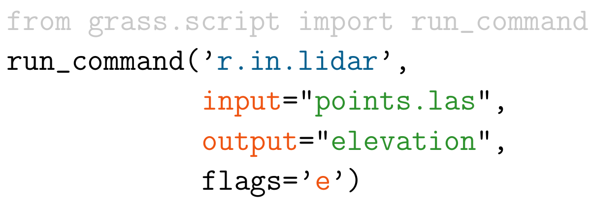
| 17:44, 19 July 2017 | Example r.in.lidar command in Python.png (file) |  |
47 KB | Example r.in.lidar command in Python with highlighted module name (blue), options and flags (red) and option values (green) and import (grey) | 1 |
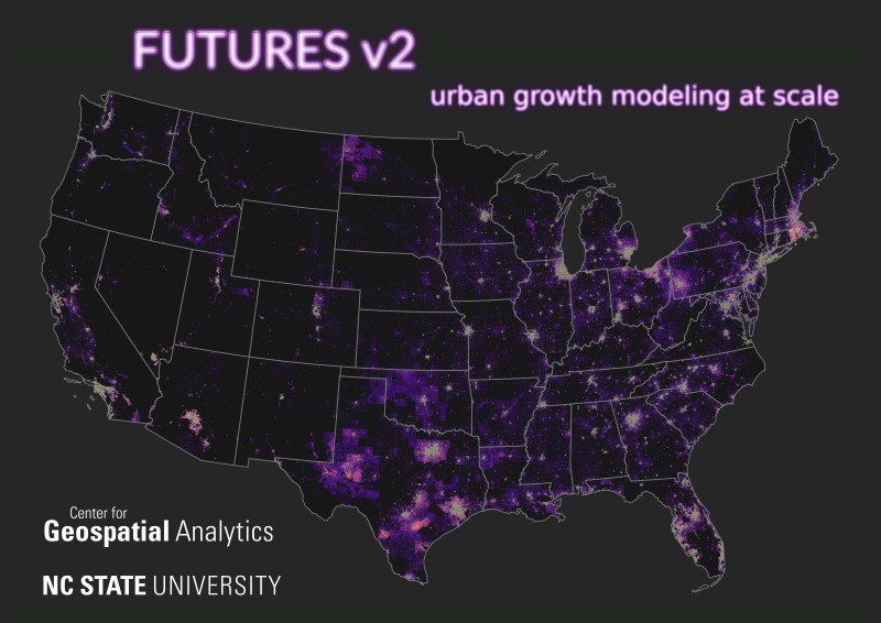
| 16:56, 11 February 2021 | FUTURES v2 petrasova 2021 poster.png (file) |  |
409 KB | Thumbnail for a conference poster for NCGIS2021 by Anna Petrasova. Anna Petrasova, Georgina Sanchez, Vaclav Petras, Ross K. Meentemeyer (2021). FUTURES v2: Urban Growth Modeling at Scale. NC GIS Virtual Conference, February 16-19, 2021. | 1 |
| 20:49, 7 March 2017 | Foss4g boston 2017 logo.png (file) | 25 KB | http://2017.foss4g.org/ | 1 | |
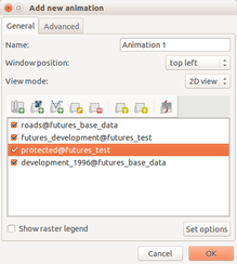
| 17:58, 12 February 2016 | Futures anim animation layers.png (file) |  |
30 KB | 1 | |
| 17:59, 12 February 2016 | Futures anim animation time series.png (file) |  |
14 KB | Animation tool: select time series | 1 |
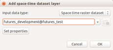
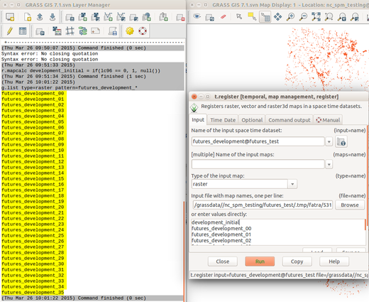
| 18:00, 12 February 2016 | Futures anim list maps.png (file) |  |
148 KB | List raster maps by patterns for t.register | 1 |
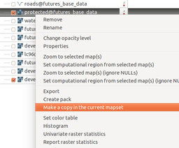
| 18:02, 12 February 2016 | Futures anim make copy.png (file) |  |
40 KB | Copy raster map to the current mapset using layer context menu | 1 |
| 18:03, 12 February 2016 | Futures anim raster set color.png (file) |  |
63 KB | Set color for category using interactive color table editing tool | 1 |
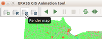
| 18:04, 12 February 2016 | Futures anim render animation.png (file) |  |
19 KB | (Re-)render animation in the animation tool | 1 |
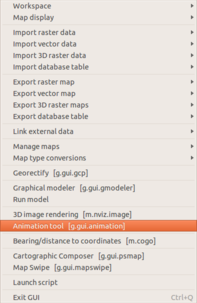
| 18:05, 12 February 2016 | Futures anim start animation tool.png (file) |  |
36 KB | Start animation from the file menu | 1 |
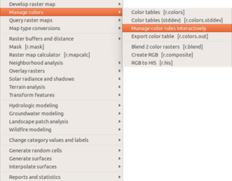
| 18:06, 12 February 2016 | Futures anim start raster color.png (file) |  |
43 KB | Manage color table interactively in the Raster menu | 1 |
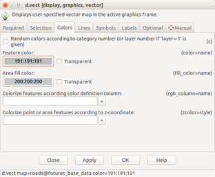
| 18:07, 12 February 2016 | Futures anim vector set color.png (file) |  |
47 KB | Set vector layer color using d.vect dialog | 1 |
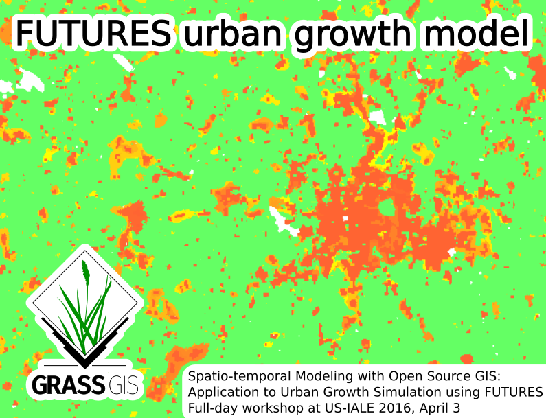
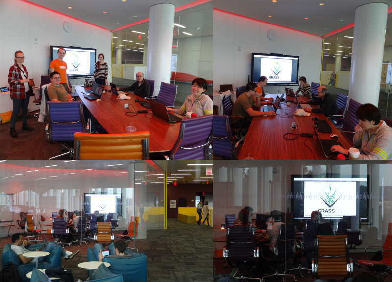
| 20:03, 24 February 2016 | Futures grass gis asheville.png (file) |  |
260 KB | Picture for Spatio-temporal Modeling with Open Source GIS: Application to Urban Growth Simulation using FUTURES workshop at US-IALE 2016 Annual Meeting in Asheville, NC, USA. | 1 |
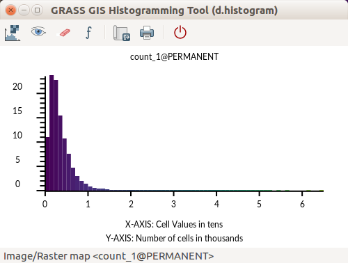
| 01:41, 1 August 2017 | GRASS GIS Histogramming Tool d.histogram - count of point.png (file) |  |
24 KB | d.histogram powered histogram in GRASS GIS 7.2 Count of points per cell | 1 |
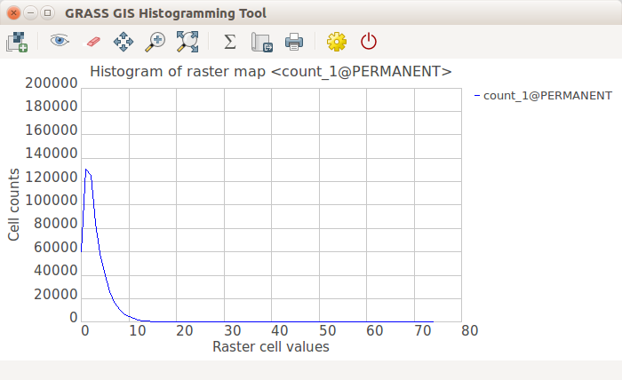
| 01:41, 1 August 2017 | GRASS GIS Histogramming Tool wxPython - count of point.png (file) |  |
33 KB | wxPython powered histogram in GRASS GIS 7.2 | 1 |
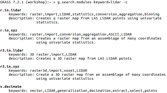
| 02:30, 8 August 2017 | G search modules with c flag.png (file) |  |
50 KB | {{cmd|g.search.modules}} keyword=lidar -c Searches through descriptions and keywords. Displays using color. | 1 |
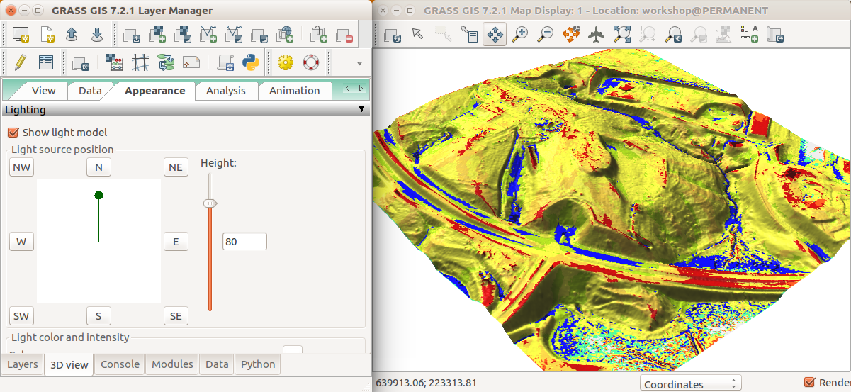
| 02:20, 1 August 2017 | Geomorphons in 3D view Appearance tab.png (file) |  |
535 KB | GRASS GIS 7.2 wxGUI NVIZ Appearance tab to change the light source position | 1 |
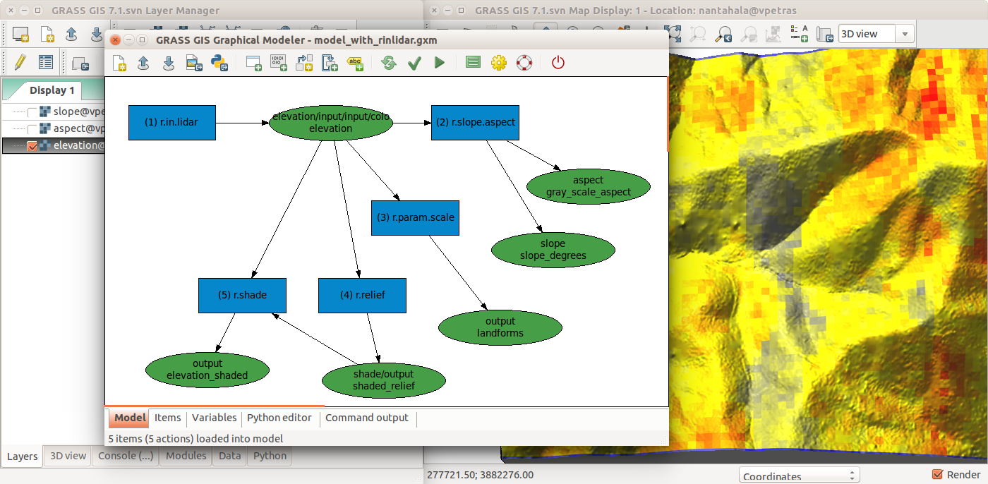
| 17:35, 19 July 2017 | Graphical Modeler with r.in.lidar and terrain analysis.png (file) |  |
457 KB | r.in.lidar followed by r.slope.aspect, r.param.scale, r.relief with r.shade in GRASS GIS Graphical Modeler with the main GUI in the background | 1 |
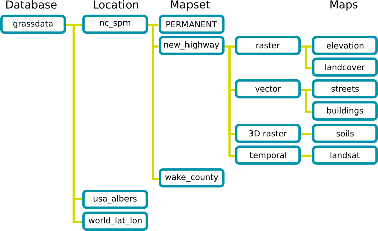
| 01:22, 24 March 2017 | Grass database.png (file) |  |
36 KB | GRASS GIS Spatial Database structure trunk/doc/grass_database.png r70793 | 1 |
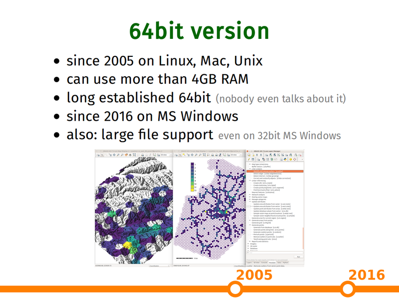
| 22:32, 25 February 2017 | Grass gis as platform presentation 64bit slide.png (file) |  |
271 KB | Capture of https://ncsu-geoforall-lab.github.io/grass-as-a-platform/ncgis2017.html#/15 (provided by the author) | 1 |
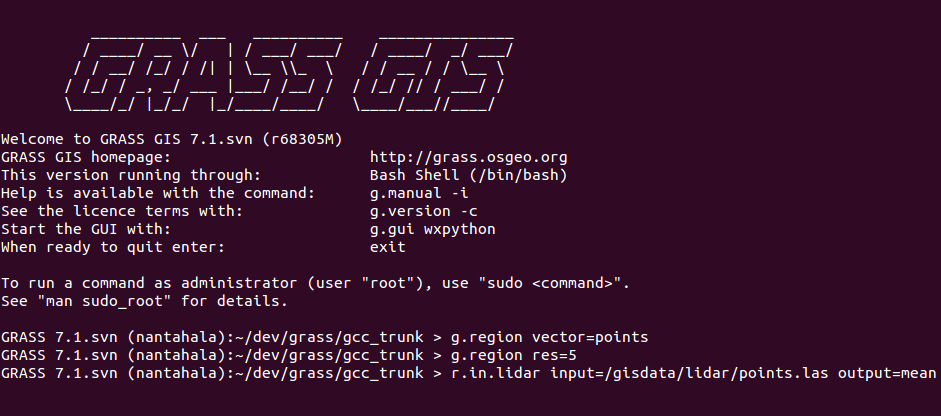
| 18:12, 19 July 2017 | Grass gis cli ubuntu purple r.in.lidar.png (file) |  |
52 KB | GRASS GIS command line interface (CLI) in Ubuntu terminal (purple/violet) Commands: g.region vector=points g.region res=5 r.in.lidar input=/gisdata/lidar/points.las output=mean | 1 |
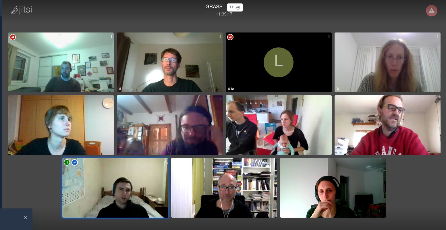
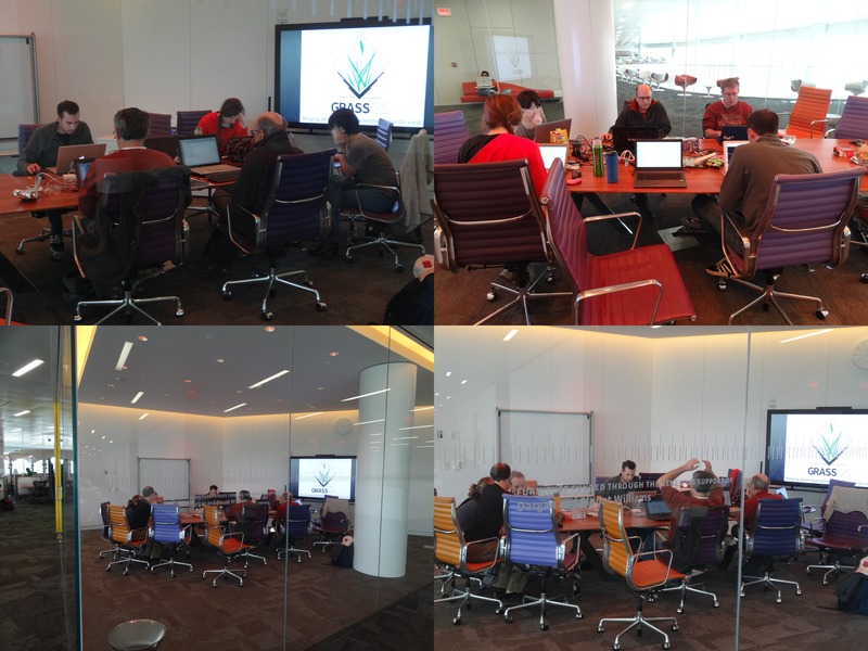
| 03:16, 20 November 2020 | Grass gis osgeo sprint 2020.jpeg (file) |  |
142 KB | GRASS GIS at OSGeo Virtual Community Sprint 2020 | 1 |
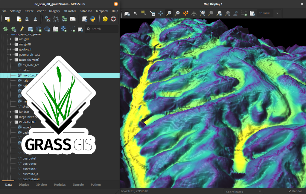
| 16:54, 11 February 2021 | Grass gis r valley bottom 3d.png (file) |  |
844 KB | Graphical user interface of GRASS GIS with result of r.valley.bottom in 3D with logo. | 1 |
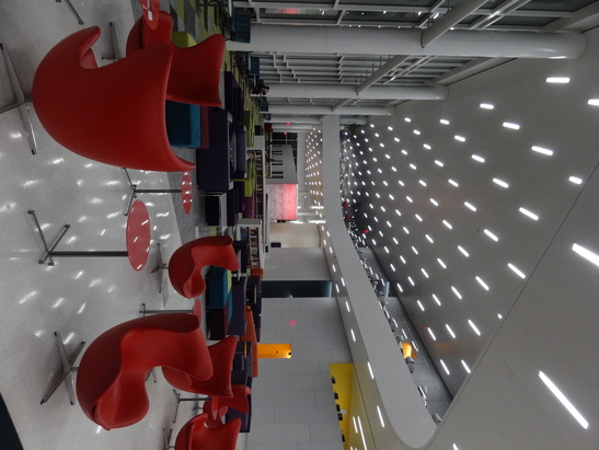
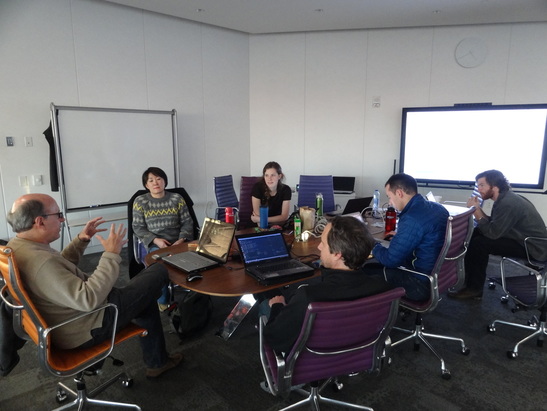
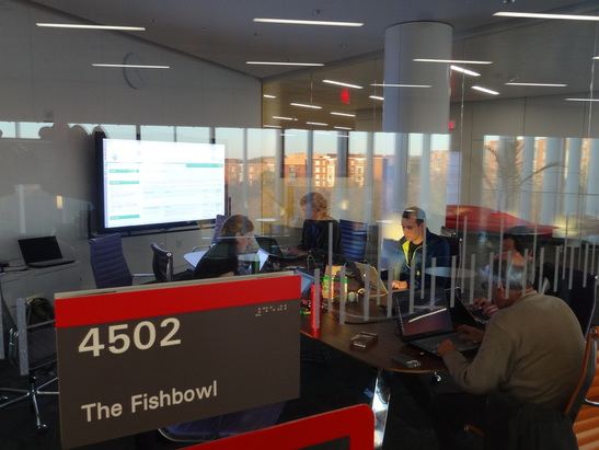
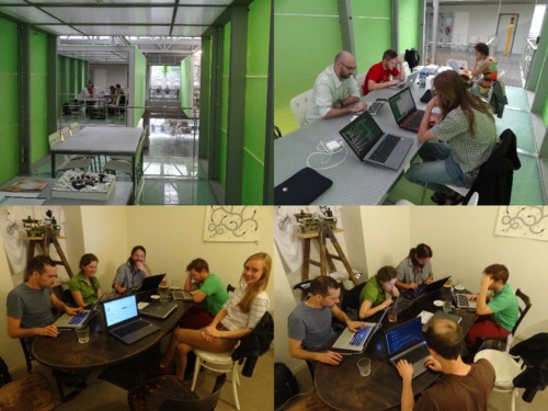
| 00:00, 21 February 2016 | Grass gis raleigh meetup feb20 2016.png (file) |  |
721 KB | Four photos from GRASS GIS Raleigh meetup, February 20, 2016. The Fishbowl room inside and from outside with the participants, visitors and people around in the Hunt library. | 1 |
| 01:07, 9 June 2016 | Grass meetup 2016 03 19.jpg (file) |  |
131 KB | GRASS GIS Raleigh meetup, March 19, 2016, The Hunt library | 1 |
| 01:59, 23 March 2017 | Grassgis logo colorlogo text whitebg.png (file) | 48 KB | GRASS GIS logo from https://grass.osgeo.org/download/logos/ Green color, white background, with text | 1 | |
| 01:02, 27 April 2021 | Hargrove 2021 repeat burnability.png (file) |  |
286 KB | Citation: William Hargrove, Jitendra Kumar, Steve Norman, Forrest Hoffman (2021). Empirical Global Fire Regimes Identify Common Fire Relationships Across the Planet. IALE - North America 2021 Annual Meeting, Virtual, April 11-15, Reno, Nevada, USA Des... | 1 |
| 01:03, 27 April 2021 | Hargrove 2021 within year seasonality.png (file) |  |
293 KB | Citation: William Hargrove, Jitendra Kumar, Steve Norman, Forrest Hoffman (2021). Empirical Global Fire Regimes Identify Common Fire Relationships Across the Planet. IALE - North America 2021 Annual Meeting, Virtual, April 11-15, Reno, Nevada, USA Des... | 1 |
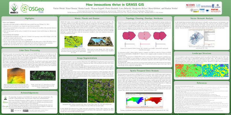
| 01:25, 26 February 2017 | How innovations thrive in GRASS GIS.png (file) |  |
331 KB | Capture from https://trac.osgeo.org/grass/browser/grass-promo/grassposter/2017_NCGIS_How_innovations_thrive/How_innovations_thrive_in_GRASS_GIS.pdf (provided by the author) | 1 |
| 01:33, 20 December 2015 | Hunt 2015 1.jpg (file) |  |
98 KB | Inside the Hunt library (Raleigh, NC) | 1 |
| 01:33, 20 December 2015 | Hunt 2015 2.jpg (file) |  |
80 KB | The Hunt library (Raleigh, NC) | 1 |
| 02:58, 25 September 2016 | Hunt Library with GRASS GIS logo.png (file) | 219 KB | Create XY location. r.import input=hunt.jpg output=hunt g.rename raster=hunt.1,hunt_red g.rename raster=hunt.2,hunt_green g.rename raster=hunt.3,hunt_blue g.region rast=hunt_red i.pca input=hunt_red,hunt_green,hunt_blue out=hunt_pca g.copy rast... | 1 | |
| 01:34, 20 December 2015 | Hunt fishbowl 2015 1.jpg (file) |  |
101 KB | Christmas GRASS GIS potential contributors meeting in Raleigh | 1 |
| 01:34, 20 December 2015 | Hunt fishbowl 2015 2.jpg (file) |  |
95 KB | Christmas GRASS GIS potential contributors meeting in Raleigh | 1 |
| 01:34, 20 December 2015 | Hunt fishbowl 2015 3.jpg (file) |  |
95 KB | Christmas GRASS GIS potential contributors meeting in Raleigh | 1 |
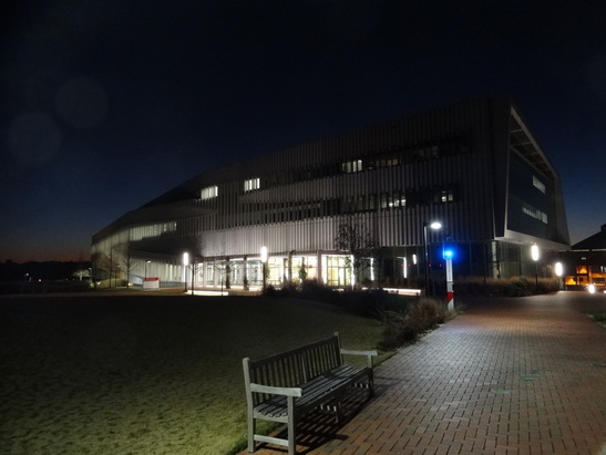
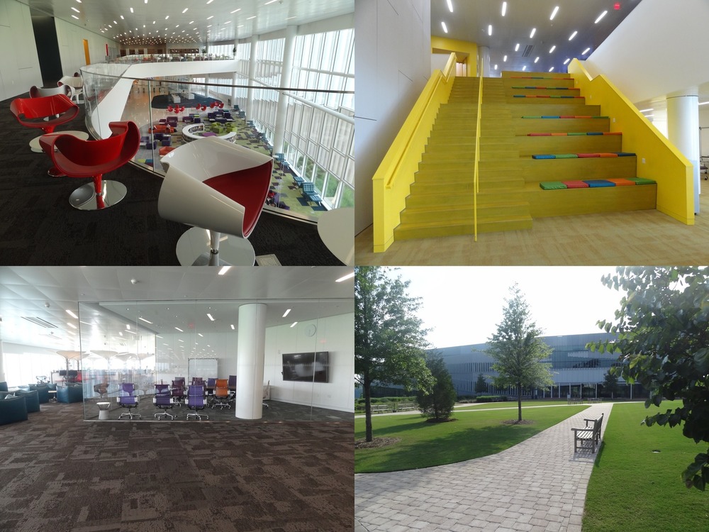
| 00:45, 9 June 2016 | Hunt library spaces.jpg (file) |  |
206 KB | Spaces in the NC State Hunt library and the building from outside. Empty Fish bowl after the GRASS GIS Raleigh meetup and almost empty library during the summer. | 1 |
| 15:14, 2 June 2017 | Icc2017 logo.png (file) | 64 KB | Logo of the 28th International Cartographic Conference of the International Cartographic Association, Washington, DC, July 2 to 7, 2017 http://icc2017.org/ http://icc2017.org/wp-content/uploads/2016/08/logo.png | 1 | |
| 01:02, 23 April 2021 | Inglis 2021 boulder viewscape.png (file) |  |
1.13 MB | Citation: Nicole Inglis, Jelena Vukomanovic (2021). Temporally Dynamic Viewscapes for Modeling the Visual Amenities of Exurban Housing Development. IALE - North America 2021 Annual Meeting, Virtual, April 11-15, Reno, Nevada, USA Description: Viewshed... | 1 |
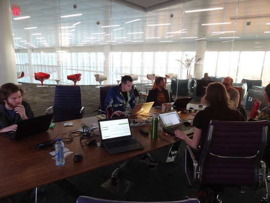
| 19:38, 5 August 2016 | Isprs prague meetup.jpg (file) |  |
63 KB | Photos taken during ISPRS Prague meetup 2016 in CTU FCE Atelier D and Pracovna Café | 1 |
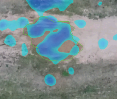
| 16:43, 29 February 2016 | Jeziorska uav grass puddle mar 18.png (file) |  |
207 KB | Comparison of simulated surface water flow and puddle in orthophoto Justyna Jeziorska, Helena Mitasova, Anna Petrasova, Vaclav Petras, Darshan Divakaran, Thomas Zajkowski (2016): Overland flow analysis using time series of sUAS-derived elevation model... | 1 |