Uploads by ⚠️Wenzeslaus
Jump to navigation
Jump to search
This special page shows all uploaded files.
| Date | Name | Thumbnail | Size | Description | Versions |
|---|---|---|---|---|---|
| 01:06, 8 March 2017 | Ncgis logo 2017.png (file) | 4 KB | NCGIS conference 2017 logo http://ncgisconference.com/ | 1 | |
| 19:22, 21 January 2019 | AGU 2018 logo.png (file) | 13 KB | Logo of AGU 2018 American Geophysical Union, Fall Meeting 2018, Washington, D.C. https://fallmeeting.agu.org/2018/ For use at pages about AGU or mentioning AGU at this wiki. | 1 | |
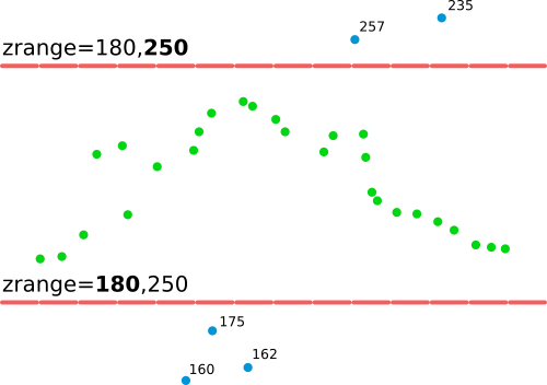
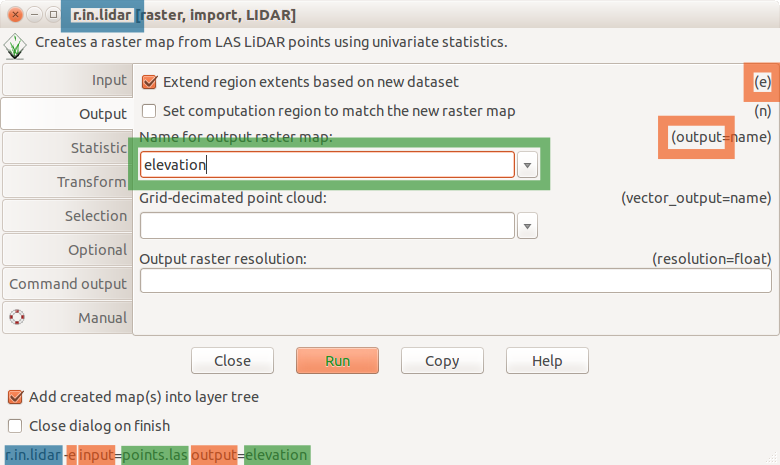
| 15:52, 19 July 2017 | R in lidar explanation of zrange option.png (file) |  |
14 KB | Explanation of zrange option applicable to v.in.lidar or r.in.lidar | 1 |
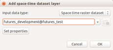
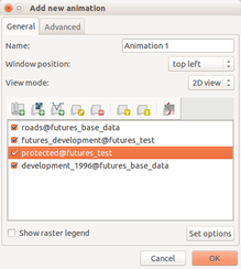
| 17:59, 12 February 2016 | Futures anim animation time series.png (file) |  |
14 KB | Animation tool: select time series | 1 |
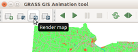
| 18:04, 12 February 2016 | Futures anim render animation.png (file) |  |
19 KB | (Re-)render animation in the animation tool | 1 |
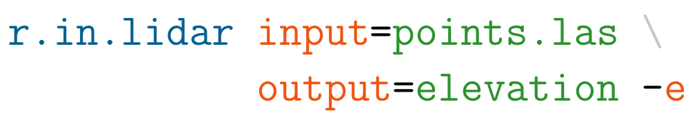
| 17:42, 19 July 2017 | Example r.in.lidar command in Bash.png (file) | 23 KB | Example r.in.lidar command in Bash with highlighted module name (blue), options and flags (red) and option values (green) | 1 | |
| 00:38, 21 May 2023 | OSGeo JP logo for web.png (file) | 23 KB | Logo of OSGeo Japan (OSGeo.JP) https://www.osgeo.jp/ | 1 | |
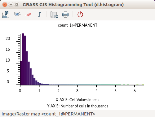
| 01:41, 1 August 2017 | GRASS GIS Histogramming Tool d.histogram - count of point.png (file) |  |
24 KB | d.histogram powered histogram in GRASS GIS 7.2 Count of points per cell | 1 |
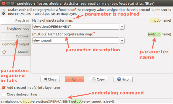
| 03:46, 24 March 2017 | Wxgui module parameters r neighbors.png (file) |  |
25 KB | wxGUI dialog/form for r.neighbors with descriptions and highlights | 1 |
| 20:49, 7 March 2017 | Foss4g boston 2017 logo.png (file) | 25 KB | http://2017.foss4g.org/ | 1 | |
| 17:58, 12 February 2016 | Futures anim animation layers.png (file) |  |
30 KB | 1 | |
| 21:22, 7 March 2017 | Us-iale logo.jpg (file) | 30 KB | http://baltimore2017.usiale.org/ https://usiale.org/ | 1 | |
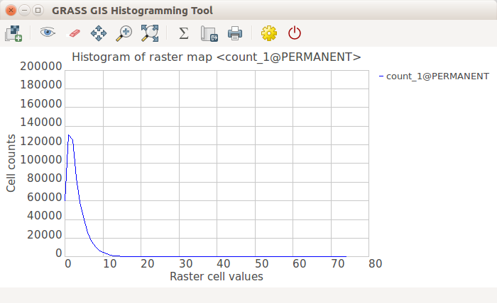
| 01:41, 1 August 2017 | GRASS GIS Histogramming Tool wxPython - count of point.png (file) |  |
33 KB | wxPython powered histogram in GRASS GIS 7.2 | 1 |
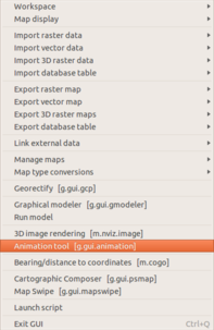
| 18:05, 12 February 2016 | Futures anim start animation tool.png (file) |  |
36 KB | Start animation from the file menu | 1 |
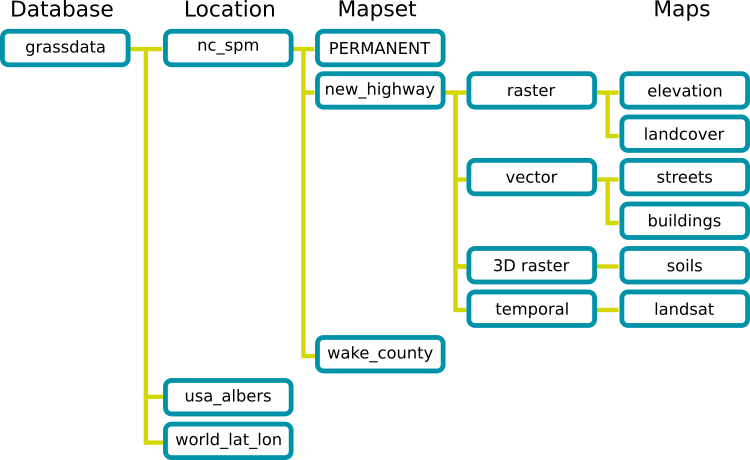
| 01:22, 24 March 2017 | Grass database.png (file) |  |
36 KB | GRASS GIS Spatial Database structure trunk/doc/grass_database.png r70793 | 1 |
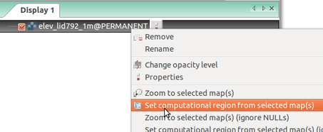
| 13:53, 24 March 2017 | Wxgui computational region set from raster.png (file) |  |
39 KB | Setting computational region (extent and resolution) based on a raster in Layer Manager in wxGUI (GRASS GIS 7.0) | 1 |
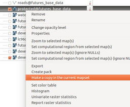
| 18:02, 12 February 2016 | Futures anim make copy.png (file) |  |
40 KB | Copy raster map to the current mapset using layer context menu | 1 |
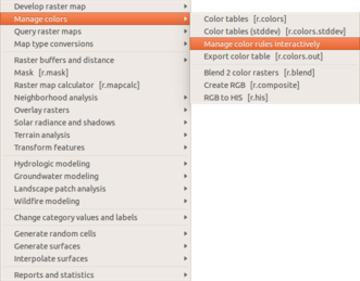
| 18:06, 12 February 2016 | Futures anim start raster color.png (file) |  |
43 KB | Manage color table interactively in the Raster menu | 1 |
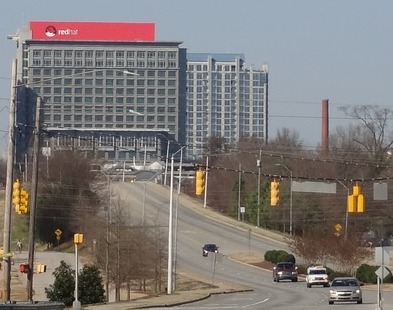
| 02:05, 21 April 2016 | Red hat raleigh.jpg (file) |  |
43 KB | Red Hat Tower in Downtown Raleigh | 1 |
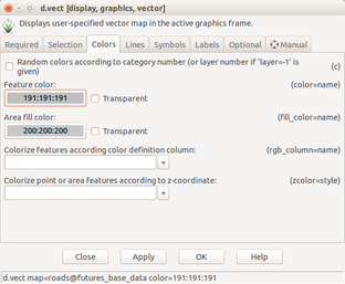
| 18:07, 12 February 2016 | Futures anim vector set color.png (file) |  |
47 KB | Set vector layer color using d.vect dialog | 1 |
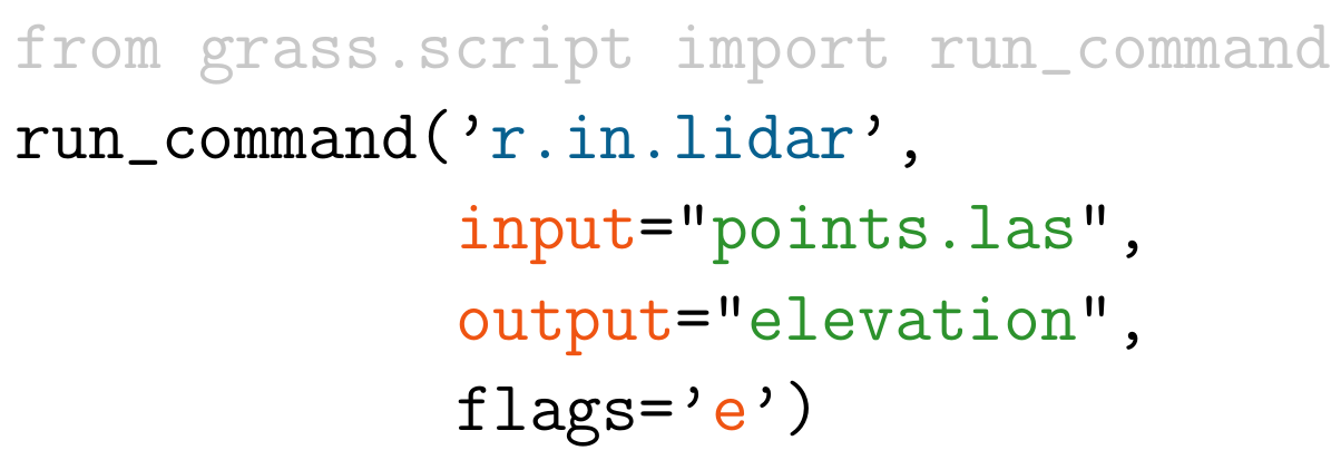
| 17:44, 19 July 2017 | Example r.in.lidar command in Python.png (file) |  |
47 KB | Example r.in.lidar command in Python with highlighted module name (blue), options and flags (red) and option values (green) and import (grey) | 1 |
| 01:59, 23 March 2017 | Grassgis logo colorlogo text whitebg.png (file) | 48 KB | GRASS GIS logo from https://grass.osgeo.org/download/logos/ Green color, white background, with text | 1 | |
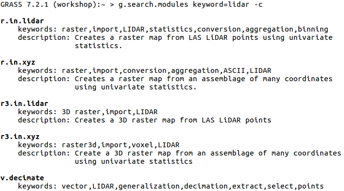
| 02:30, 8 August 2017 | G search modules with c flag.png (file) |  |
50 KB | {{cmd|g.search.modules}} keyword=lidar -c Searches through descriptions and keywords. Displays using color. | 1 |
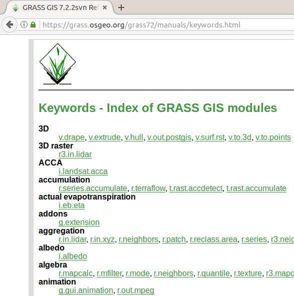
| 15:19, 21 July 2017 | Manual pages online keywords 7.2.png (file) |  |
51 KB | https://grass.osgeo.org/grass72/manuals/keywords.html for 7.2.2svn showing web browser tab and part of the page | 1 |
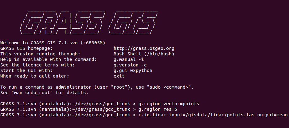
| 18:12, 19 July 2017 | Grass gis cli ubuntu purple r.in.lidar.png (file) |  |
52 KB | GRASS GIS command line interface (CLI) in Ubuntu terminal (purple/violet) Commands: g.region vector=points g.region res=5 r.in.lidar input=/gisdata/lidar/points.las output=mean | 1 |
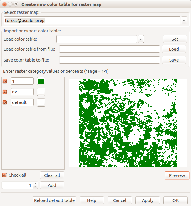
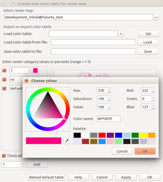
| 19:23, 24 March 2017 | Create new color table for raster map forest.png (file) |  |
53 KB | Dialog for interactive change of color table with preview r.mapcalc "forest = if(landclass96 == 5, 1, null())" | 1 |
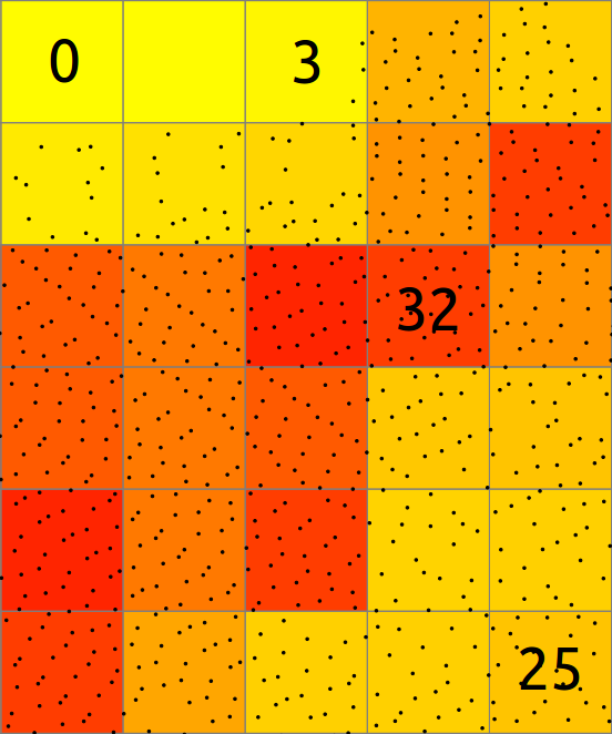
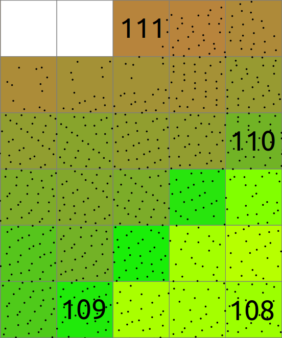
| 15:19, 19 July 2017 | Binning count explanation.png (file) |  |
54 KB | Explanation of binning of points into a 2D raster map. | 1 |
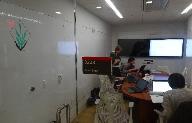
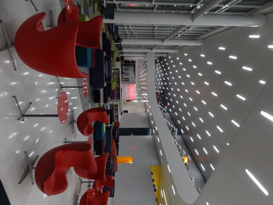
| 01:08, 31 January 2016 | Room3208 jan30.jpg (file) |  |
56 KB | GRASS GIS Raleigh meetup, January 30, Hunt lib, room 3208 | 1 |
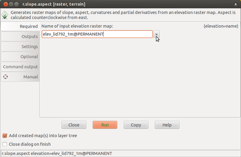
| 15:13, 24 March 2017 | R slope aspect 1 required.png (file) |  |
57 KB | r.slope.aspect Required tab (input elevation) | 1 |
| 17:38, 19 July 2017 | R in lidar dialog.png (file) |  |
58 KB | r.in.lidar dialog with Output tab active and highlighted module name (blue), options and flags (red) and option values (green) | 1 |
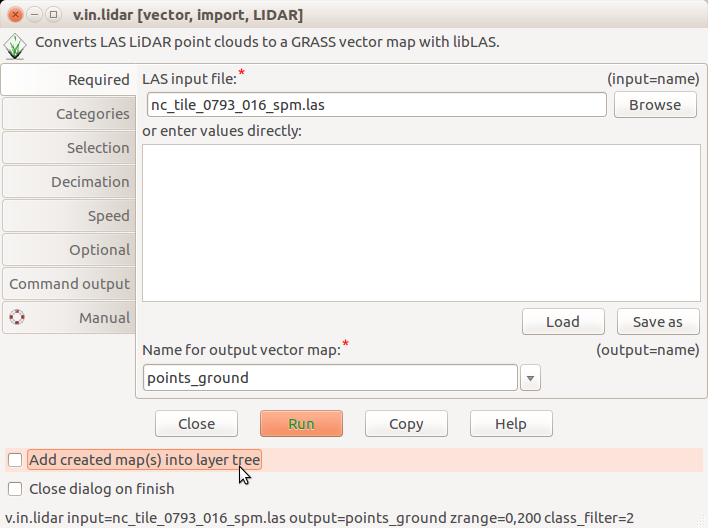
| 20:55, 31 July 2017 | V.in.lidar dialog do not add into layer tree.png (file) |  |
59 KB | Unchecked ''Add created map(s) into layer tree'' in v.in.lidar | 1 |
| 15:20, 19 July 2017 | Binning mean explanation.png (file) |  |
61 KB | Explanation of binning of points into a 2D raster map where resulting cell value is mean of point values. | 1 |
| 18:03, 12 February 2016 | Futures anim raster set color.png (file) |  |
63 KB | Set color for category using interactive color table editing tool | 1 |
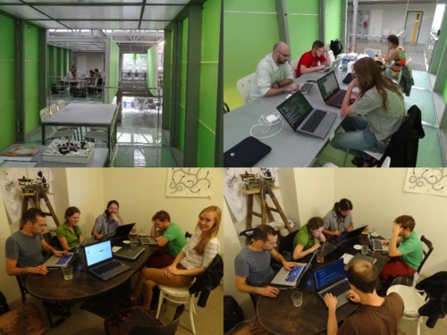
| 19:38, 5 August 2016 | Isprs prague meetup.jpg (file) |  |
63 KB | Photos taken during ISPRS Prague meetup 2016 in CTU FCE Atelier D and Pracovna Café | 1 |
| 15:14, 2 June 2017 | Icc2017 logo.png (file) | 64 KB | Logo of the 28th International Cartographic Conference of the International Cartographic Association, Washington, DC, July 2 to 7, 2017 http://icc2017.org/ http://icc2017.org/wp-content/uploads/2016/08/logo.png | 1 | |
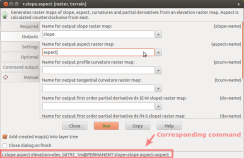
| 15:14, 24 March 2017 | R slope aspect 2 outputs.png (file) |  |
77 KB | r.slope.aspect Outputs tab (slope and aspect outputs) with corresponding command highlighted | 1 |
| 01:33, 20 December 2015 | Hunt 2015 2.jpg (file) |  |
80 KB | The Hunt library (Raleigh, NC) | 1 |
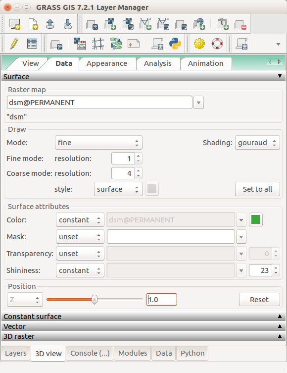
| 02:47, 6 August 2017 | Nviz data tab dsm set relative positon.png (file) |  |
82 KB | GRASS GIS 7.2 3D view in wxGUI, 3D view tab, Data tab, Surface | 1 |
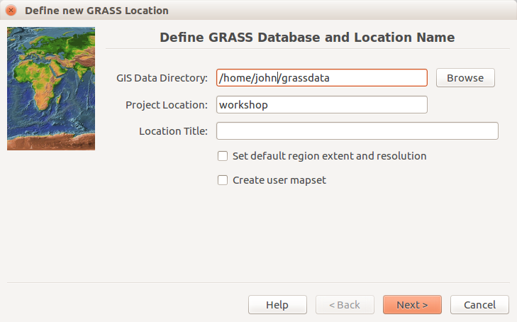
| 15:25, 21 July 2017 | Location wizard define.png (file) |  |
83 KB | Initial (define path and names) page of the Location Wizard. The user name is john. The location name workshop. Database is in /home/john/grassdata. Screenshot from GRASS GIS 7.2.1. | 1 |
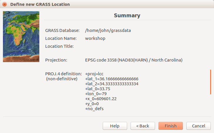
| 15:22, 21 July 2017 | Location wizard summary 7.2.1.png (file) |  |
88 KB | Summary page of the Location Wizard. The user name is john. The location name workshop. Database is in /home/john/grassdata. EPSG is 3358. | 1 |
| 02:56, 27 April 2023 | Screenshot from 2023-04-26 22-52-53.png (file) |  |
89 KB | 1 | |
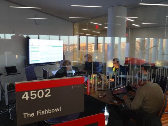
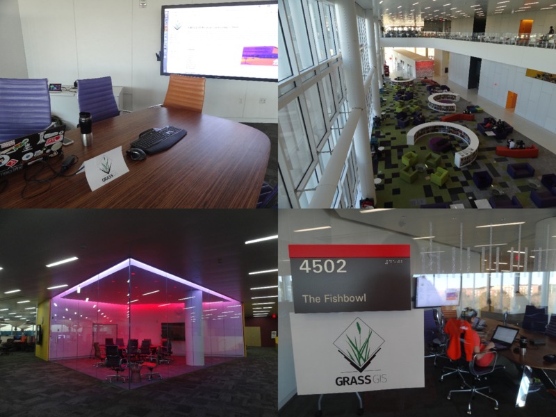
| 01:34, 20 December 2015 | Hunt fishbowl 2015 3.jpg (file) |  |
95 KB | Christmas GRASS GIS potential contributors meeting in Raleigh | 1 |
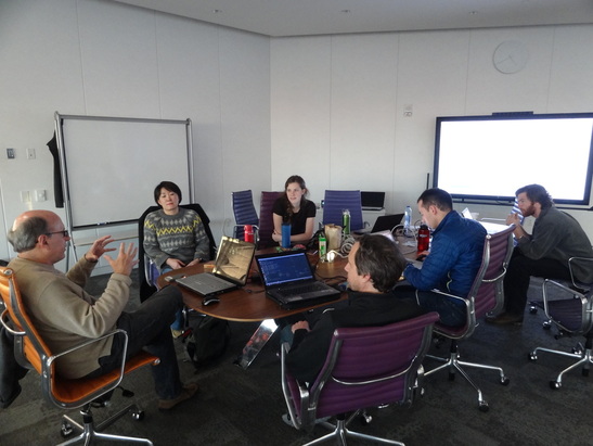
| 01:34, 20 December 2015 | Hunt fishbowl 2015 2.jpg (file) |  |
95 KB | Christmas GRASS GIS potential contributors meeting in Raleigh | 1 |
| 01:33, 20 December 2015 | Hunt 2015 1.jpg (file) |  |
98 KB | Inside the Hunt library (Raleigh, NC) | 1 |
| 01:34, 20 December 2015 | Hunt fishbowl 2015 1.jpg (file) |  |
101 KB | Christmas GRASS GIS potential contributors meeting in Raleigh | 1 |
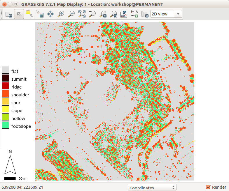
| 02:17, 15 August 2017 | R geomorphon lidar dsm vegetation.png (file) |  |
103 KB | r.geomorphon setting showing vegetation | 1 |
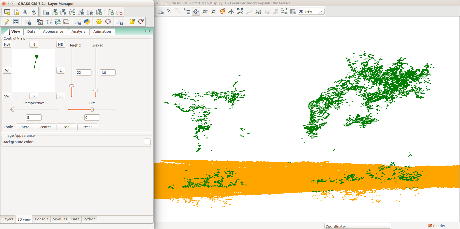
| 04:09, 6 August 2017 | Selection 409.png (file) |  |
115 KB | GRASS GIS 7.2 3D view in wxGUI, 3D view tab, View tab, group point cloud (orange), non-ground point cloud (green), detail (trees) | 1 |
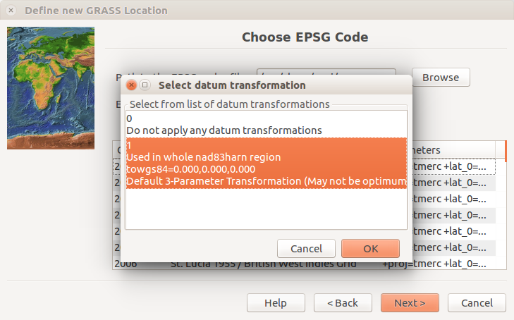
| 15:28, 21 July 2017 | Location wizard epsg datum transformation.png (file) | 116 KB | Choose EPSG page of the Location Wizard after pressing Next with a dialog for selecting datum transformation with the default selection. EPSG is 3358. Screenshot from GRASS GIS 7.2.1. | 1 | |
| 16:54, 29 February 2016 | Tangible landscape termite game.jpg (file) |  |
117 KB | https://geospatial.ncsu.edu/osgeorel/tangible-landscape.html | 1 |
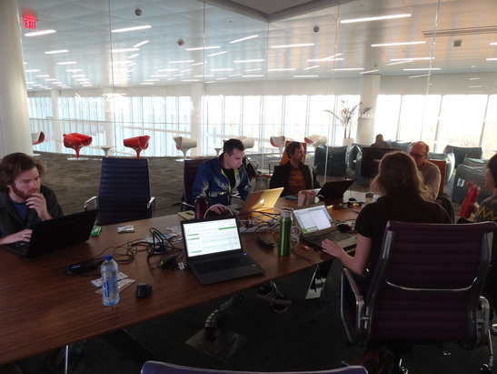
| 00:31, 6 November 2016 | Raleigh 2016 11 05.jpg (file) |  |
118 KB | GRASS GIS meetup, Hunt Library, Raleigh, NC, November 5, 2016 | 1 |