Search results
Jump to navigation
Jump to search
Page title matches
- 16 members (0 subcategories, 0 files) - 11:45, 21 May 2010
 Raster querying (2010-07-01) ...(1,280 × 800 (221 KB)) - 14:25, 1 July 2010
- ...MASKing can be even used inside a <code>ps.map</code> script. This way, a raster MASK can be applied to vector features that need to be masked. This is achi [[Category:Raster]] ...736 bytes (127 words) - 09:57, 5 February 2013
- * The resulting raster will contain aggregate values of the input raster, using the new grid topology ...1 KB (211 words) - 15:49, 26 August 2010
- 32 bytes (3 words) - 19:56, 24 April 2010
- What is be the recommended way to downsample a raster map? However, that requires that your raster contains no null cells ...662 bytes (112 words) - 00:56, 6 September 2014
- == Raster map precision types == * '''CELL DATA TYPE''': a raster map from INTEGER type (4 bytes, whole numbers only). ...8 KB (1,295 words) - 12:31, 7 February 2022
 (639 × 638 (13 KB)) - 19:35, 17 September 2012
- ....agent|version=7}} shall provide an inital base for organizing worlds with raster playgrounds and agents in. Still under development. {{AddonSrc|raster|r.area|version=7}} can be used to remove, areas smaller than treshold, recl ...16 KB (2,410 words) - 07:29, 25 June 2020
- 26 bytes (3 words) - 07:07, 26 August 2009
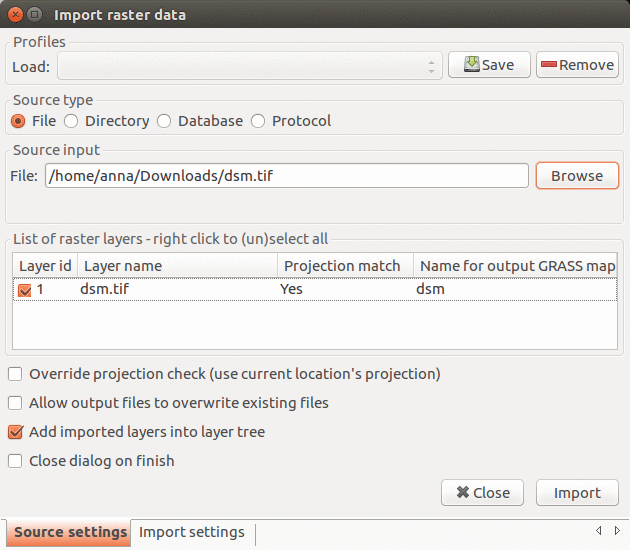 Import raster data dialog in GRASS GIS 7.2.1 ...(630 × 550 (130 KB)) - 14:02, 22 June 2017
- 31 bytes (4 words) - 07:07, 26 August 2009
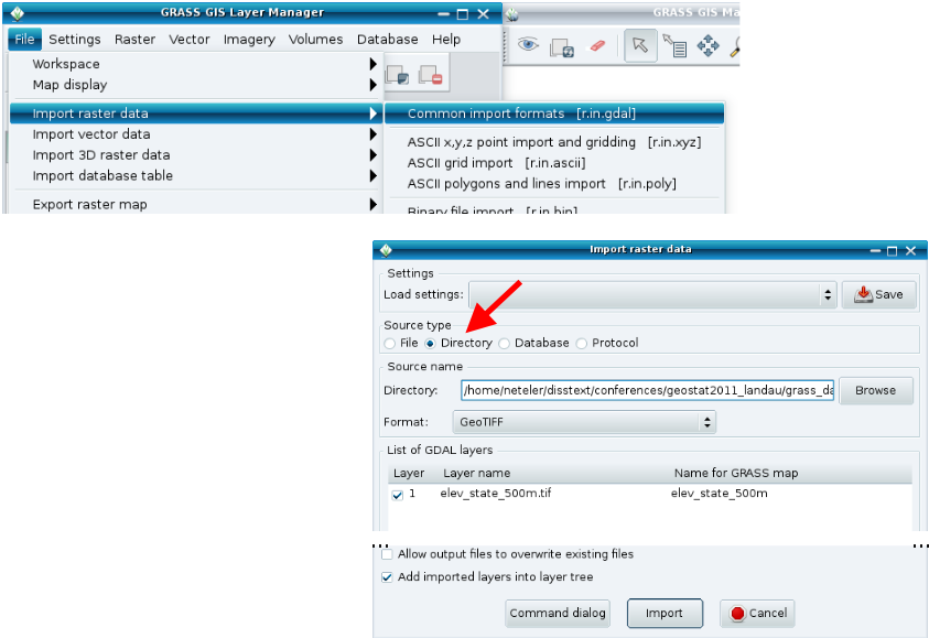 GRASS Raster Import for tutorial from geostat2012 seminar ...(843 × 579 (99 KB)) - 15:51, 25 April 2013
- == Raster Modules with OpenMP support == ...p and one which outputs a new raster map after some computation of a given raster map. ...5 KB (866 words) - 16:02, 19 August 2021
 (553 × 504 (355 KB)) - 15:13, 15 October 2010
 (554 × 505 (361 KB)) - 15:14, 15 October 2010
 (553 × 502 (239 KB)) - 15:14, 15 October 2010
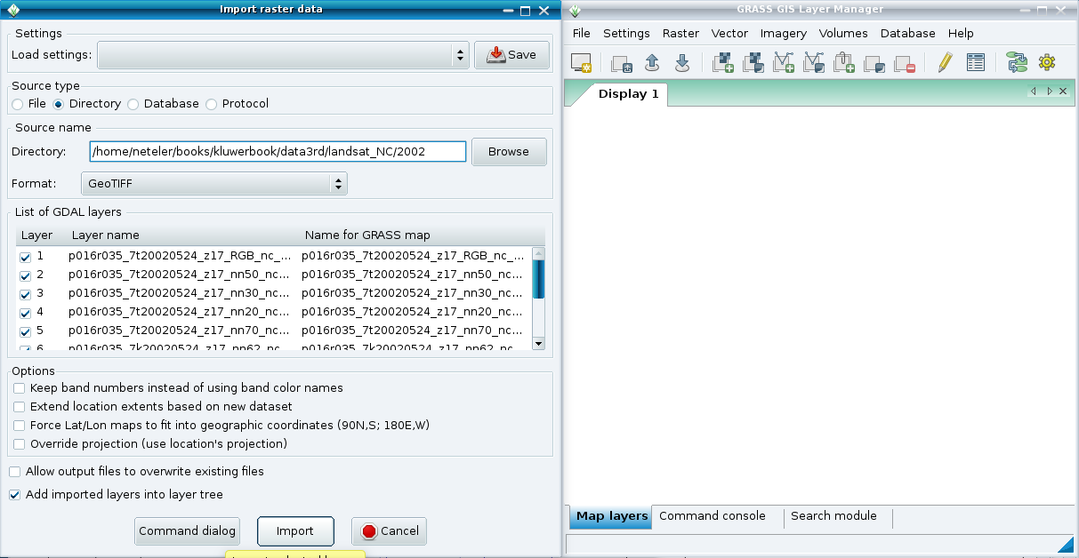 (1,213 × 628 (74 KB)) - 08:53, 1 May 2011
- [[Category:Raster]] ...8 KB (1,399 words) - 09:52, 27 September 2019
 (554 × 503 (153 KB)) - 15:05, 9 October 2010


Page text matches
 ps.map sample showing 4 raster maps on a single page by saving each raster as EPS first. ...(646 × 512 (65 KB)) - 07:07, 25 October 2007
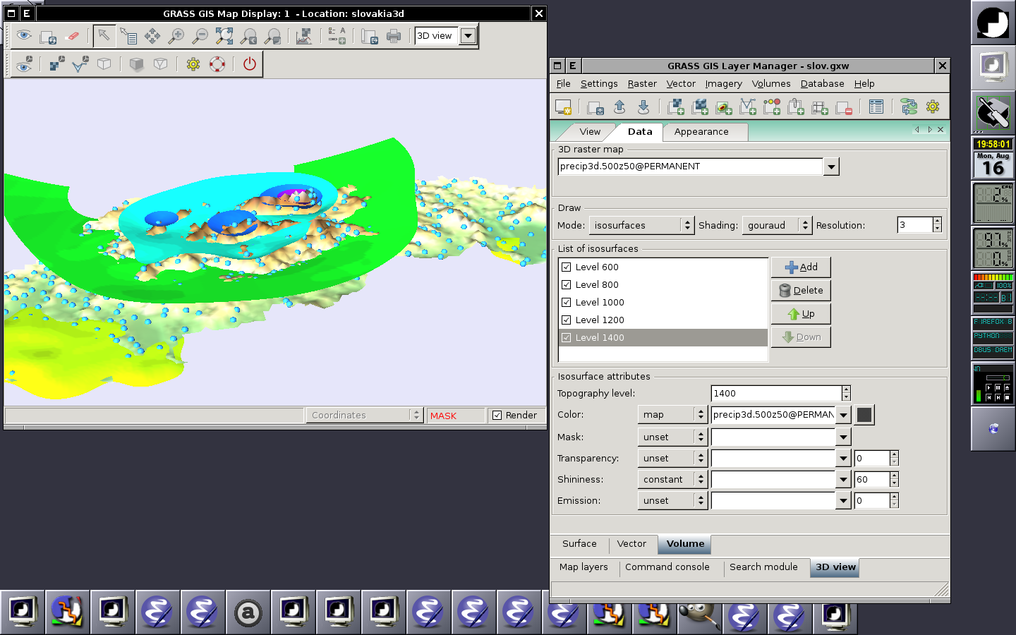 Displaying raster (surface), 2D vector and 3D raster (volume) in the 3D space (2010-08-16) ...(1,440 × 900 (259 KB)) - 18:04, 16 August 2010
 ...dar), converted to vector map and then interpolated (e.g. v.surf.rst) into raster or analyzed as vector map (e.g. v.vect.stats). ...(2,613 × 966 (127 KB)) - 15:17, 19 July 2017
 Computational region concept showing one large raster (blue) and one other raster with smaller extent (green) which matches the current computational region g.region raster=elevation ...(798 × 613 (250 KB)) - 13:40, 24 March 2017
- What is be the recommended way to downsample a raster map? However, that requires that your raster contains no null cells ...662 bytes (112 words) - 00:56, 6 September 2014
 g.rename raster=hunt.1,hunt_red g.rename raster=hunt.2,hunt_green ...(499 × 375 (219 KB)) - 02:58, 25 September 2016
- ===Raster add-ons=== ...367 bytes (49 words) - 19:15, 19 October 2012
- == Raster data == ...u/dataservice/available2.asp?type=findkeyword&theme=raster%20data European raster datasets available through EEA's Dataservice] ...977 bytes (131 words) - 22:50, 10 August 2009
- ...be used to calculate statistics based on the clumps instead of individual raster cells. * '''{{cmd|r.univar}}: univariate and zonal raster statistics''' ...2 KB (295 words) - 11:32, 5 April 2017
- <nowiki>{{src|raster/r.info/main.c}}</nowiki> : {{src|raster/r.info/main.c}} ...858 bytes (113 words) - 09:53, 7 March 2024
- ===Raster add-ons=== * [[AddOns/GRASS6/raster]] ...586 bytes (81 words) - 01:28, 6 December 2011
- ==Raster data management== ...used. The module <code>r.extenal</code> can be used in lieu of importing a raster into GRASS. ...1 KB (235 words) - 09:47, 9 August 2013
- === Raster addons === svn co https://svn.osgeo.org/grass/grass-addons/raster/r.terracost ...1 KB (160 words) - 19:15, 19 October 2012
- ...oduction system, and spatial modeling system. It contains many modules for raster and vector data manipulation, rendering images on the monitor or paper, mul ...439 bytes (57 words) - 06:57, 14 October 2022
 Raster add icon ...(24 × 24 (491 bytes)) - 23:08, 15 February 2012
 Raster with three file as input ...(561 × 510 (501 KB)) - 14:37, 15 October 2010
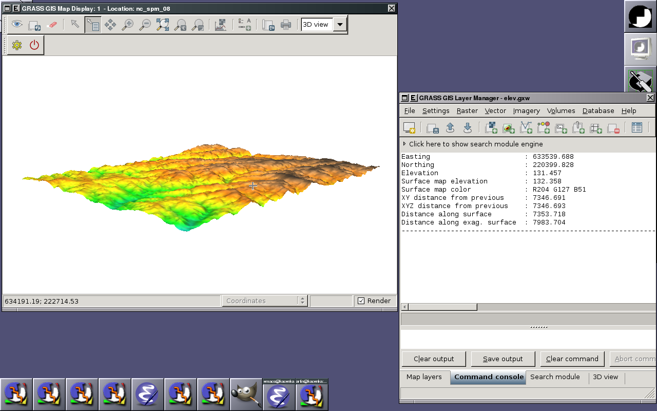
 nc_spm_08 raster surface trials ...(957 × 413 (149 KB)) - 14:55, 27 February 2010
- ==== Raster ==== ...774 bytes (120 words) - 04:15, 19 November 2009
 Raster with one file as input ...(569 × 517 (362 KB)) - 14:36, 15 October 2010
 Raster with two file as input ...(568 × 515 (450 KB)) - 14:37, 15 October 2010


