File:Mean monthly global rad maps over a study area in central Greece.png
Jump to navigation
Jump to search
No higher resolution available.
Mean_monthly_global_rad_maps_over_a_study_area_in_central_Greece.png (711 × 400 pixels, file size: 470 KB, MIME type: image/png)
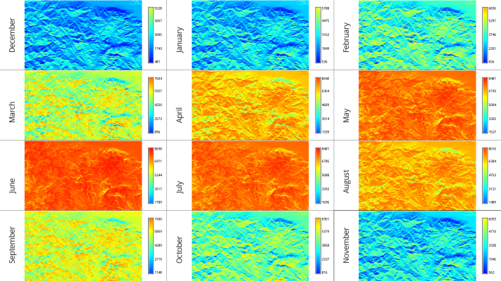
Overview of 12 mean monthly global irradiation maps over a study area in central Greece (s=38.531, e=22.436, n=38.918, w=21.793)
File history
Click on a date/time to view the file as it appeared at that time.
| Date/Time | Thumbnail | Dimensions | User | Comment | |
|---|---|---|---|---|---|
| current | 18:14, 21 July 2010 | | 711 × 400 (470 KB) | ⚠️NikosA (talk | contribs) | Overview of 12 mean monthly global irradiation maps over a study area in central Greece (s=38.531, e=22.436, n=38.918, w=21.793) |
You cannot overwrite this file.
File usage
The following page uses this file: