File:WxGUI metadata rinfo.png
Jump to navigation
Jump to search
Size of this preview: 800 × 386 pixels. Other resolution: 1,184 × 571 pixels.
Original file (1,184 × 571 pixels, file size: 65 KB, MIME type: image/png)
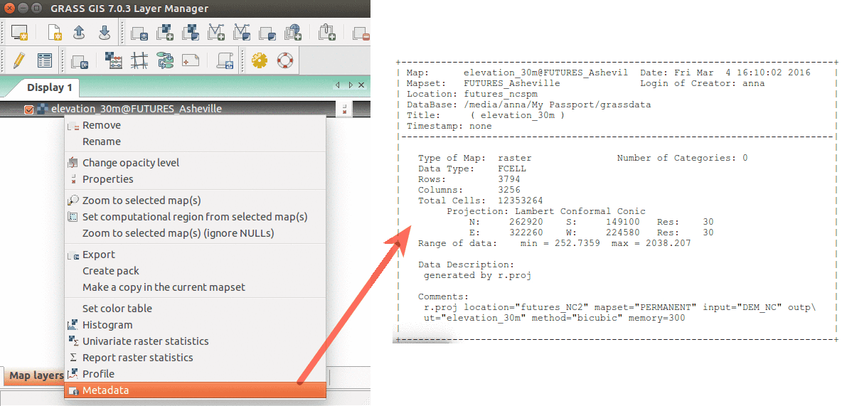
Show raster map metadata by right click on layer
File history
Click on a date/time to view the file as it appeared at that time.
| Date/Time | Thumbnail | Dimensions | User | Comment | |
|---|---|---|---|---|---|
| current | 03:41, 17 March 2016 | | 1,184 × 571 (65 KB) | Annakrat (talk | contribs) | Show raster map metadata by right click on layer |
You cannot overwrite this file.
File usage
The following 7 pages use this file:
- Analytical data visualizations at ICC 2017
- Analytical data visualizations at ICC 2017/es
- FUTURES land-change modeling for evaluating innovative conservation scenarios
- From GRASS GIS novice to power user (workshop at FOSS4G Boston 2017)
- Unleash the power of GRASS GIS at US-IALE 2017
- Unleash the power of GRASS GIS at US-IALE 2017/es
- Workshop on urban growth modeling with FUTURES