File:SlopePoint bathy.jpg: Difference between revisions
Jump to navigation
Jump to search
(Example of raw x,y,z bathymetry imported from MB-System and gridded with {{cmd|r.in.xyz}}. Slope Point, the southern-most point on the New Zealand mainland.) |
(No difference)
|
Latest revision as of 17:27, 8 January 2010
File history
Click on a date/time to view the file as it appeared at that time.
| Date/Time | Thumbnail | Dimensions | User | Comment | |
|---|---|---|---|---|---|
| current | 17:27, 8 January 2010 | 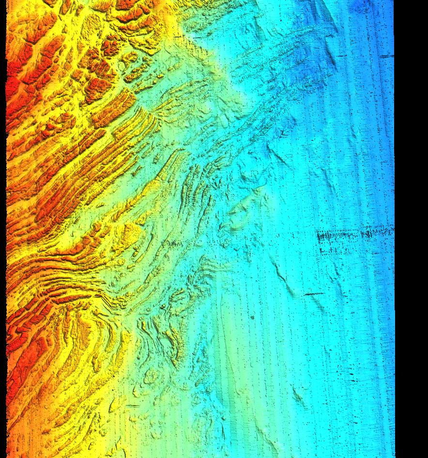 | 884 × 946 (246 KB) | ⚠️HamishBowman (talk | contribs) | Example of raw x,y,z bathymetry imported from MB-System and gridded with {{cmd|r.in.xyz}}. Slope Point, the southern-most point on the New Zealand mainland. |
You cannot overwrite this file.
File usage
The following page uses this file: