File:Mean monthly global rad maps over a study area in central Greece 700px height.jpg
Size of this preview: 800 × 450 pixels. Other resolution: 1,245 × 700 pixels.
Original file (1,245 × 700 pixels, file size: 271 KB, MIME type: image/jpeg)
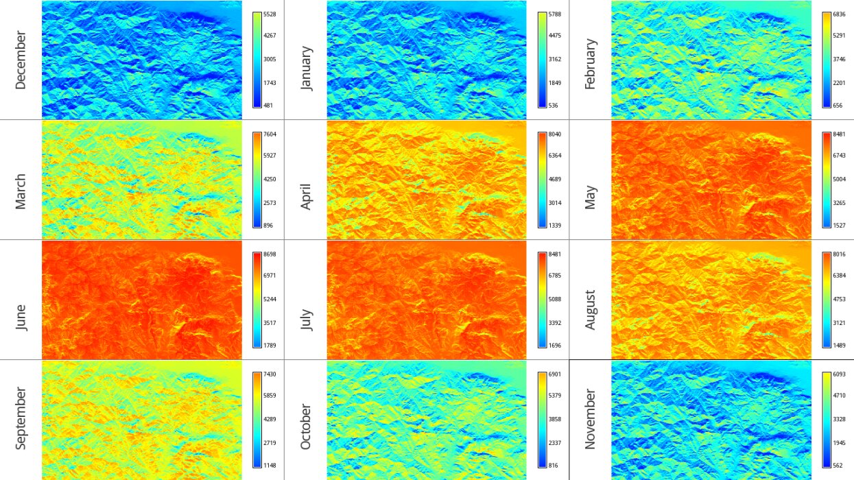
Overview of 12 mean monthly global irradiation maps over a study area in central Greece (s=38.531, e=22.436, n=38.918, w=21.793)
File history
Click on a date/time to view the file as it appeared at that time.
| Date/Time | Thumbnail | Dimensions | User | Comment | |
|---|---|---|---|---|---|
| current | 18:41, 21 July 2010 | | 1,245 × 700 (271 KB) | ⚠️NikosA (talk | contribs) | Overview of 12 mean monthly global irradiation maps over a study area in central Greece (s=38.531, e=22.436, n=38.918, w=21.793) |
You cannot overwrite this file.
File usage
There are no pages that use this file.