File:US temp model comparison.png
Size of this preview: 800 × 309 pixels. Other resolution: 1,624 × 627 pixels.
Original file (1,624 × 627 pixels, file size: 529 KB, MIME type: image/png)
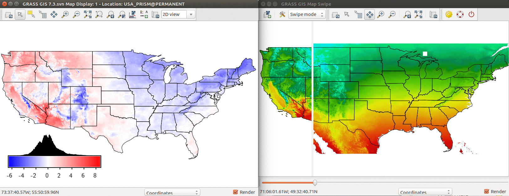
Comparison of PRISM annual mean temperature and modeled temperature based on latitude and elevation. Left: Difference between modeled and real temperature in degree Celsius. Right: Using Map Swipe to visually assess the model (modeled temperature on the right side).
File history
Click on a date/time to view the file as it appeared at that time.
| Date/Time | Thumbnail | Dimensions | User | Comment | |
|---|---|---|---|---|---|
| current | 20:03, 4 April 2017 | 1,624 × 627 (529 KB) | Annakrat (talk | contribs) | Comparison of PRISM annual mean temperature and modeled temperature based on latitude and elevation. Left: Difference between modeled and real temperature in degree Celsius. Right: Using Map Swipe to visually assess the model (modeled temperature on th... |
You cannot overwrite this file.
File usage
The following 2 pages use this file: