File:Una basin reservoir project Taubate SP Brasil png.png: Difference between revisions
Jump to navigation
Jump to search
⚠️Cscatelani (talk | contribs) No edit summary |
⚠️Cscatelani (talk | contribs) No edit summary |
||
| Line 1: | Line 1: | ||
this picture released on NVIZ GRASS presents a visualization of the a lake to be formed | this picture released on NVIZ GRASS presents a visualization of the a lake to be formed if dam is constructed in this area. This would prevent several environment impacts on the Una watershed basin located in Taubaté municipality, in São Paulo State, southeast Brazil. | ||
Latest revision as of 23:33, 11 February 2008
this picture released on NVIZ GRASS presents a visualization of the a lake to be formed if dam is constructed in this area. This would prevent several environment impacts on the Una watershed basin located in Taubaté municipality, in São Paulo State, southeast Brazil.
File history
Click on a date/time to view the file as it appeared at that time.
| Date/Time | Thumbnail | Dimensions | User | Comment | |
|---|---|---|---|---|---|
| current | 12:54, 10 February 2008 | 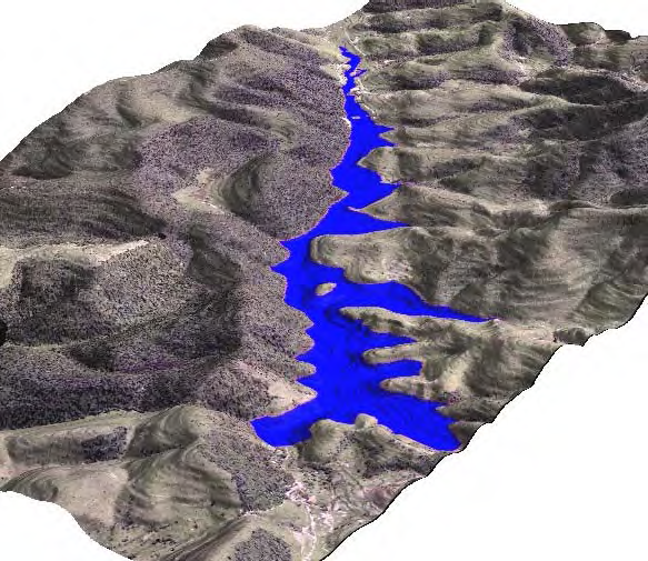 | 583 × 505 (524 KB) | ⚠️Cscatelani (talk | contribs) | this picture presents a visualization of the a lake to be formed on a construction of a reservoir in a future project to be improved whith several environment impacts on the Una watershed basin located in Taubaté municipality, in São Paulo State, southe |
You cannot overwrite this file.
File usage
The following 2 pages use this file: