GRASS GIS Standardized Sample Datasets: Difference between revisions
Jump to navigation
Jump to search
⚠️Wenzeslaus (talk | contribs) (add known usages section) |
⚠️Wenzeslaus (talk | contribs) (mention some helpful modules) |
||
| Line 62: | Line 62: | ||
* [http://grass.osgeo.org/grass70/manuals/ GRASS GIS manual] (currently using original, not fully compliant North Carolina GRASS Sample Location) | * [http://grass.osgeo.org/grass70/manuals/ GRASS GIS manual] (currently using original, not fully compliant North Carolina GRASS Sample Location) | ||
* [http://courses.ncsu.edu/gis582/common/ NCSU Geospatial Modeling and Analysis course] and other [http://geospatial.ncsu.edu/osgeorel/courses.html NCSU OSGeoREL courses] (currently using original, not fully compliant North Carolina GRASS Sample Location) | * [http://courses.ncsu.edu/gis582/common/ NCSU Geospatial Modeling and Analysis course] and other [http://geospatial.ncsu.edu/osgeorel/courses.html NCSU OSGeoREL courses] (currently using original, not fully compliant North Carolina GRASS Sample Location) | ||
== Tools to help with managing a dataset == | |||
* [http://grass.osgeo.org/grass70/manuals/g.rename.html g.rename] for changing names of individual raster and vector maps | |||
* [http://grass.osgeo.org/grass70/manuals/addons/g.rename.many.html g.rename.many] for renaming large amount of maps (to standard names or to/from different language) | |||
* [http://grass.osgeo.org/grass70/manuals/addons/r.in.proj.html r.in.proj] and [http://grass.osgeo.org/grass70/manuals/addons/v.in.proj.html v.in.proj] for importing data with different coordinate system | |||
Revision as of 03:24, 4 June 2015
See Trac wiki page for the development of the dataset.
List of datasets
- Future GRASS GIS Sample Dataset (reference for other datasets, under development)
- Original North Carolina GRASS Sample Location (map names partially standardized, content partially standardized, currently used dataset, to be depreciated)
- Piemonte, Italy (map names not standardized, content not standardized, work in progress)
Examples
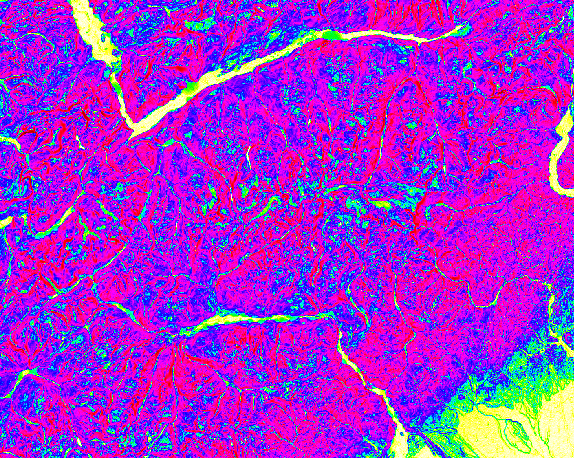
Computing slope and aspect
Compute slope, aspect and profile curvature of the terrain:
g.region raster=elevation
r.slope.aspect elevation=elevation slope=slope aspect=aspect pcurvature=profile_curvature
-
Aspect (North Carolina, USA)
-
Slope (North Carolina, USA)
-
Profile curvature (North Carolina, USA)
-
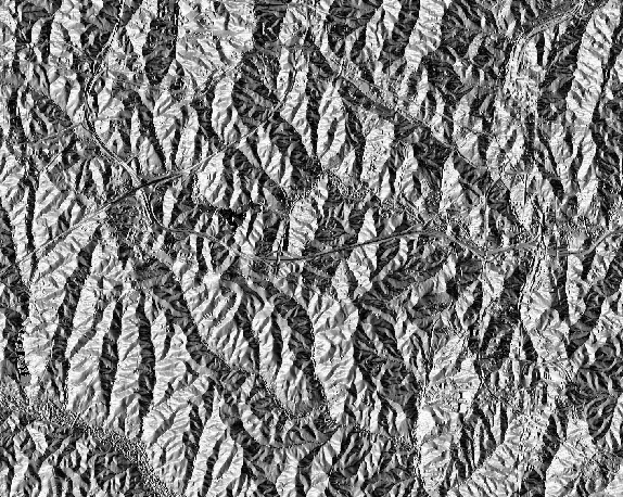
Aspect (Piemonte, Italy)
-
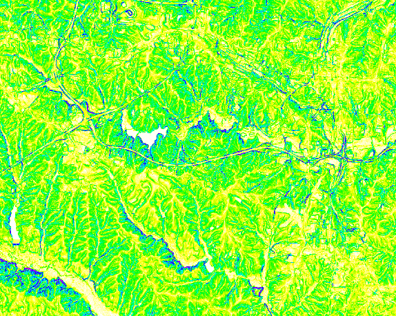
Slope (Piemonte, Italy)
-
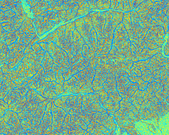
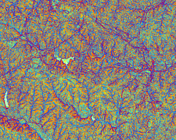
Profile curvature (Piemonte, Italy)


Visualizing shaded relief
Visualize digital elevation model with shaded relief:
g.region raster=elevation
r.relief input=elevation output=shade
d.shade shade=shade color=elevation
-
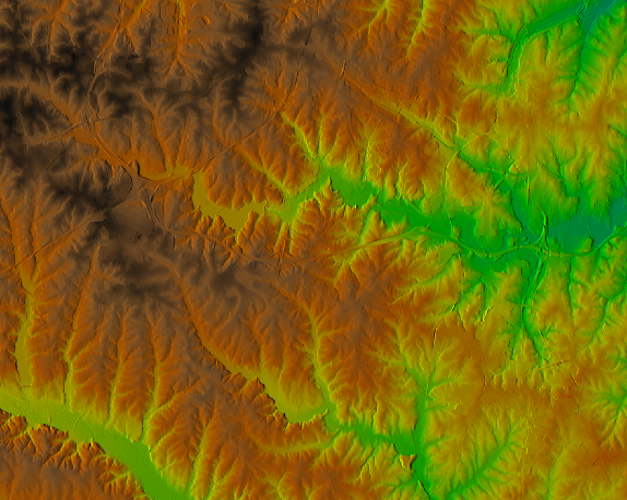
North Carolina, USA
-
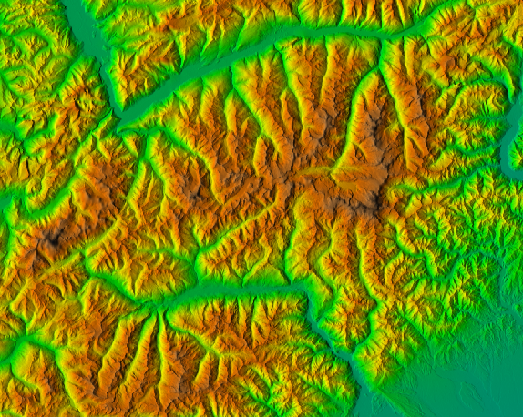
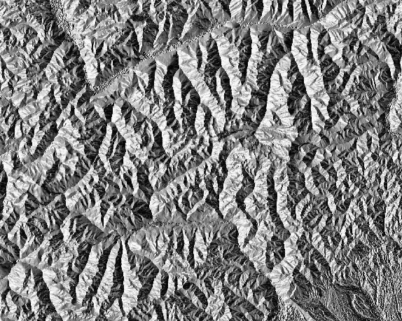
Piemonte, Italy


Where are the datasets used
- GRASS GIS manual (currently using original, not fully compliant North Carolina GRASS Sample Location)
- NCSU Geospatial Modeling and Analysis course and other NCSU OSGeoREL courses (currently using original, not fully compliant North Carolina GRASS Sample Location)
Tools to help with managing a dataset
- g.rename for changing names of individual raster and vector maps
- g.rename.many for renaming large amount of maps (to standard names or to/from different language)
- r.in.proj and v.in.proj for importing data with different coordinate system