GRASS GIS Standardized Sample Datasets: Difference between revisions
Jump to navigation
Jump to search
⚠️Wenzeslaus (talk | contribs) (create placeholder for now, should contain a list of datasets (not all of them suitable for main site, certainly not now), explanation of the concept, example commands and outputs for different datasets, its not clear where should be a list of maps) |
⚠️Wenzeslaus (talk | contribs) (→Example: add NC and Piemonte examples for r.slope.aspect and r.relief) |
||
| Line 5: | Line 5: | ||
== List of datasets == | == List of datasets == | ||
== | == Examples == | ||
=== Computing slope and aspect === | |||
Compute slope, aspect and profile curvature of the terrain: | |||
g.region raster=elevation | |||
r.slope.aspect elevation=elevation slope=slope aspect=aspect pcurvature=profile_curvature | |||
<!-- | |||
Piemonte display region: | |||
north: 5136489.9425 | |||
south: 5035337.95613 | |||
west: 321279.974525 | |||
east: 448051.241282 | |||
rows=458 | |||
cols=574 | |||
NC display region: | |||
north: 228500 | |||
south: 215000 | |||
west: 630000 | |||
east: 645000 | |||
rows=458 | |||
cols=574 | |||
--> | |||
<gallery mode=packed> | |||
File:std_dataset_nc_aspect.png|Aspect (North Carolina, USA) | |||
File:std_dataset_nc_slope.png|Slope (North Carolina, USA) | |||
File:std_dataset_nc_profile_curvature.png|Profile curvature (North Carolina, USA) | |||
File:std_dataset_piemonte_aspect.png|Aspect (Piemonte, Italy) | |||
File:std_dataset_piemonte_slope.png|Slope (Piemonte, Italy) | |||
File:std_dataset_piemonte_profile_curvature.png|Profile curvature (Piemonte, Italy) | |||
</gallery> | |||
=== Visualizing shaded relief === | |||
Visualize digital elevation model with shaded relief: | |||
g.region raster=elevation | |||
r.relief input=elevation output=shade | |||
d.shade shade=shade color=elevation | |||
<gallery mode=packed> | |||
File:std_dataset_nc_shaded_elevation.png|North Carolina, USA | |||
File:std_dataset_piemonte_shaded_elevation.png|Piemonte, Italy | |||
</gallery> | |||
Revision as of 17:47, 25 March 2015
See Trac wiki page for the development of the dataset.
List of datasets
Examples
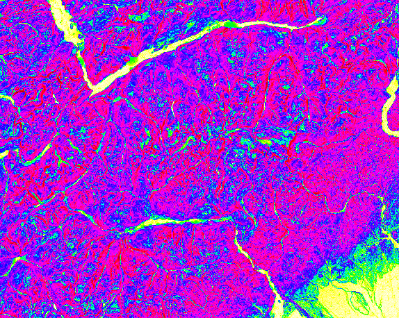
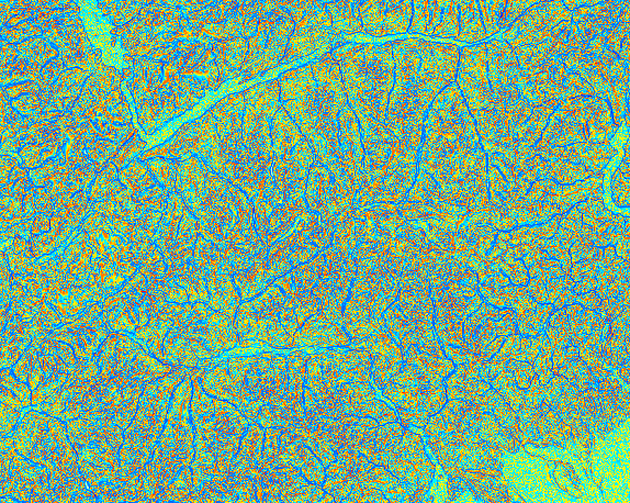
Computing slope and aspect
Compute slope, aspect and profile curvature of the terrain:
g.region raster=elevation
r.slope.aspect elevation=elevation slope=slope aspect=aspect pcurvature=profile_curvature
-
Aspect (North Carolina, USA)
-
Slope (North Carolina, USA)
-
Profile curvature (North Carolina, USA)
-
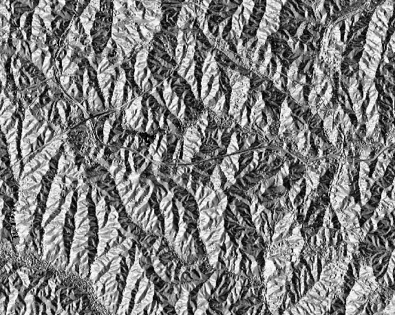
Aspect (Piemonte, Italy)
-
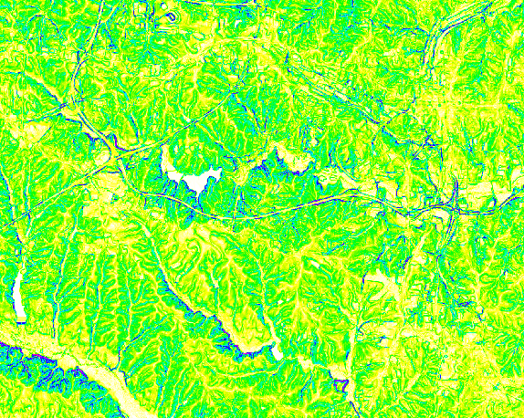
Slope (Piemonte, Italy)
-
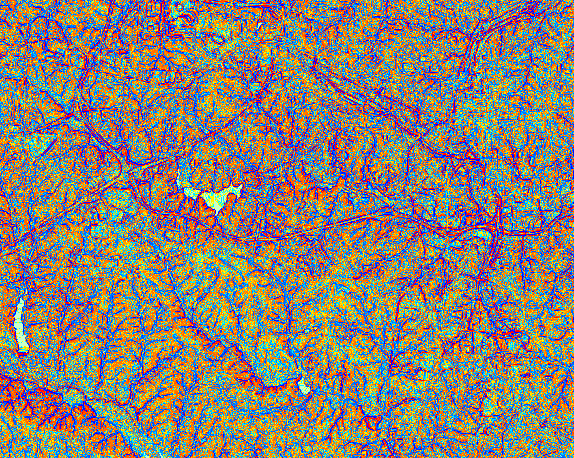
Profile curvature (Piemonte, Italy)


Visualizing shaded relief
Visualize digital elevation model with shaded relief:
g.region raster=elevation
r.relief input=elevation output=shade
d.shade shade=shade color=elevation
-
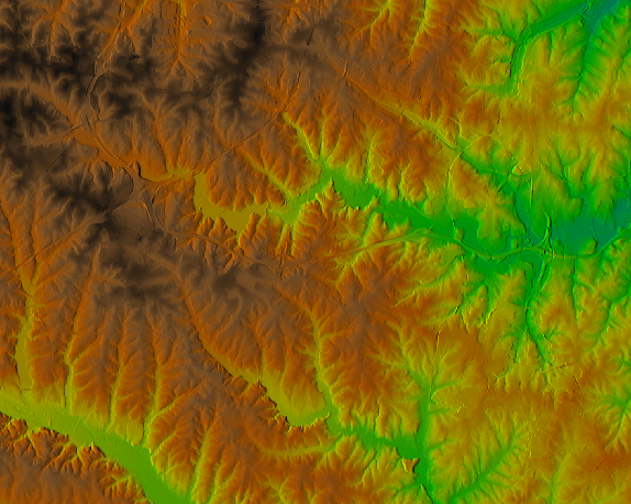
North Carolina, USA
-
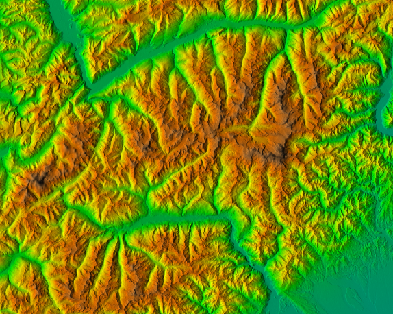
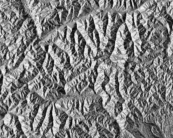
Piemonte, Italy

