Uploads by Neteler
Jump to navigation
Jump to search
This special page shows all uploaded files.
| Date | Name | Thumbnail | Size | Description | Versions |
|---|---|---|---|---|---|
| 11:55, 16 July 2012 | Helena.jpg (file) |  |
11 KB | 1 | |
| 11:55, 16 July 2012 | Hamish.jpg (file) |  |
3 KB | 1 | |
| 11:55, 16 July 2012 | DaveSampson.png (file) |  |
39 KB | 1 | |
| 11:55, 16 July 2012 | Cedric.jpg (file) |  |
6 KB | 1 | |
| 11:55, 16 July 2012 | Benjamin.png (file) |  |
22 KB | 1 | |
| 11:54, 16 July 2012 | Scott.jpg (file) |  |
9 KB | 1 | |
| 13:27, 11 July 2012 | OSGeo 220pix.png (file) |  |
16 KB | Latest logo | 2 |
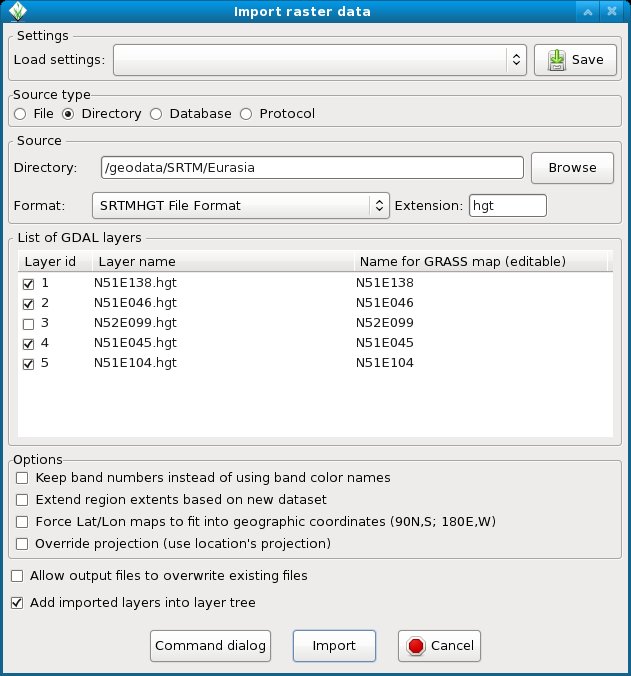
| 12:14, 10 July 2012 | WxGUI bulk srtm import.jpg (file) |  |
85 KB | Bulk import of SRTM (remember to add 'hgt' into the extension field) | 1 |
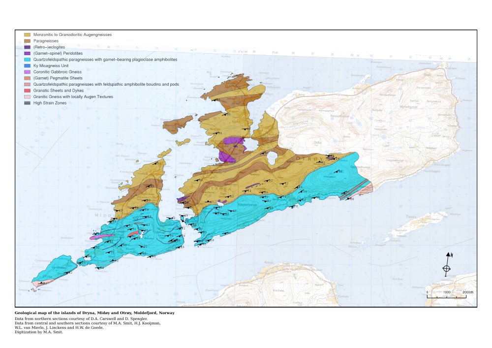
| 12:55, 4 June 2012 | Geomap klein.jpg (file) |  |
115 KB | Geology map of Moldefjord, Norway by Willem van Mierlo (from GRASS screenshots) | 1 |
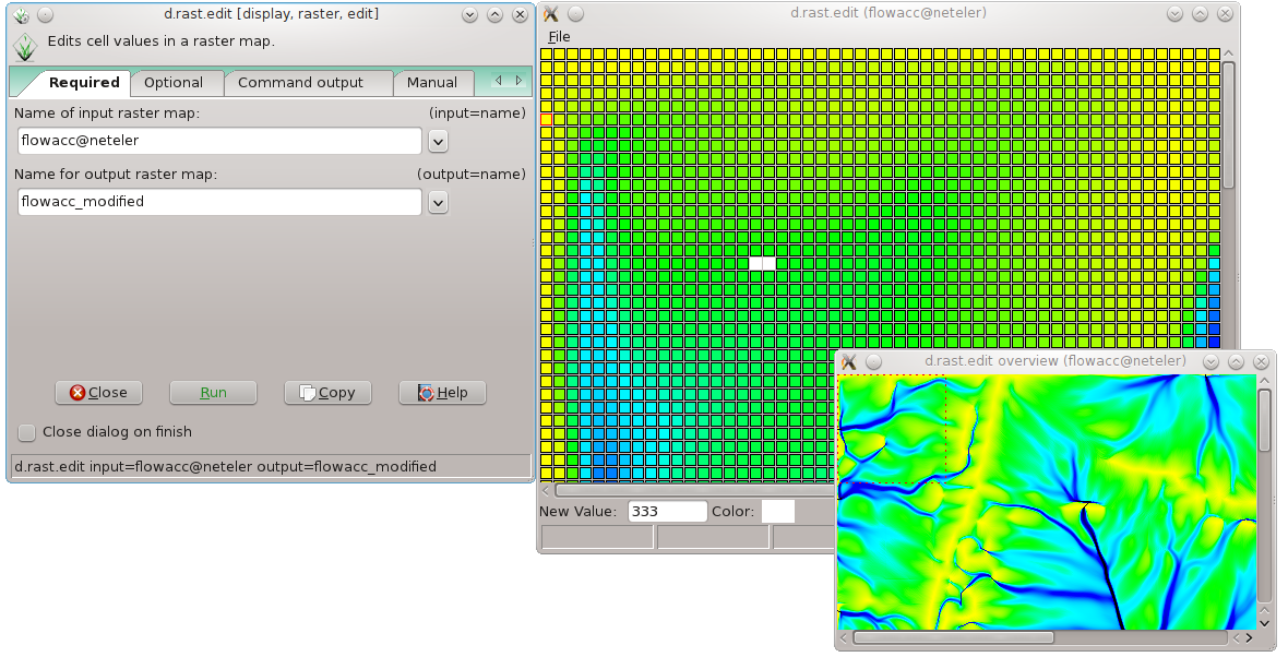
| 21:33, 30 May 2012 | D rast edit grass7.png (file) |  |
198 KB | Raster map editor in GRASS 7 | 1 |
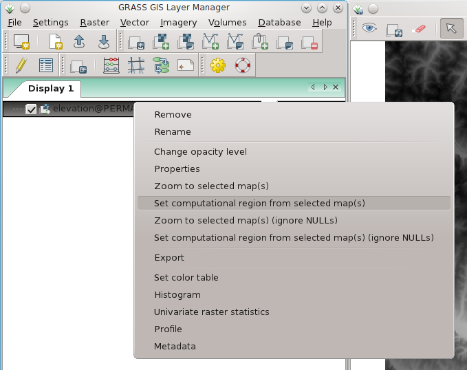
| 13:46, 7 April 2012 | Wxgui computat region to raster.png (file) |  |
80 KB | wxGUI: set computational region to selected map (right mouse button context menu on map name) | 1 |
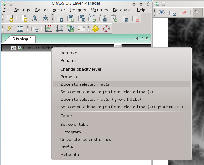
| 13:46, 7 April 2012 | Wxgui zoom to raster.png (file) |  |
90 KB | wxGUI: set map display to selected map (right mouse button context menu on map name) | 1 |
| 18:53, 1 April 2012 | WxGUI vector bulk import2.png (file) |  |
75 KB | Bulk import of multiple SHAPES via menu (files are auto-selected) | 1 |
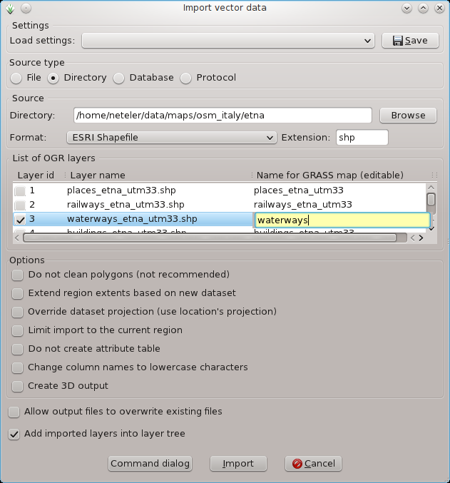
| 18:52, 1 April 2012 | WxGUI vector bulk import1.png (file) |  |
51 KB | Bulk import of vector files via menu | 1 |
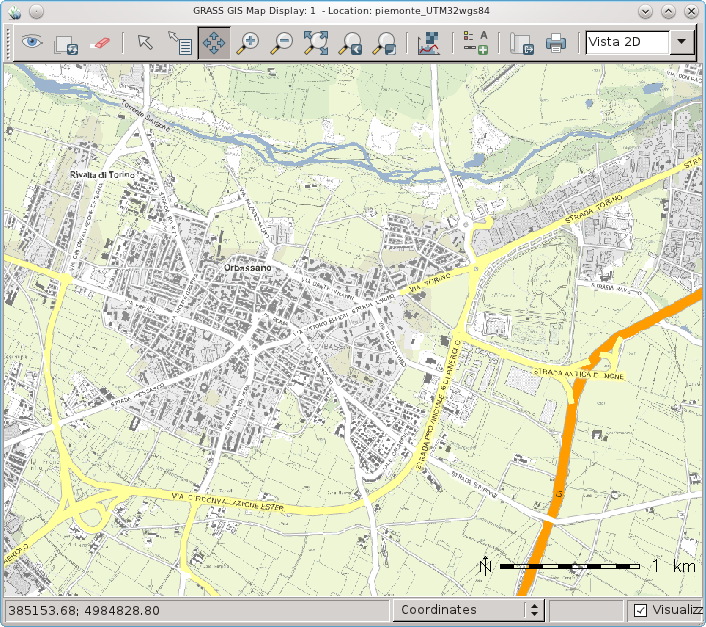
| 13:14, 27 March 2012 | WxGUI and Piedmont (Italy) WMS.png (file) | _WMS.png) |
379 KB | Piedmont (Italy) WMS data in wxGUI | 1 |
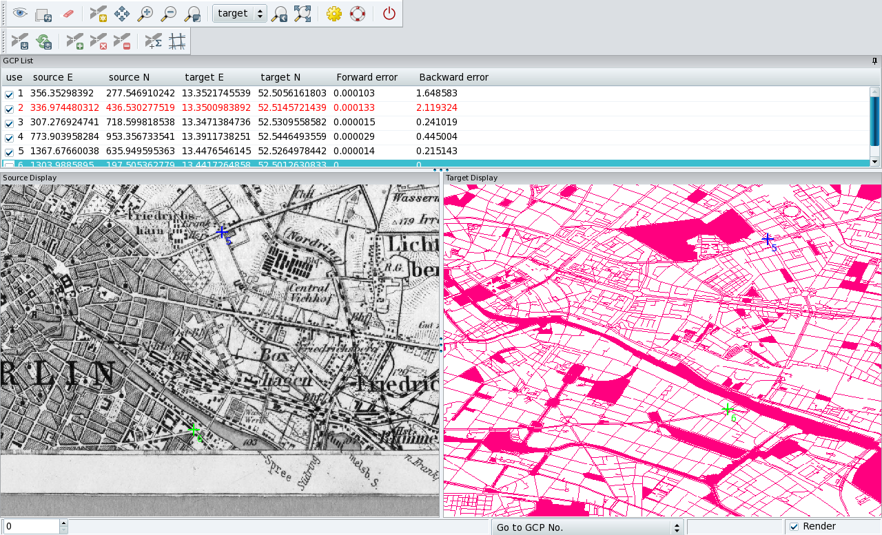
| 16:16, 8 March 2012 | Georectifier berlin.png (file) |  |
791 KB | Georectifying of historical maps (example Berlin) | 1 |
| 23:08, 15 February 2012 | GRASS-Layer-raster-add.png (file) |  |
491 bytes | Raster add icon | 1 |
| 23:07, 15 February 2012 | GRASS-Zoom-in.png (file) |  |
975 bytes | Zoom Icon | 1 |
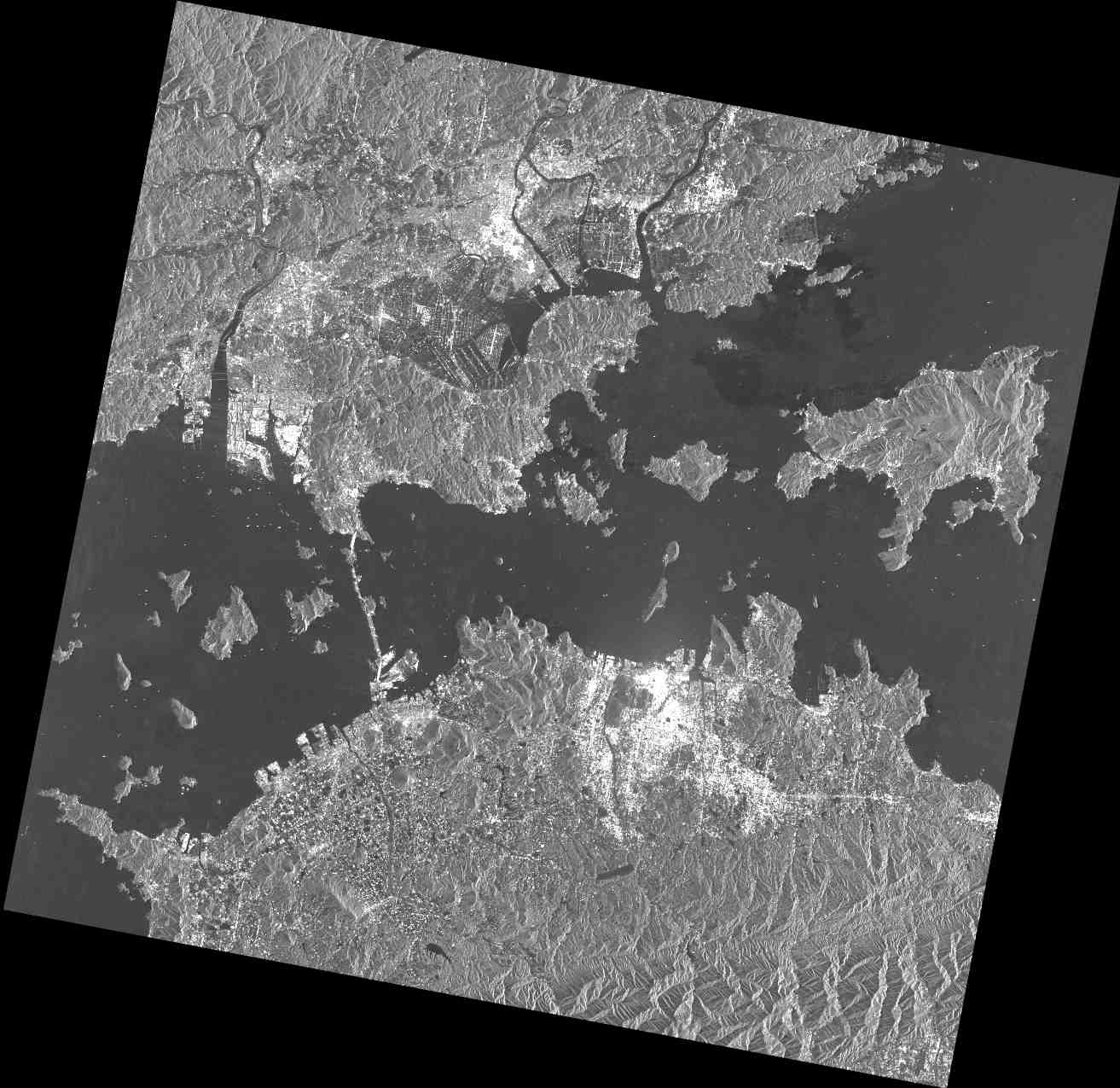
| 23:05, 15 February 2012 | Palsar osm japan2008.png (file) |  |
1.11 MB | PALSAR data set imported into GRASS GIS | 1 |
| 23:04, 15 February 2012 | PASL1500701140134440805020299B.jpg (file) |  |
128 KB | PALSAR raw data screenshot | 1 |
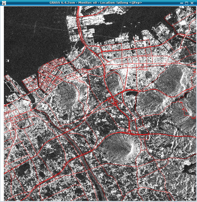
| 14:42, 10 February 2012 | Palsar in grass64.png (file) |  |
774 KB | PALSAR shown in GRASS | 1 |
| 14:04, 11 January 2012 | Paraview fondazione mach ortho 3D.png (file) |  |
1.4 MB | .. with menu | 2 |
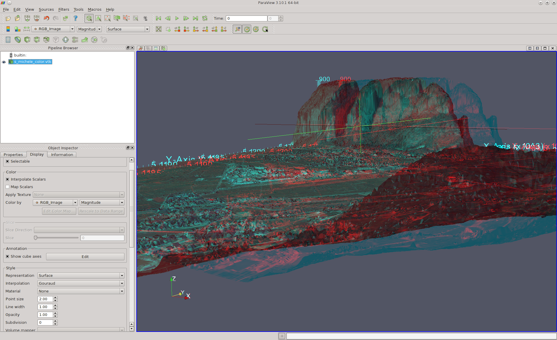
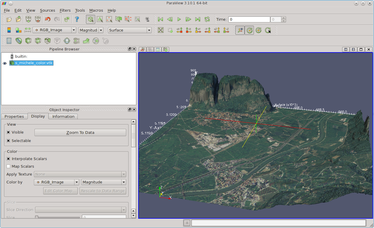
| 13:36, 11 January 2012 | Paraview fondazione mach 3D.png (file) |  |
716 KB | Fondazione Mach - S. Michele (Italy) area shown in ParaView | 1 |
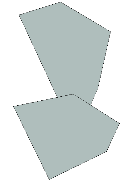
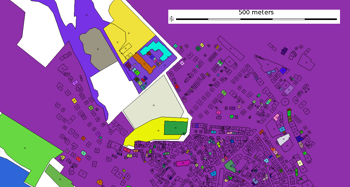
| 18:19, 2 January 2012 | Polygons overlapping cleaned.png (file) |  |
9 KB | Overlayed polygons topologically cleaned. Image donated by G. Allegri | 1 |
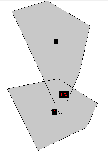
| 18:18, 2 January 2012 | Polygons overlapping.png (file) |  |
11 KB | Overlayed polygons after import from SHAPE file (Simple Features). Image donated by G. Allegri | 1 |
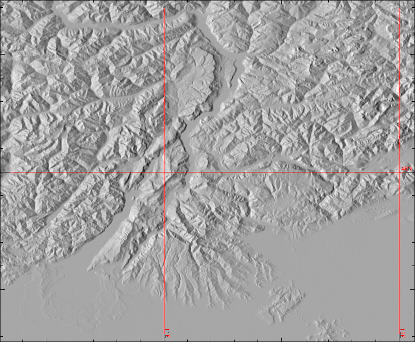
| 14:22, 1 December 2011 | Gmted2010 30N000E 20101117 shaded.png (file) |  |
535 KB | Global Multi-resolution Terrain Elevation Data 2010 (GMTED2010) example: Trento - Garda Lake - Verona area (Northern Italy): | 1 |
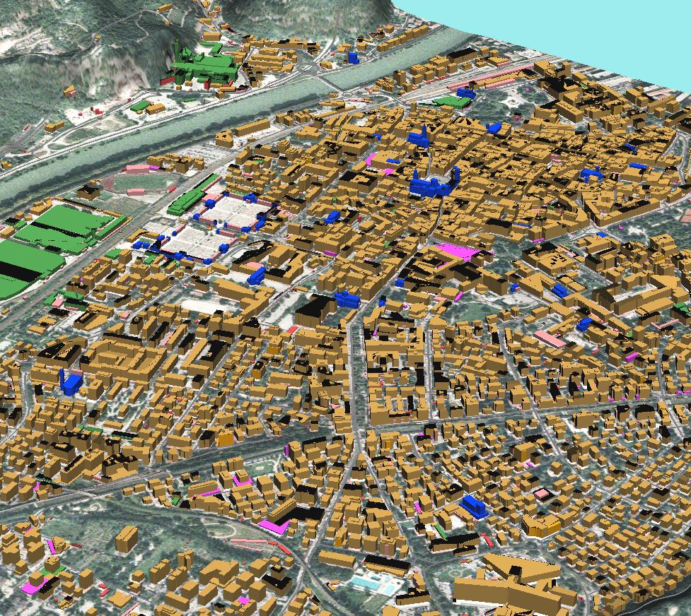
| 14:31, 24 November 2011 | Trento3d colors.jpg (file) |  |
316 KB | GRASS: building footprints extruded to 3D blocks, colorized by building type screenshot: M. Neteler (data courtesy City of Trento, Italy - http://webapps.comune.trento.it/ambiente/?LANG=it, see "Mostra Strumenti Dati" for geodata download) | 1 |
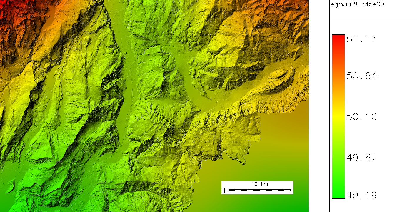
| 20:26, 27 October 2011 | Trentino egm2008 map 5m resampled.jpg (file) |  |
452 KB | Geoid undulations in Trentino, dereived from EGM2008 GIS Data (http://earth-info.nga.mil/GandG/wgs84/gravitymod/egm2008/egm08_gis.html) by resampling them with cubic convolution higher than original resolution | 1 |
| 19:49, 25 October 2011 | Osm map2d.png (file) |  |
64 KB | OSM 2D map with colorized buildings | 1 |
| 13:28, 24 October 2011 | LausanneDemoDataset3dParaview 4.png (file) |  |
299 KB | With author's permission: http://www-pool.math.tu-berlin.de/~soeren/grass/modules/screenshots/LausanneDemoDataset3dParaview_4.png | 1 |
| 13:28, 24 October 2011 | LausanneDemoDataset3dParaview 10.png (file) |  |
601 KB | With author's permission: http://www-pool.math.tu-berlin.de/~soeren/grass/modules/screenshots/LausanneDemoDataset3dParaview_10.png | 1 |
| 15:00, 22 October 2011 | Osm map3d buildings.png (file) |  |
44 KB | 3D buildings map from OSM | 1 |
| 14:58, 22 October 2011 | Osm map2d buildings.png (file) |  |
14 KB | OSM 2D map, extracted buildings (using OSM tag) | 1 |
| 14:14, 11 October 2011 | CleanTOPO2 map.png (file) |  |
1.06 MB | Rescaled map from http://www.shadedrelief.com/cleantopo2/#data | 1 |
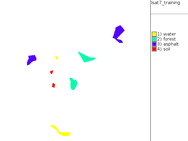
| 19:11, 26 September 2011 | Training map supervised.png (file) |  |
9 KB | NC Landsat map 2002 - digitized training areas | 1 |
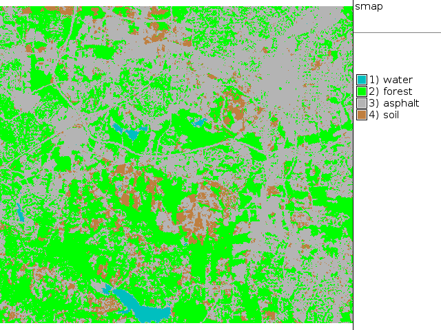
| 19:09, 26 September 2011 | Map lsat7 2002 class supervised.png (file) |  |
69 KB | NC Landsat map 2002 - SMAP supervised classification | 1 |
| 18:53, 26 September 2011 | Map lsat7 2002 class unsupervised 15.png (file) |  |
182 KB | NC Landsat map 2002 - unsupervised classification 15 classes | 1 |
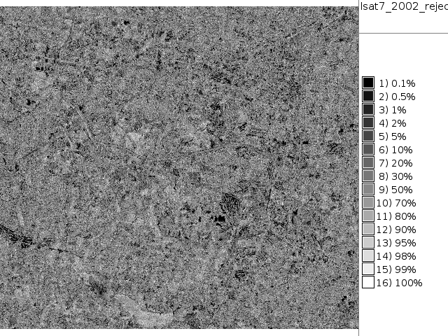
| 18:44, 26 September 2011 | Map lsat7 2002 reject.png (file) |  |
237 KB | NC Landsat map 2002 - unsupervised classification rejection map | 1 |
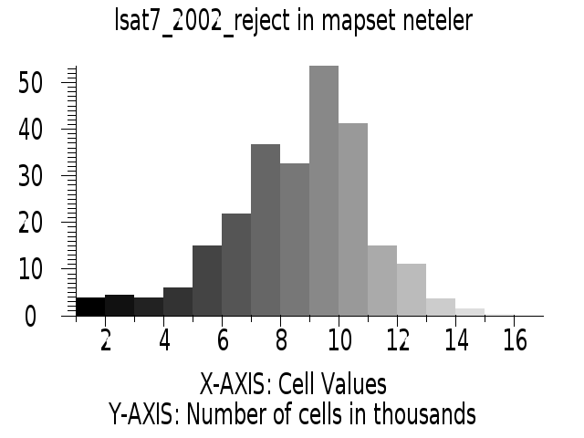
| 18:43, 26 September 2011 | Histogram lsat7 2002 reject.png (file) |  |
24 KB | NC Landsat map 2002 - unsupervised classification rejection map histogram | 1 |
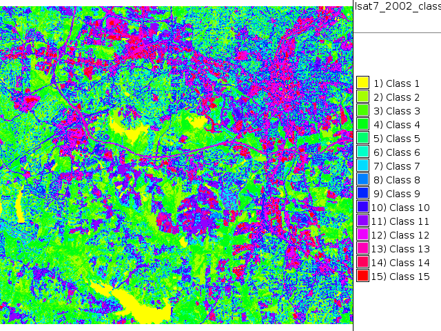
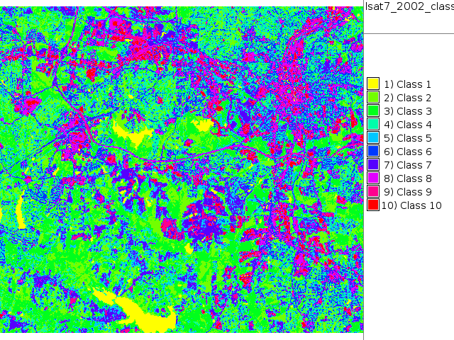
| 18:42, 26 September 2011 | Map lsat7 2002 class.png (file) |  |
164 KB | NC Landsat map 2002 - unsupervised classification | 1 |
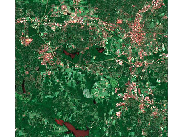
| 18:40, 26 September 2011 | Map lsat7 2002 r1g5b7.png (file) |  |
687 KB | NC Landsat map 2002 - false color composite | 1 |
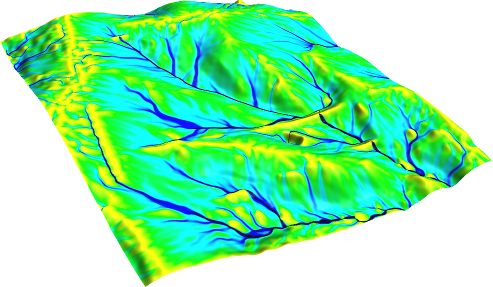
| 07:33, 29 August 2011 | Flowacc nviz.png (file) |  |
171 KB | Flow accumulation(NC dataset) with Multiple Flow Direction: # set computational region to map g.region rast=elev_lid792_1m -p # -f for MFD r.watershed -f elevation=elev_lid792_1m accumulation=flowacc # check map list g.list rast # show metadata r.info | 1 |
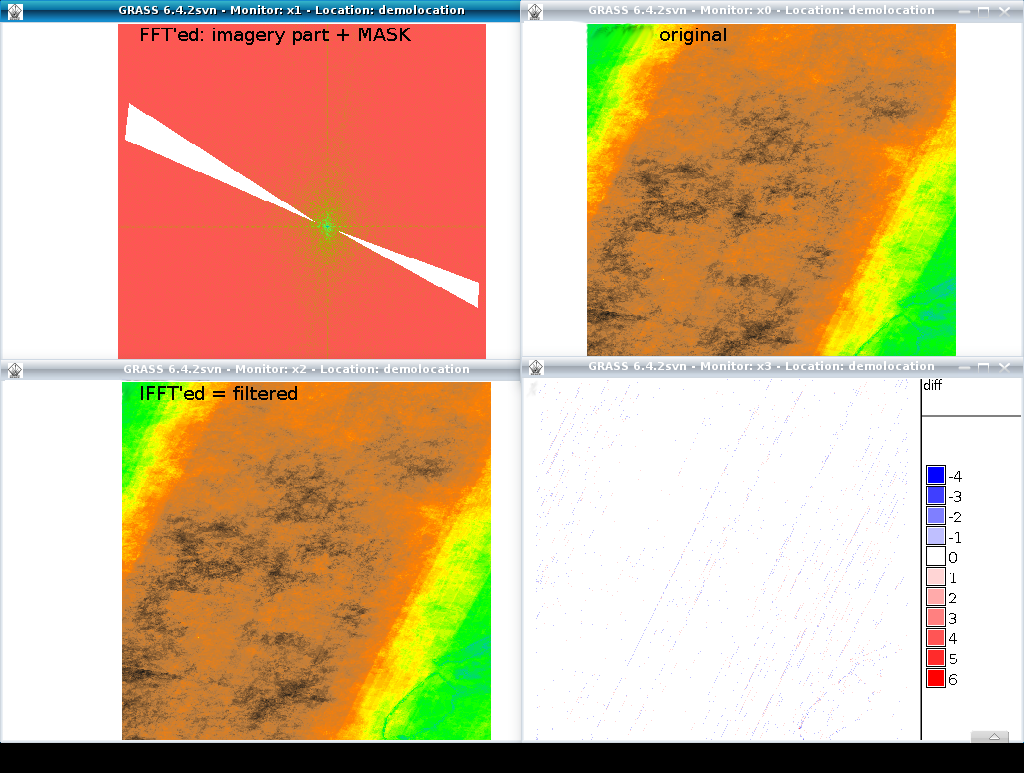
| 12:06, 29 July 2011 | Grass image destriping with FFT.png (file) |  |
434 KB | 2 | |
| 16:06, 5 June 2011 | QGIS17 GRASS64.png (file) |  |
696 KB | GRASS Toolbox in QGIS | 1 |
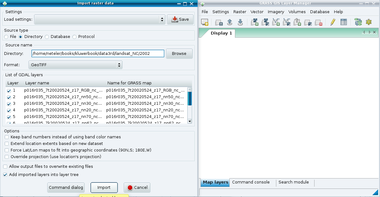
| 08:53, 1 May 2011 | WxGUI bulk raster import2.png (file) |  |
74 KB | Bulk import of GeoTIFF 2 | 1 |
| 08:53, 1 May 2011 | WxGUI bulk raster import1.png (file) |  |
73 KB | Bulk import of GeoTIFF 1 | 1 |
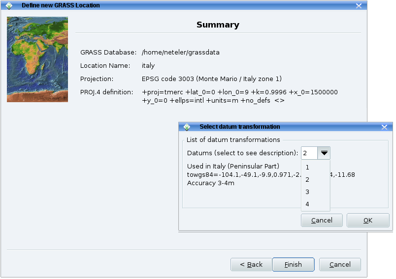
| 09:51, 17 April 2011 | Grass64 location wiz3.png (file) |  |
86 KB | 1 | |
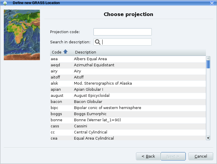
| 09:51, 17 April 2011 | Grass64 location wiz2.png (file) |  |
84 KB | 1 | |
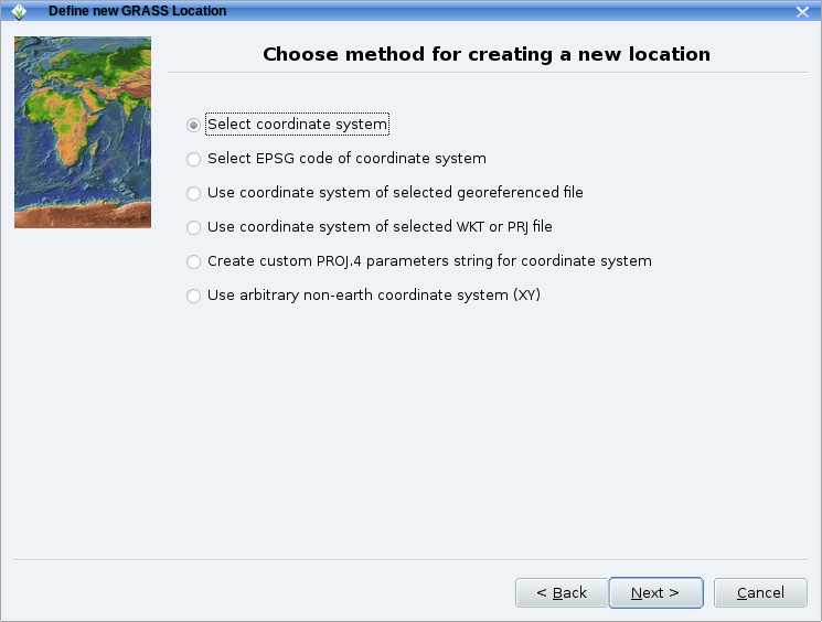
| 09:51, 17 April 2011 | Grass64 location wiz1.png (file) |  |
78 KB | 1 | |
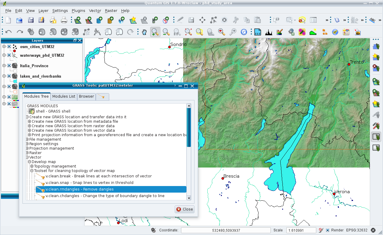
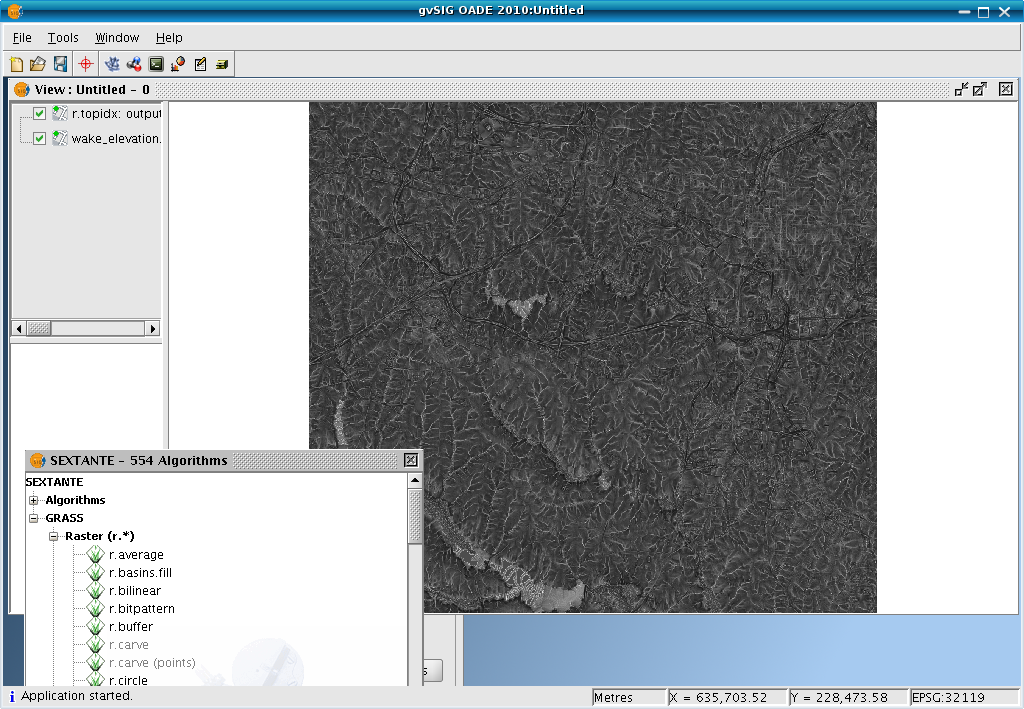
| 22:58, 15 April 2011 | GvSIG OADE sextante rtopidx.png (file) |  |
556 KB | 1 |