File list
Jump to navigation
Jump to search
This special page shows all uploaded files.
| Date | Name | Thumbnail | Size | User | Description | Versions |
|---|---|---|---|---|---|---|
| 09:47, 12 June 2017 | FOSS4G-Europe-2017.png (file) |  |
386 KB | Lucadelu | 1 | |
| 15:14, 2 June 2017 | Icc2017 logo.png (file) | 64 KB | ⚠️Wenzeslaus | Logo of the 28th International Cartographic Conference of the International Cartographic Association, Washington, DC, July 2 to 7, 2017 http://icc2017.org/ http://icc2017.org/wp-content/uploads/2016/08/logo.png | 1 | |
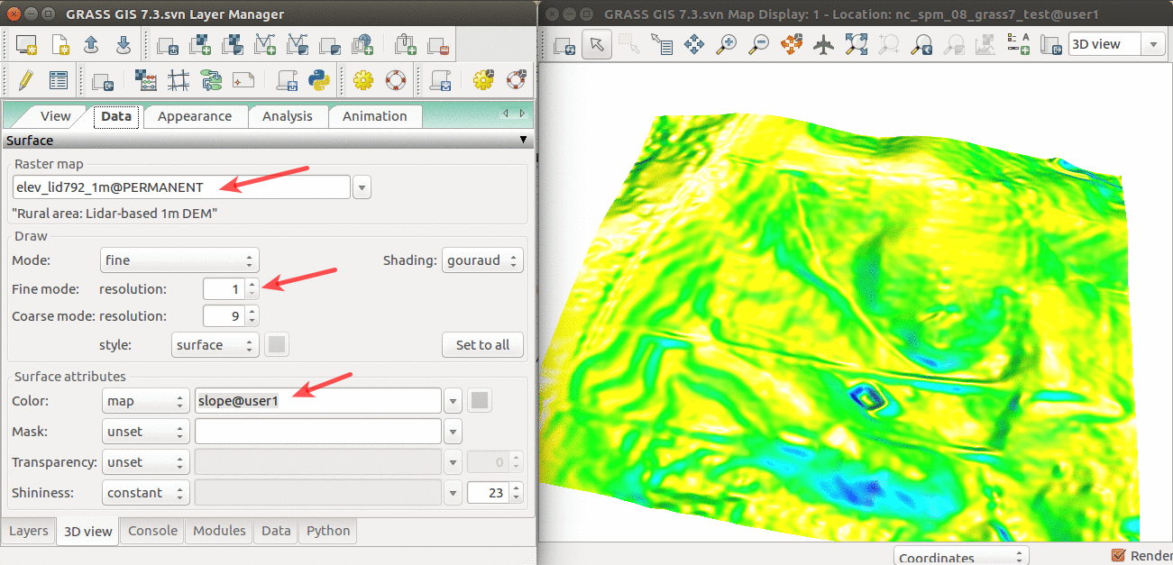
| 14:48, 11 April 2017 | Elevation slope 3D view.png (file) |  |
565 KB | Annakrat | 3D visualization of elev_lid792_1m DEM with slope draped over. | 1 |
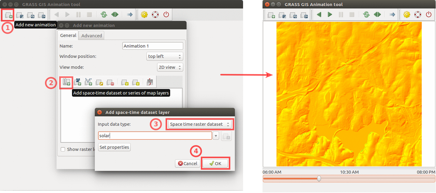
| 22:15, 9 April 2017 | Animation solar example.png (file) |  |
439 KB | Annakrat | Using GRASS GIS animation tool to animate solar irradiance during a day. Computed by {{addonCmd|r.sun.hourly}}. | 1 |
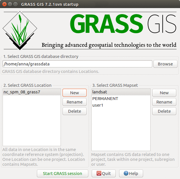
| 15:29, 5 April 2017 | GRASS startup ncspm.png (file) |  |
150 KB | Annakrat | GRASS GIS 7.2 startup screen with North Carolina sample dataset | 1 |
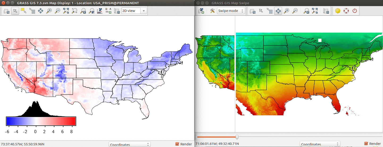
| 20:03, 4 April 2017 | US temp model comparison.png (file) |  |
529 KB | Annakrat | Comparison of PRISM annual mean temperature and modeled temperature based on latitude and elevation. Left: Difference between modeled and real temperature in degree Celsius. Right: Using Map Swipe to visually assess the model (modeled temperature on th... | 1 |
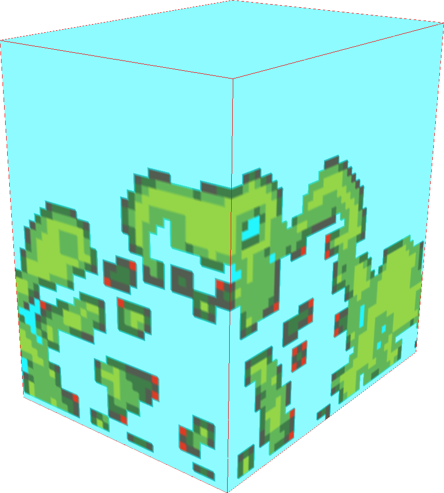
| 21:05, 24 March 2017 | Raster3d example small data.png (file) |  |
147 KB | ⚠️Wenzeslaus | Example of a 3D raster. Small data. Lidar-based presence/absence in 3D. r3.forestfrag. Using slices in 3D view (NVIZ). Modified colors. | 1 |
| 20:53, 24 March 2017 | Viewscape modeling with LiDAR.png (file) |  |
783 KB | ⚠️Wenzeslaus | Not seeing the forest for the trees: viewscape modeling with LiDAR by Jelena Vukomanovic (presenter), John B. Vogler, Kunwar K. Singh, and Anna Petrasova from North Carolina State University US-IALE 2017 Annual Meeting | 1 |
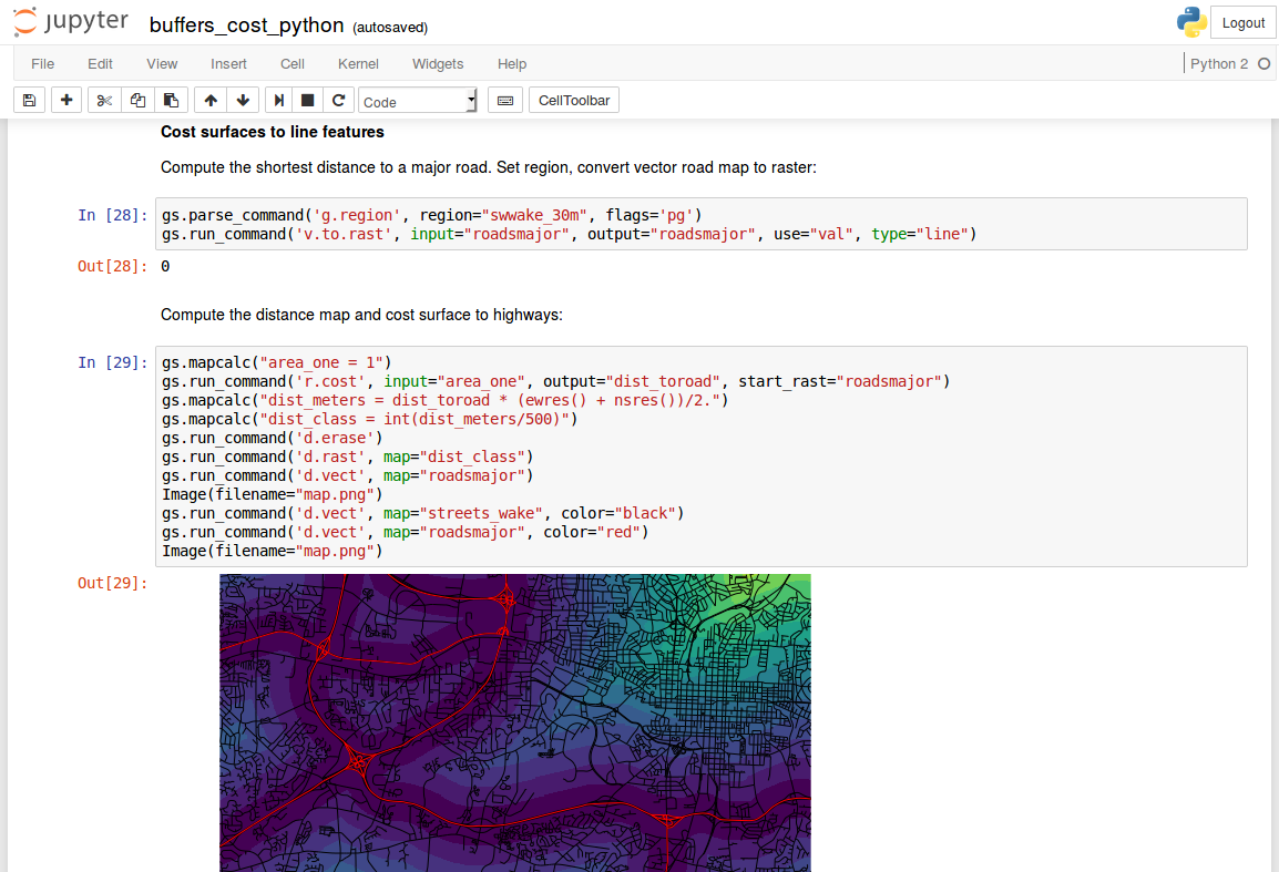
| 20:44, 24 March 2017 | Jupyter notebook with grass gis.png (file) |  |
221 KB | ⚠️Wenzeslaus | Jupyter Notebook with GRASS GIS Python code computing distance (with r.cost) from lines (roads) | 1 |
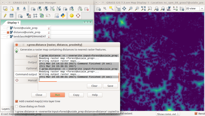
| 19:40, 24 March 2017 | Wxgui r grow distance from forest edge.png (file) |  |
318 KB | ⚠️Wenzeslaus | Screenshot of distance to forest edge computed with r.grow.distance in the wxGUI with Layer Manager, Map Display, and r.grow.distance dialog. r.mapcalc "forest = if(landclass96 == 5, 1, null())" r.grow.distance -n input=forest distance=distance (or... | 1 |
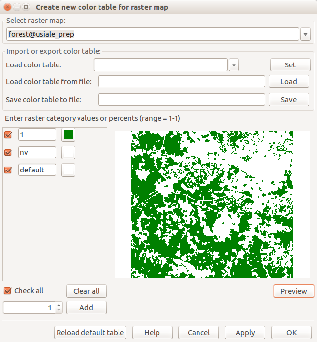
| 19:23, 24 March 2017 | Create new color table for raster map forest.png (file) |  |
53 KB | ⚠️Wenzeslaus | Dialog for interactive change of color table with preview r.mapcalc "forest = if(landclass96 == 5, 1, null())" | 1 |
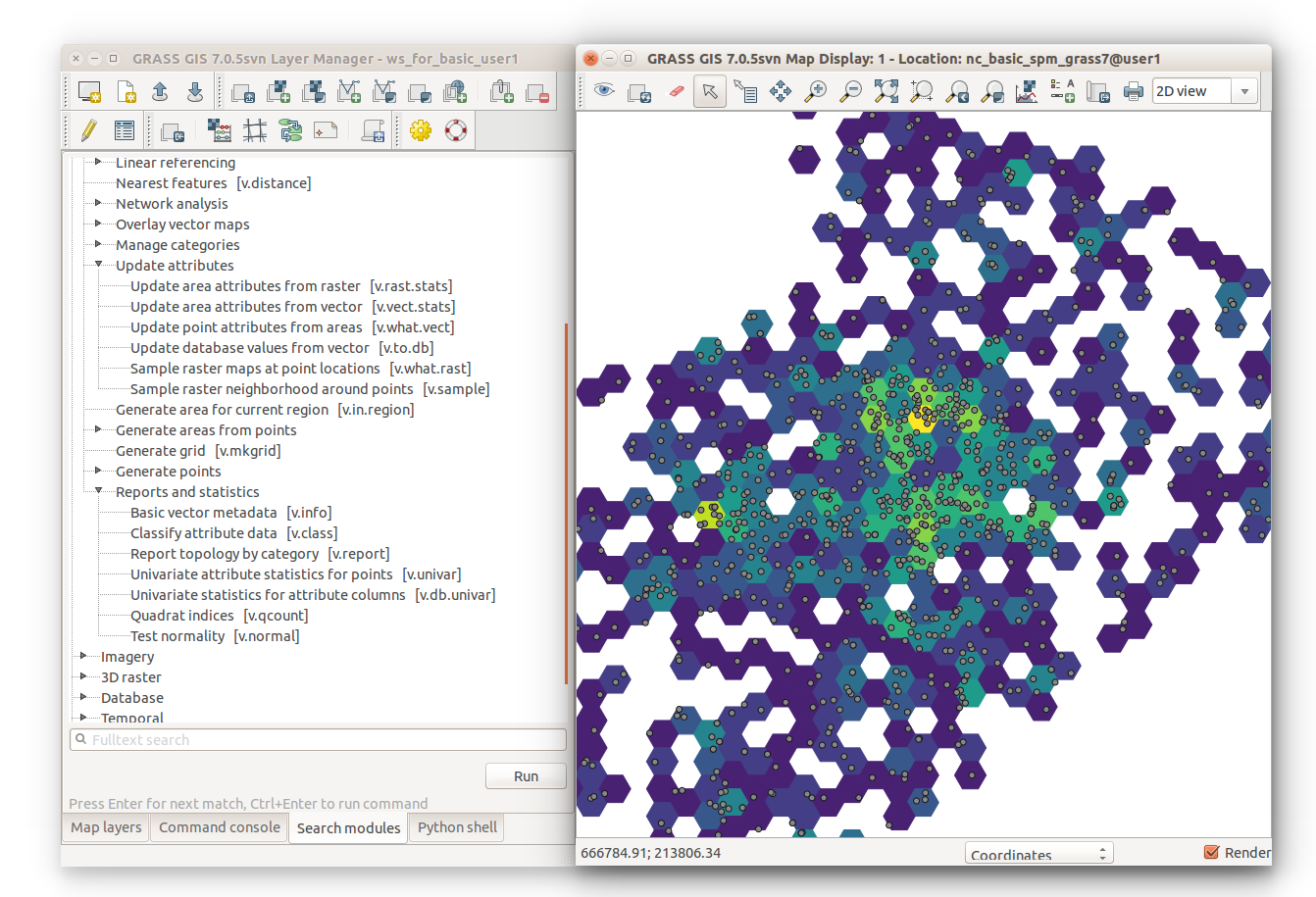
| 16:58, 24 March 2017 | V vect stats hexagons with module tree.png (file) |  |
386 KB | ⚠️Wenzeslaus | v.vect.stats result on v.mkgrid -h polygons showing point density with Layer Manager Modules tab on the left g.region vector=points_of_interest res=2000 -pa v.mkgrid map=hexagons -h v.vect.stats points=points_of_interest areas=hexagons count_column... | 1 |
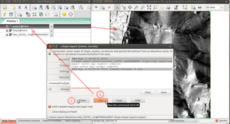
| 15:17, 24 March 2017 | R slope aspect 4 run.png (file) |  |
211 KB | ⚠️Wenzeslaus | r.slope.aspect Command output tab with Run, Close, and resulting raster map layer in the background | 1 |
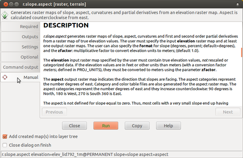
| 15:16, 24 March 2017 | R slope aspect 3 manual.png (file) |  |
130 KB | ⚠️Wenzeslaus | r.slope.aspect Manual tab | 1 |
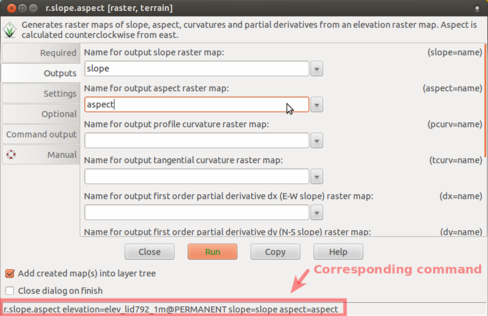
| 15:14, 24 March 2017 | R slope aspect 2 outputs.png (file) |  |
77 KB | ⚠️Wenzeslaus | r.slope.aspect Outputs tab (slope and aspect outputs) with corresponding command highlighted | 1 |
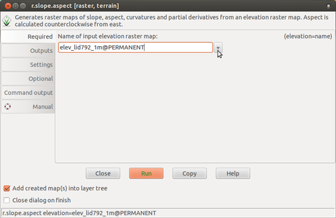
| 15:13, 24 March 2017 | R slope aspect 1 required.png (file) |  |
57 KB | ⚠️Wenzeslaus | r.slope.aspect Required tab (input elevation) | 1 |
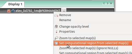
| 13:53, 24 March 2017 | Wxgui computational region set from raster.png (file) |  |
39 KB | ⚠️Wenzeslaus | Setting computational region (extent and resolution) based on a raster in Layer Manager in wxGUI (GRASS GIS 7.0) | 1 |
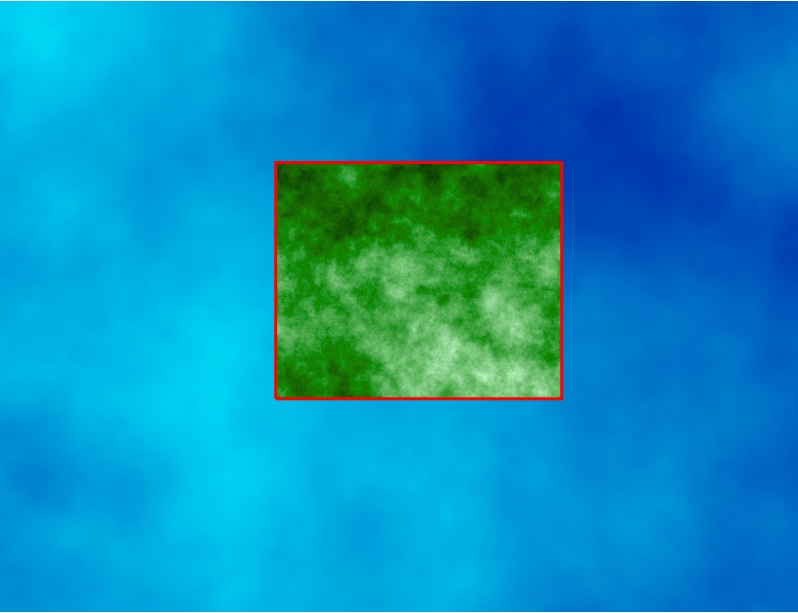
| 13:40, 24 March 2017 | Computational region two rasters.png (file) |  |
250 KB | ⚠️Wenzeslaus | Computational region concept showing one large raster (blue) and one other raster with smaller extent (green) which matches the current computational region (red). # larger region g.region raster=elevation # larger raster r.surf.fractal output=fra... | 1 |
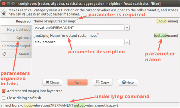
| 03:46, 24 March 2017 | Wxgui module parameters r neighbors.png (file) |  |
25 KB | ⚠️Wenzeslaus | wxGUI dialog/form for r.neighbors with descriptions and highlights | 1 |
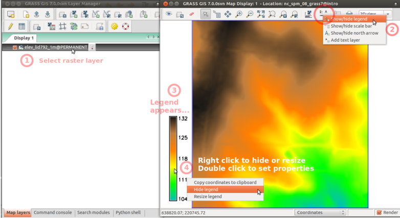
| 02:36, 24 March 2017 | Wxgui add legend elev lid.png (file) |  |
174 KB | ⚠️Wenzeslaus | Add raster legend in wxGUI screenshot with numbers and descriptions | 1 |
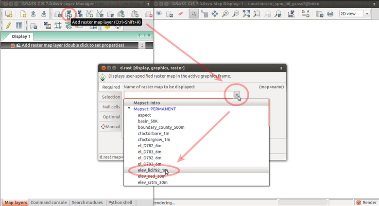
| 02:12, 24 March 2017 | Wxgui add elev lid.png (file) |  |
125 KB | ⚠️Wenzeslaus | Add elev_lid792_1m raster map layer using d.rast dialog from toolbar with arrows | 1 |
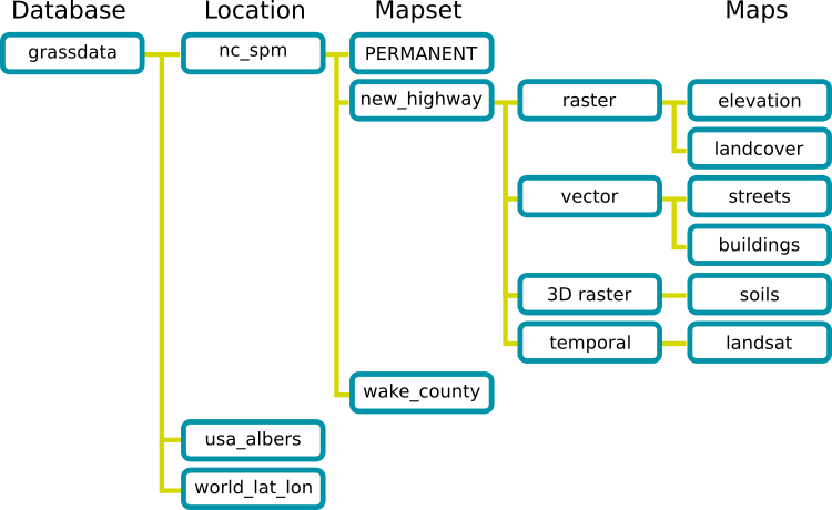
| 01:22, 24 March 2017 | Grass database.png (file) |  |
36 KB | ⚠️Wenzeslaus | GRASS GIS Spatial Database structure trunk/doc/grass_database.png r70793 | 1 |
| 01:59, 23 March 2017 | Grassgis logo colorlogo text whitebg.png (file) | 48 KB | ⚠️Wenzeslaus | GRASS GIS logo from https://grass.osgeo.org/download/logos/ Green color, white background, with text | 1 | |
| 01:06, 8 March 2017 | Ncgis logo 2017.png (file) | 4 KB | ⚠️Wenzeslaus | NCGIS conference 2017 logo http://ncgisconference.com/ | 1 | |
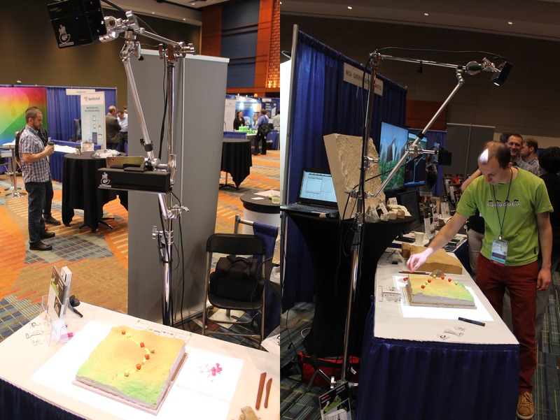
| 01:04, 8 March 2017 | Ncgis2017 ncsu booth tangible landscape.jpg (file) |  |
136 KB | ⚠️Wenzeslaus | North Carolina State University booth at NCGIS2017: Tangible Landscape (powered by GRASS GIS) Thanks to Anna Klevtcova for providing the photographs. | 1 |
| 21:22, 7 March 2017 | Us-iale logo.jpg (file) | 30 KB | ⚠️Wenzeslaus | http://baltimore2017.usiale.org/ https://usiale.org/ | 1 | |
| 20:49, 7 March 2017 | Foss4g boston 2017 logo.png (file) | 25 KB | ⚠️Wenzeslaus | http://2017.foss4g.org/ | 1 | |
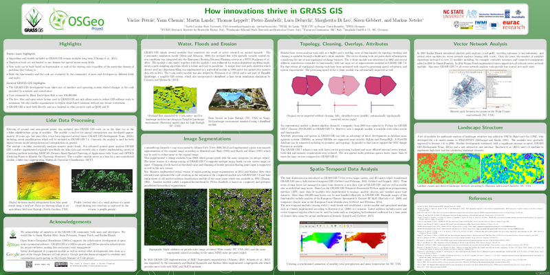
| 01:25, 26 February 2017 | How innovations thrive in GRASS GIS.png (file) |  |
331 KB | ⚠️Wenzeslaus | Capture from https://trac.osgeo.org/grass/browser/grass-promo/grassposter/2017_NCGIS_How_innovations_thrive/How_innovations_thrive_in_GRASS_GIS.pdf (provided by the author) | 1 |
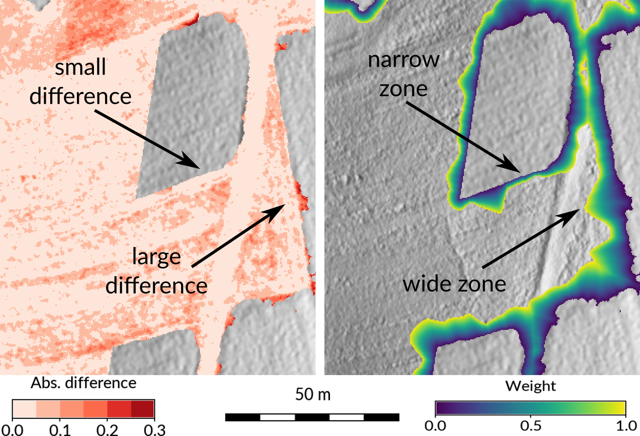
| 00:06, 26 February 2017 | Seamless fusion of high-resolution DEMs from multiple sources.png (file) |  |
718 KB | ⚠️Wenzeslaus | Taken from https://petrasovaa.github.io/dem-fusion-talk/#/17 (provided by the author) | 1 |
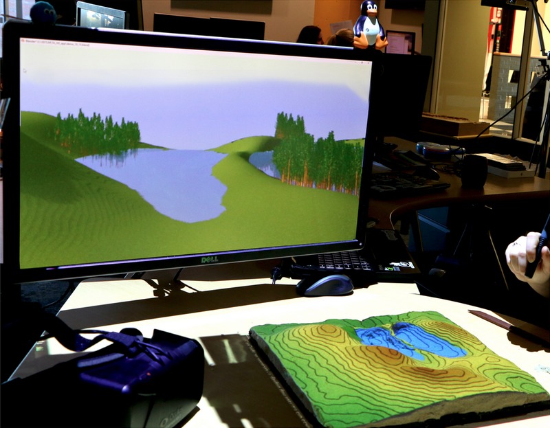
| 23:59, 25 February 2017 | Tangible landscape and blender with water and trees.jpg (file) |  |
121 KB | ⚠️Wenzeslaus | Taken from https://ncsu-geoforall-lab.github.io/tangible-landscape-talk/ncgis2017#/21 (provided by the author) | 1 |
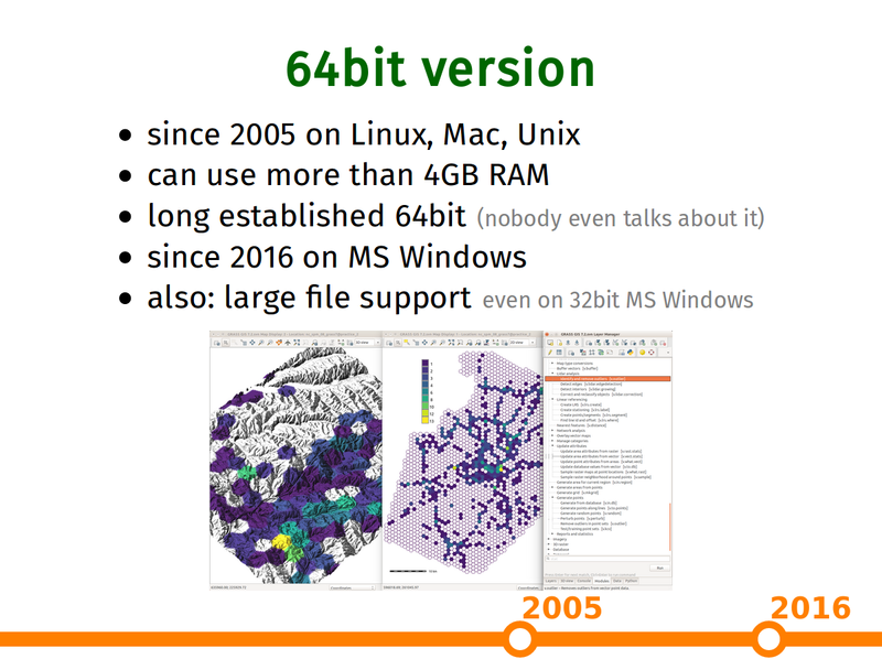
| 22:32, 25 February 2017 | Grass gis as platform presentation 64bit slide.png (file) |  |
271 KB | ⚠️Wenzeslaus | Capture of https://ncsu-geoforall-lab.github.io/grass-as-a-platform/ncgis2017.html#/15 (provided by the author) | 1 |
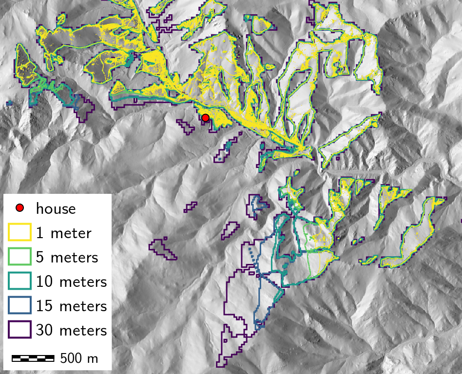
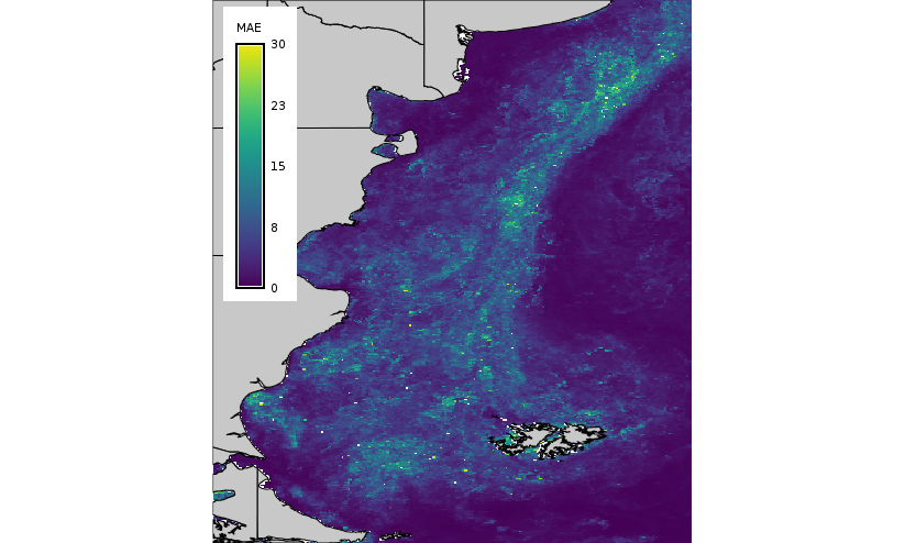
| 15:35, 17 February 2017 | Mae lwr map.png (file) |  |
159 KB | Veroandreo | 1 | |
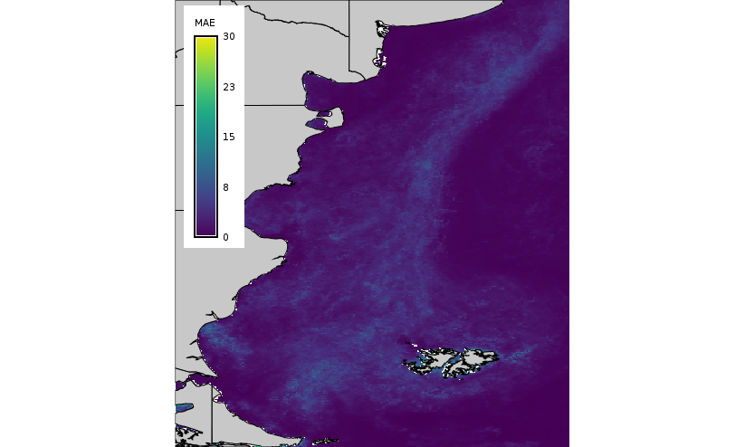
| 15:34, 17 February 2017 | Mae hants map.png (file) |  |
205 KB | Veroandreo | 1 | |
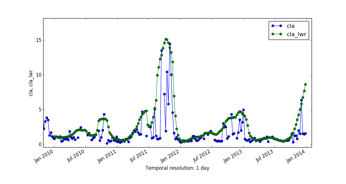
| 15:32, 17 February 2017 | Cla vs cla lwr.png (file) |  |
69 KB | Veroandreo | 1 | |
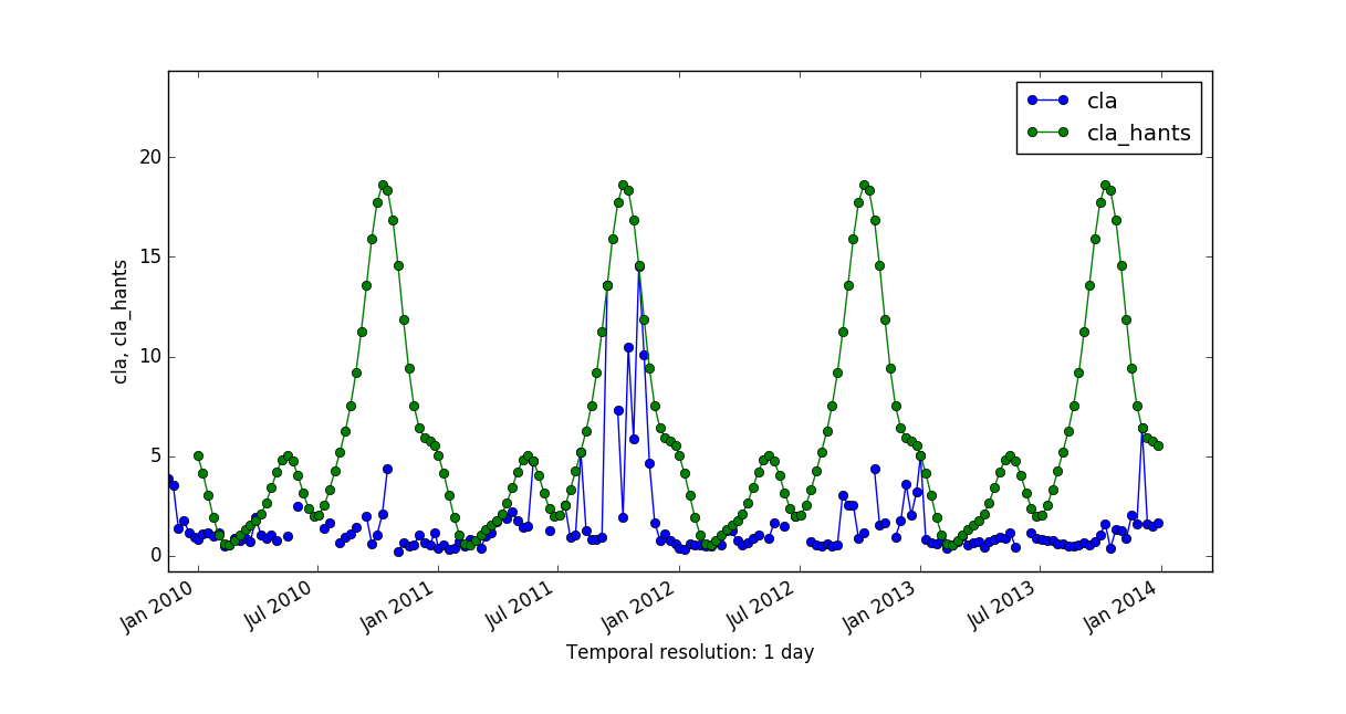
| 15:31, 17 February 2017 | Cla vs cla hants.png (file) |  |
75 KB | Veroandreo | 1 | |
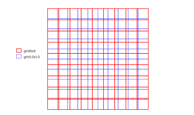
| 08:20, 28 November 2016 | Grid examples.png (file) |  |
14 KB | ⚠️Mlennert | Image showing two different pixel grids 10x10 and 9x9 within the same extent. | 1 |
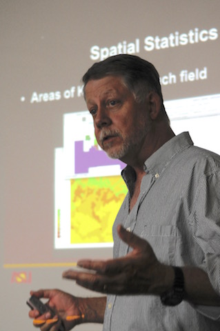
| 16:38, 23 November 2016 | Michael.jpg (file) |  |
39 KB | ⚠️Cmbarton | updated to picture to replace ancient one in GRASS team listing | 2 |
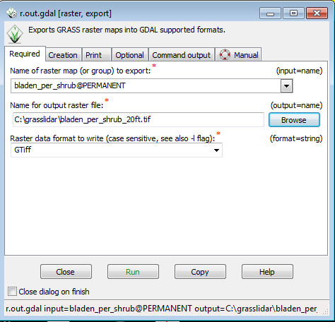
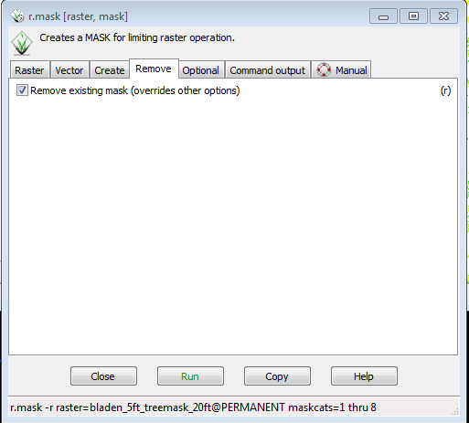
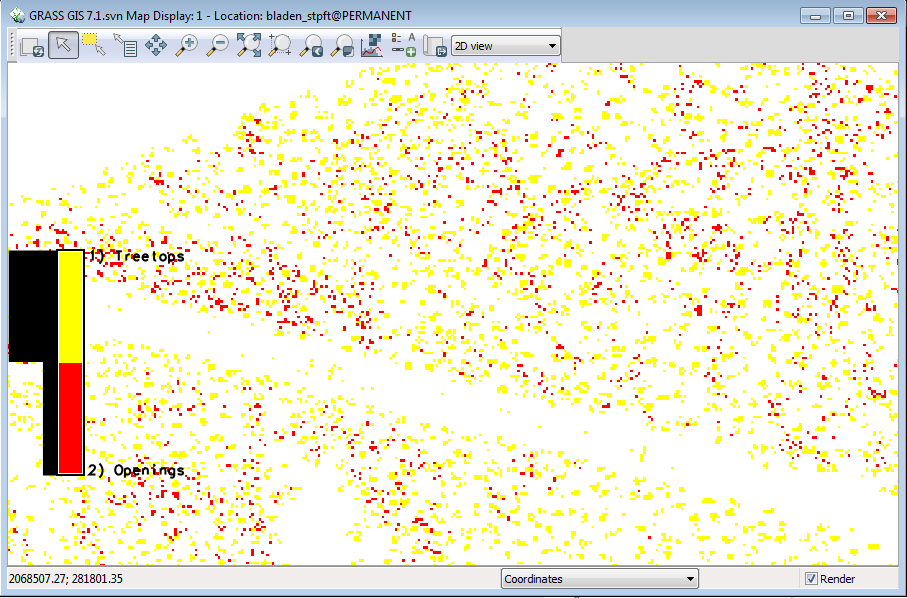
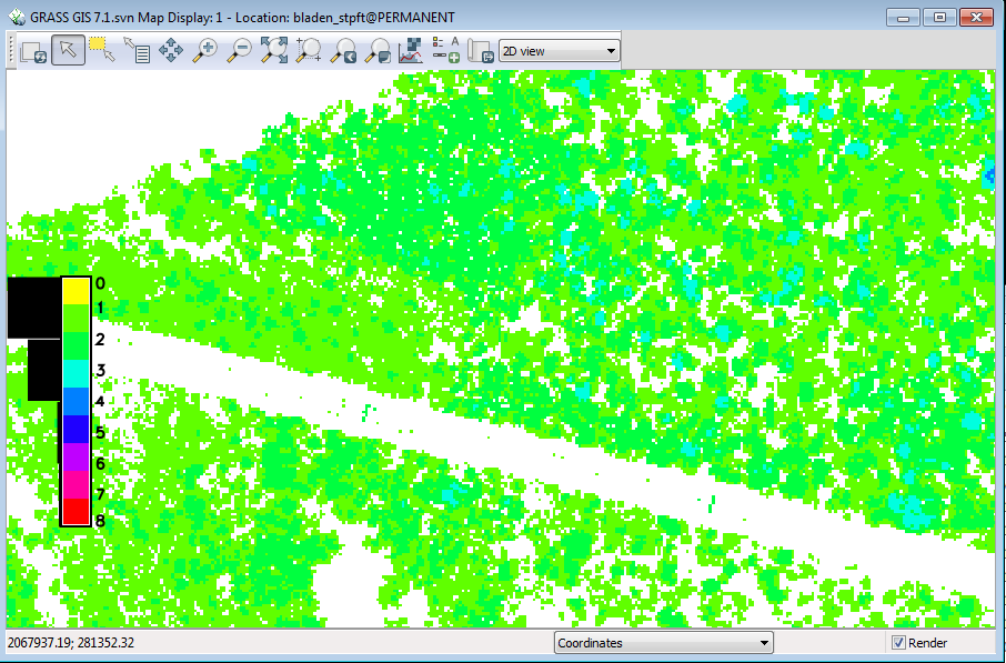
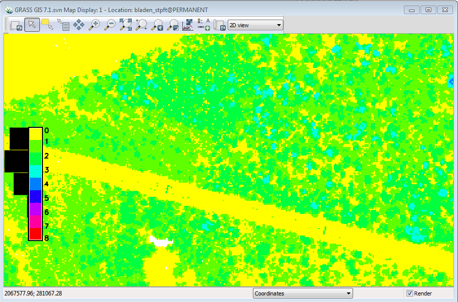
| 02:06, 9 November 2016 | Grasslidar 71.png (file) |  |
30 KB | ⚠️Dnewcomb | 1 | |
| 02:03, 9 November 2016 | Grasslidar 70.png (file) |  |
25 KB | ⚠️Dnewcomb | 1 | |
| 02:00, 9 November 2016 | Grasslidar 69.png (file) |  |
20 KB | ⚠️Dnewcomb | 1 | |
| 01:56, 9 November 2016 | Grasslidar 68.png (file) |  |
18 KB | ⚠️Dnewcomb | 1 | |
| 01:53, 9 November 2016 | Grasslidar 67.png (file) |  |
48 KB | ⚠️Dnewcomb | 1 | |
| 01:50, 9 November 2016 | Grasslidar 66.png (file) |  |
55 KB | ⚠️Dnewcomb | 1 | |
| 01:48, 9 November 2016 | Grasslidar 65.png (file) |  |
21 KB | ⚠️Dnewcomb | 1 | |
| 01:42, 9 November 2016 | Grasslidar 64.png (file) |  |
53 KB | ⚠️Dnewcomb | 1 | |
| 01:37, 9 November 2016 | Grasslidar 63.png (file) |  |
32 KB | ⚠️Dnewcomb | 1 | |
| 01:33, 9 November 2016 | Grasslidar 62.png (file) |  |
62 KB | ⚠️Dnewcomb | 1 | |
| 01:27, 9 November 2016 | Grasslidar 61.png (file) |  |
13 KB | ⚠️Dnewcomb | 1 | |
| 01:21, 9 November 2016 | Grasslidar 60.png (file) |  |
9 KB | ⚠️Dnewcomb | 1 | |
| 01:18, 9 November 2016 | Grasslidar 59.png (file) |  |
1 KB | ⚠️Dnewcomb | 1 |