Uploads by Annakrat
Jump to navigation
Jump to search
This special page shows all uploaded files.
| Date | Name | Thumbnail | Size | Description | Versions |
|---|---|---|---|---|---|
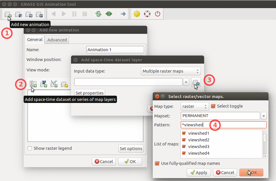
| 20:54, 21 June 2017 | Animation tool add multiple rasters.png (file) |  |
320 KB | How to add multiple raster maps and filter them by name. | 1 |
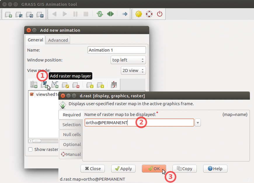
| 20:54, 21 June 2017 | Animation tool add base raster.png (file) |  |
251 KB | How to add base raster to Animation Tool | 1 |
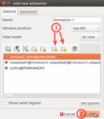
| 20:55, 21 June 2017 | Animation tool layers.png (file) |  |
114 KB | How to change order of layers in Animation Tool | 1 |
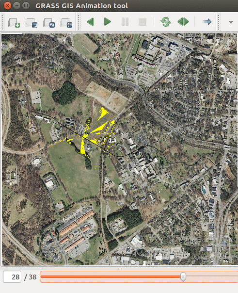
| 21:40, 21 June 2017 | Animation tool viewsheds.png (file) |  |
619 KB | Showing series of viewsheds with Animation Tool | 1 |
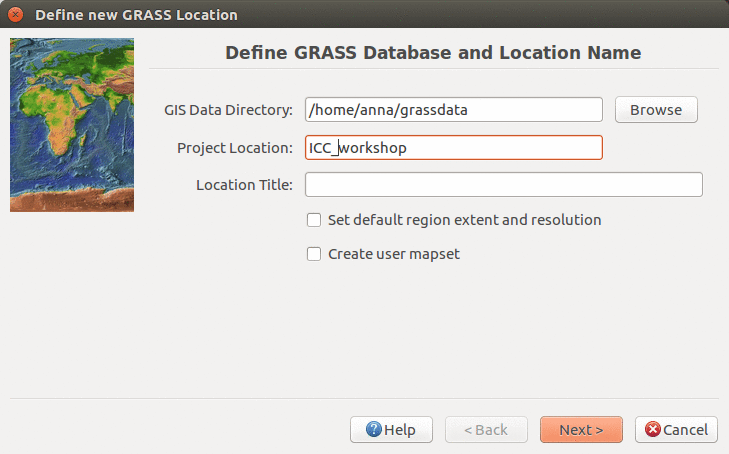
| 03:18, 22 June 2017 | ICC workshop location wizard define 7.2.png (file) |  |
118 KB | Defining new location name in Location Wizard (ICC workshop) | 1 |
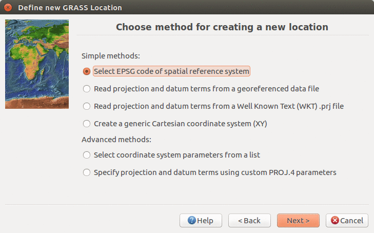
| 03:20, 22 June 2017 | Location wizard method 7.2.png (file) |  |
126 KB | Define CRS in Location Wizard in 7.2. version using EPSG code | 1 |
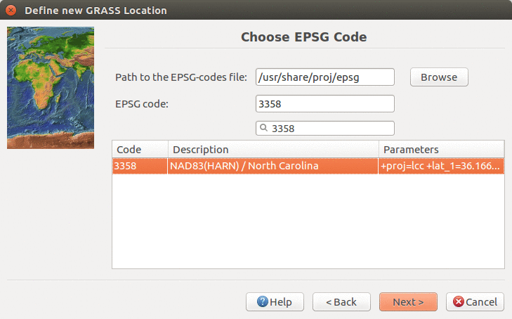
| 03:21, 22 June 2017 | Location wizard EPSG3358 7.2.png (file) |  |
131 KB | Creating new location with EPSG 3358 in Location Wizard | 1 |
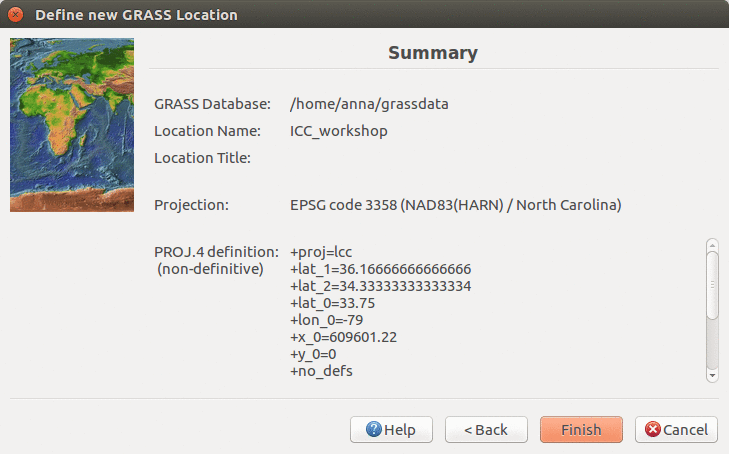
| 03:22, 22 June 2017 | ICC workshop location wizard summary 7.2.png (file) |  |
114 KB | Location Wizard summary page | 1 |
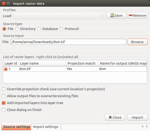
| 14:02, 22 June 2017 | Import raster 7.2.1.png (file) |  |
130 KB | Import raster data dialog in GRASS GIS 7.2.1 | 1 |
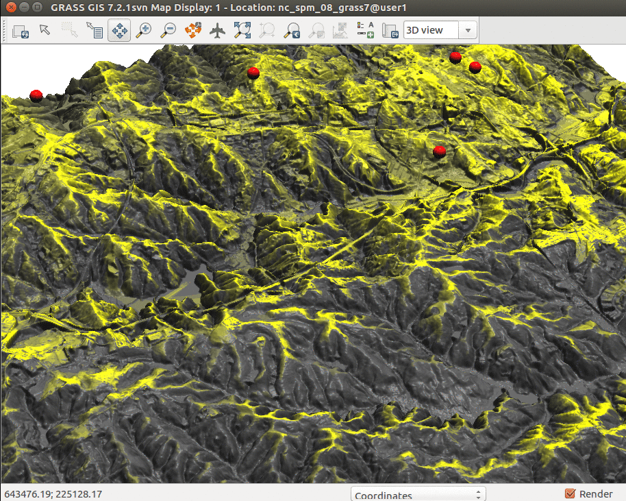
| 21:00, 22 June 2017 | ICC workshop 3Dview ortho.png (file) |  |
1.45 MB | 3D visulization of digital surface model draped with orthophoto | 1 |
| 21:51, 22 June 2017 | Blender-plain.png (file) |  |
11 KB | Blender logo | 1 |
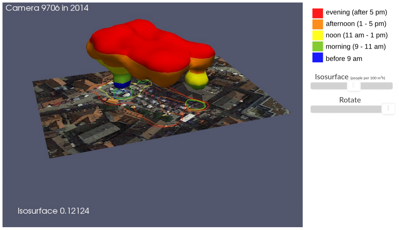
| 01:40, 18 July 2017 | ICC STC illustration.png (file) |  |
468 KB | Presentation on Using space-time cube for visualization and analysis of active transportation patterns derived from public webcams by Anna Petrasova, Aaron Hipp, and Helena Mitasova from North Carolina State University | 1 |
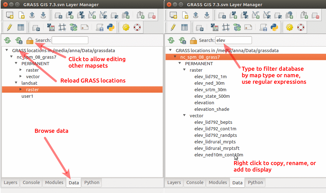
| 01:36, 19 July 2017 | GRASS GIS 7.3 data catalog.png (file) |  |
241 KB | Data catalog in GRASS GIS 7.3 with nc_spm_08_grass7 location | 1 |
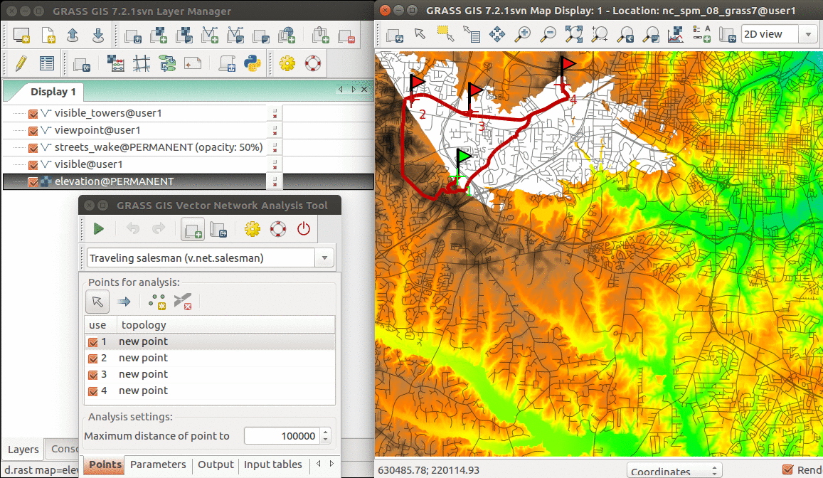
| 19:33, 19 July 2017 | Vector network GUI GRASS 72.png (file) |  |
727 KB | Example of using Vector Network Analysis Tool for Traveling Salesman problem | 1 |
| 20:28, 19 July 2017 | Cumulative viewshed elevation.png (file) |  |
1.08 MB | Cumulative viewshed draped over elevation raster (Boston 2017 workshop) | 1 |
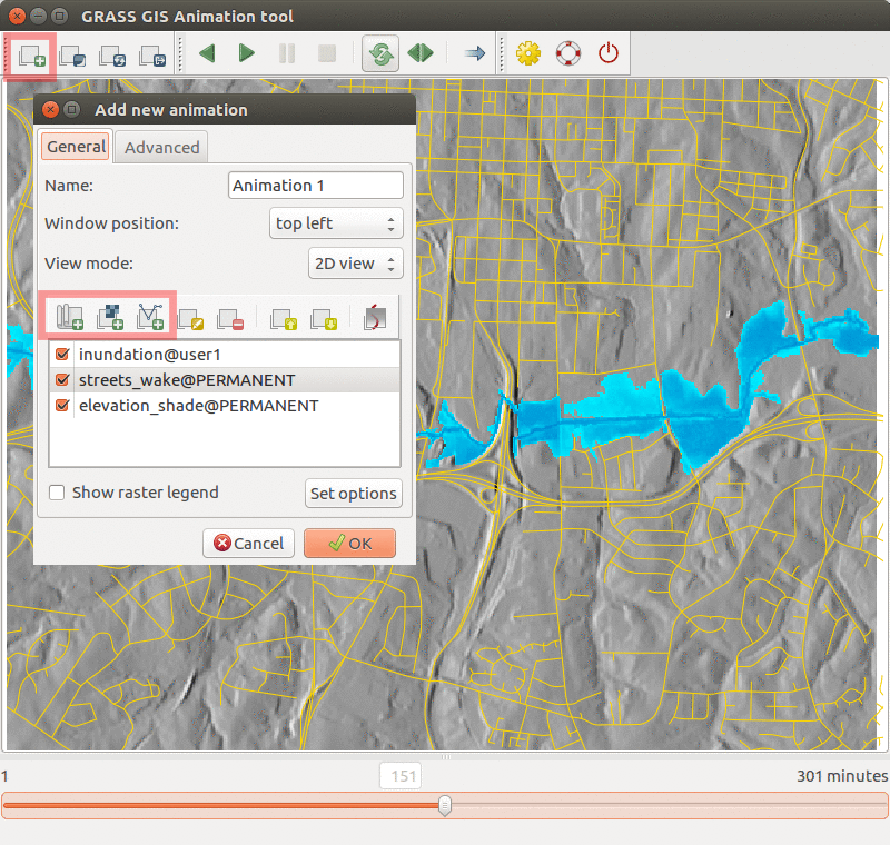
| 04:38, 21 July 2017 | Animation tool inundation.png (file) |  |
468 KB | Inundation computed with {{addonCmd|r.stream.distance}} and {{addonCmd|r.lake.series}} and visualized in Animation Tool. | 1 |
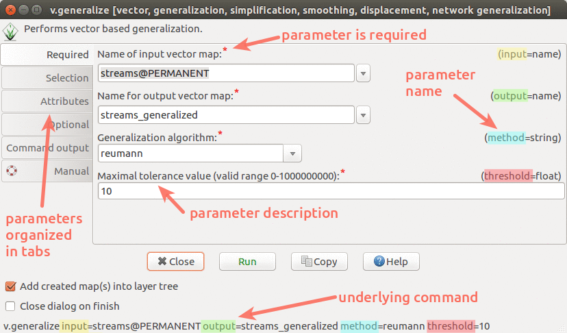
| 22:48, 1 August 2017 | Wxgui module parameters v generalize.png (file) |  |
171 KB | wxGUI dialog/form for v.generalize with descriptions and highlights | 1 |
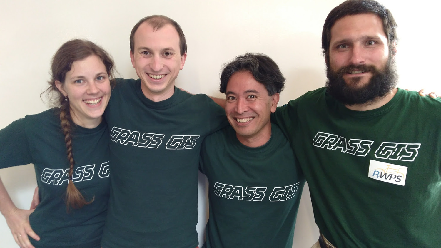
| 19:46, 19 August 2017 | GRASS GIS sprint FOSS4G 2017.jpg (file) |  |
202 KB | Photo of participants of code sprint during FOSS4G 2017 | 1 |
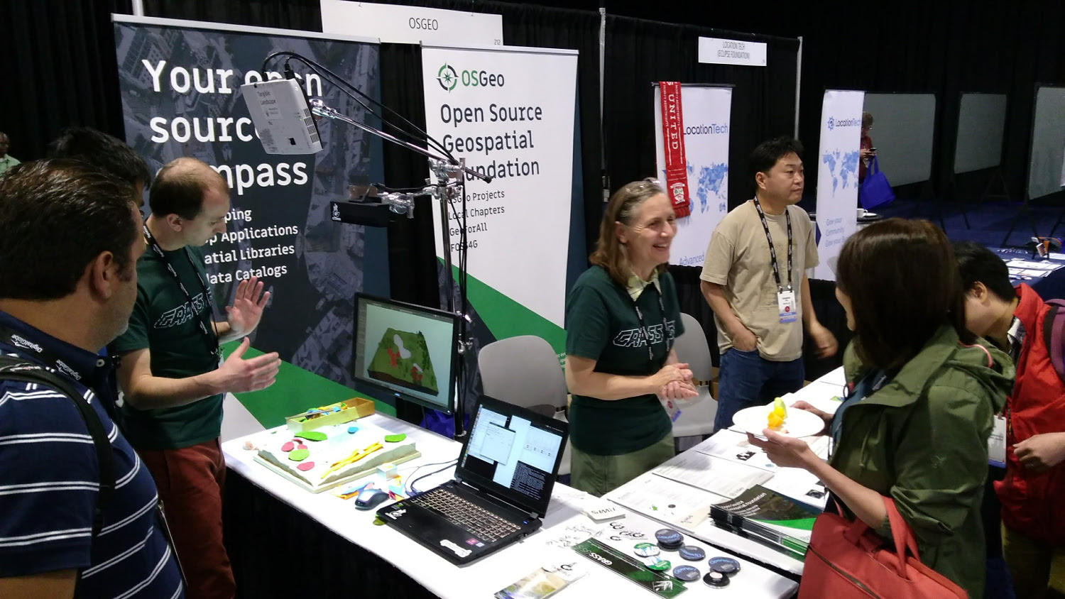
| 20:14, 20 August 2017 | OSGeo booth Boston 2017.jpg (file) |  |
311 KB | OSGeo booth at FOSS4G 2017 in Boston. Tangible Landscape demo, stickers, flyers. | 1 |
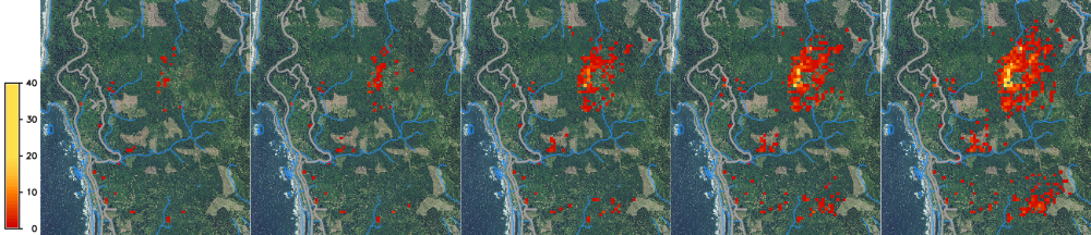
| 19:09, 31 March 2020 | SOD spread example.png (file) | 535 KB | Spread of SOD from 2019 to 2023, one stochastic realization. | 1 | |
| 18:14, 12 October 2023 | NSF Official logo.png (file) | 279 KB | 2 | ||
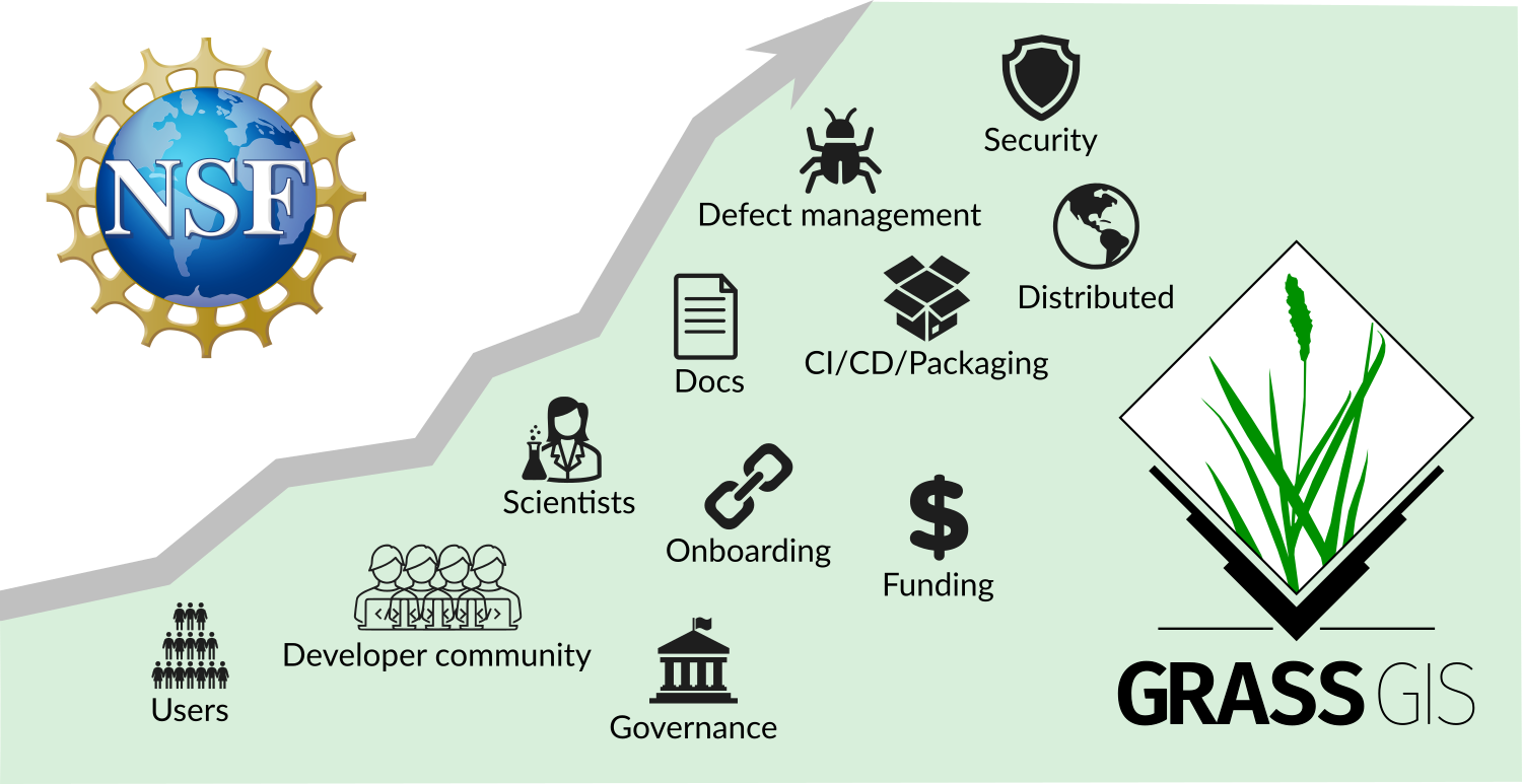
| 20:58, 7 December 2023 | NSF grant announcement.png (file) |  |
252 KB | POSE: Phase II: Growing GRASS OSE for Worldwide Access to Multidisciplinary Geospatial Analytics, award 2303651 | 1 |
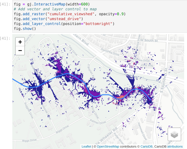
| 03:48, 5 February 2024 | Jupyter interactive viewshed.png (file) |  |
124 KB | Visualization of viewshed using InteractiveMap in grass.jupyter library. | 1 |