File list
Jump to navigation
Jump to search
This special page shows all uploaded files.
| Date | Name | Thumbnail | Size | User | Description | Versions |
|---|---|---|---|---|---|---|
| 20:37, 26 November 2012 | FP7-people logo.jpg (file) | 74 KB | ⚠️Lponti | 1 | ||
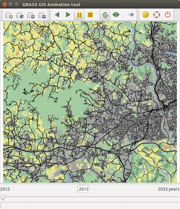
| 03:17, 30 March 2016 | FUTURES animation tool.gif (file) |  |
504 KB | Annakrat | FUTURES results animated using GRASS GIS Animation tool | 1 |
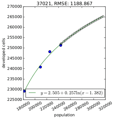
| 03:21, 29 March 2016 | FUTURES demand.png (file) |  |
11 KB | Annakrat | Per capita development for one county derived by {{AddonCmd|r.futures.demand}}. | 1 |
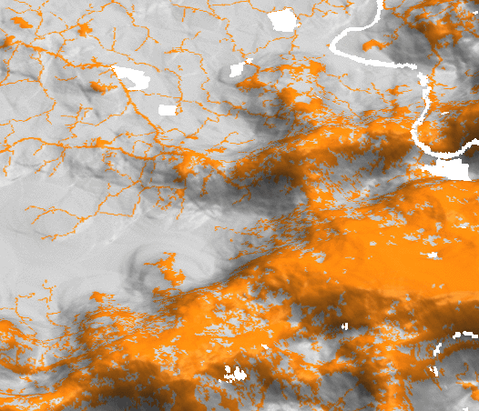
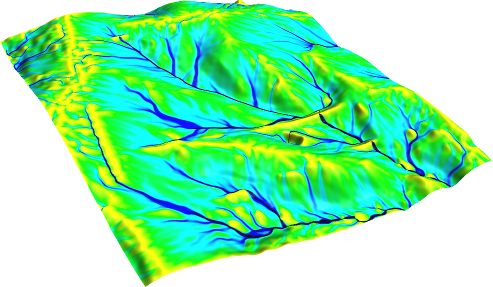
| 03:03, 29 March 2016 | FUTURES devpressure 3D.png (file) |  |
120 KB | Annakrat | Development pressure (computed by r.futures.devpressure) visualized as 3D surface with binary development map draped as color (orange developed, grey undeveloped). | 1 |
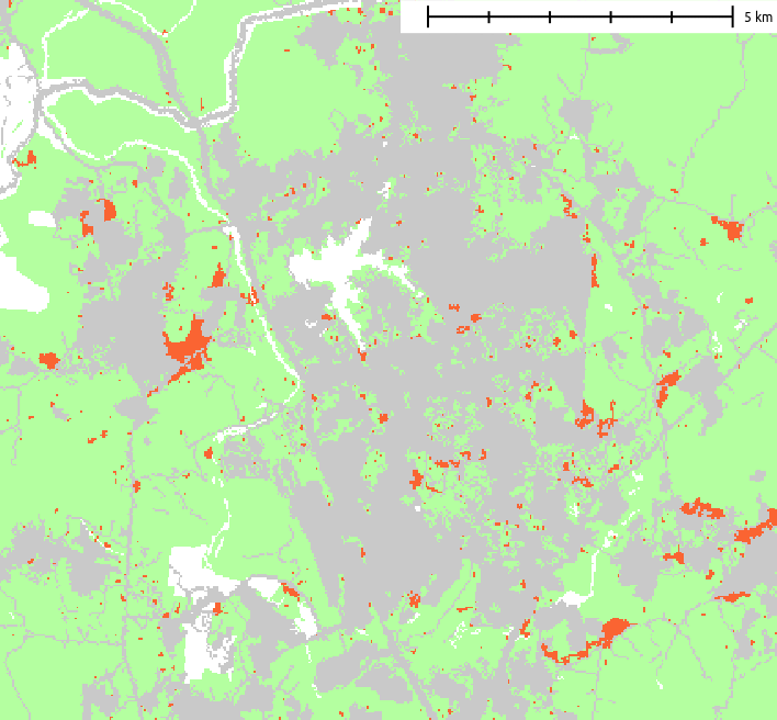
| 03:49, 29 March 2016 | FUTURES result.png (file) |  |
22 KB | Annakrat | Example of resulting pattern of r.futures.pga | 1 |
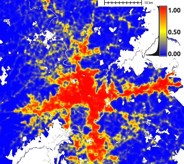
| 03:16, 29 March 2016 | FUTURES suitability.png (file) |  |
157 KB | Annakrat | FUTURES site suitability modeled by r.futures.potential and computed by r.futures.potsurface | 1 |
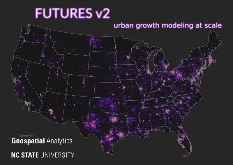
| 16:56, 11 February 2021 | FUTURES v2 petrasova 2021 poster.png (file) |  |
409 KB | ⚠️Wenzeslaus | Thumbnail for a conference poster for NCGIS2021 by Anna Petrasova. Anna Petrasova, Georgina Sanchez, Vaclav Petras, Ross K. Meentemeyer (2021). FUTURES v2: Urban Growth Modeling at Scale. NC GIS Virtual Conference, February 16-19, 2021. | 1 |
| 06:46, 15 June 2006 | Factory.png (file) |  |
268 bytes | ⚠️Stephan | 1 | |
| 02:47, 27 January 2008 | Fiducial 125.png (file) |  |
793 bytes | ⚠️HamishBowman | demo of new extra/fiducial symbol rendered with ps.map -> ps2pdf13 -> acroread | 1 |
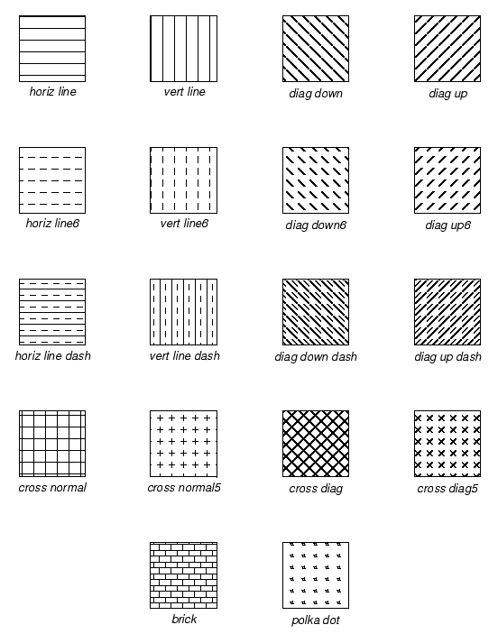
| 17:39, 28 June 2006 | Fillpatterns.png (file) |  |
7 KB | ⚠️HamishBowman | ps.map fill patterns | 1 |
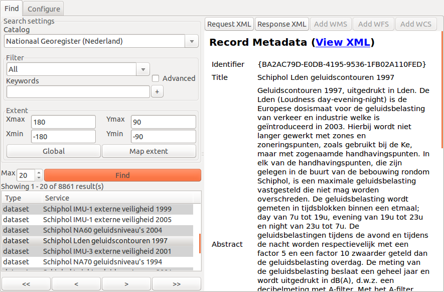
| 14:08, 14 August 2015 | Find1.png (file) |  |
139 KB | ⚠️Krejcmat | g.gui.cswbrowser, searching page | 1 |
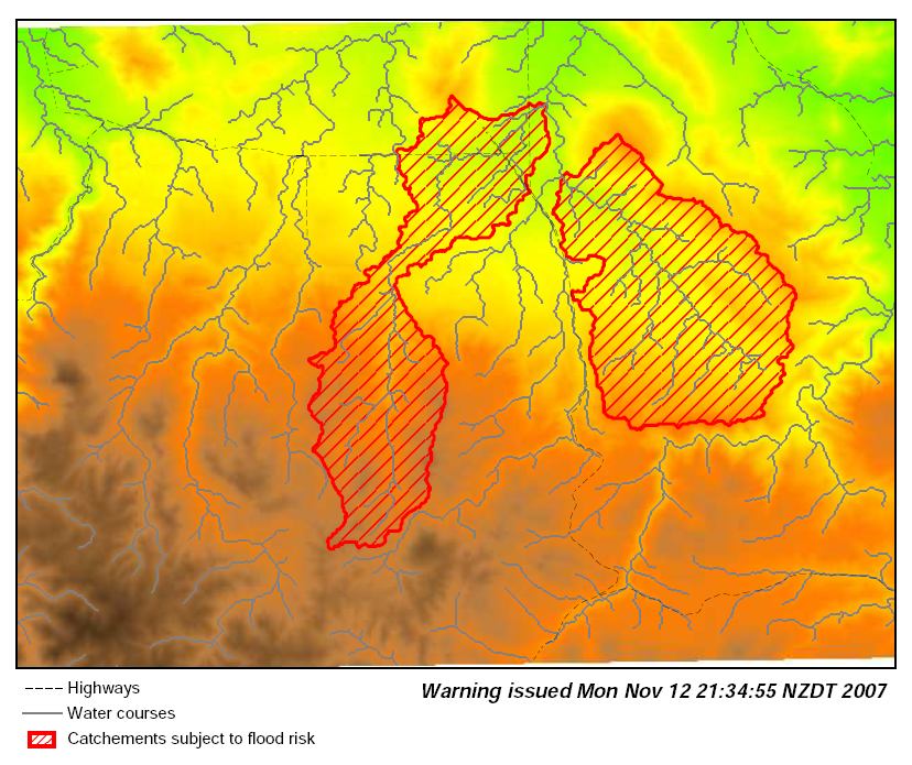
| 15:20, 18 November 2007 | Flood warning basins.png (file) |  |
474 KB | ⚠️HamishBowman | demo of ps.map from a script highlighting spearfish catchments. see the Psmap_flooding_example | 1 |
| 07:33, 29 August 2011 | Flowacc nviz.png (file) |  |
171 KB | Neteler | Flow accumulation(NC dataset) with Multiple Flow Direction: # set computational region to map g.region rast=elev_lid792_1m -p # -f for MFD r.watershed -f elevation=elev_lid792_1m accumulation=flowacc # check map list g.list rast # show metadata r.info | 1 |
| 09:28, 26 August 2015 | Flyer 0.pdf (file) | 546 KB | ⚠️Vincent | first proposal | 1 | |
| 09:28, 26 August 2015 | Flyer gray 0.pdf (file) | 871 KB | ⚠️Vincent | 1 | ||
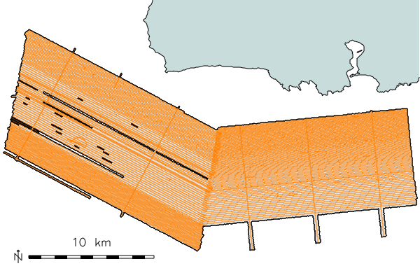
| 04:29, 11 January 2010 | Fnv coverage.png (file) |  |
62 KB | ⚠️HamishBowman | example of track lines over combined swath area imported with v.in.mbsys_fnv addon module | 1 |
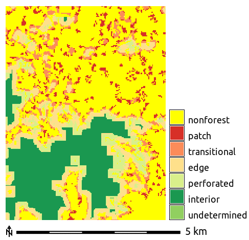
| 02:46, 1 April 2016 | Forest fragmentation.png (file) |  |
11 KB | Annakrat | Forest fragmentation computed with addon r.forestfrag | 1 |
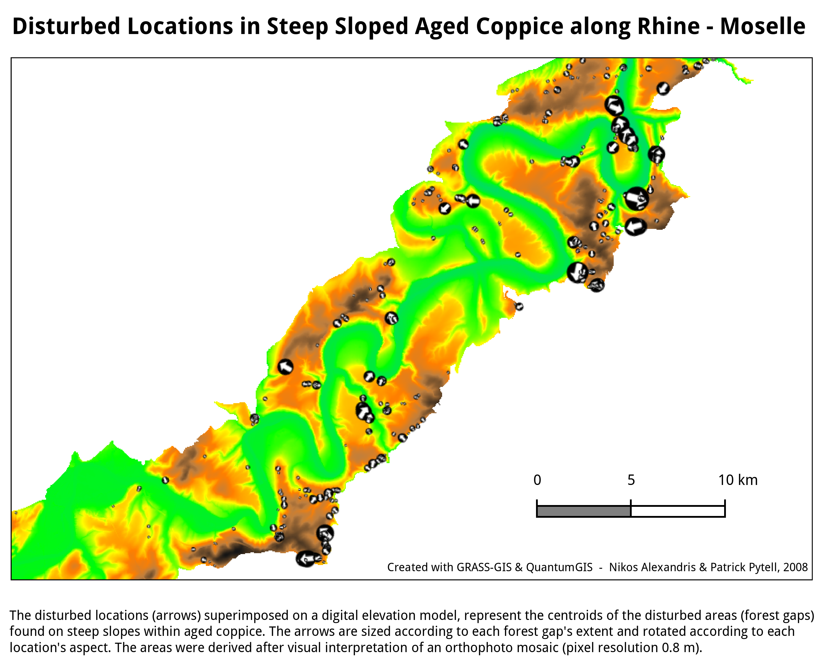
| 09:28, 23 July 2010 | Forestgaps Moseltal Germany.png (file) |  |
497 KB | ⚠️NikosA | Forest gaps in Moseltal, Germany | 1 |
| 20:49, 7 March 2017 | Foss4g boston 2017 logo.png (file) | 25 KB | ⚠️Wenzeslaus | http://2017.foss4g.org/ | 1 | |
| 07:07, 25 October 2007 | Fourmaps.jpg (file) |  |
65 KB | ⚠️HamishBowman | ps.map sample showing 4 raster maps on a single page by saving each raster as EPS first. | 1 |
| 08:49, 6 October 2009 | Full hydo 8056.png (file) |  |
187 KB | ⚠️Jarekj 71 | 1 | |
| 17:58, 12 February 2016 | Futures anim animation layers.png (file) |  |
30 KB | ⚠️Wenzeslaus | 1 | |
| 17:59, 12 February 2016 | Futures anim animation time series.png (file) |  |
14 KB | ⚠️Wenzeslaus | Animation tool: select time series | 1 |
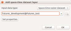
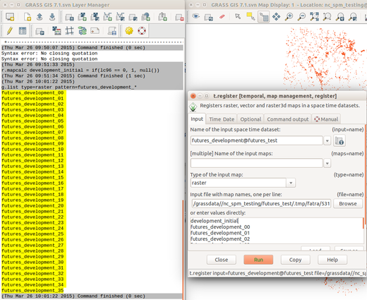
| 18:00, 12 February 2016 | Futures anim list maps.png (file) |  |
148 KB | ⚠️Wenzeslaus | List raster maps by patterns for t.register | 1 |
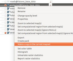
| 18:02, 12 February 2016 | Futures anim make copy.png (file) |  |
40 KB | ⚠️Wenzeslaus | Copy raster map to the current mapset using layer context menu | 1 |
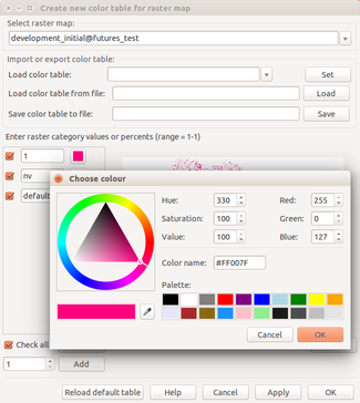
| 18:03, 12 February 2016 | Futures anim raster set color.png (file) |  |
63 KB | ⚠️Wenzeslaus | Set color for category using interactive color table editing tool | 1 |
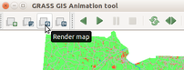
| 18:04, 12 February 2016 | Futures anim render animation.png (file) |  |
19 KB | ⚠️Wenzeslaus | (Re-)render animation in the animation tool | 1 |
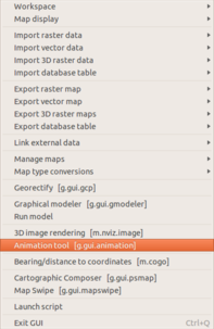
| 18:05, 12 February 2016 | Futures anim start animation tool.png (file) |  |
36 KB | ⚠️Wenzeslaus | Start animation from the file menu | 1 |
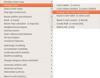
| 18:06, 12 February 2016 | Futures anim start raster color.png (file) |  |
43 KB | ⚠️Wenzeslaus | Manage color table interactively in the Raster menu | 1 |
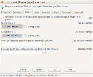
| 18:07, 12 February 2016 | Futures anim vector set color.png (file) |  |
47 KB | ⚠️Wenzeslaus | Set vector layer color using d.vect dialog | 1 |
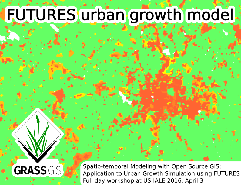
| 20:03, 24 February 2016 | Futures grass gis asheville.png (file) |  |
260 KB | ⚠️Wenzeslaus | Picture for Spatio-temporal Modeling with Open Source GIS: Application to Urban Growth Simulation using FUTURES workshop at US-IALE 2016 Annual Meeting in Asheville, NC, USA. | 1 |
| 19:48, 3 October 2017 | GCI-logo.jpg (file) | 12 KB | Veroandreo | 1 | ||
| 13:48, 19 May 2006 | GDF LOGO 100 trans.png (file) | 3 KB | ⚠️Stephan | 1 | ||
| 23:08, 15 February 2012 | GRASS-Layer-raster-add.png (file) |  |
491 bytes | Neteler | Raster add icon | 1 |
| 23:07, 15 February 2012 | GRASS-Zoom-in.png (file) |  |
975 bytes | Neteler | Zoom Icon | 1 |
| 09:01, 4 June 2023 | GRASS-smiles.jpg (file) |  |
677 KB | ⚠️Chaedrich | 1 | |
| 12:38, 28 January 2015 | GRASSGIS logo color.png (file) | 48 KB | ⚠️Vincent | GRASS GIS logotype, cleaned version, full color | 1 | |
| 12:49, 28 January 2015 | GRASSGIS logo gray.png (file) | 48 KB | ⚠️Vincent | GRASS GIS logotype, cleaned version, grayscale color | 1 | |
| 12:57, 28 January 2015 | GRASSGIS logo white.png (file) | 512 KB | ⚠️Vincent | 3 | ||
| 13:47, 28 January 2015 | GRASSGIS splash1.jpg (file) |  |
114 KB | ⚠️Vincent | First minimal splash screen | 1 |
| 13:48, 28 January 2015 | GRASSGIS splash2.jpg (file) |  |
527 KB | ⚠️Vincent | Second splash screen, using white version of logotype+tagline | 1 |
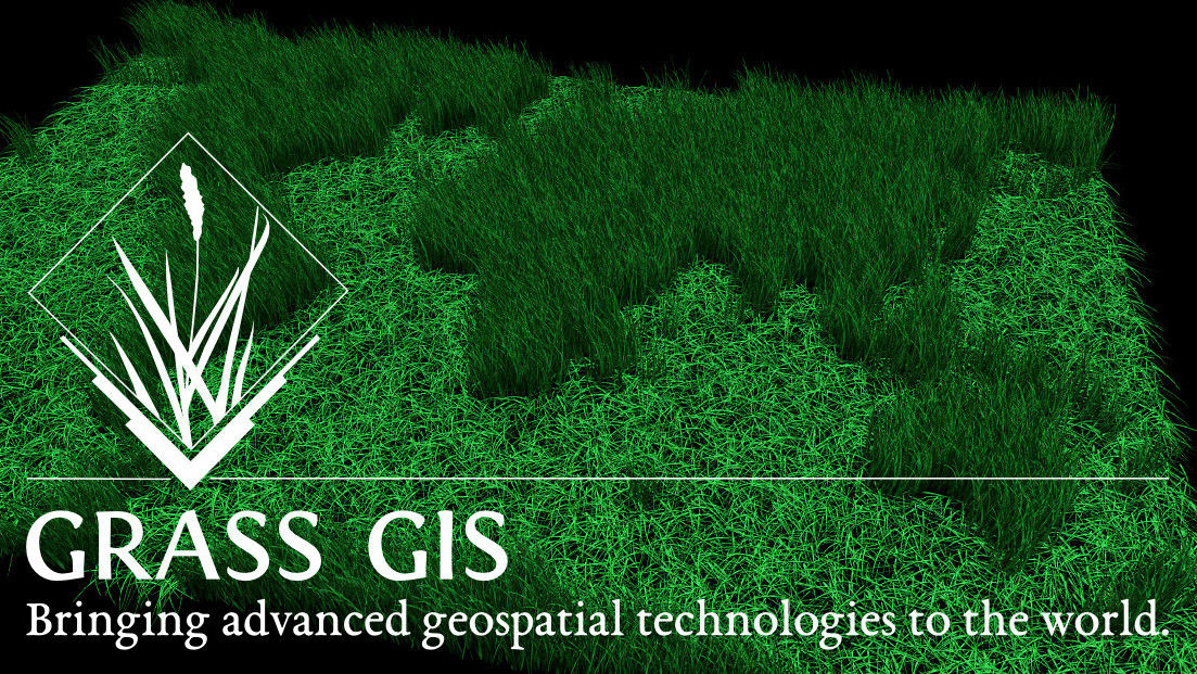
| 13:50, 28 January 2015 | GRASSGIS splash3.jpg (file) |  |
442 KB | ⚠️Vincent | Third splash screen, using white version of logotype+tagline, more personal choice for bg image | 1 |
| 14:12, 28 January 2015 | GRASSGIS splash4.jpg (file) |  |
376 KB | ⚠️Vincent | GRASS splash screen with a grassy world map as background image | 1 |
| 20:36, 28 January 2015 | GRASSGIS splash5.jpg (file) |  |
1.02 MB | ⚠️Vincent | another attempt with Fira Sans as titling font | 1 |
| 20:37, 28 January 2015 | GRASSGIS splash6.jpg (file) |  |
823 KB | ⚠️Vincent | Fira Sans titling font on grayscale bg and green logo/title | 1 |
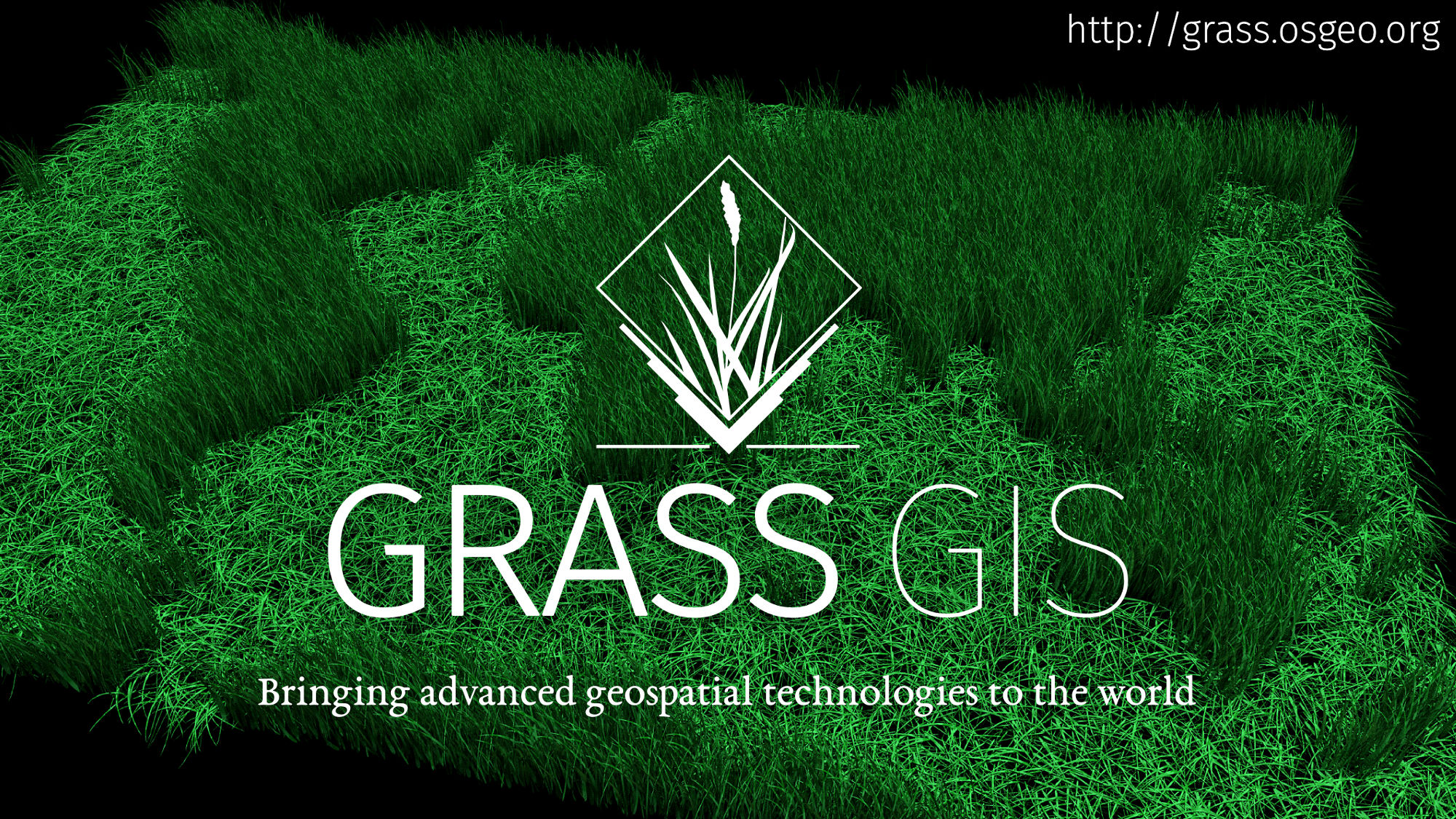
| 12:02, 30 January 2015 | GRASSGIS splash7.jpg (file) |  |
1,022 KB | ⚠️Vincent | GRASS GIS splash screen, centered layout, capitalized title | 1 |
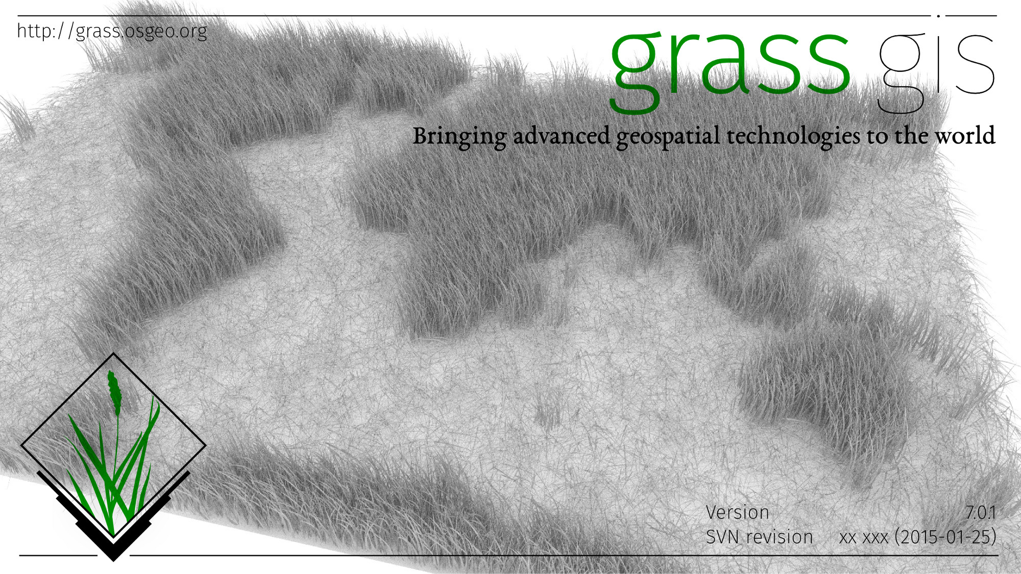
| 12:03, 30 January 2015 | GRASSGIS splash8.jpg (file) |  |
553 KB | ⚠️Vincent | GRASS GIS splash screen, centered layout, capitalized title, grayscale version | 1 |
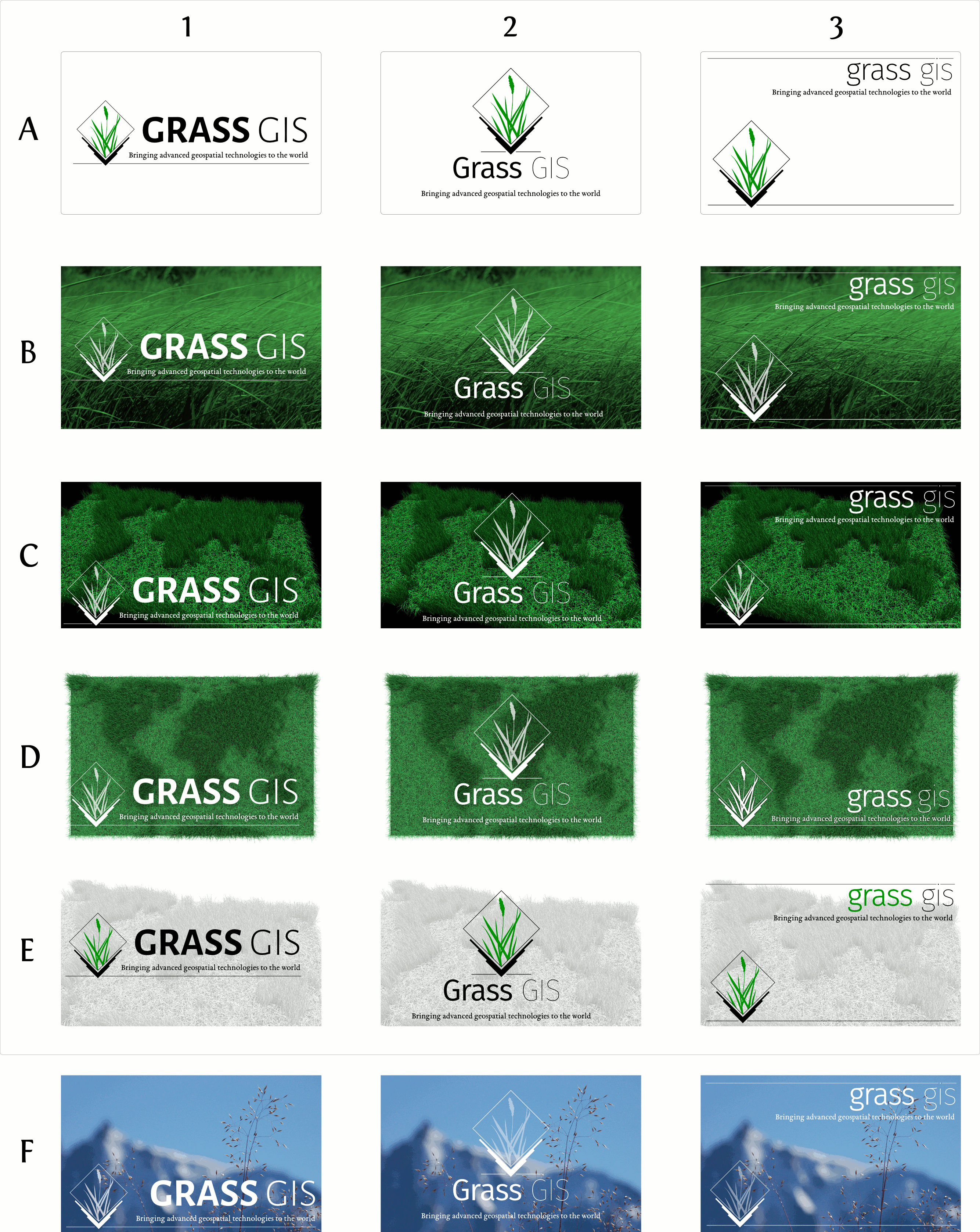
| 06:51, 5 February 2015 | GRASSGIS splash synthesis.jpg (file) |  |
1.71 MB | ⚠️Vincent | Eighteen solutions to various options mixed together. | 2 |
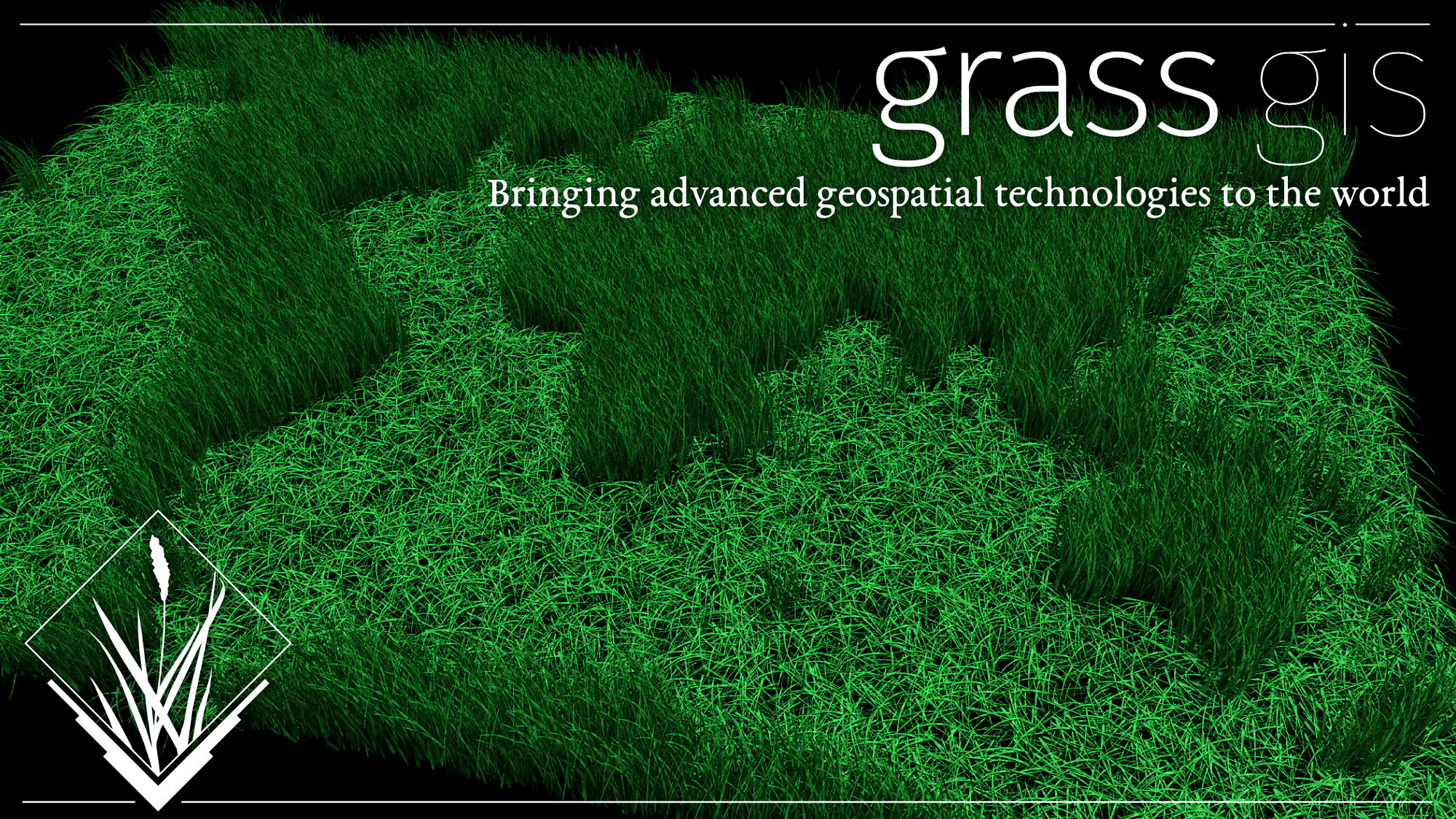
| 14:14, 28 January 2015 | GRASSGIS welcome banner1.jpg (file) |  |
75 KB | ⚠️Vincent | GRASS welcome banner, minimalist version | 1 |
| 14:16, 28 January 2015 | GRASSGIS welcome banner2.jpg (file) |  |
74 KB | ⚠️Vincent | GRASS welcome banner, minimalist version with transparency (fails on dark bg desktop themes) | 1 |