Uploads by Annakrat
Jump to navigation
Jump to search
This special page shows all uploaded files.
| Date | Name | Thumbnail | Size | Description | Versions |
|---|---|---|---|---|---|
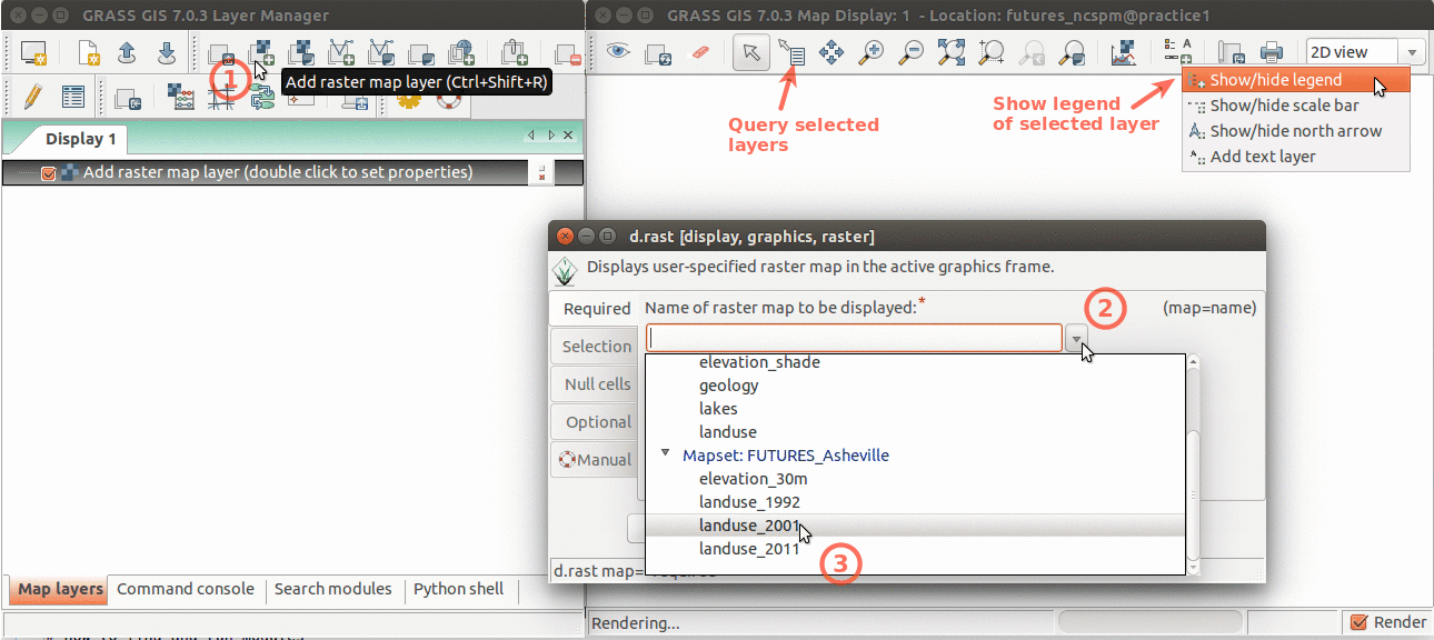
| 15:00, 16 March 2016 | GRASS FUTURES wxGUI display.png (file) |  |
138 KB | Layer Manager and Map Display overview. Annotations show how to add raster layer, query, add legend. | 1 |
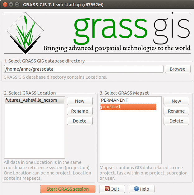
| 15:30, 28 March 2016 | GRASS FUTURES startup.png (file) |  |
55 KB | different layout of mapsets | 2 |
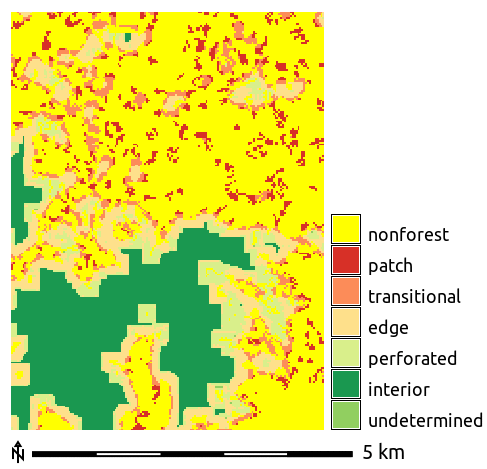
| 02:46, 1 April 2016 | Forest fragmentation.png (file) |  |
11 KB | Forest fragmentation computed with addon r.forestfrag | 1 |
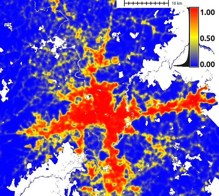
| 03:16, 29 March 2016 | FUTURES suitability.png (file) |  |
157 KB | FUTURES site suitability modeled by r.futures.potential and computed by r.futures.potsurface | 1 |
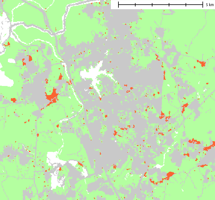
| 03:49, 29 March 2016 | FUTURES result.png (file) |  |
22 KB | Example of resulting pattern of r.futures.pga | 1 |
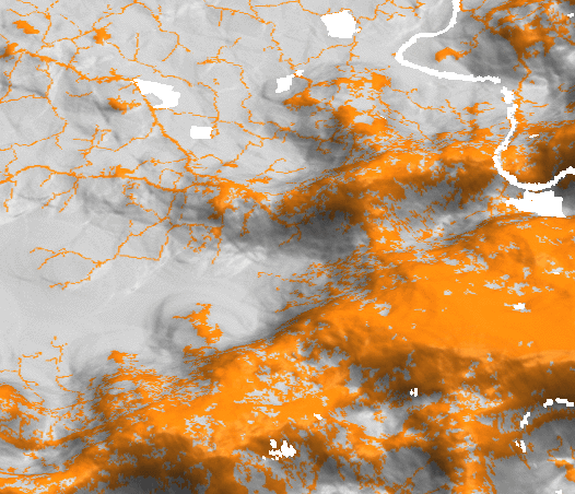
| 03:03, 29 March 2016 | FUTURES devpressure 3D.png (file) |  |
120 KB | Development pressure (computed by r.futures.devpressure) visualized as 3D surface with binary development map draped as color (orange developed, grey undeveloped). | 1 |
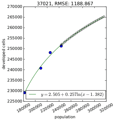
| 03:21, 29 March 2016 | FUTURES demand.png (file) |  |
11 KB | Per capita development for one county derived by {{AddonCmd|r.futures.demand}}. | 1 |
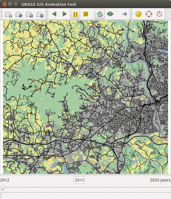
| 03:17, 30 March 2016 | FUTURES animation tool.gif (file) |  |
504 KB | FUTURES results animated using GRASS GIS Animation tool | 1 |
| 03:19, 22 April 2016 | FOSS4G NA 2016.png (file) | 67 KB | Downloaded from https://2016.foss4g-na.org/sites/default/files/728X90.png | 1 | |
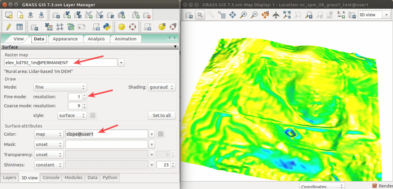
| 14:48, 11 April 2017 | Elevation slope 3D view.png (file) |  |
565 KB | 3D visualization of elev_lid792_1m DEM with slope draped over. | 1 |
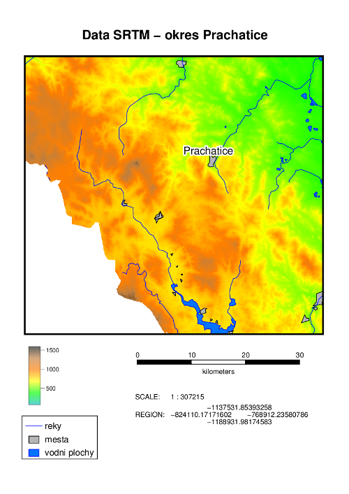
| 20:05, 30 September 2011 | DEM SRTM.png (file) |  |
175 KB | An example of hardcopy map output created by Cartographic Composer. | 1 |
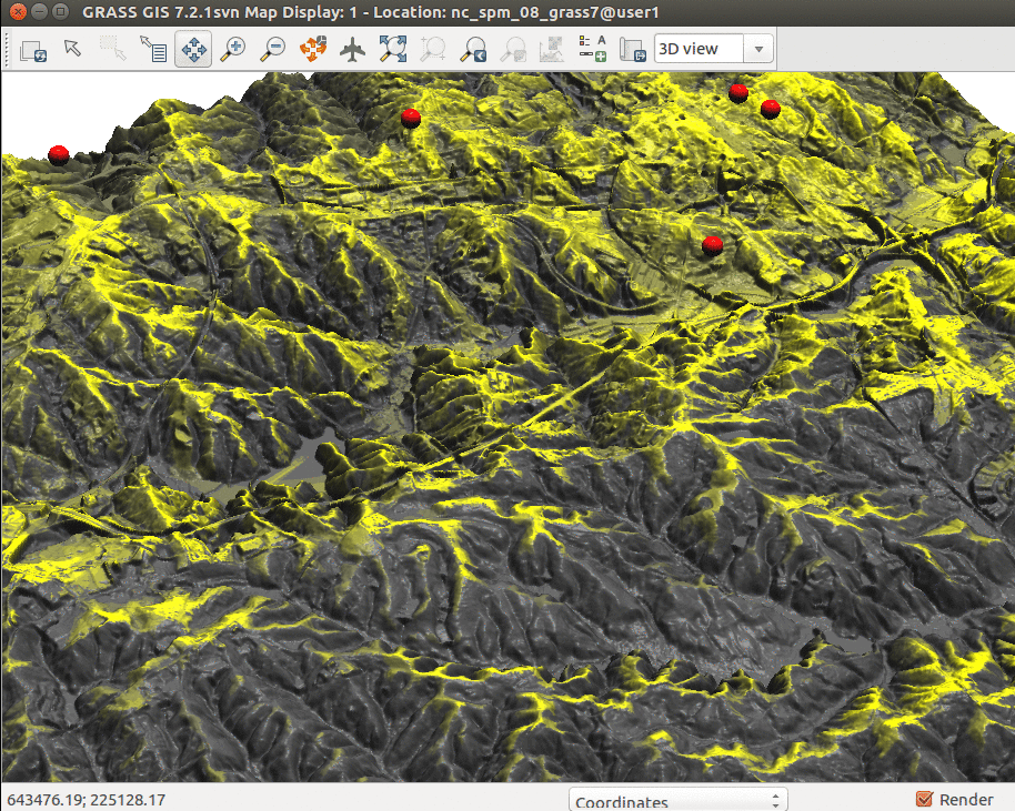
| 20:28, 19 July 2017 | Cumulative viewshed elevation.png (file) |  |
1.08 MB | Cumulative viewshed draped over elevation raster (Boston 2017 workshop) | 1 |
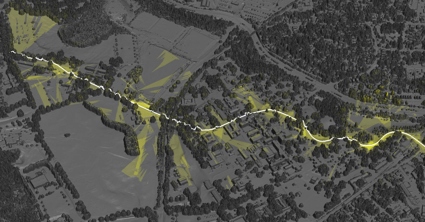
| 19:27, 21 June 2017 | Cumulative viewshed.png (file) |  |
1.34 MB | Cumulative viewshed computed from views along a road. | 1 |
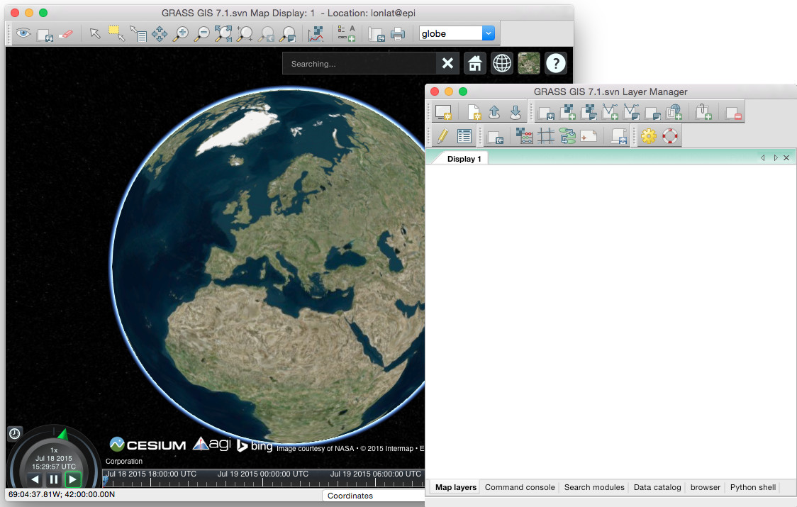
| 16:07, 18 July 2015 | Cesium globe in GRASS GIS.jpg (file) |  |
171 KB | First steps in integration Cesium virtual globe in GRASS GIS 7 | 1 |
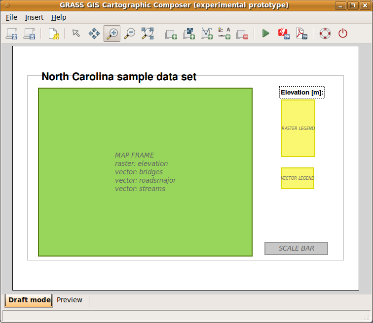
| 14:49, 15 February 2012 | CartographicComposer.png (file) |  |
42 KB | 2 | |
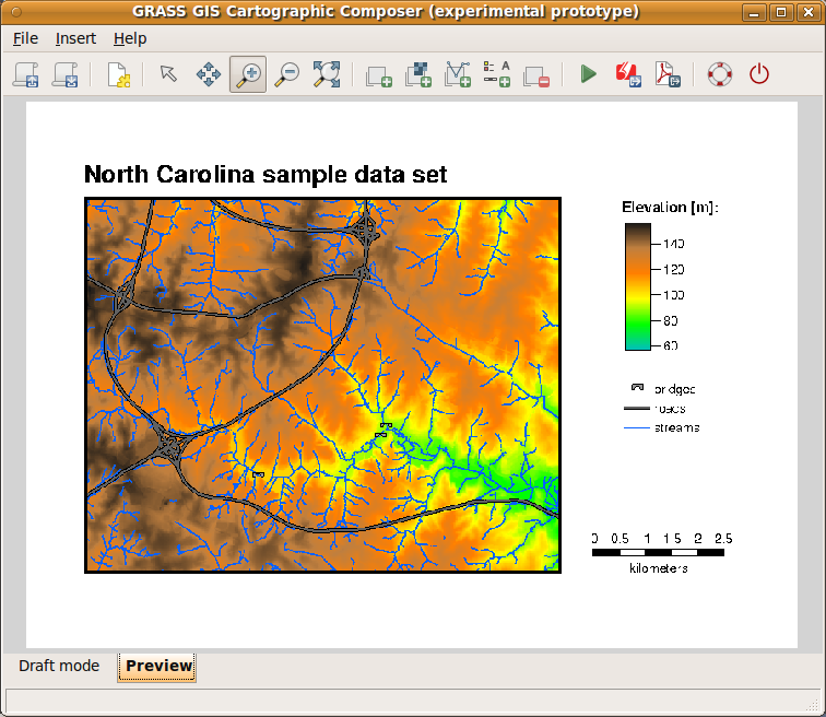
| 15:00, 15 February 2012 | CCPreview.png (file) |  |
206 KB | wxGUI: Cartographic Composer - preview mode (<6.4.2) | 1 |
| 21:51, 22 June 2017 | Blender-plain.png (file) |  |
11 KB | Blender logo | 1 |
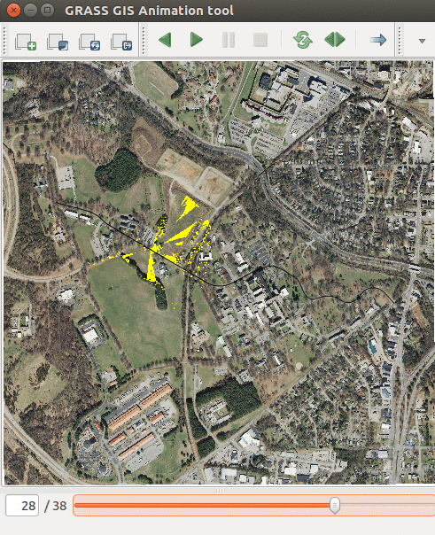
| 21:40, 21 June 2017 | Animation tool viewsheds.png (file) |  |
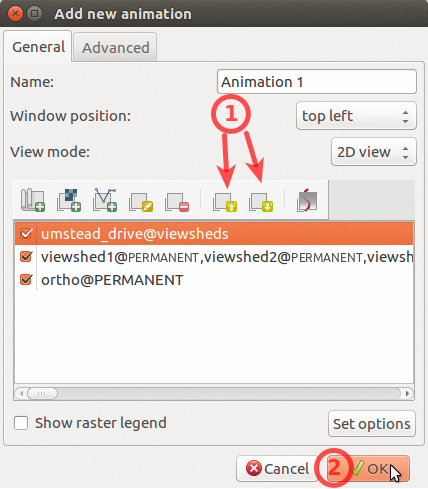
619 KB | Showing series of viewsheds with Animation Tool | 1 |
| 20:55, 21 June 2017 | Animation tool layers.png (file) |  |
114 KB | How to change order of layers in Animation Tool | 1 |
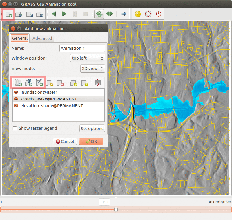
| 04:38, 21 July 2017 | Animation tool inundation.png (file) |  |
468 KB | Inundation computed with {{addonCmd|r.stream.distance}} and {{addonCmd|r.lake.series}} and visualized in Animation Tool. | 1 |
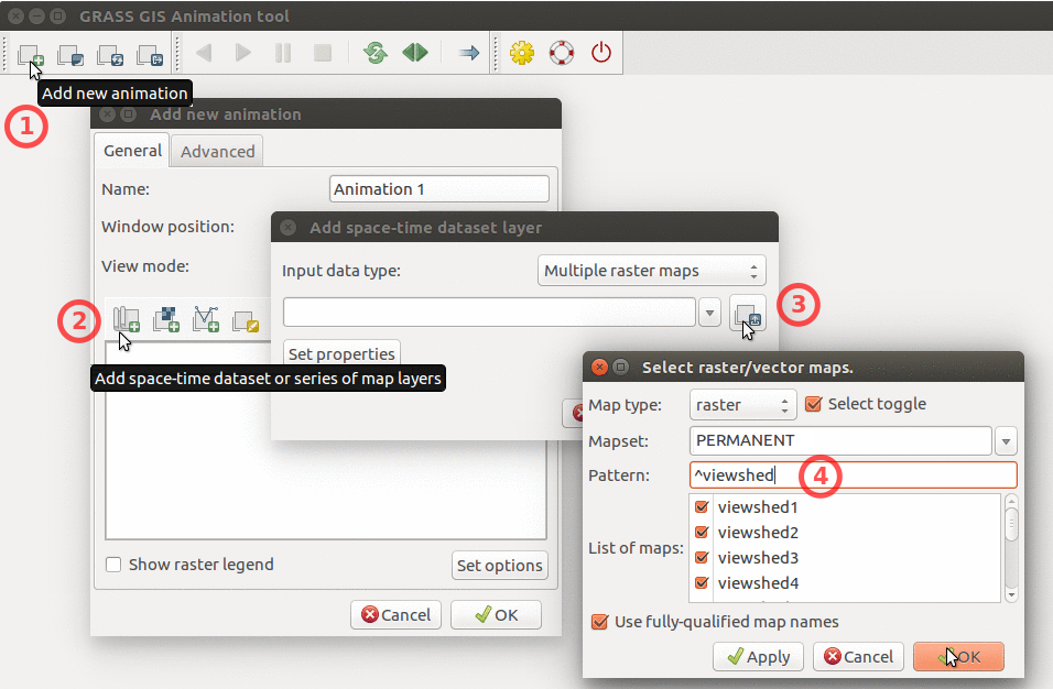
| 20:54, 21 June 2017 | Animation tool add multiple rasters.png (file) |  |
320 KB | How to add multiple raster maps and filter them by name. | 1 |
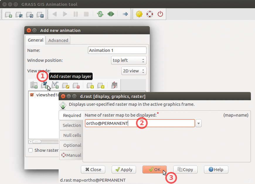
| 20:54, 21 June 2017 | Animation tool add base raster.png (file) |  |
251 KB | How to add base raster to Animation Tool | 1 |
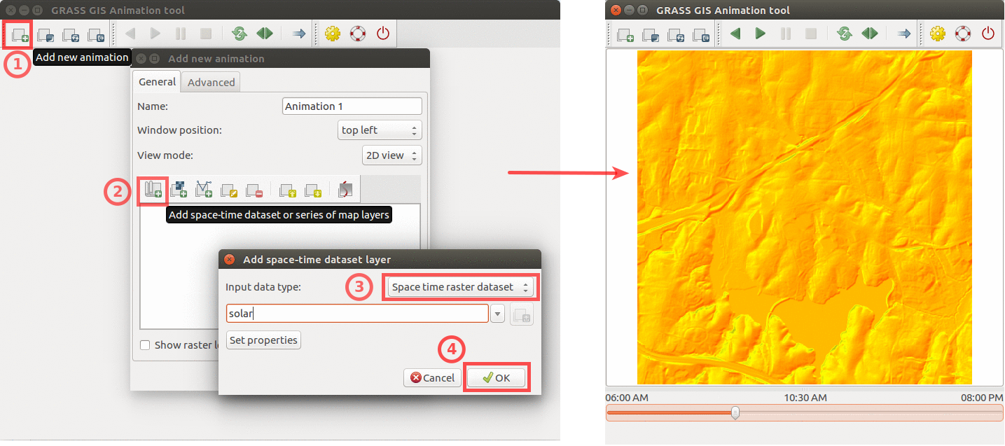
| 22:15, 9 April 2017 | Animation solar example.png (file) |  |
439 KB | Using GRASS GIS animation tool to animate solar irradiance during a day. Computed by {{addonCmd|r.sun.hourly}}. | 1 |