Uploads by Annakrat
Jump to navigation
Jump to search
This special page shows all uploaded files.
| Date | Name | Thumbnail | Size | Description | Versions |
|---|---|---|---|---|---|
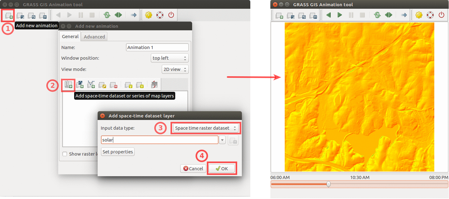
| 22:15, 9 April 2017 | Animation solar example.png (file) |  |
439 KB | Using GRASS GIS animation tool to animate solar irradiance during a day. Computed by {{addonCmd|r.sun.hourly}}. | 1 |
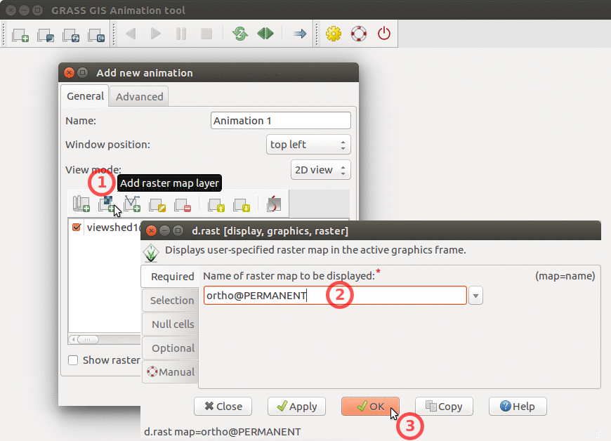
| 20:54, 21 June 2017 | Animation tool add base raster.png (file) |  |
251 KB | How to add base raster to Animation Tool | 1 |
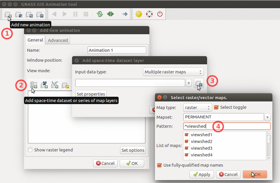
| 20:54, 21 June 2017 | Animation tool add multiple rasters.png (file) |  |
320 KB | How to add multiple raster maps and filter them by name. | 1 |
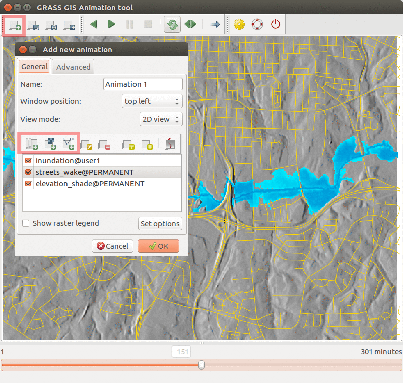
| 04:38, 21 July 2017 | Animation tool inundation.png (file) |  |
468 KB | Inundation computed with {{addonCmd|r.stream.distance}} and {{addonCmd|r.lake.series}} and visualized in Animation Tool. | 1 |
| 20:55, 21 June 2017 | Animation tool layers.png (file) |  |
114 KB | How to change order of layers in Animation Tool | 1 |
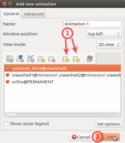
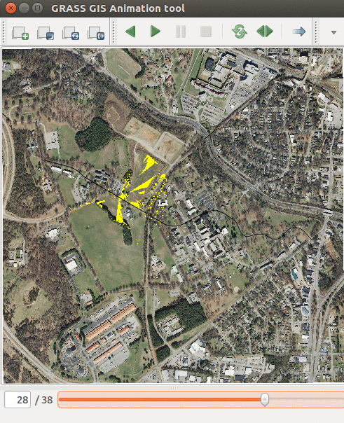
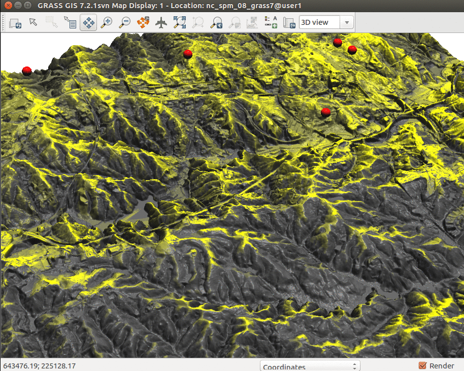
| 21:40, 21 June 2017 | Animation tool viewsheds.png (file) |  |
619 KB | Showing series of viewsheds with Animation Tool | 1 |
| 21:51, 22 June 2017 | Blender-plain.png (file) |  |
11 KB | Blender logo | 1 |
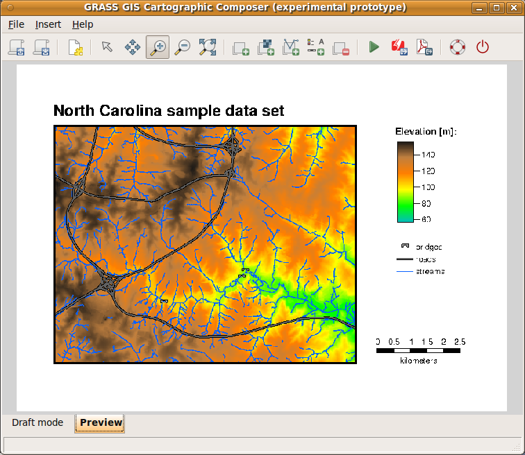
| 15:00, 15 February 2012 | CCPreview.png (file) |  |
206 KB | wxGUI: Cartographic Composer - preview mode (<6.4.2) | 1 |
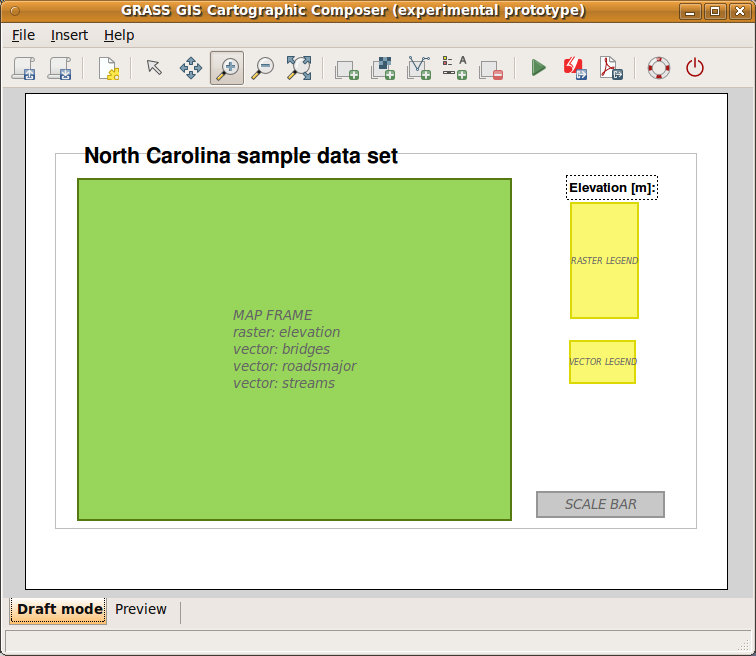
| 14:49, 15 February 2012 | CartographicComposer.png (file) |  |
42 KB | 2 | |
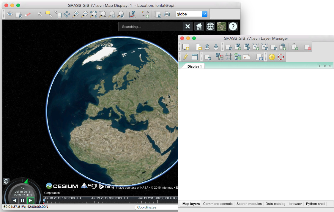
| 16:07, 18 July 2015 | Cesium globe in GRASS GIS.jpg (file) |  |
171 KB | First steps in integration Cesium virtual globe in GRASS GIS 7 | 1 |
| 19:27, 21 June 2017 | Cumulative viewshed.png (file) |  |
1.34 MB | Cumulative viewshed computed from views along a road. | 1 |
| 20:28, 19 July 2017 | Cumulative viewshed elevation.png (file) |  |
1.08 MB | Cumulative viewshed draped over elevation raster (Boston 2017 workshop) | 1 |
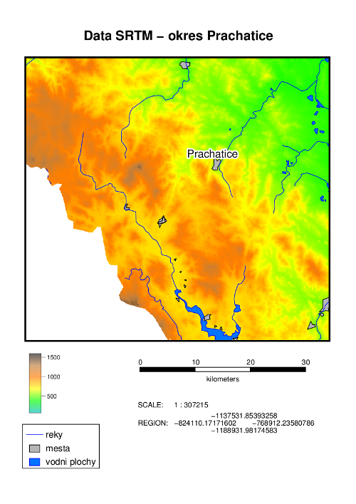
| 20:05, 30 September 2011 | DEM SRTM.png (file) |  |
175 KB | An example of hardcopy map output created by Cartographic Composer. | 1 |
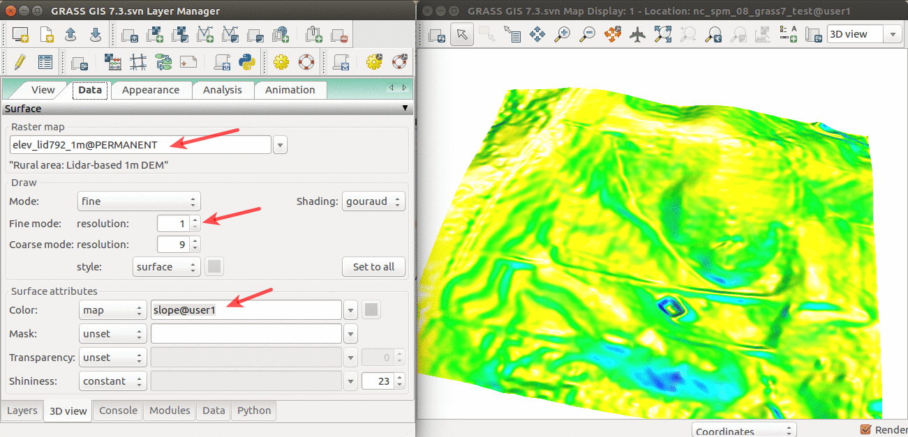
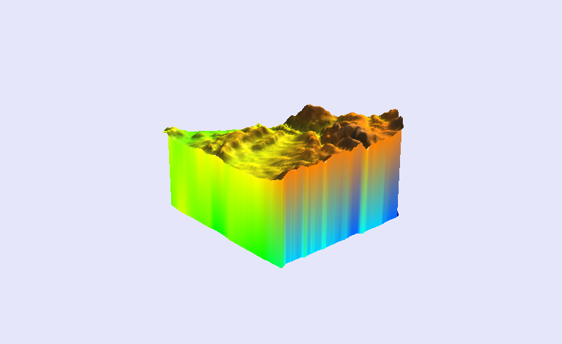
| 14:48, 11 April 2017 | Elevation slope 3D view.png (file) |  |
565 KB | 3D visualization of elev_lid792_1m DEM with slope draped over. | 1 |
| 03:19, 22 April 2016 | FOSS4G NA 2016.png (file) | 67 KB | Downloaded from https://2016.foss4g-na.org/sites/default/files/728X90.png | 1 | |
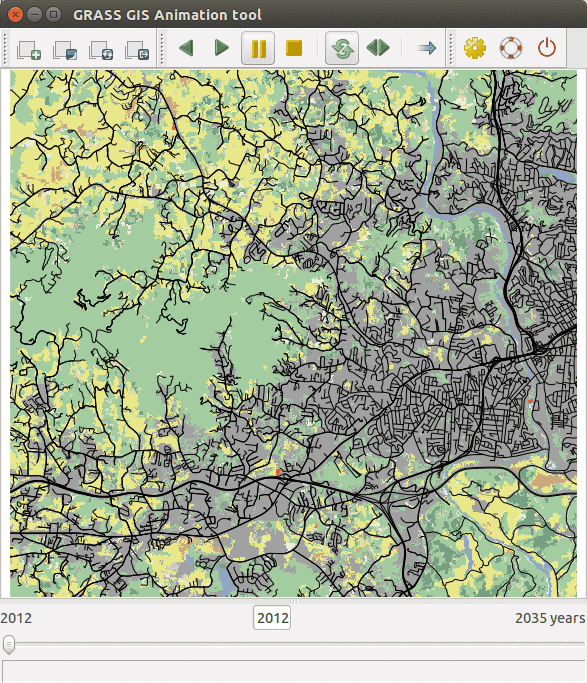
| 03:17, 30 March 2016 | FUTURES animation tool.gif (file) |  |
504 KB | FUTURES results animated using GRASS GIS Animation tool | 1 |
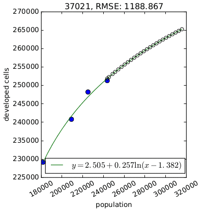
| 03:21, 29 March 2016 | FUTURES demand.png (file) |  |
11 KB | Per capita development for one county derived by {{AddonCmd|r.futures.demand}}. | 1 |
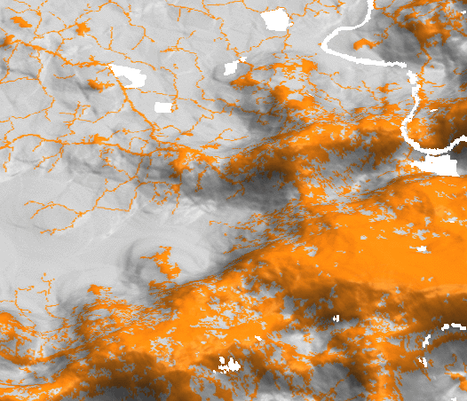
| 03:03, 29 March 2016 | FUTURES devpressure 3D.png (file) |  |
120 KB | Development pressure (computed by r.futures.devpressure) visualized as 3D surface with binary development map draped as color (orange developed, grey undeveloped). | 1 |
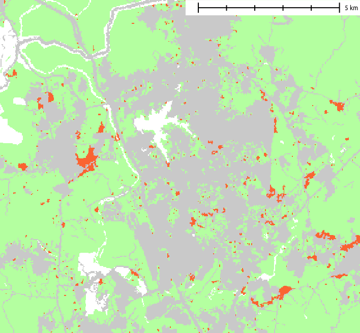
| 03:49, 29 March 2016 | FUTURES result.png (file) |  |
22 KB | Example of resulting pattern of r.futures.pga | 1 |
| 03:16, 29 March 2016 | FUTURES suitability.png (file) |  |
157 KB | FUTURES site suitability modeled by r.futures.potential and computed by r.futures.potsurface | 1 |
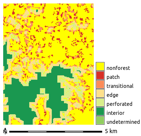
| 02:46, 1 April 2016 | Forest fragmentation.png (file) |  |
11 KB | Forest fragmentation computed with addon r.forestfrag | 1 |
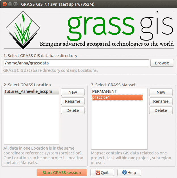
| 15:30, 28 March 2016 | GRASS FUTURES startup.png (file) |  |
55 KB | different layout of mapsets | 2 |
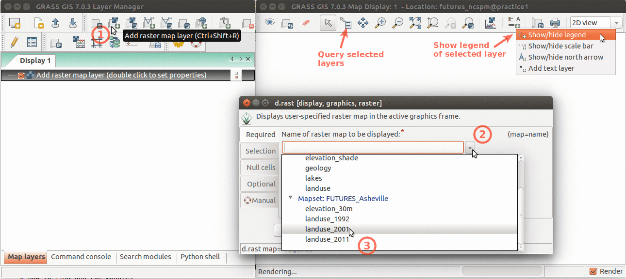
| 15:00, 16 March 2016 | GRASS FUTURES wxGUI display.png (file) |  |
138 KB | Layer Manager and Map Display overview. Annotations show how to add raster layer, query, add legend. | 1 |
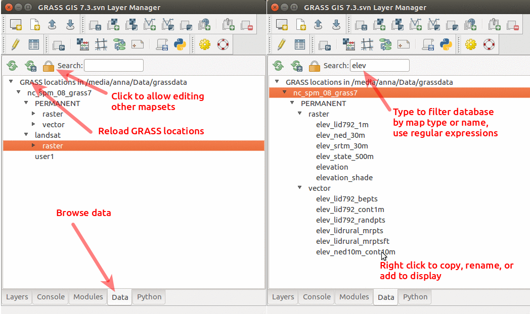
| 01:36, 19 July 2017 | GRASS GIS 7.3 data catalog.png (file) |  |
241 KB | Data catalog in GRASS GIS 7.3 with nc_spm_08_grass7 location | 1 |
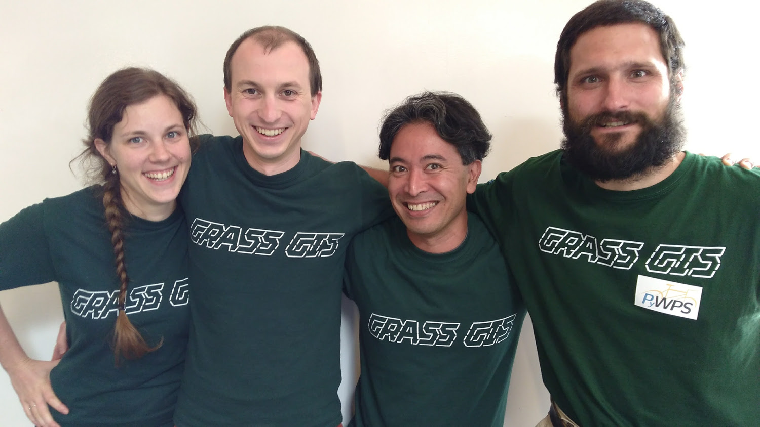
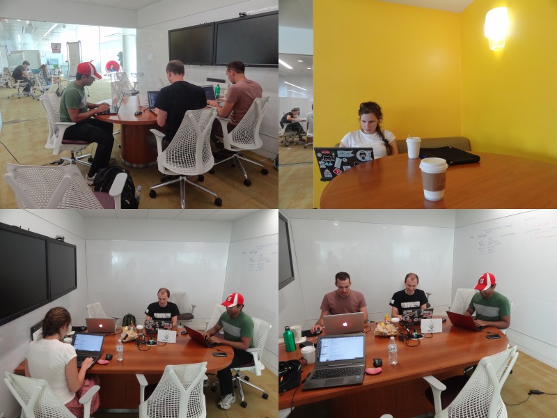
| 19:46, 19 August 2017 | GRASS GIS sprint FOSS4G 2017.jpg (file) |  |
202 KB | Photo of participants of code sprint during FOSS4G 2017 | 1 |
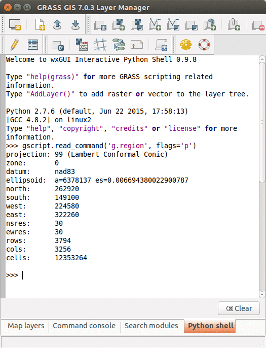
| 18:32, 30 March 2016 | GRASS GUI Python shell.png (file) |  |
42 KB | Python Shell in GRASS GIS GUI | 1 |
| 21:01, 1 October 2016 | GRASS meetup 10 01 2016.jpg (file) |  |
113 KB | GRASS GIS meetup in Hunt Library, Raleigh 10/01/2016 | 1 |
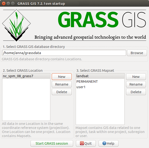
| 15:29, 5 April 2017 | GRASS startup ncspm.png (file) |  |
150 KB | GRASS GIS 7.2 startup screen with North Carolina sample dataset | 1 |
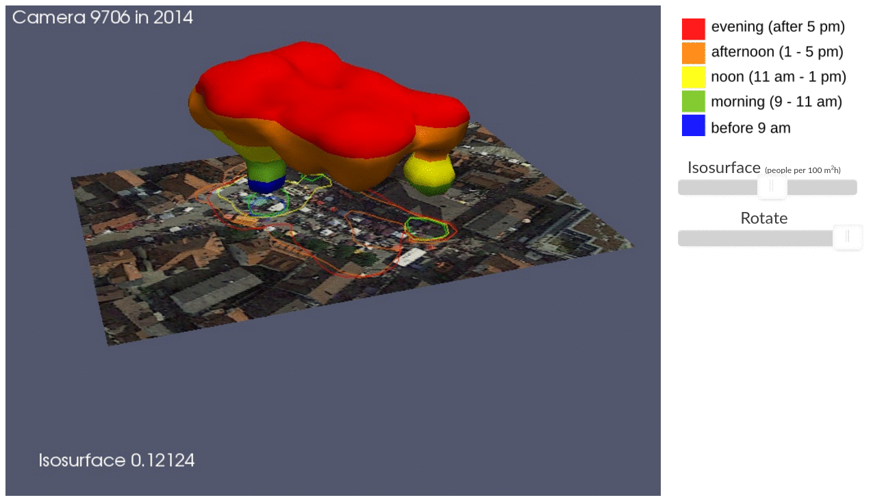
| 01:40, 18 July 2017 | ICC STC illustration.png (file) |  |
468 KB | Presentation on Using space-time cube for visualization and analysis of active transportation patterns derived from public webcams by Anna Petrasova, Aaron Hipp, and Helena Mitasova from North Carolina State University | 1 |
| 21:00, 22 June 2017 | ICC workshop 3Dview ortho.png (file) |  |
1.45 MB | 3D visulization of digital surface model draped with orthophoto | 1 |
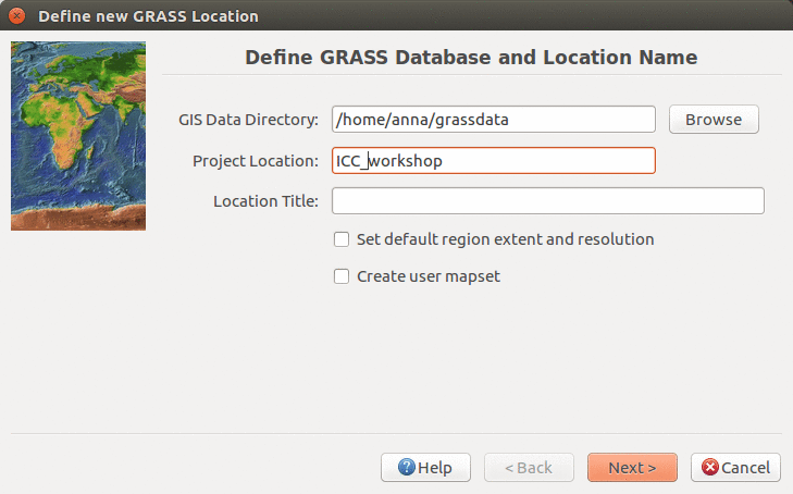
| 03:18, 22 June 2017 | ICC workshop location wizard define 7.2.png (file) |  |
118 KB | Defining new location name in Location Wizard (ICC workshop) | 1 |
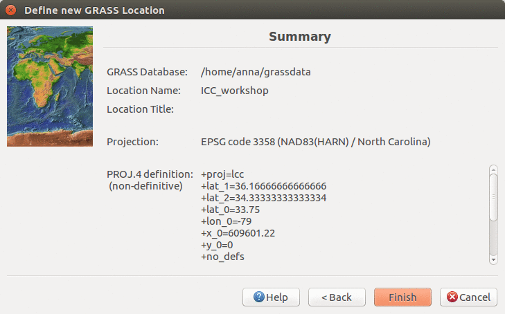
| 03:22, 22 June 2017 | ICC workshop location wizard summary 7.2.png (file) |  |
114 KB | Location Wizard summary page | 1 |
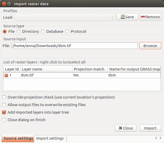
| 14:02, 22 June 2017 | Import raster 7.2.1.png (file) |  |
130 KB | Import raster data dialog in GRASS GIS 7.2.1 | 1 |
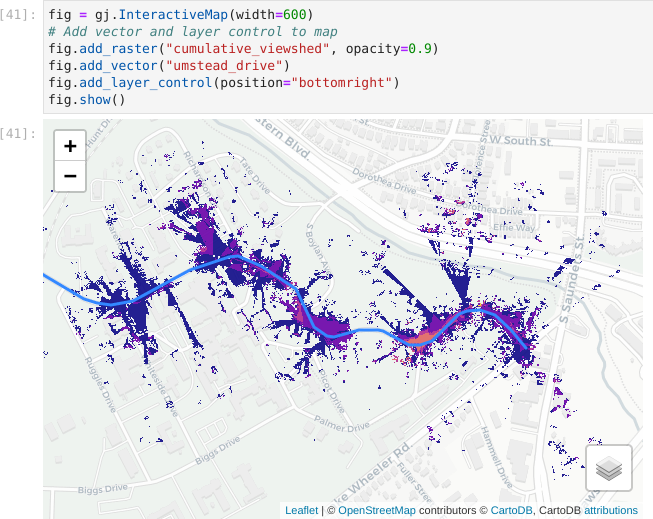
| 03:48, 5 February 2024 | Jupyter interactive viewshed.png (file) |  |
124 KB | Visualization of viewshed using InteractiveMap in grass.jupyter library. | 1 |
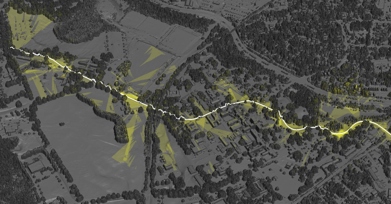
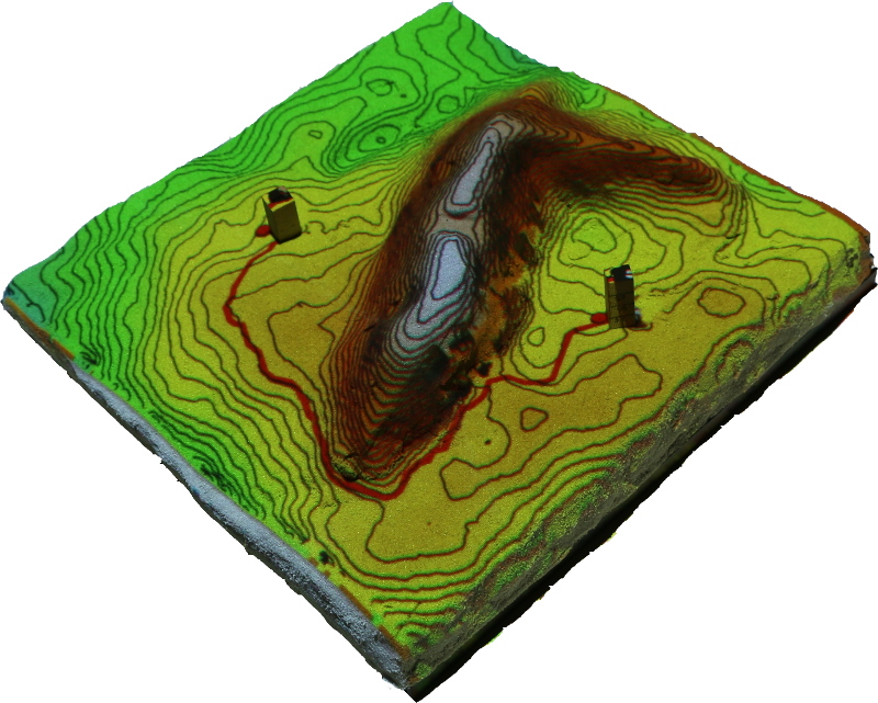
| 21:42, 25 April 2016 | Least cost path.jpg (file) |  |
246 KB | Tangible landscape: Least cost path example where cost is slope | 1 |
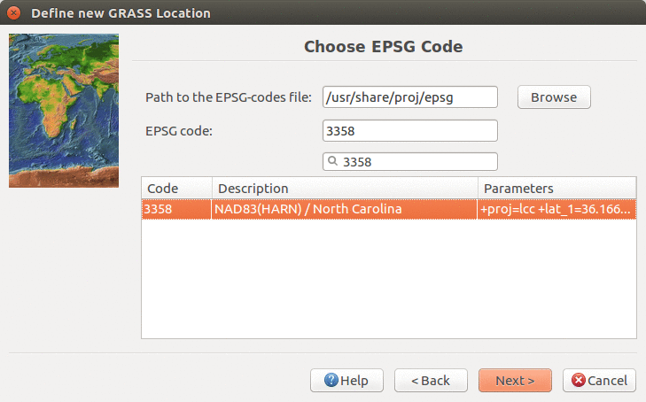
| 03:21, 22 June 2017 | Location wizard EPSG3358 7.2.png (file) |  |
131 KB | Creating new location with EPSG 3358 in Location Wizard | 1 |
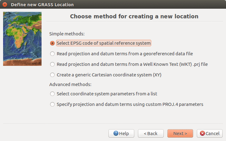
| 03:20, 22 June 2017 | Location wizard method 7.2.png (file) |  |
126 KB | Define CRS in Location Wizard in 7.2. version using EPSG code | 1 |
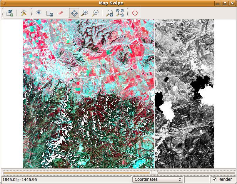
| 07:36, 10 August 2012 | MapSwipe1.png (file) |  |
513 KB | 1 | |
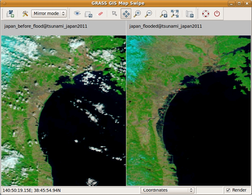
| 14:26, 10 December 2012 | Mapswipe tsunami mirror.jpeg (file) |  |
342 KB | Map Swipe mirror mode: pre and post disaster images of the tsunami in Japan in 2011. Source: http://earthobservatory.nasa.gov/NaturalHazards/view.php?id=49634 | 1 |
| 18:14, 12 October 2023 | NSF Official logo.png (file) | 279 KB | 2 | ||
| 20:58, 7 December 2023 | NSF grant announcement.png (file) |  |
252 KB | POSE: Phase II: Growing GRASS OSE for Worldwide Access to Multidisciplinary Geospatial Analytics, award 2303651 | 1 |
| 14:59, 30 June 2011 | Nviz cmd cutting planes.png (file) |  |
62 KB | Picture of surfaces cut by two planes (generated by nviz_cmd) | 1 |
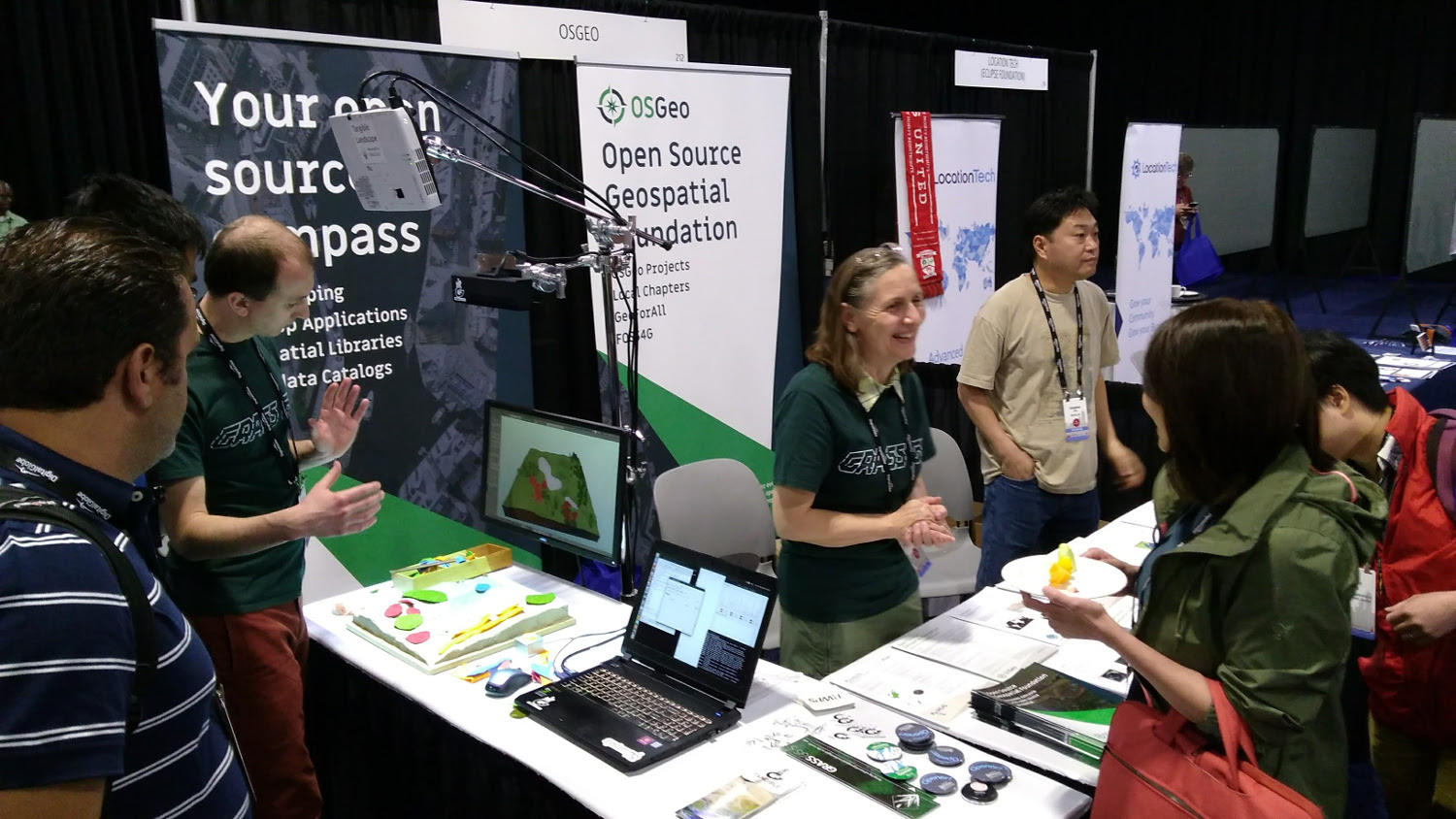
| 20:14, 20 August 2017 | OSGeo booth Boston 2017.jpg (file) |  |
311 KB | OSGeo booth at FOSS4G 2017 in Boston. Tangible Landscape demo, stickers, flyers. | 1 |
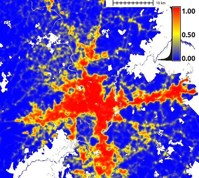
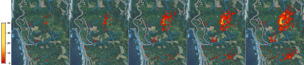
| 19:09, 31 March 2020 | SOD spread example.png (file) | 535 KB | Spread of SOD from 2019 to 2023, one stochastic realization. | 1 | |
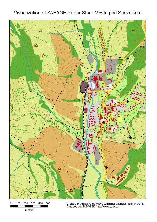
| 20:06, 30 September 2011 | StareMesto.png (file) |  |
460 KB | An example of hardcopy map output created by Cartographic Composer. | 1 |
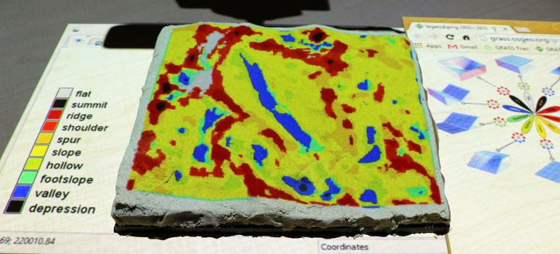
| 03:15, 22 April 2016 | Tangible landscape geomorphons.jpg (file) |  |
197 KB | Tangible Landscape: Landforms computed with {{AddonCmd|r.geomorphon}} | 1 |
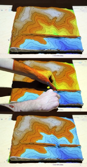
| 22:02, 25 April 2016 | Tangible landscape r fill dir.jpg (file) |  |
130 KB | Tangible Landscape: example of using {{cmd|r.fill.dir}} to create ponds | 1 |
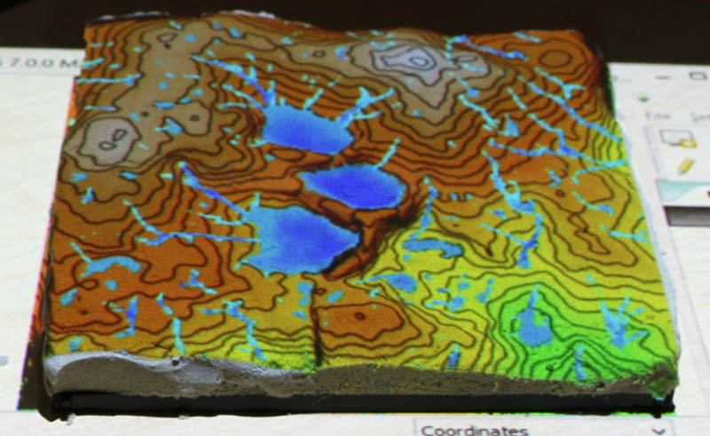
| 03:07, 22 April 2016 | Tangible landscape rlake.jpg (file) |  |
65 KB | Example of simple flooding simulation with Tangible Landscape and {{cmd|r.lake}} module. | 1 |
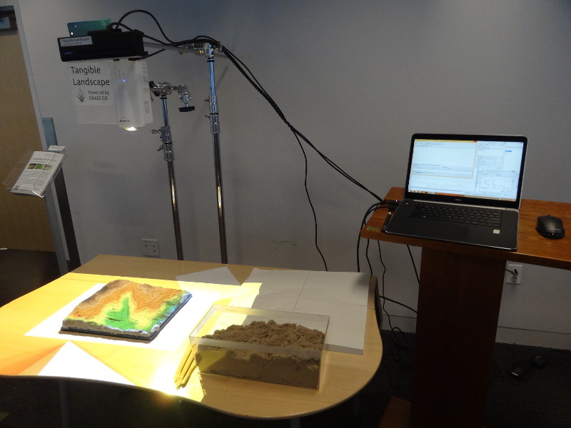
| 01:37, 28 April 2016 | Tangible landscape setup.jpg (file) |  |
134 KB | One possible Tangible Landscape setup | 1 |
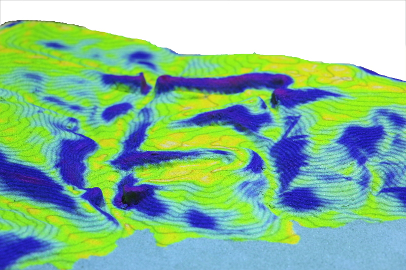
| 22:13, 25 April 2016 | Tangible landscape slope.jpg (file) |  |
244 KB | Tangible Landscape: topographic slope | 1 |