Uploads by Annakrat
Jump to navigation
Jump to search
This special page shows all uploaded files.
| Date | Name | Thumbnail | Size | Description | Versions |
|---|---|---|---|---|---|
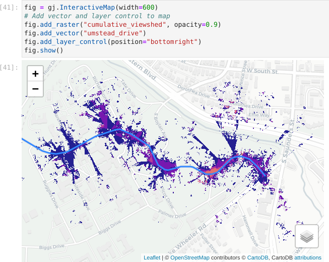
| 03:48, 5 February 2024 | Jupyter interactive viewshed.png (file) |  |
124 KB | Visualization of viewshed using InteractiveMap in grass.jupyter library. | 1 |
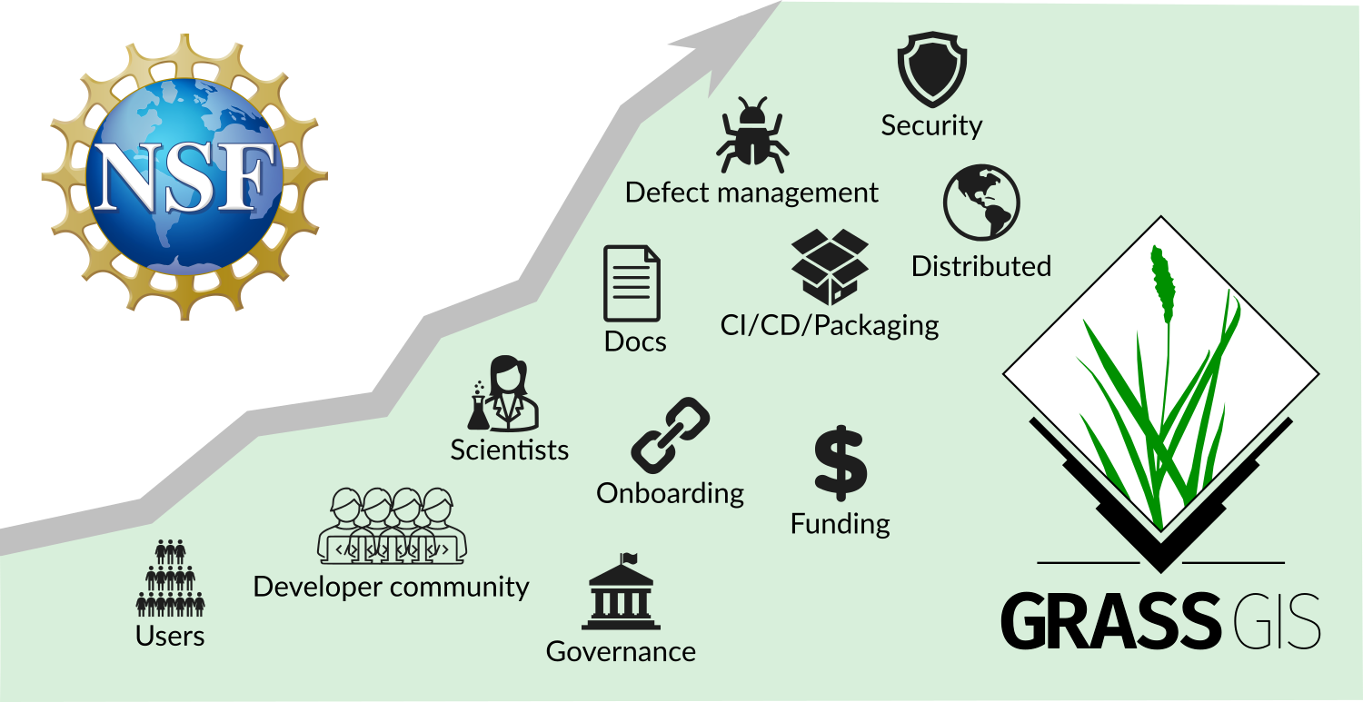
| 20:58, 7 December 2023 | NSF grant announcement.png (file) |  |
252 KB | POSE: Phase II: Growing GRASS OSE for Worldwide Access to Multidisciplinary Geospatial Analytics, award 2303651 | 1 |
| 18:14, 12 October 2023 | NSF Official logo.png (file) | 279 KB | 2 | ||
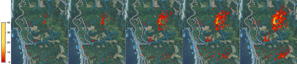
| 19:09, 31 March 2020 | SOD spread example.png (file) | 535 KB | Spread of SOD from 2019 to 2023, one stochastic realization. | 1 | |
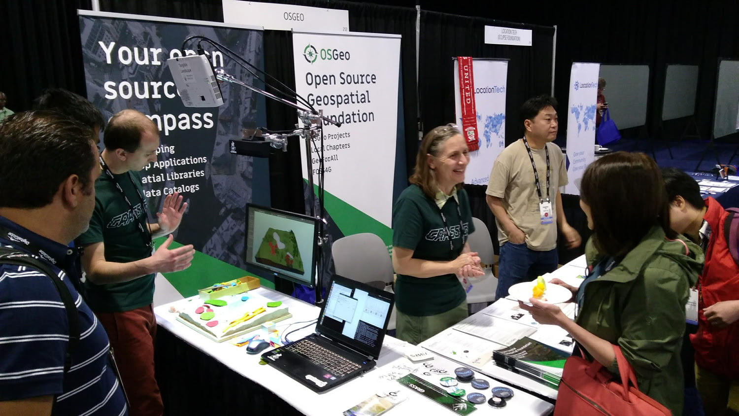
| 20:14, 20 August 2017 | OSGeo booth Boston 2017.jpg (file) |  |
311 KB | OSGeo booth at FOSS4G 2017 in Boston. Tangible Landscape demo, stickers, flyers. | 1 |
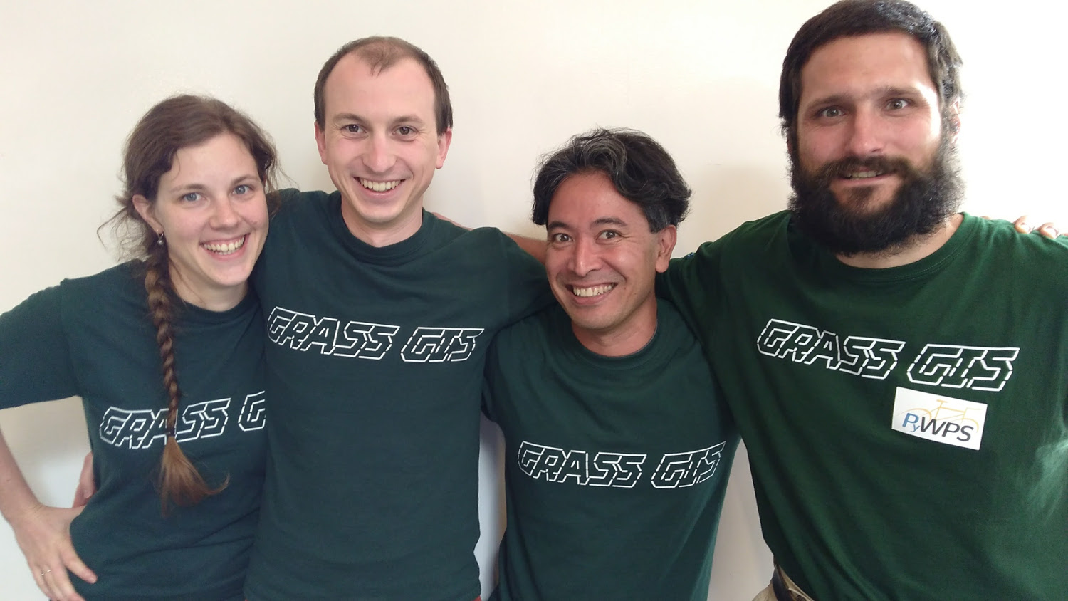
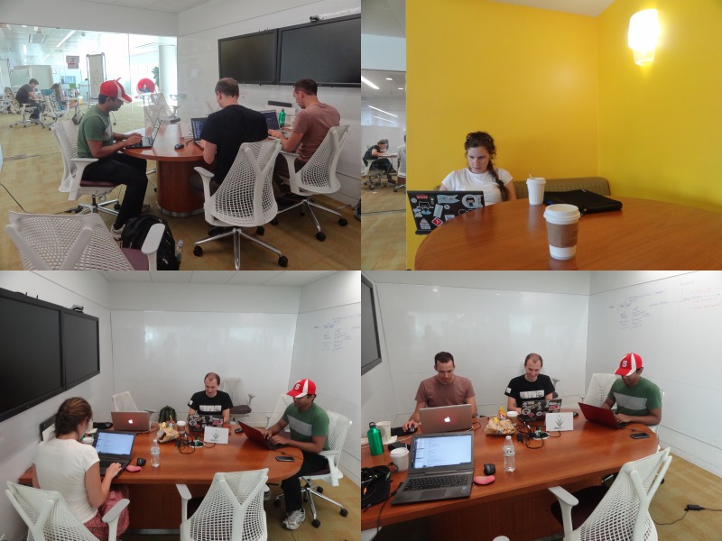
| 19:46, 19 August 2017 | GRASS GIS sprint FOSS4G 2017.jpg (file) |  |
202 KB | Photo of participants of code sprint during FOSS4G 2017 | 1 |
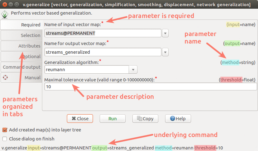
| 22:48, 1 August 2017 | Wxgui module parameters v generalize.png (file) |  |
171 KB | wxGUI dialog/form for v.generalize with descriptions and highlights | 1 |
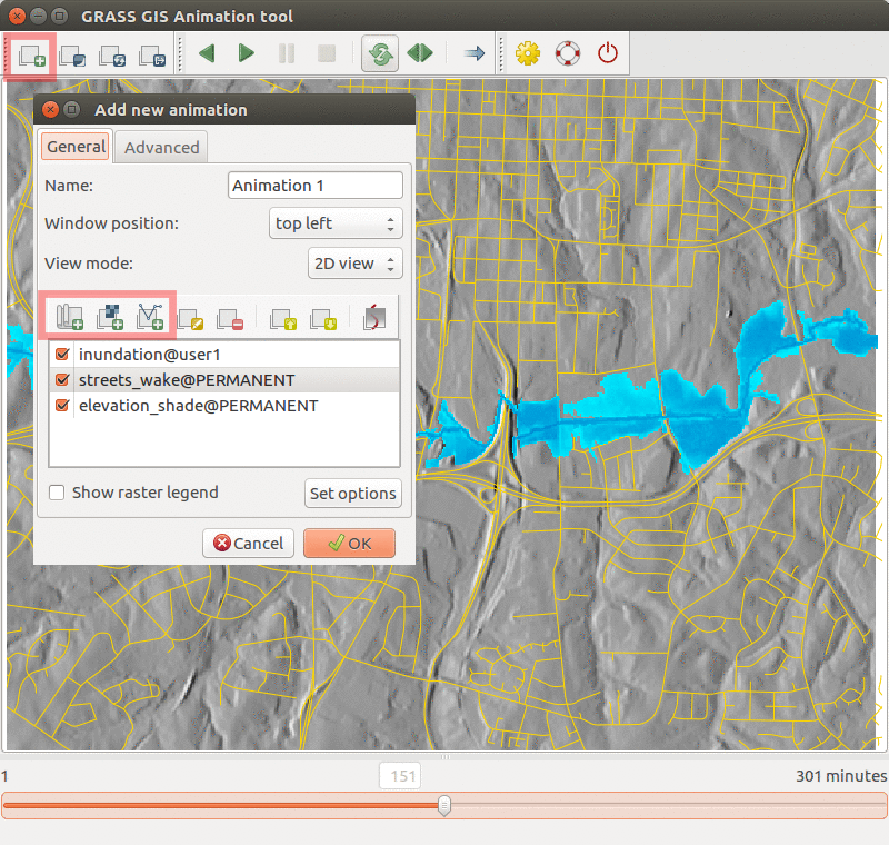
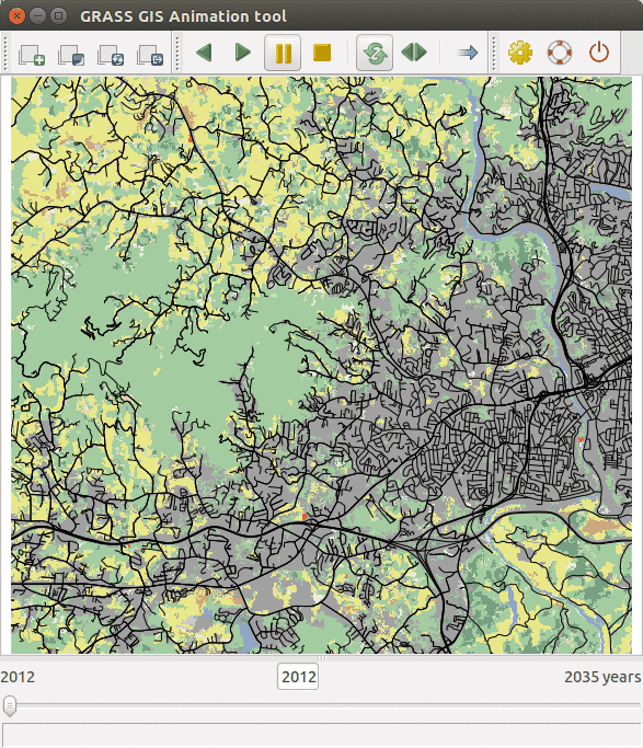
| 04:38, 21 July 2017 | Animation tool inundation.png (file) |  |
468 KB | Inundation computed with {{addonCmd|r.stream.distance}} and {{addonCmd|r.lake.series}} and visualized in Animation Tool. | 1 |
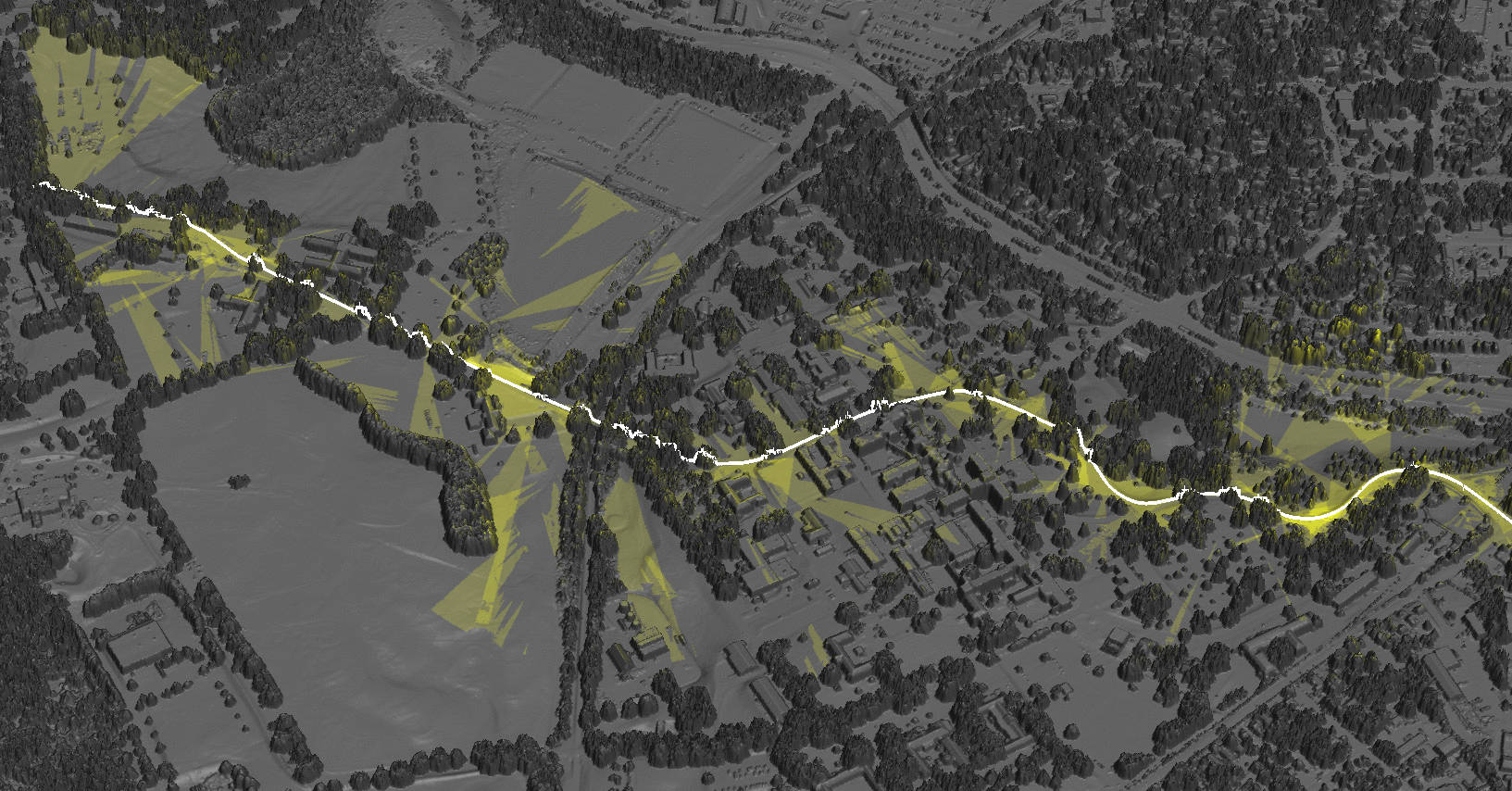
| 20:28, 19 July 2017 | Cumulative viewshed elevation.png (file) |  |
1.08 MB | Cumulative viewshed draped over elevation raster (Boston 2017 workshop) | 1 |
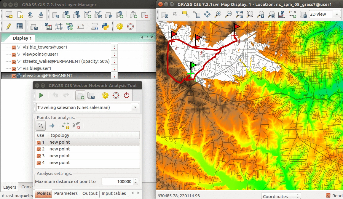
| 19:33, 19 July 2017 | Vector network GUI GRASS 72.png (file) |  |
727 KB | Example of using Vector Network Analysis Tool for Traveling Salesman problem | 1 |
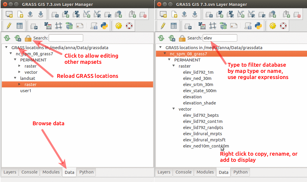
| 01:36, 19 July 2017 | GRASS GIS 7.3 data catalog.png (file) |  |
241 KB | Data catalog in GRASS GIS 7.3 with nc_spm_08_grass7 location | 1 |
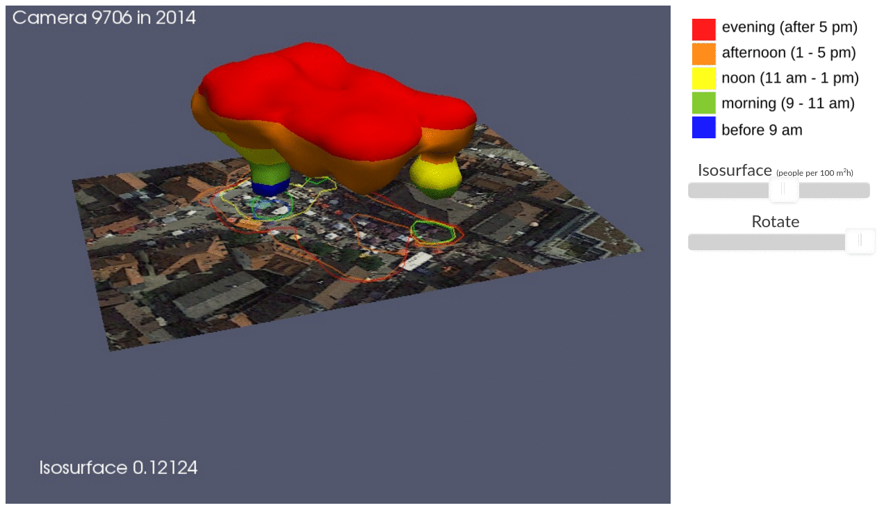
| 01:40, 18 July 2017 | ICC STC illustration.png (file) |  |
468 KB | Presentation on Using space-time cube for visualization and analysis of active transportation patterns derived from public webcams by Anna Petrasova, Aaron Hipp, and Helena Mitasova from North Carolina State University | 1 |
| 21:51, 22 June 2017 | Blender-plain.png (file) |  |
11 KB | Blender logo | 1 |
| 21:00, 22 June 2017 | ICC workshop 3Dview ortho.png (file) |  |
1.45 MB | 3D visulization of digital surface model draped with orthophoto | 1 |
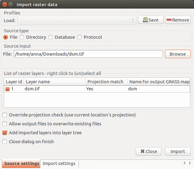
| 14:02, 22 June 2017 | Import raster 7.2.1.png (file) |  |
130 KB | Import raster data dialog in GRASS GIS 7.2.1 | 1 |
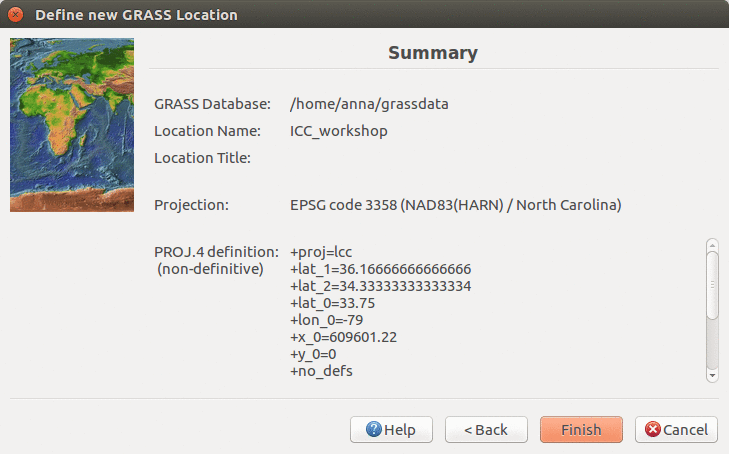
| 03:22, 22 June 2017 | ICC workshop location wizard summary 7.2.png (file) |  |
114 KB | Location Wizard summary page | 1 |
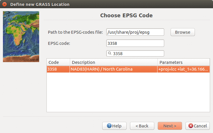
| 03:21, 22 June 2017 | Location wizard EPSG3358 7.2.png (file) |  |
131 KB | Creating new location with EPSG 3358 in Location Wizard | 1 |
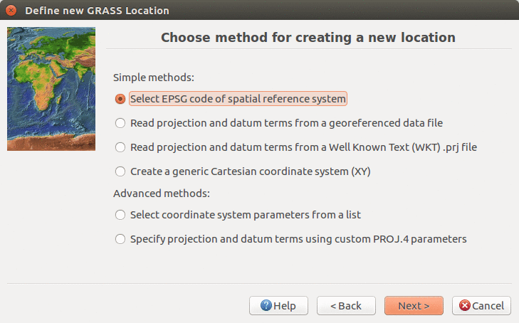
| 03:20, 22 June 2017 | Location wizard method 7.2.png (file) |  |
126 KB | Define CRS in Location Wizard in 7.2. version using EPSG code | 1 |
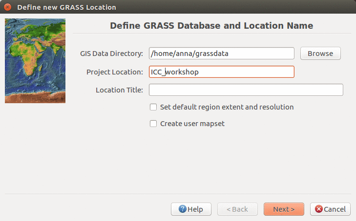
| 03:18, 22 June 2017 | ICC workshop location wizard define 7.2.png (file) |  |
118 KB | Defining new location name in Location Wizard (ICC workshop) | 1 |
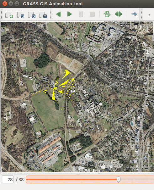
| 21:40, 21 June 2017 | Animation tool viewsheds.png (file) |  |
619 KB | Showing series of viewsheds with Animation Tool | 1 |
| 20:55, 21 June 2017 | Animation tool layers.png (file) |  |
114 KB | How to change order of layers in Animation Tool | 1 |
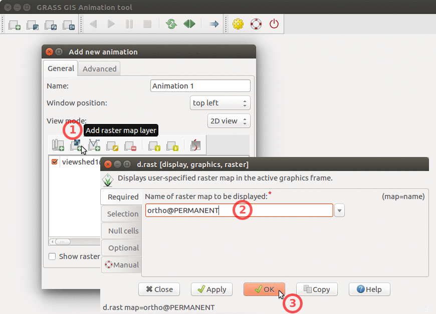
| 20:54, 21 June 2017 | Animation tool add base raster.png (file) |  |
251 KB | How to add base raster to Animation Tool | 1 |
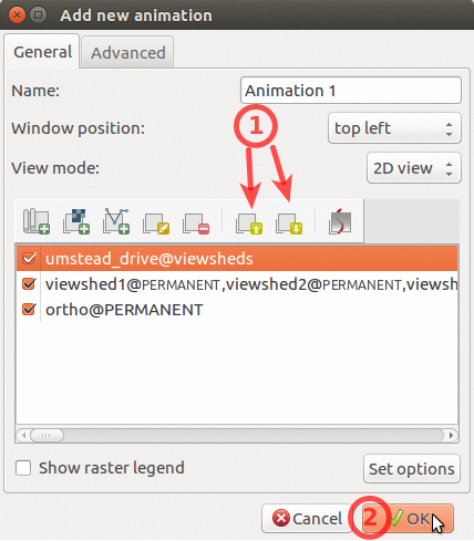
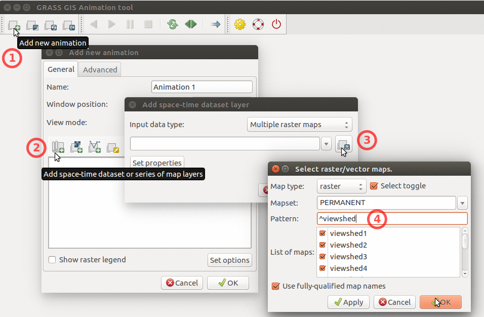
| 20:54, 21 June 2017 | Animation tool add multiple rasters.png (file) |  |
320 KB | How to add multiple raster maps and filter them by name. | 1 |
| 19:27, 21 June 2017 | Cumulative viewshed.png (file) |  |
1.34 MB | Cumulative viewshed computed from views along a road. | 1 |
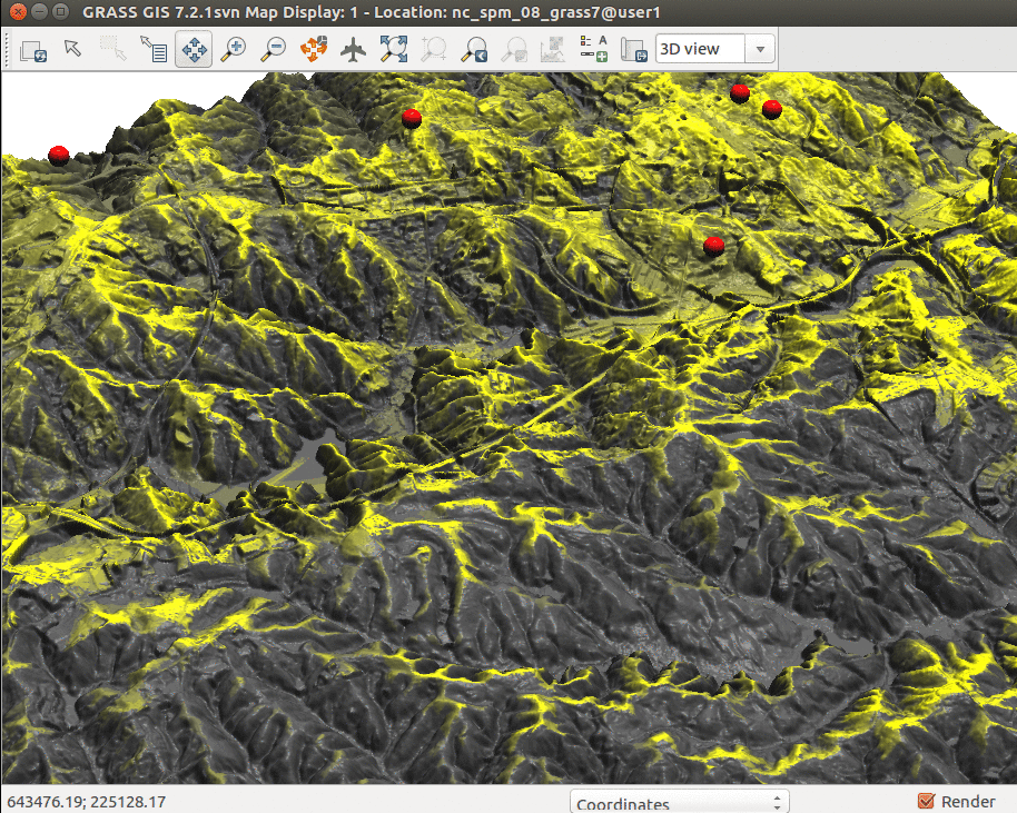
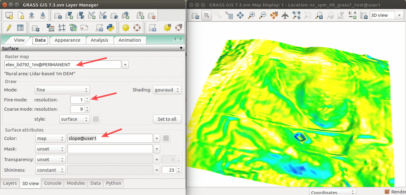
| 14:48, 11 April 2017 | Elevation slope 3D view.png (file) |  |
565 KB | 3D visualization of elev_lid792_1m DEM with slope draped over. | 1 |
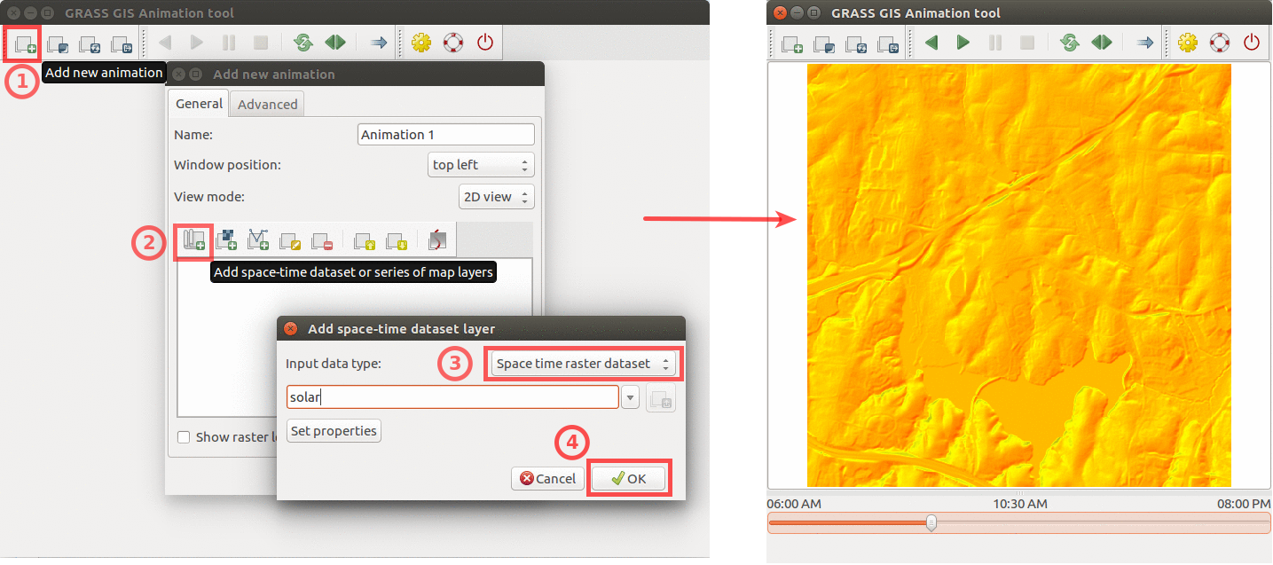
| 22:15, 9 April 2017 | Animation solar example.png (file) |  |
439 KB | Using GRASS GIS animation tool to animate solar irradiance during a day. Computed by {{addonCmd|r.sun.hourly}}. | 1 |
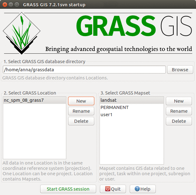
| 15:29, 5 April 2017 | GRASS startup ncspm.png (file) |  |
150 KB | GRASS GIS 7.2 startup screen with North Carolina sample dataset | 1 |
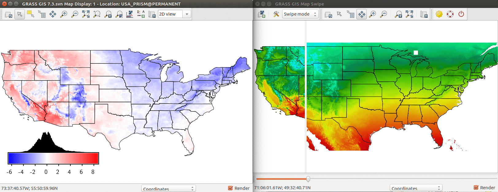
| 20:03, 4 April 2017 | US temp model comparison.png (file) |  |
529 KB | Comparison of PRISM annual mean temperature and modeled temperature based on latitude and elevation. Left: Difference between modeled and real temperature in degree Celsius. Right: Using Map Swipe to visually assess the model (modeled temperature on th... | 1 |
| 21:01, 1 October 2016 | GRASS meetup 10 01 2016.jpg (file) |  |
113 KB | GRASS GIS meetup in Hunt Library, Raleigh 10/01/2016 | 1 |
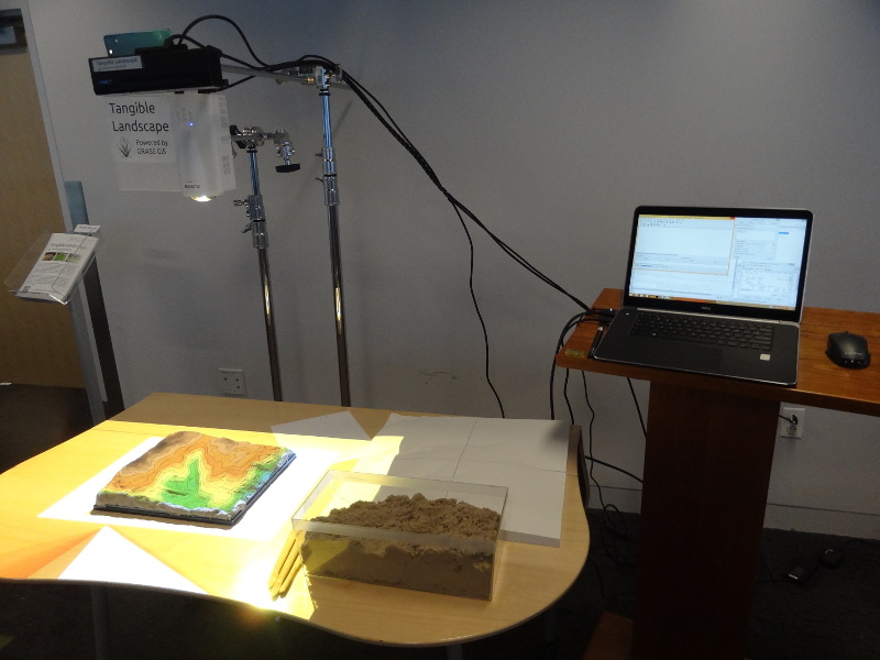
| 01:37, 28 April 2016 | Tangible landscape setup.jpg (file) |  |
134 KB | One possible Tangible Landscape setup | 1 |
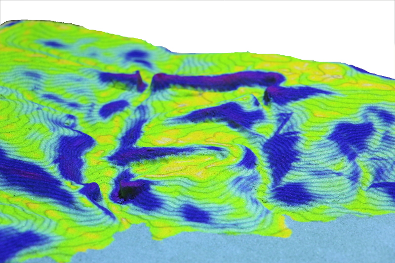
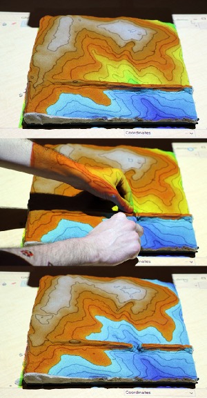
| 22:13, 25 April 2016 | Tangible landscape slope.jpg (file) |  |
244 KB | Tangible Landscape: topographic slope | 1 |
| 22:02, 25 April 2016 | Tangible landscape r fill dir.jpg (file) |  |
130 KB | Tangible Landscape: example of using {{cmd|r.fill.dir}} to create ponds | 1 |
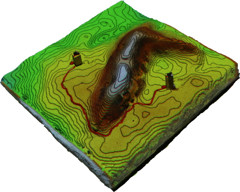
| 21:42, 25 April 2016 | Least cost path.jpg (file) |  |
246 KB | Tangible landscape: Least cost path example where cost is slope | 1 |
| 03:19, 22 April 2016 | FOSS4G NA 2016.png (file) | 67 KB | Downloaded from https://2016.foss4g-na.org/sites/default/files/728X90.png | 1 | |
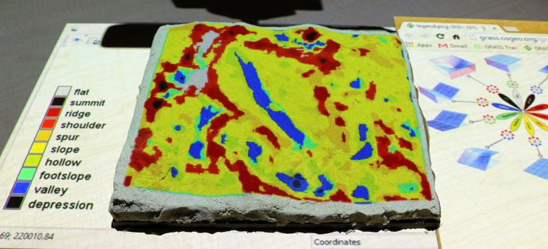
| 03:15, 22 April 2016 | Tangible landscape geomorphons.jpg (file) |  |
197 KB | Tangible Landscape: Landforms computed with {{AddonCmd|r.geomorphon}} | 1 |
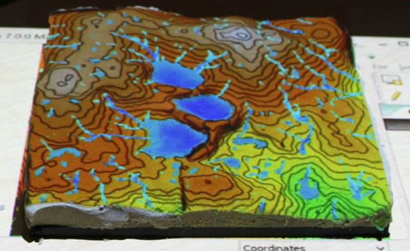
| 03:07, 22 April 2016 | Tangible landscape rlake.jpg (file) |  |
65 KB | Example of simple flooding simulation with Tangible Landscape and {{cmd|r.lake}} module. | 1 |
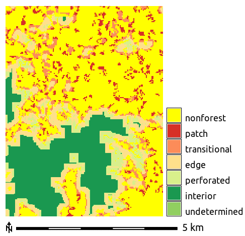
| 02:46, 1 April 2016 | Forest fragmentation.png (file) |  |
11 KB | Forest fragmentation computed with addon r.forestfrag | 1 |
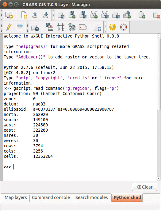
| 18:32, 30 March 2016 | GRASS GUI Python shell.png (file) |  |
42 KB | Python Shell in GRASS GIS GUI | 1 |
| 03:17, 30 March 2016 | FUTURES animation tool.gif (file) |  |
504 KB | FUTURES results animated using GRASS GIS Animation tool | 1 |
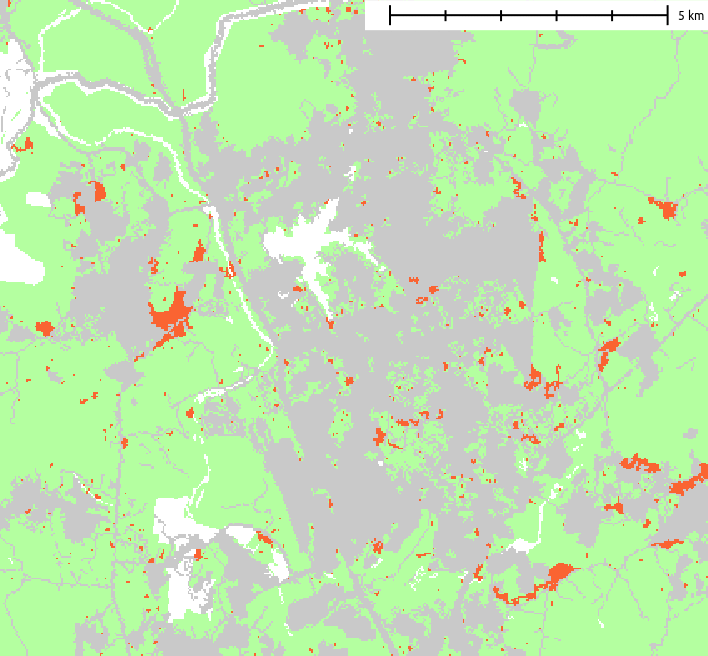
| 03:49, 29 March 2016 | FUTURES result.png (file) |  |
22 KB | Example of resulting pattern of r.futures.pga | 1 |
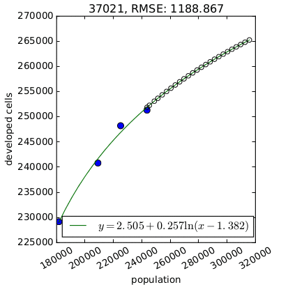
| 03:21, 29 March 2016 | FUTURES demand.png (file) |  |
11 KB | Per capita development for one county derived by {{AddonCmd|r.futures.demand}}. | 1 |
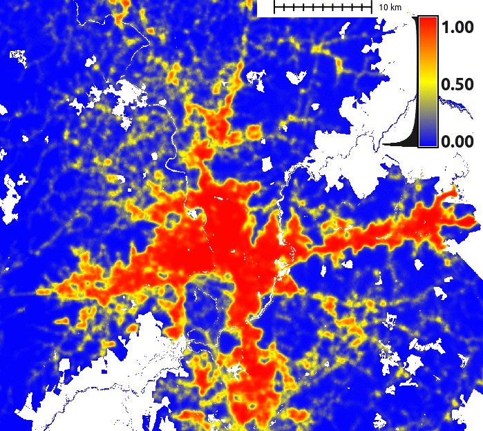
| 03:16, 29 March 2016 | FUTURES suitability.png (file) |  |
157 KB | FUTURES site suitability modeled by r.futures.potential and computed by r.futures.potsurface | 1 |
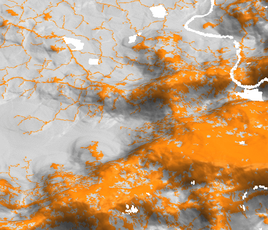
| 03:03, 29 March 2016 | FUTURES devpressure 3D.png (file) |  |
120 KB | Development pressure (computed by r.futures.devpressure) visualized as 3D surface with binary development map draped as color (orange developed, grey undeveloped). | 1 |
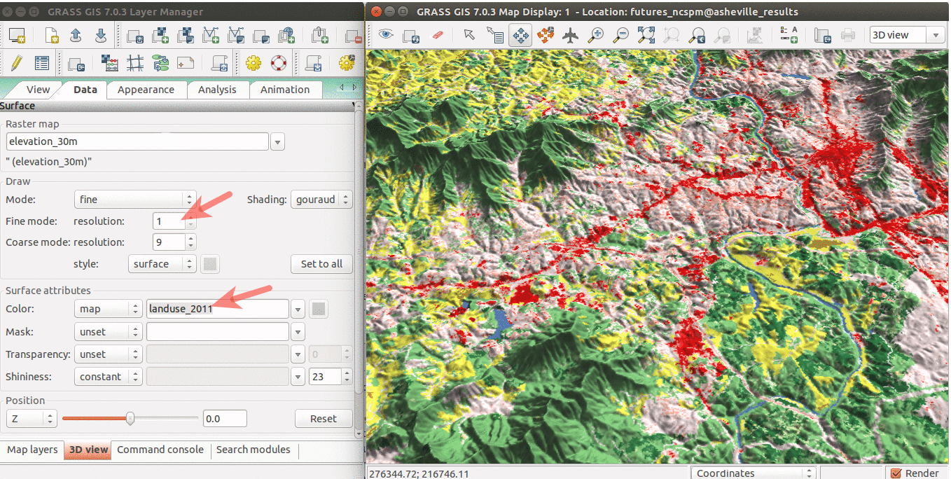
| 15:55, 28 March 2016 | WxGUI 3Dview.png (file) |  |
482 KB | Draped NLCD 2011 over NED elevation raster. | 1 |
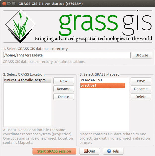
| 15:30, 28 March 2016 | GRASS FUTURES startup.png (file) |  |
55 KB | different layout of mapsets | 2 |
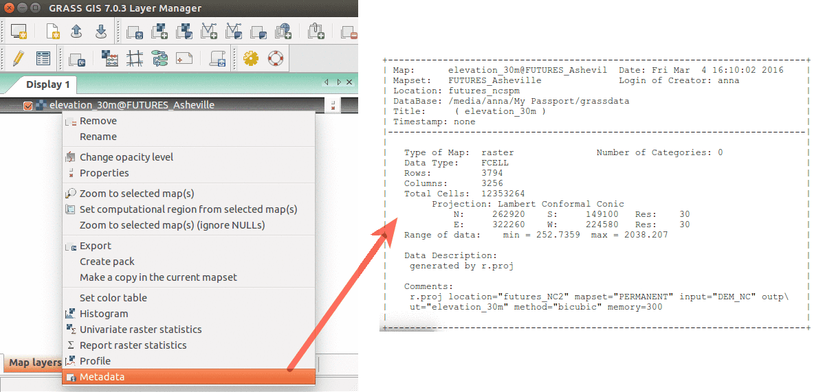
| 03:41, 17 March 2016 | WxGUI metadata rinfo.png (file) |  |
65 KB | Show raster map metadata by right click on layer | 1 |
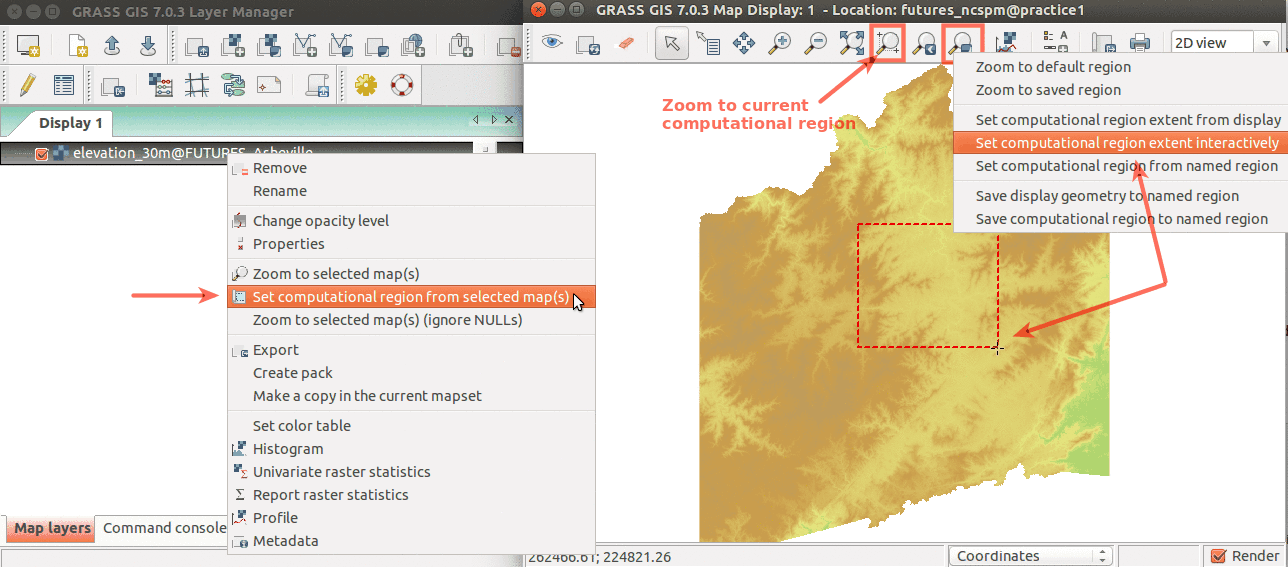
| 03:27, 17 March 2016 | WxGUI set region.png (file) |  |
118 KB | Simple ways to set computational region from GUI. On the left, set region based to match raster map. On the right, select the highlighted option and then set region by drawing rectangle. | 1 |
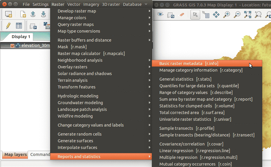
| 02:50, 17 March 2016 | WxGUI menu rinfo.png (file) |  |
101 KB | r.info module accessible from wxGUI menu | 2 |
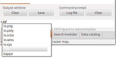
| 02:39, 17 March 2016 | WxGUI console completion.png (file) |  |
10 KB | Running GRASS modules from wxGUI command console. Module name is autocompleted. | 1 |
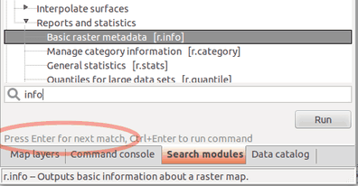
| 02:37, 17 March 2016 | WxGUI module search.png (file) |  |
15 KB | Fulltext module search in wxGUI (searching in module name, description, keywords) | 1 |