Search results
Jump to navigation
Jump to search
Page title matches
 (1,400 × 686 (457 KB)) - 17:35, 19 July 2017
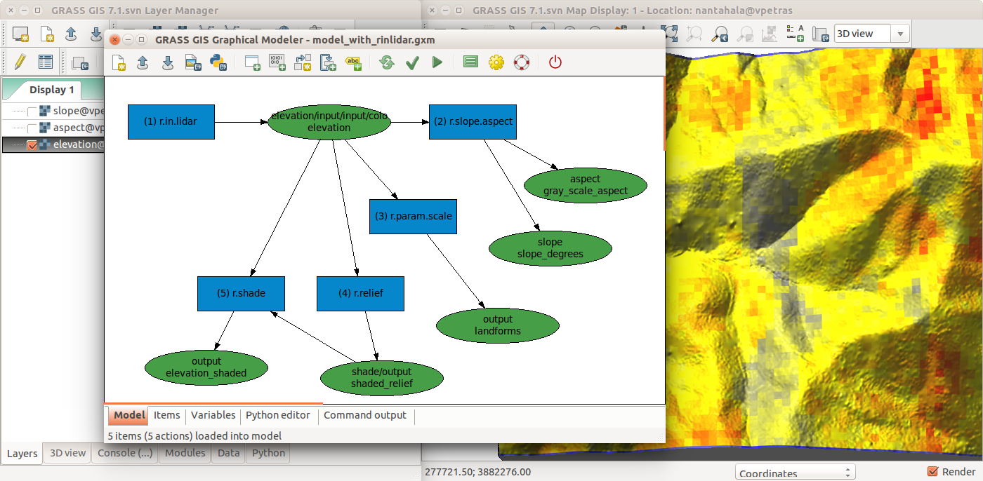
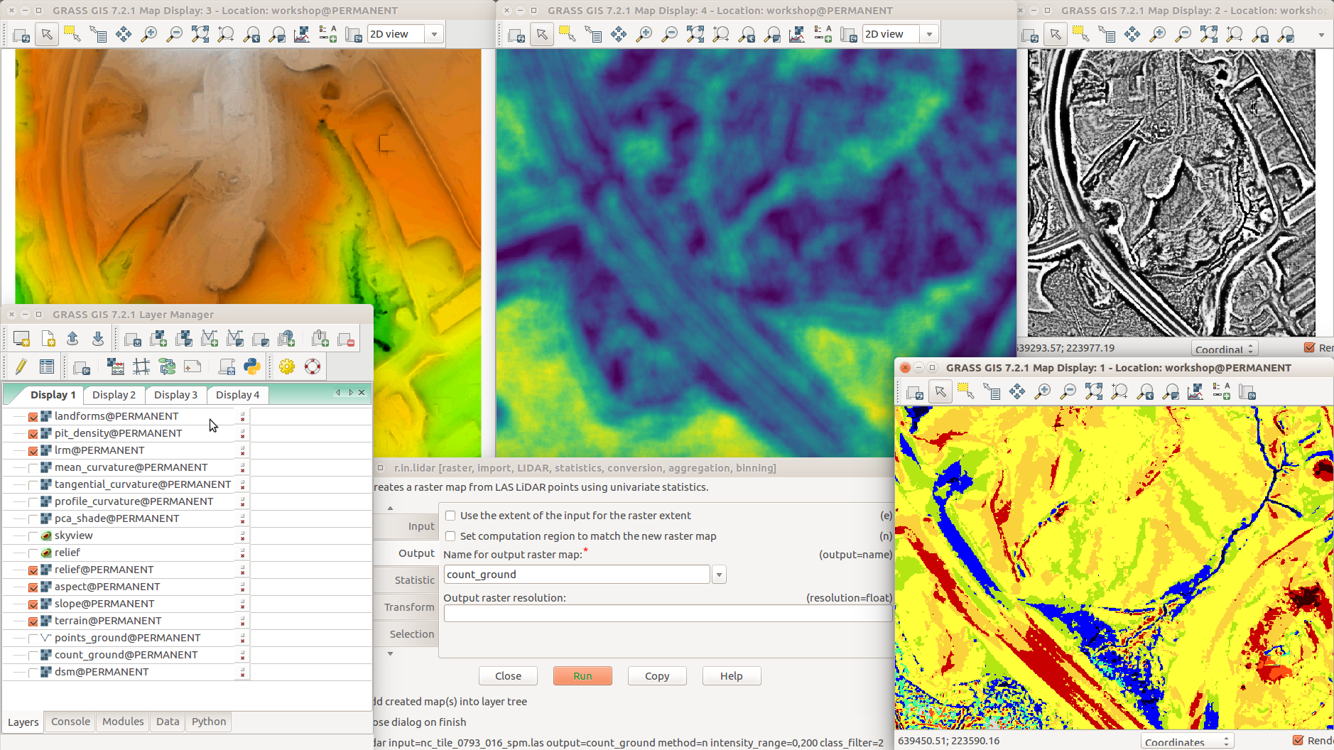 r.terrain.texture (pit density, top middle) ...(1,878 × 1,056 (1,014 KB)) - 02:05, 1 August 2017


Page text matches
 Global Multi-resolution Terrain Elevation Data 2010 (GMTED2010) example: Trento - Garda Lake - Verona area ...(851 × 702 (535 KB)) - 14:22, 1 December 2011
 Dataset: Nantahala NF, NC: Forest Leaf Structure, Terrain and Hydrophysiology ...(800 × 477 (578 KB)) - 16:49, 29 February 2016
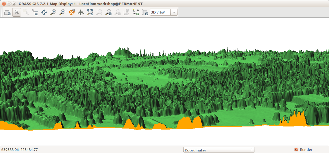 GRASS GIS 7.2, 3D view in wxGUI, Map Display, cutting plane for DEM (terrain, orange color) and DSM (trees, buildings, green color) surfaces. ...(1,290 × 600 (553 KB)) - 03:03, 6 August 2017
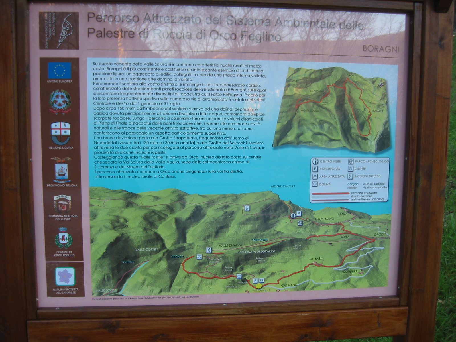 ...a touristic panel of a climbing site of Finale Ligure, Savona, Italy. The terrain model has been realized with Grass. The authors of the whole panel (also th ...(1,600 × 1,200 (887 KB)) - 15:23, 31 January 2009


