File:WxGUI set region.png
Jump to navigation
Jump to search
Size of this preview: 800 × 352 pixels. Other resolution: 1,288 × 567 pixels.
Original file (1,288 × 567 pixels, file size: 118 KB, MIME type: image/png)
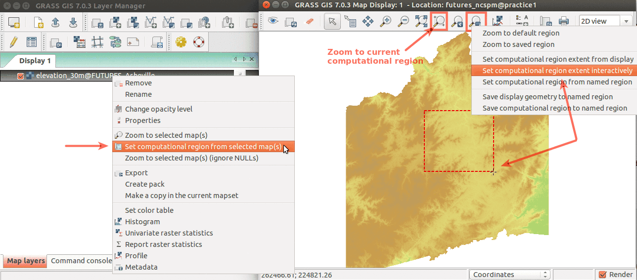
Simple ways to set computational region from GUI. On the left, set region based to match raster map. On the right, select the highlighted option and then set region by drawing rectangle.
File history
Click on a date/time to view the file as it appeared at that time.
| Date/Time | Thumbnail | Dimensions | User | Comment | |
|---|---|---|---|---|---|
| current | 03:27, 17 March 2016 | | 1,288 × 567 (118 KB) | Annakrat (talk | contribs) | Simple ways to set computational region from GUI. On the left, set region based to match raster map. On the right, select the highlighted option and then set region by drawing rectangle. |
You cannot overwrite this file.
File usage
The following 9 pages use this file:
- Analytical data visualizations at ICC 2017
- Analytical data visualizations at ICC 2017/es
- FUTURES land-change modeling for evaluating innovative conservation scenarios
- From GRASS GIS novice to power user (workshop at FOSS4G Boston 2017)
- Processing lidar and UAV point clouds in GRASS GIS (workshop at FOSS4G Boston 2017)
- Processing lidar and UAV point clouds in GRASS GIS (workshop at FOSS4G Boston 2017)/es
- Unleash the power of GRASS GIS at US-IALE 2017
- Unleash the power of GRASS GIS at US-IALE 2017/es
- Workshop on urban growth modeling with FUTURES