Uploads by ⚠️NikosA
Jump to navigation
Jump to search
This special page shows all uploaded files.
| Date | Name | Thumbnail | Size | Description | Versions |
|---|---|---|---|---|---|
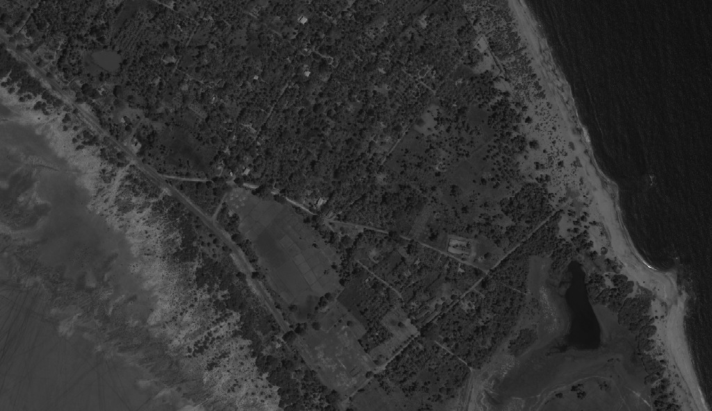
| 19:30, 15 November 2013 | Pan 04APR05050541-M2AS-000000186011 01 P001.jpg (file) |  |
163 KB | Fragment from the high resolution (0.7m) panchromatic image of the QuickBird acquisition "04APR05050541-X2AS_R1C1-000000186011_01_P001-Sri_Lanka-Kokilai_Lagoon" which is publicly available via the GLCF | 1 |
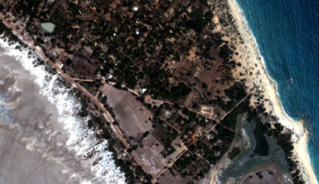
| 19:28, 15 November 2013 | RGB HPF Sharpened Center Low Modulator Min.jpg (file) |  |
309 KB | Fragment from another HPFA Pan-Sharpened RGB composite image of the QuickBird acquisition "04APR05050541-X2AS_R1C1-000000186011_01_P001-Sri_Lanka-Kokilai_Lagoon" which is publicly available via the GLCF. Sharpening performed with "center=low" and "modu... | 1 |
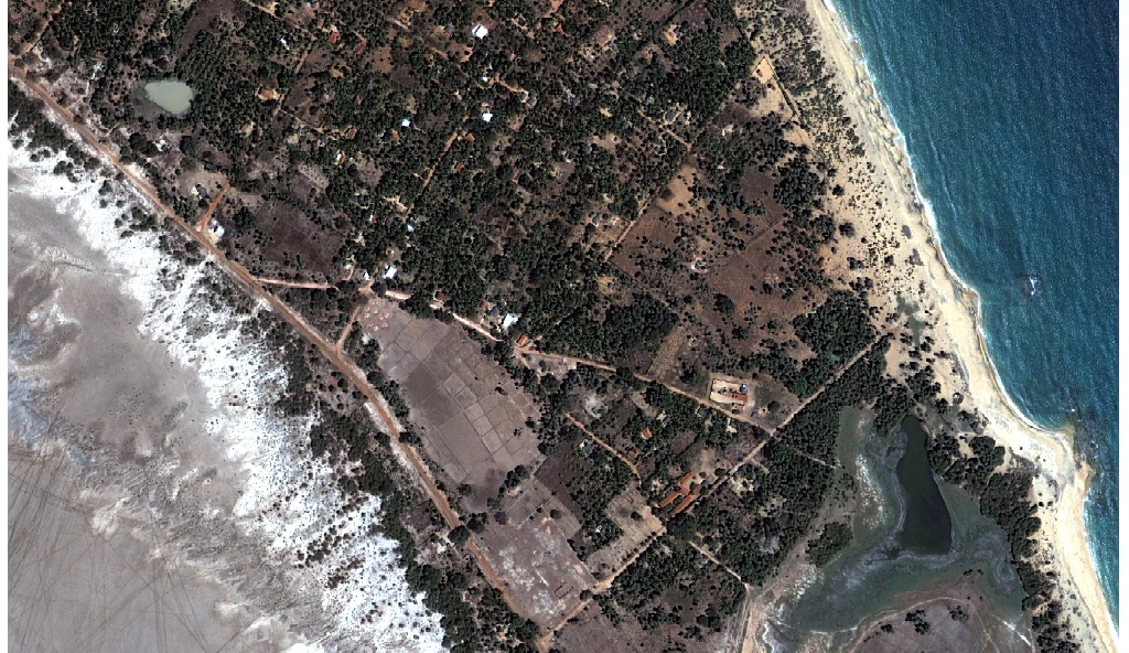
| 19:27, 15 November 2013 | RGB HPF Sharpened Default Parameters.jpg (file) |  |
378 KB | Fragment from the HPFA Pan-Sharpened RGB composite image of the QuickBird acquisition "04APR05050541-X2AS_R1C1-000000186011_01_P001-Sri_Lanka-Kokilai_Lagoon" which is publicly available via the GLCF. Sharpening performed with default parameters. | 1 |
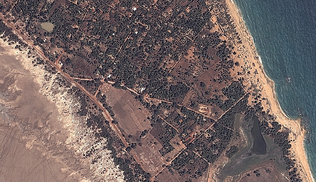
| 19:26, 15 November 2013 | RGB 04APR05050541-M2AS-000000186011 01 P001.jpg (file) |  |
219 KB | Fragment from the low resolution (2.8m) multi-spectral RGB composite image of the QuickBird acquisition "04APR05050541-X2AS_R1C1-000000186011_01_P001-Sri_Lanka-Kokilai_Lagoon" which is publicly available via the GLCF | 1 |
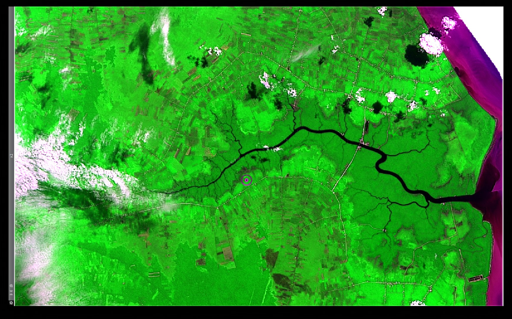
| 01:32, 15 November 2013 | Bengkalis Island Landsat8 HPFA Sharpened RGB Red NIR Blue Max Crispness.jpg (file) |  |
480 KB | A Pan-Sharpened RGB composite based on the Red, the NIR and the Blue multi-spectral bands, as well as the corresponding Panchromatic image of a Landsat 8 acquisition over the Bengkalis Island, Indonesia (LC81260592013137LGN01), merged via the High Pass... | 1 |
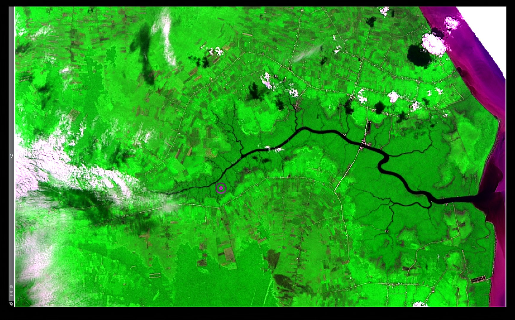
| 01:31, 15 November 2013 | Bengkalis Island Landsat8 HPFA Sharpened RGB Red NIR Blue Default Parameters.jpg (file) |  |
452 KB | A Pan-Sharpened RGB composite based on the Red, the NIR and the Blue multi-spectral bands, as well as the corresponding Panchromatic image of a Landsat 8 acquisition over the Bengkalis Island, Indonesia (LC81260592013137LGN01), merged via the High Pass... | 1 |
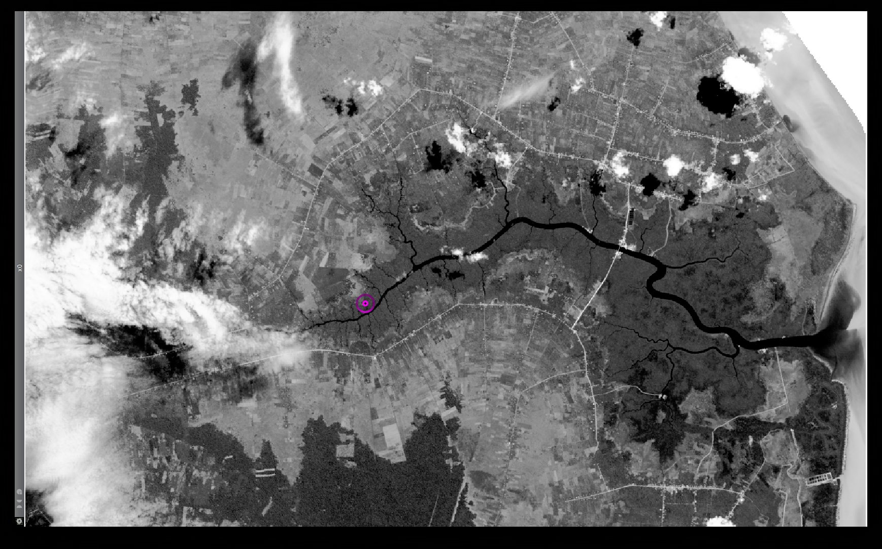
| 01:28, 15 November 2013 | Bengkalis Island Landsat8 Panchromatic.jpg (file) |  |
401 KB | A Panchromatic band of a Landsat 8 acquisition over the Bengkalis Island, Indonesia (LC81260592013137LGN01) | 1 |
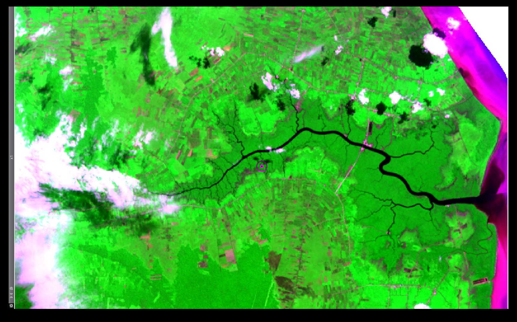
| 01:28, 15 November 2013 | Bengkalis Island Landsat8 RGB Red NIR Blue.jpg (file) |  |
378 KB | An RGB composite based on the Red, the NIR and the Blue multi-spectral bands of a Landsat 8 acquisition over the Bengkalis Island, Indonesia (LC81260592013137LGN01) | 1 |
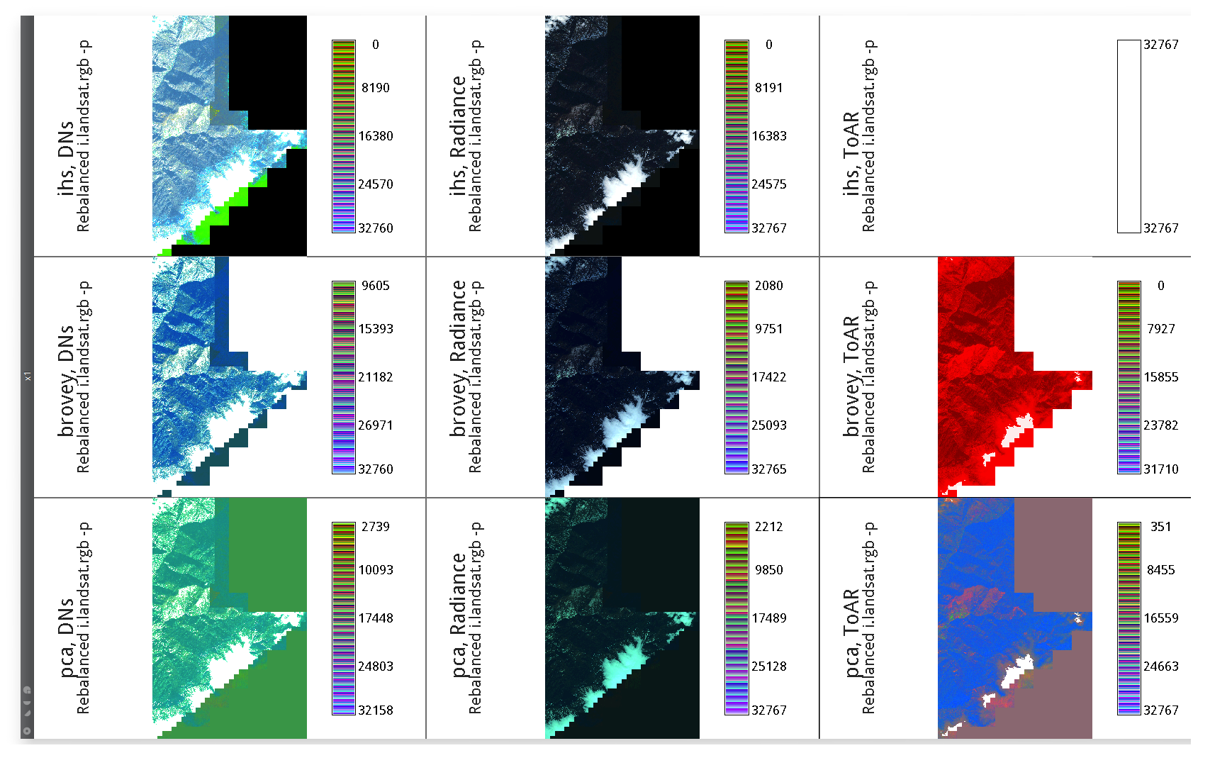
| 15:48, 31 July 2013 | IKONOS PanSharpening Three Inputs Rebalanced Three Methods.png (file) |  |
712 KB | Pan sharpening attempts (ihs, brovey, pca) using IKONOS DNs, Radiance and Reflectance values. RGB shown composites are Color Rebalanced (i.landsat.rgb -p). | 1 |
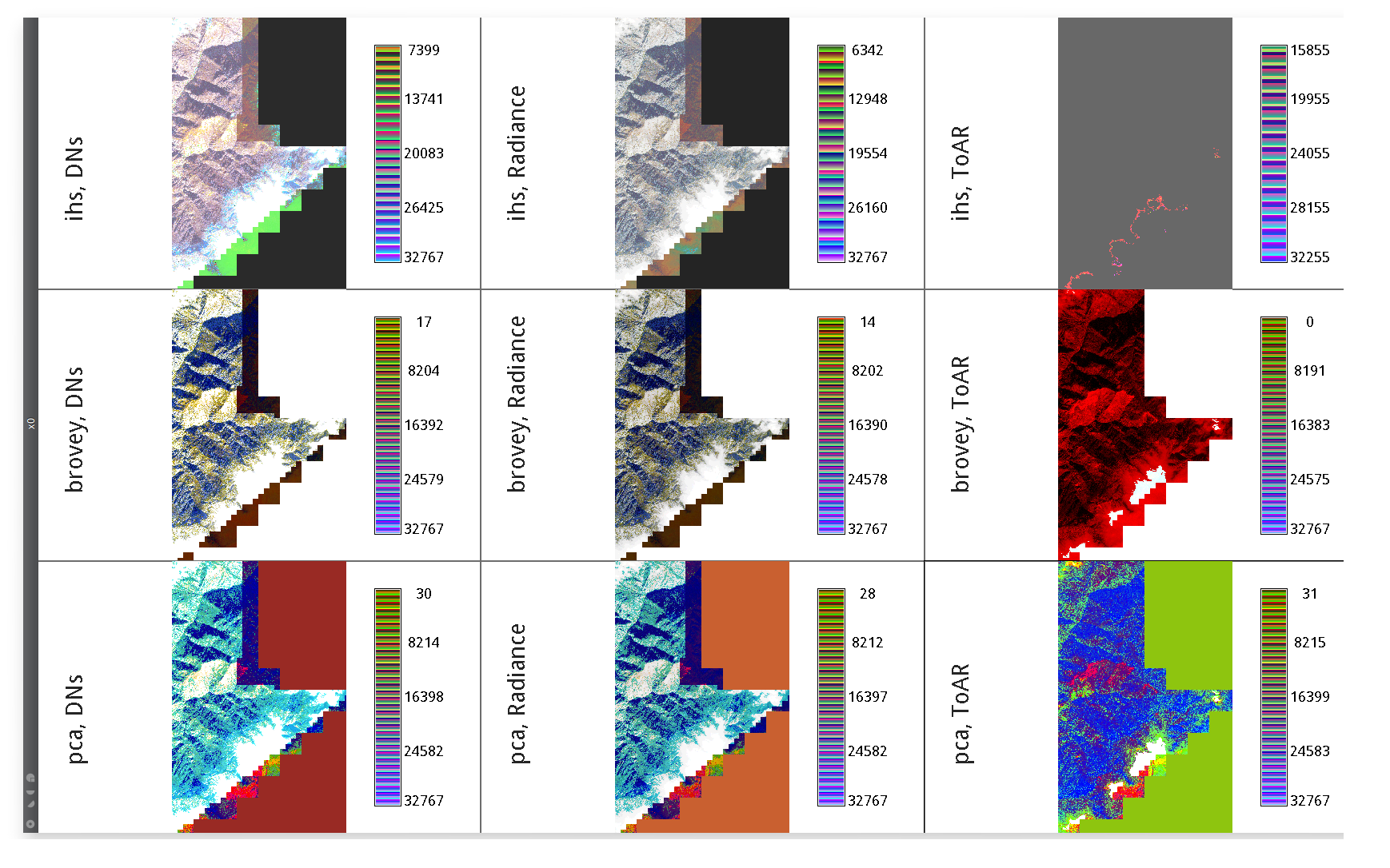
| 15:47, 31 July 2013 | IKONOS PanSharpening Three Inputs Greyscaled Three Methods.png (file) |  |
888 KB | Pan sharpening attempts (ihs, brovey, pca) using IKONOS DNs, Radiance and Reflectance values. RGB shown composites are not re-balanced. | 1 |
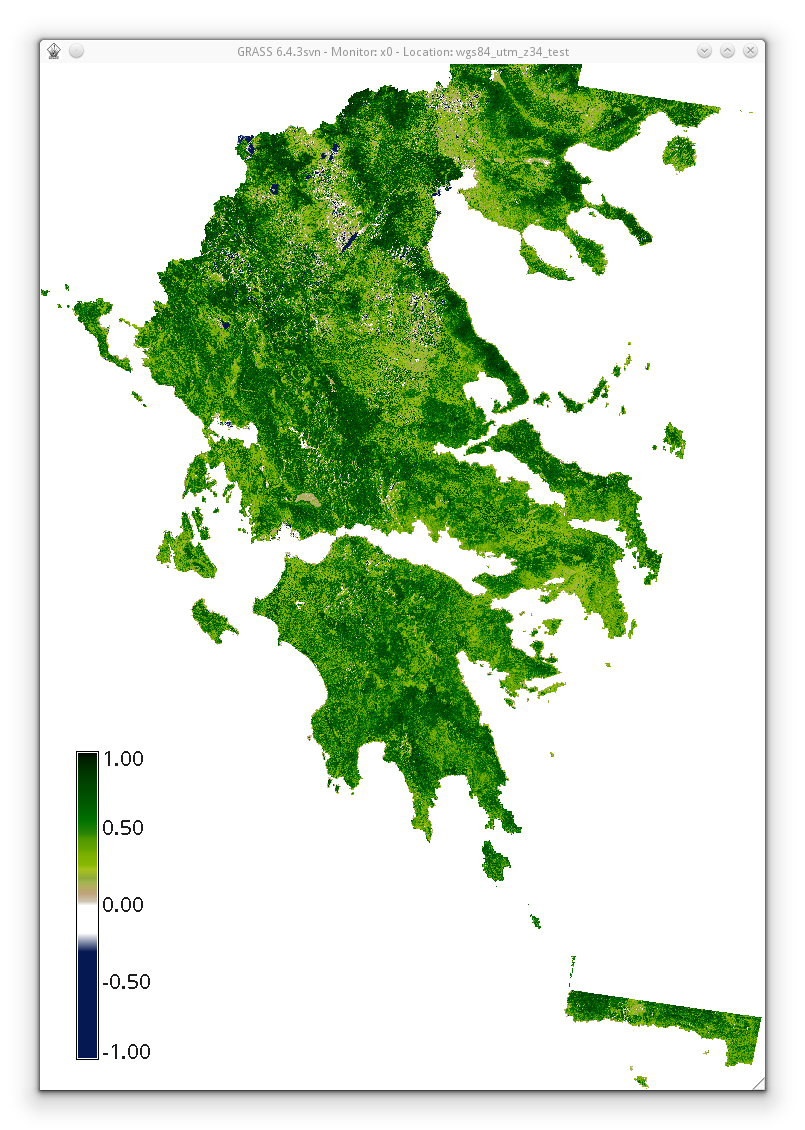
| 08:42, 4 May 2013 | Evi2 based on histomatched summer landsat utm z34n.png (file) |  |
693 KB | EVI2 based on summer Landsat acquisitions (from 2009 to 2011, histomatched, only tiles that originally fall into UTM Z34N) covering Ellas (Greece) | 1 |
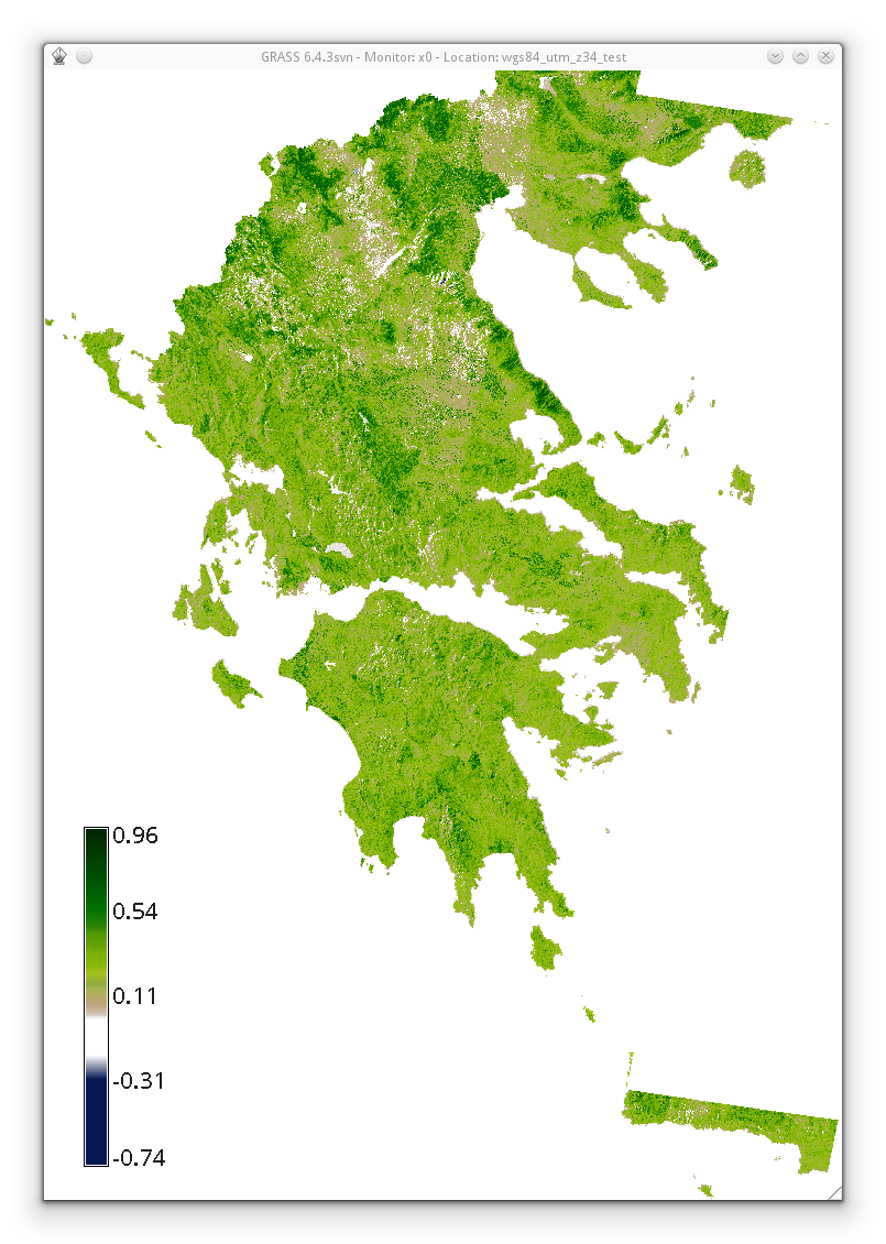
| 08:41, 4 May 2013 | Ndvi based on histomatched summer landsat utm z34n.png (file) |  |
631 KB | NDVI based on summer Landsat acquisitions (from 2009 to 2011, histomatched, only tiles that originally fall into UTM Z34N) covering Ellas (Greece) | 1 |
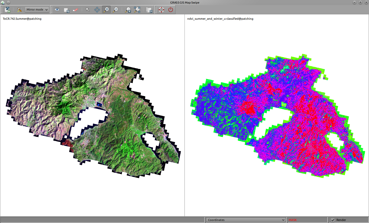
| 23:19, 23 February 2013 | Grassgis mirroring landsat rgb 742 and unsupervised classification of a bitemporal ndvi lesvos aegean sea greece.png (file) |  |
501 KB | The Greek island Mytilene (Lesvos): mirroring a summer Landsat RGB (bands 7, 4 and 2) composite image and an unsupervised classification based on a bi-temporal NDVI image (summer and winter NDVI). | 1 |
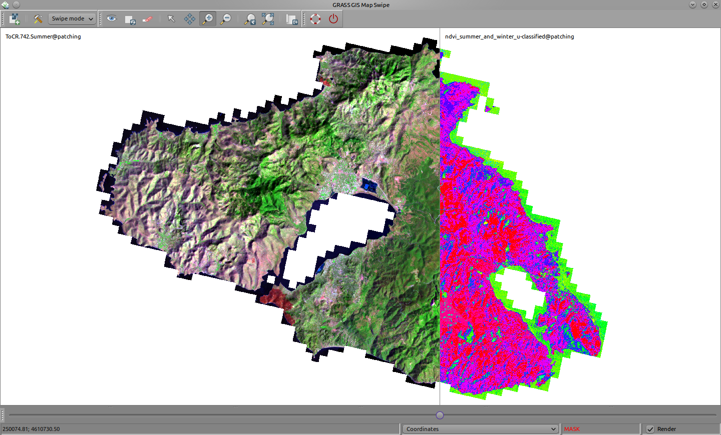
| 23:18, 23 February 2013 | Grassgis swiping landsat rgb 743 and unsupervised classification of a bitemporal ndvi lesvos aegean sea greece.png (file) |  |
593 KB | The Greek island Mytilene (Lesvos): swiping a summer Landsat RGB (bands 7, 4 and 2) composite image and an unsupervised classification based on a bi-temporal NDVI image (summer and winter NDVI). | 1 |
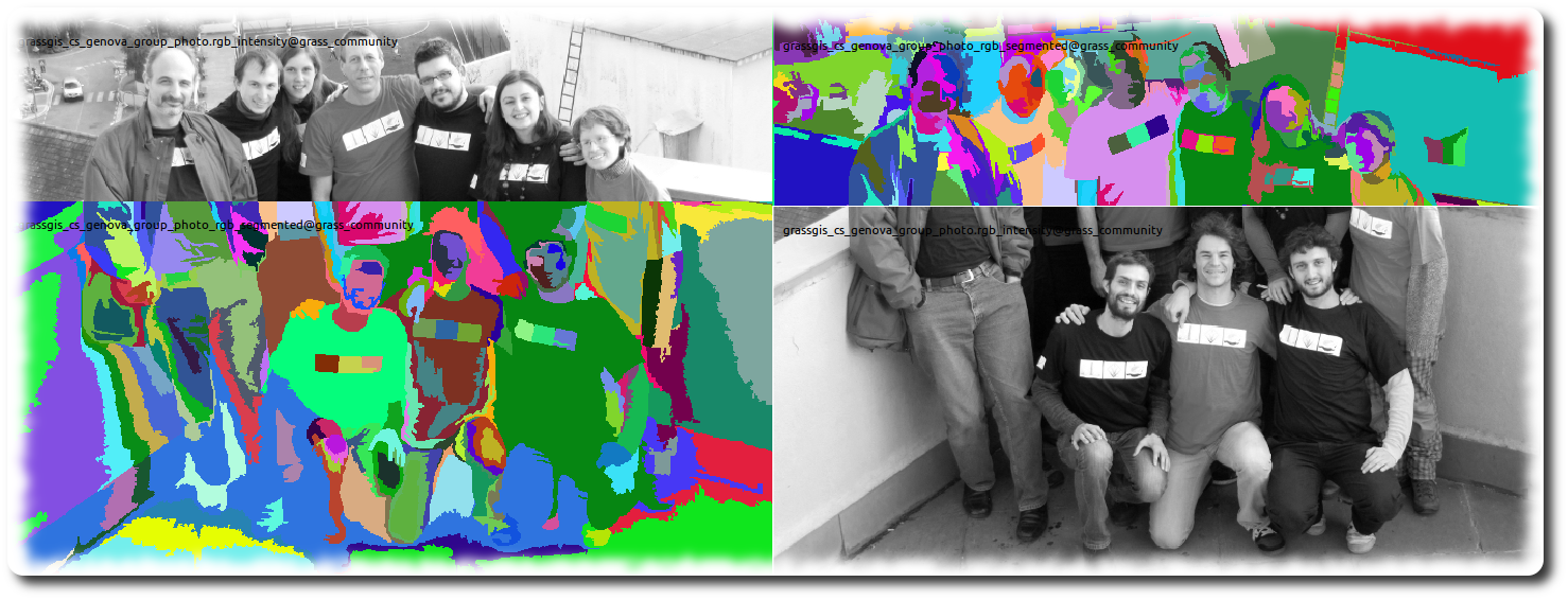
| 16:45, 10 February 2013 | Grassgis cs genova swiping intensity and segmented rgb group photo.png (file) |  |
489 KB | - intensity (i.rgb.his) - segmented rgb, threshold=8 radioweight=0.2, minsize=130, smoothweight=0.2 | 1 |
| 15:32, 8 February 2013 | Grasswiki history logo A.png (file) | 31 KB | Proposal of a "badge" for historic GRASS-Wiki material | 1 | |
| 14:45, 5 February 2013 | Grasswiki logogram suggestion B vector.png (file) |  |
12 KB | 2 | |
| 00:03, 26 January 2013 | Grasswiki logogram suggestion F vector.png (file) |  |
31 KB | 2 | |
| 23:59, 25 January 2013 | Grasswiki logogram suggestion E vector.png (file) |  |
28 KB | An alternative GRASS-Wiki logogram | 1 |
| 23:58, 25 January 2013 | Grasswiki logogram suggestion A vector.png (file) |  |
32 KB | An alternative GRASS-Wiki logogram | 1 |
| 10:42, 16 January 2013 | Sample screenshot while working on the custom css 2.jpg (file) |  |
127 KB | proposed by archi.tect.gr | 1 |
| 10:42, 16 January 2013 | Sample screenshot while working on the custom css.jpg (file) |  |
127 KB | proposed by archi.tect.gr | 1 |
| 00:43, 16 January 2013 | Sample Navigation Toolbox InOther.png (file) |  |
22 KB | proposed by archi.tect.gr | 1 |
| 00:43, 16 January 2013 | Sample Categories bar.png (file) | 7 KB | proposed by archi.tect.gr | 1 | |
| 00:42, 16 January 2013 | Sample of Content and ToC on the Right.png (file) |  |
90 KB | proposed by archi.tect.gr | 1 |
| 00:42, 16 January 2013 | Sample Pointer over ToC.png (file) |  |
39 KB | proposed by archi.tect.gr | 1 |
| 00:41, 16 January 2013 | Sample Semi Transparent ToC.png (file) | 46 KB | proposed by archi.tect.gr | 1 | |
| 02:56, 6 January 2013 | 180px-500px-Grass GIS.svg altered.png (file) |  |
12 KB | A slightly altered GRASS-GIS logo | 1 |
| 21:44, 2 January 2013 | 500px-Grass GIS.svg.png (file) |  |
37 KB | 1 | |
| 15:12, 29 December 2012 | Grasswiki special pages distance between sections.png (file) |  |
31 KB | 1 | |
| 13:54, 29 December 2012 | Mediawiki distance between sections.png (file) |  |
21 KB | 1 | |
| 13:53, 29 December 2012 | Grasswiki distance between sections.png (file) |  |
23 KB | 1 | |
| 13:53, 29 December 2012 | Mediawiki distance between toc and section.png (file) |  |
15 KB | 1 | |
| 13:52, 29 December 2012 | Grasswiki distance between toc and section.png (file) |  |
17 KB | 1 | |
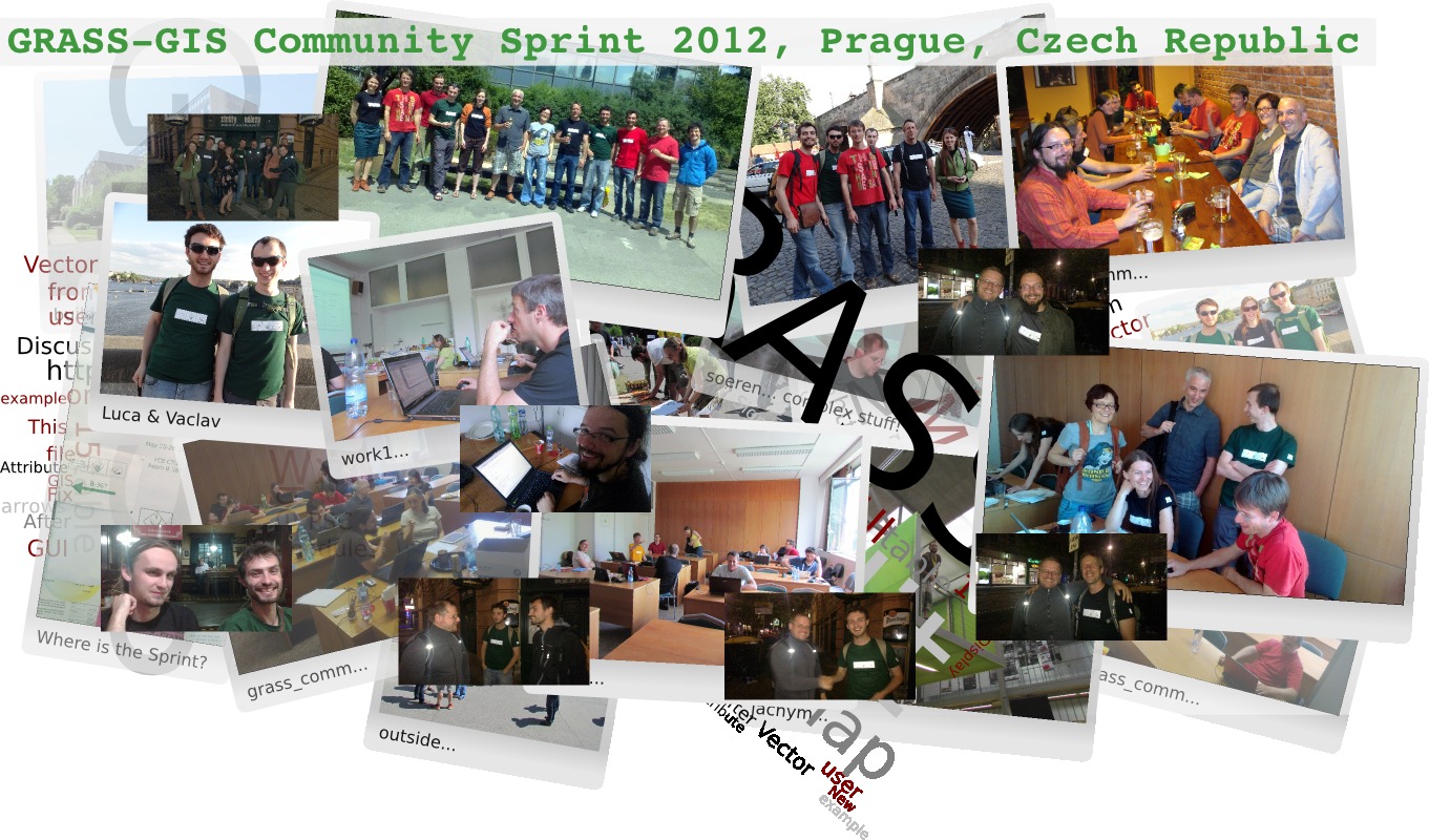
| 07:53, 3 June 2012 | Grass-gis community sprint 2012 collage.jpg (file) |  |
341 KB | 2 | |
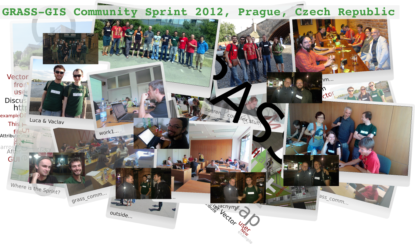
| 07:48, 3 June 2012 | Grass-gis community sprint 2012 collage final.png (file) |  |
1.5 MB | 1 | |
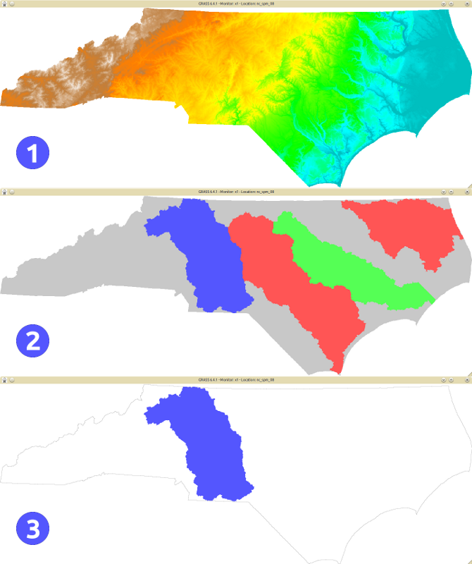
| 15:52, 26 May 2012 | Nc spm 09 r.blend of aspect and streams derived buffered.png (file) |  |
431 KB | Buffered streams in NC over the aspect map | 1 |
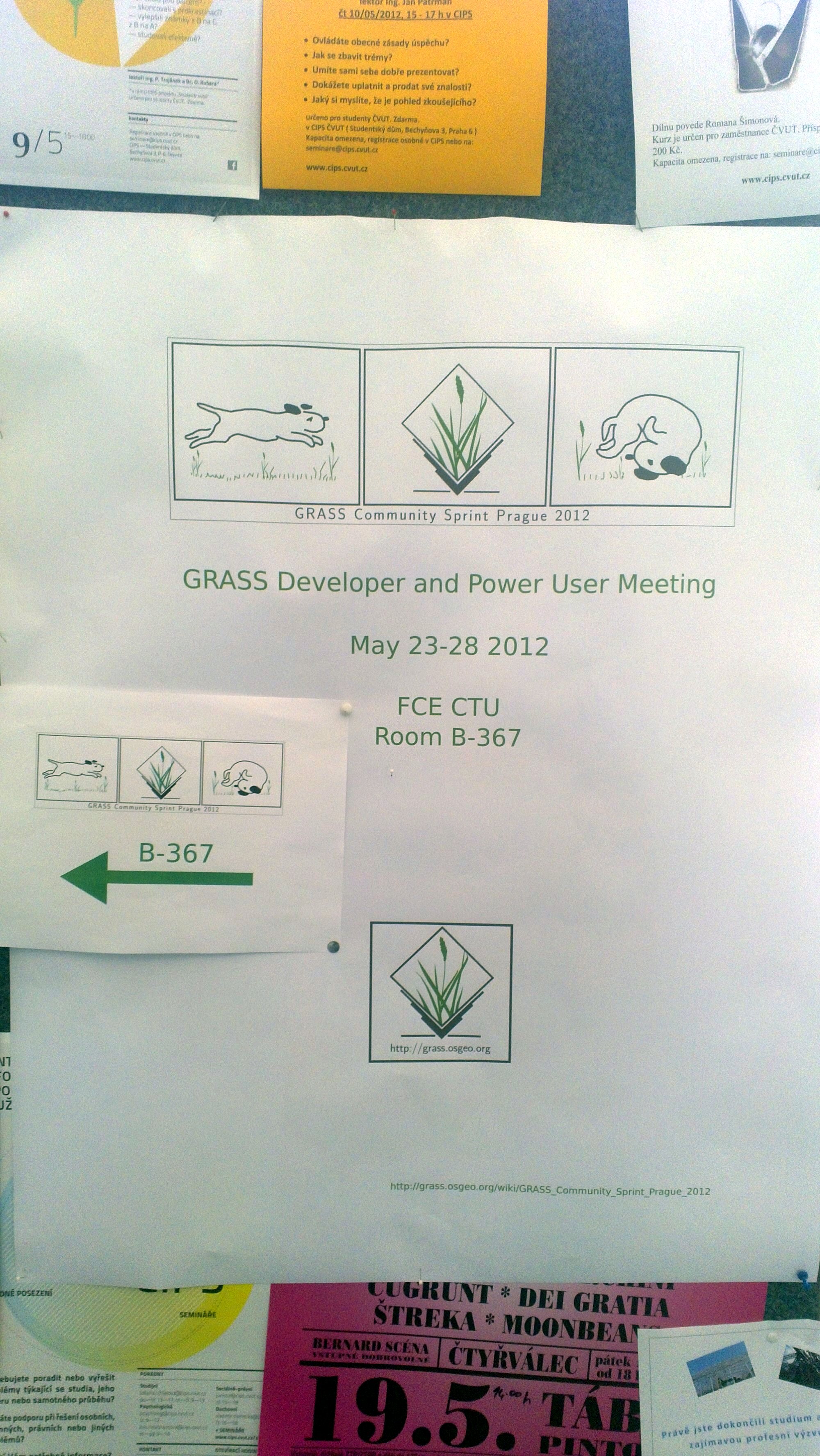
| 15:02, 26 May 2012 | Grass community sprint 2012 1.jpg (file) |  |
1.26 MB | Informative poster inside the Czech Technical University in Prague | 1 |
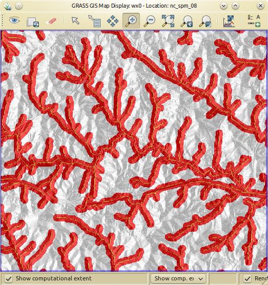
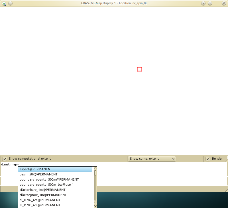
| 14:36, 26 May 2012 | Nc spm 08 the computational region concept 800px height.png (file) |  |
212 KB | 1 | |
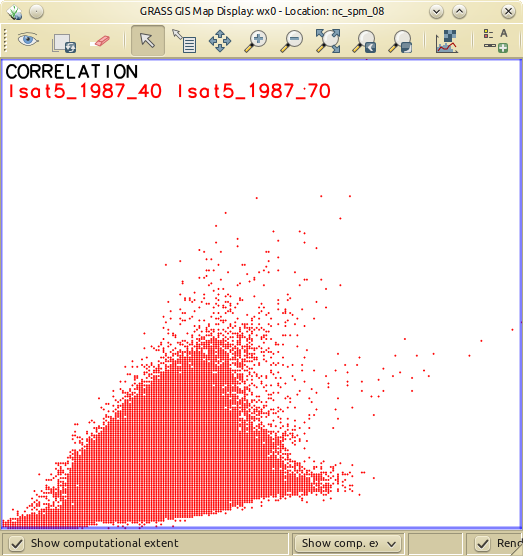
| 15:53, 25 May 2012 | Nc spm 09 d.correlation of lsat5 1987 40 and lsat5 1987 70.png (file) |  |
108 KB | 1 | |
| 13:44, 25 May 2012 | Grass-gis minimalistic map-display with comman-console layout mockup.png (file) |  |
61 KB | 3 | |
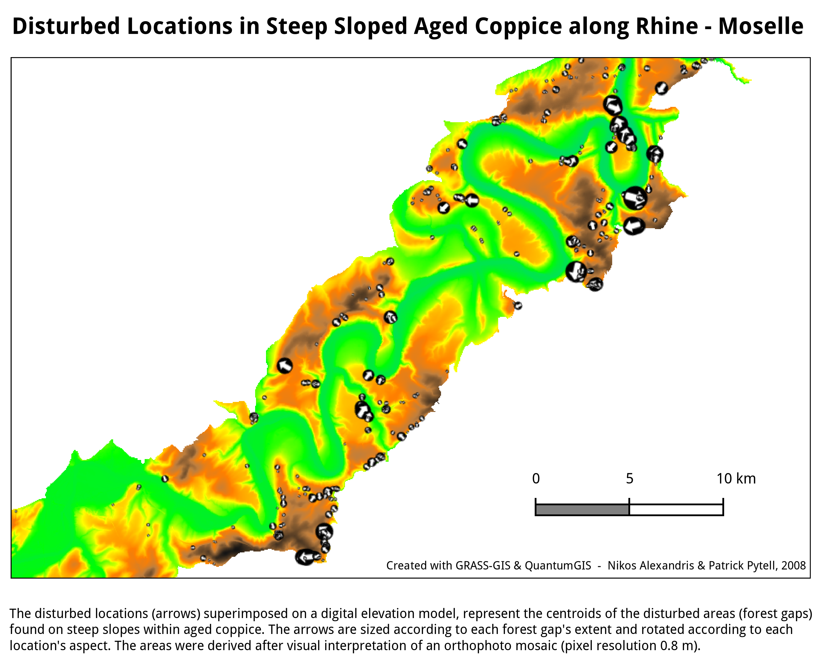
| 09:28, 23 July 2010 | Forestgaps Moseltal Germany.png (file) |  |
497 KB | Forest gaps in Moseltal, Germany | 1 |
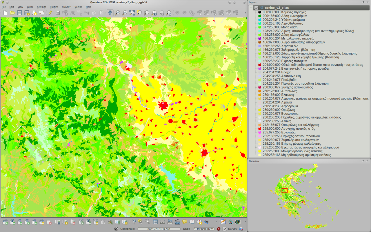
| 07:42, 23 July 2010 | Corine v2 greece viewed in qgis16 h800px.png (file) |  |
852 KB | The CORINE land cover (GRASS-GIS raster) map over Greece viewed within from QGIS | 1 |
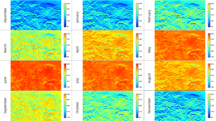
| 18:41, 21 July 2010 | Mean monthly global rad maps over a study area in central Greece 700px height.jpg (file) |  |
271 KB | Overview of 12 mean monthly global irradiation maps over a study area in central Greece (s=38.531, e=22.436, n=38.918, w=21.793) | 1 |
| 18:14, 21 July 2010 | Mean monthly global rad maps over a study area in central Greece.png (file) |  |
470 KB | Overview of 12 mean monthly global irradiation maps over a study area in central Greece (s=38.531, e=22.436, n=38.918, w=21.793) | 1 |
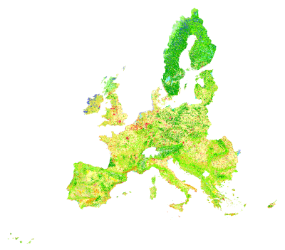
| 09:16, 11 August 2009 | Corine land cover 2000.png (file) |  |
85 KB | keep the 400pix version | 5 |