Uploads by ⚠️Wenzeslaus
Jump to navigation
Jump to search
This special page shows all uploaded files.
| Date | Name | Thumbnail | Size | Description | Versions |
|---|---|---|---|---|---|
| 00:38, 21 May 2023 | OSGeo JP logo for web.png (file) | 23 KB | Logo of OSGeo Japan (OSGeo.JP) https://www.osgeo.jp/ | 1 | |
| 02:56, 27 April 2023 | Screenshot from 2023-04-26 22-52-53.png (file) |  |
89 KB | 1 | |
| 01:03, 27 April 2021 | Hargrove 2021 within year seasonality.png (file) |  |
293 KB | Citation: William Hargrove, Jitendra Kumar, Steve Norman, Forrest Hoffman (2021). Empirical Global Fire Regimes Identify Common Fire Relationships Across the Planet. IALE - North America 2021 Annual Meeting, Virtual, April 11-15, Reno, Nevada, USA Des... | 1 |
| 01:02, 27 April 2021 | Hargrove 2021 repeat burnability.png (file) |  |
286 KB | Citation: William Hargrove, Jitendra Kumar, Steve Norman, Forrest Hoffman (2021). Empirical Global Fire Regimes Identify Common Fire Relationships Across the Planet. IALE - North America 2021 Annual Meeting, Virtual, April 11-15, Reno, Nevada, USA Des... | 1 |
| 01:02, 23 April 2021 | Inglis 2021 boulder viewscape.png (file) |  |
1.13 MB | Citation: Nicole Inglis, Jelena Vukomanovic (2021). Temporally Dynamic Viewscapes for Modeling the Visual Amenities of Exurban Housing Development. IALE - North America 2021 Annual Meeting, Virtual, April 11-15, Reno, Nevada, USA Description: Viewshed... | 1 |
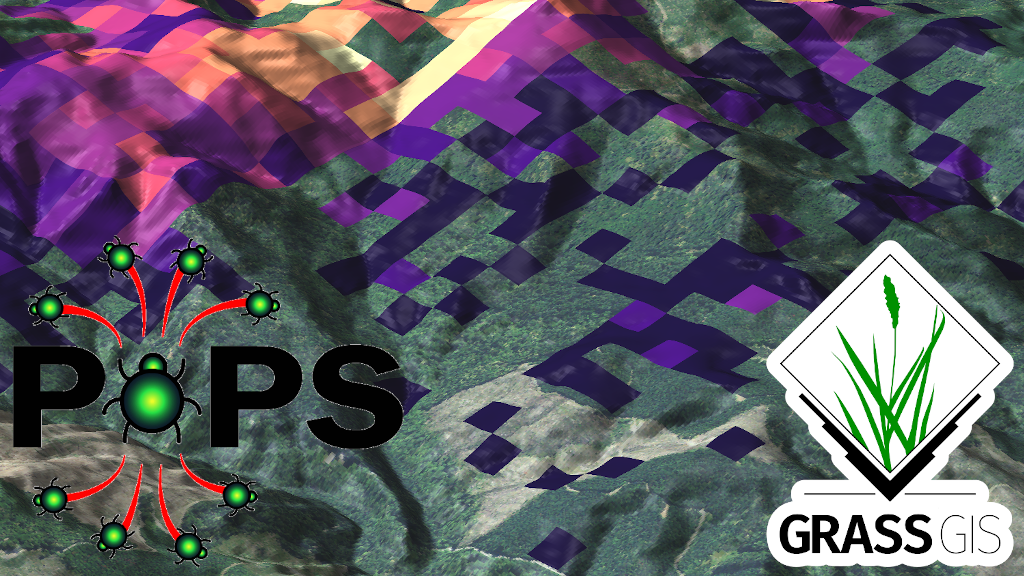
| 18:00, 22 April 2021 | R pops spread 1024.png (file) |  |
1.04 MB | r.pops.spread output See {{addonCmd|r.pops.spread}} module in GRASS Addons for citation. | 1 |
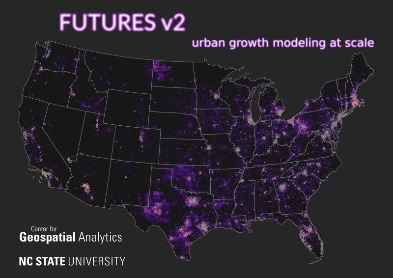
| 16:56, 11 February 2021 | FUTURES v2 petrasova 2021 poster.png (file) |  |
409 KB | Thumbnail for a conference poster for NCGIS2021 by Anna Petrasova. Anna Petrasova, Georgina Sanchez, Vaclav Petras, Ross K. Meentemeyer (2021). FUTURES v2: Urban Growth Modeling at Scale. NC GIS Virtual Conference, February 16-19, 2021. | 1 |
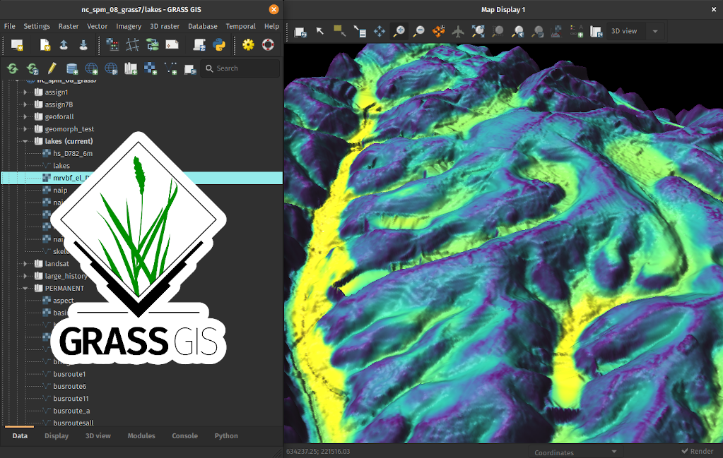
| 16:54, 11 February 2021 | Grass gis r valley bottom 3d.png (file) |  |
844 KB | Graphical user interface of GRASS GIS with result of r.valley.bottom in 3D with logo. | 1 |
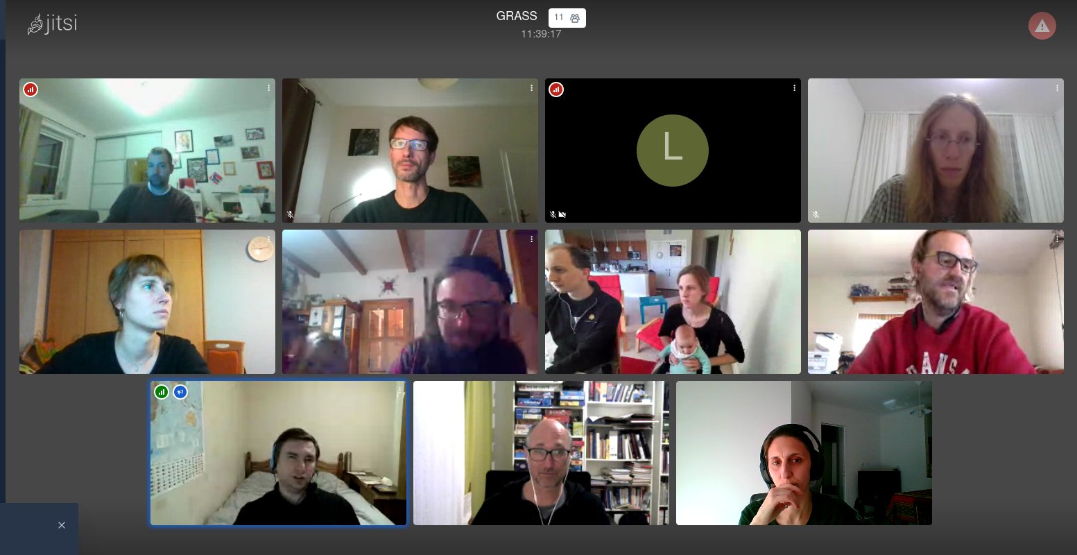
| 03:16, 20 November 2020 | Grass gis osgeo sprint 2020.jpeg (file) |  |
142 KB | GRASS GIS at OSGeo Virtual Community Sprint 2020 | 1 |
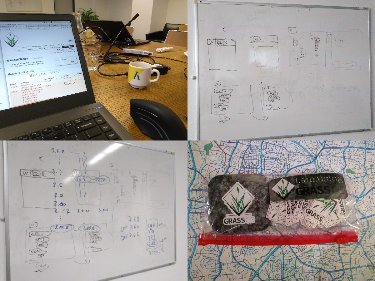
| 08:23, 10 December 2019 | Prague 2019 whiteboards and things.jpg (file) |  |
321 KB | GRASS GIS Community Sprint Prague 2019 table, startup whiteboard, releases whiteboard, stickers. | 1 |
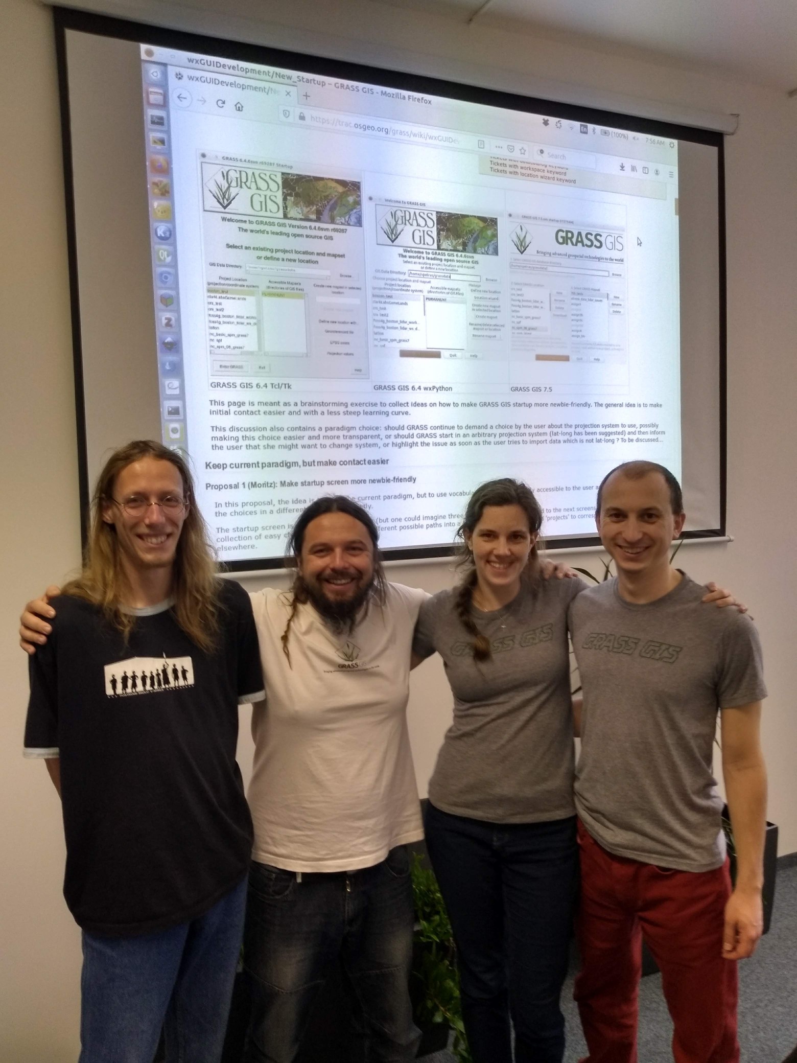
| 08:22, 10 December 2019 | Prague 2019 group.jpg (file) |  |
501 KB | GRASS GIS Community Sprint Prague 2019 group picture | 1 |
| 19:22, 21 January 2019 | AGU 2018 logo.png (file) | 13 KB | Logo of AGU 2018 American Geophysical Union, Fall Meeting 2018, Washington, D.C. https://fallmeeting.agu.org/2018/ For use at pages about AGU or mentioning AGU at this wiki. | 1 | |
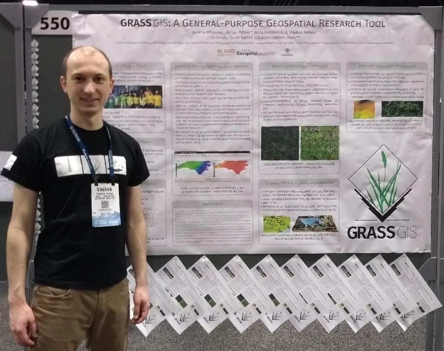
| 10:41, 3 January 2019 | Mitasova petras 2018 agu grass gis abstract.png (file) |  |
752 KB | AGU Fall Meeting 2018 NS53A-0550 GRASS GIS: A General-purpose Geospatial Research Tool Helena Mitasova 1, Vaclav Petras 2, Anna Petrasova 2, Markus Neteler 3 and GRASS GIS Development Team, (1)North Carolina State University Raleigh, Marine, Earth an... | 1 |
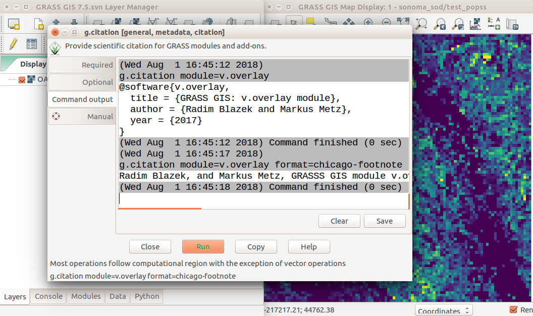
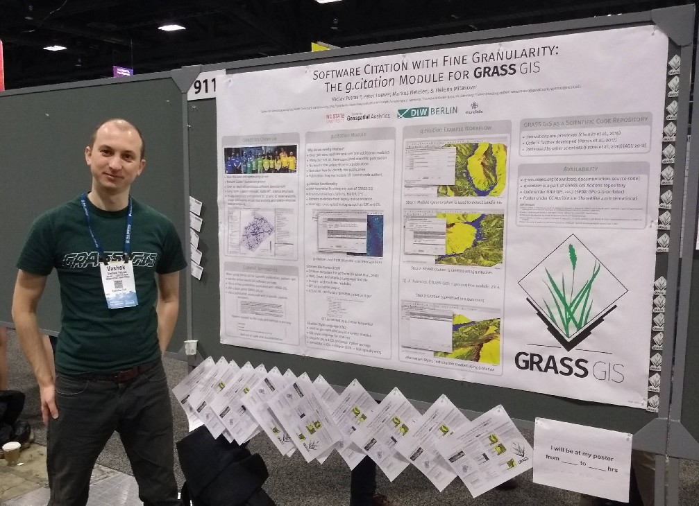
| 10:37, 3 January 2019 | Petras 2018 agu gcitation abstract.png (file) |  |
160 KB | AGU Fall Meeting 2018 IN43C-0911 Software Citation with Fine Granularity: The g.citation Module for GRASS GIS Vaclav Petras, North Carolina State University Raleigh, Raleigh, NC, United States, Peter Loewe, DIW Berlin Deutsches Institut für Wirtscha... | 1 |
| 07:45, 3 January 2019 | Petras 2018 agu gcitation.jpg (file) |  |
197 KB | Vaclav Petras (North Carolina State University, Center for Geospatial Analytics) presenting at AGU Fall Meeting 2018 IN43C-0911 Software Citation with Fine Granularity: The g.citation Module for GRASS GIS Vaclav Petras, North Carolina State Universit... | 1 |
| 07:42, 3 January 2019 | Mitasova petras 2018 agu grass gis.jpg (file) |  |
201 KB | Vaclav Petras (North Carolina State University, Center for Geospatial Analytics) presenting at AGU Fall Meeting 2018 NS53A-0550 GRASS GIS: A General-purpose Geospatial Research Tool Helena Mitasova 1, Vaclav Petras 2, Anna Petrasova 2, Markus Neteler... | 1 |
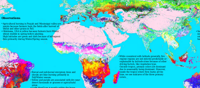
| 21:16, 2 January 2019 | Kumar 2018 agu poster.png (file) |  |
368 KB | Jitendra Kumar, William W. Hargrove, Steven P. Norman, Forrest M. Hoffman (2018). Empirical Characterization of Fire Regimes Across the Globe https://forestthreats.org/products/posters/empirical-characterization-of-fire-regimes-across-the-globe AGU F... | 1 |
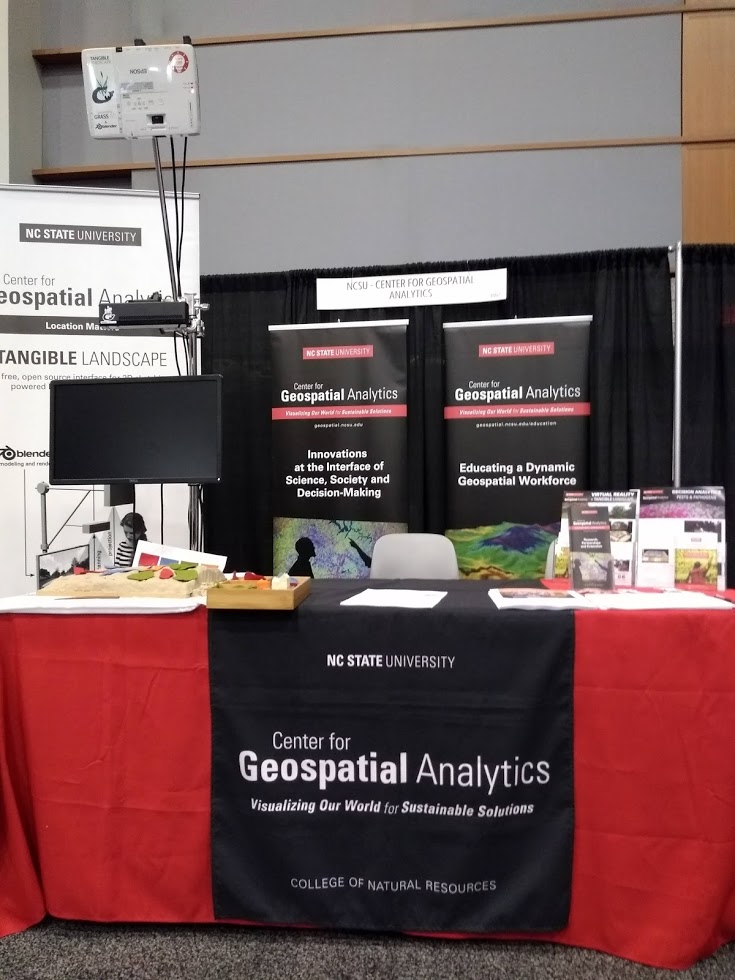
| 20:49, 2 January 2019 | Ncsu cga booth agu 2018.jpg (file) |  |
126 KB | NCSU Center for Geospatial Analytics Booth at AGU 2018 (North Carolina State University, PhD in Geospatial Analytics, Tangible Landscape, PoPS, GRASS GIS) | 1 |
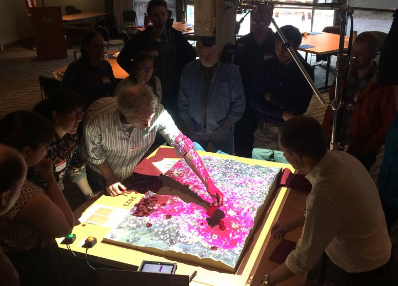
| 10:06, 23 December 2018 | Petrasova gaydos tangible landscape oregon sod workshop.jpg (file) |  |
126 KB | Stakeholders interacting with Sudden Oak Death Model in GRASS GIS (r.spread.sod/r.pops.spread module, PoPS model) using Tangible Landscape interface PA23G-1071 Engaging stakeholders and decision-makers in geosimulations with Tangible Landscape. Anna P... | 1 |
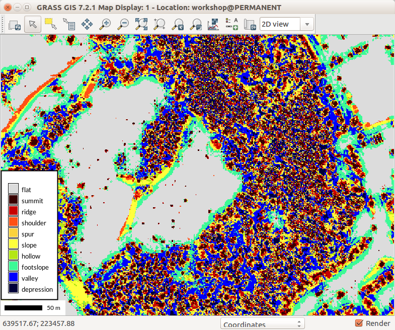
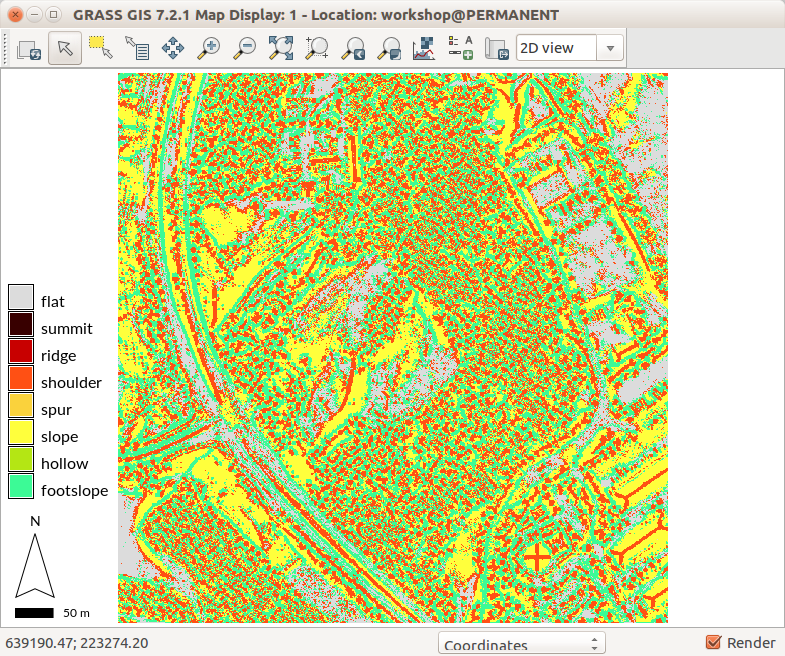
| 02:23, 15 August 2017 | R geomorphon lidar dsm trees.png (file) |  |
297 KB | Threes from DSM using r.geomorphon | 1 |
| 02:20, 15 August 2017 | R geomorphon lidar dsm vegetation details.png (file) |  |
174 KB | r.geomorphon showing details of vegetation structure | 1 |
| 02:17, 15 August 2017 | R geomorphon lidar dsm vegetation.png (file) |  |
103 KB | r.geomorphon setting showing vegetation | 1 |
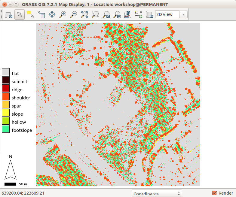
| 02:17, 15 August 2017 | R geomorphon lidar dsm roofs.png (file) |  |
160 KB | r.geomorphon settings showing building roof shapes | 1 |
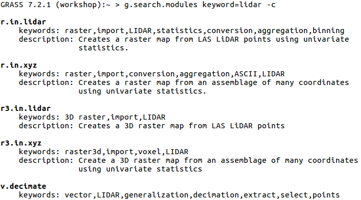
| 02:30, 8 August 2017 | G search modules with c flag.png (file) |  |
50 KB | {{cmd|g.search.modules}} keyword=lidar -c Searches through descriptions and keywords. Displays using color. | 1 |
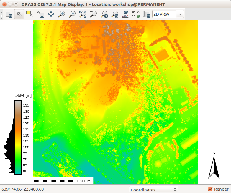
| 21:54, 6 August 2017 | Map Display with DSM and legend with histogram.png (file) |  |
380 KB | GRASS GIS 7.2 wxGUI Map Display with DSM, legend with histogram, scale bar and north arrow | 1 |
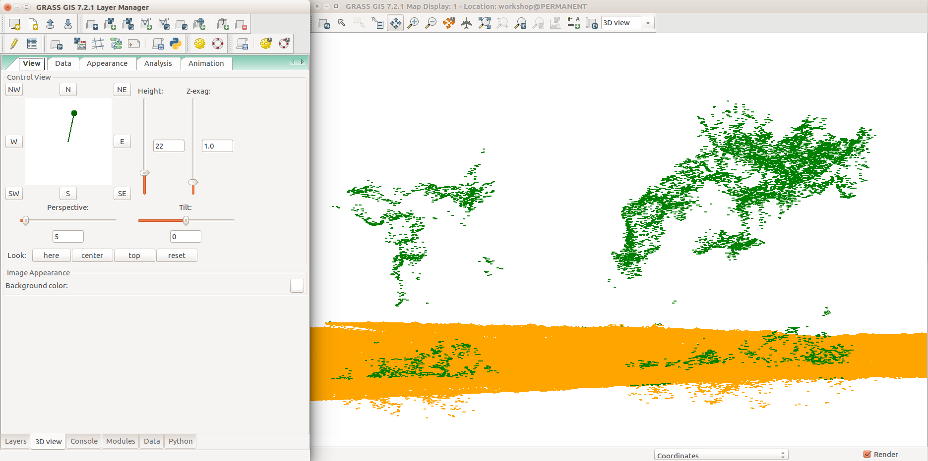
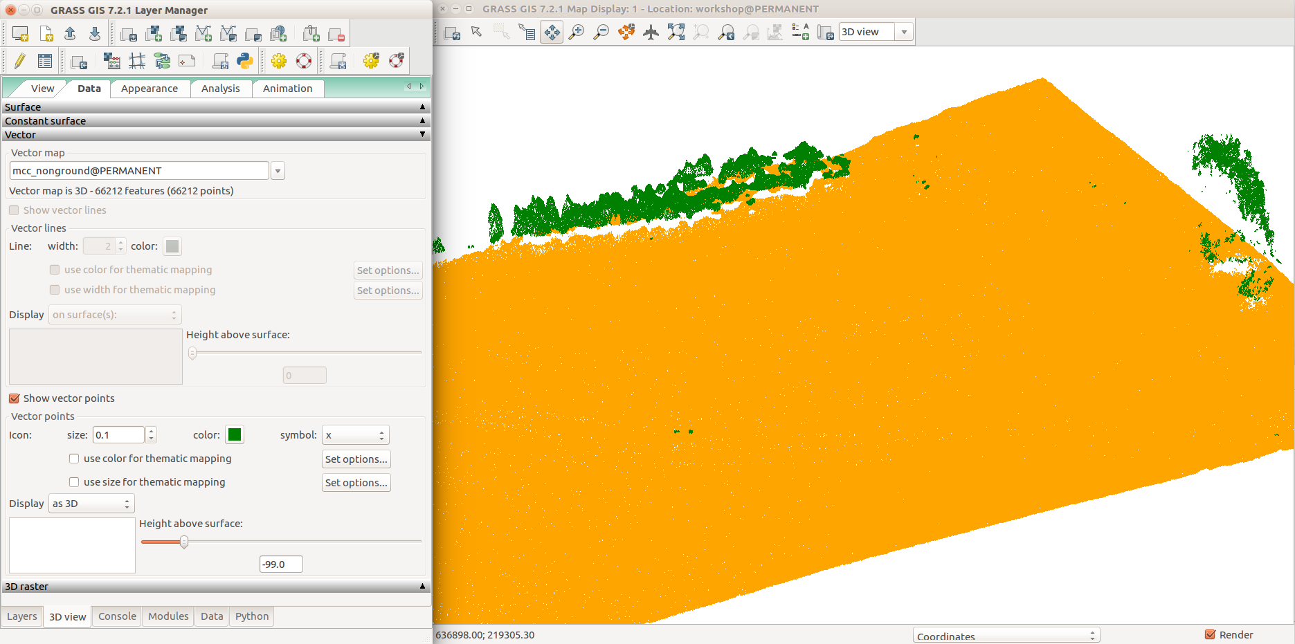
| 04:09, 6 August 2017 | Selection 409.png (file) |  |
115 KB | GRASS GIS 7.2 3D view in wxGUI, 3D view tab, View tab, group point cloud (orange), non-ground point cloud (green), detail (trees) | 1 |
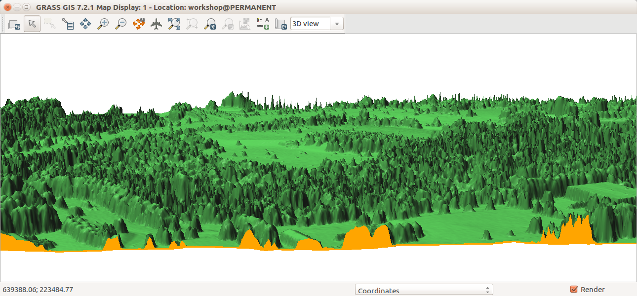
| 04:09, 6 August 2017 | WxGUI nviz with point cloud ground and non-ground data tab.png (file) |  |
162 KB | GRASS GIS 7.2 3D view in wxGUI, 3D view tab, Data tab, group point cloud (orange), non-ground point cloud (green), all points | 1 |
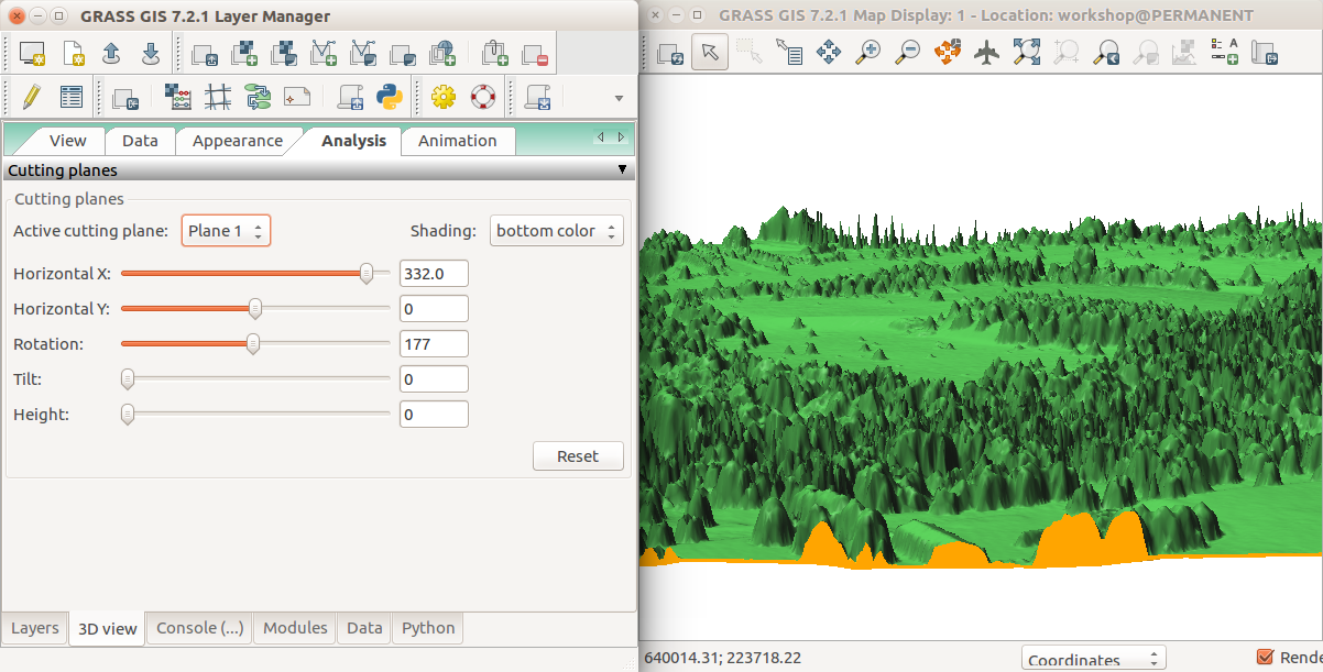
| 03:03, 6 August 2017 | Nviz cutting plane dem dsm.png (file) |  |
553 KB | GRASS GIS 7.2, 3D view in wxGUI, Map Display, cutting plane for DEM (terrain, orange color) and DSM (trees, buildings, green color) surfaces. | 1 |
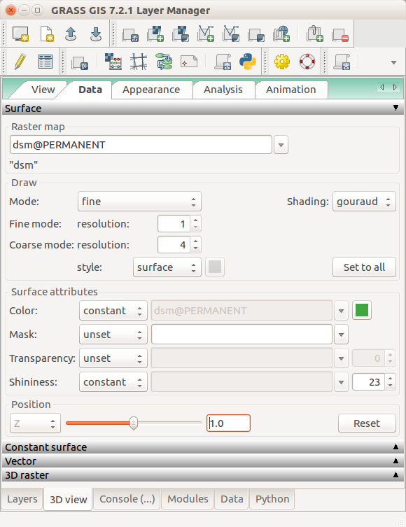
| 02:47, 6 August 2017 | Nviz data tab dsm set relative positon.png (file) |  |
82 KB | GRASS GIS 7.2 3D view in wxGUI, 3D view tab, Data tab, Surface | 1 |
| 02:47, 6 August 2017 | Nviz cutting plane analysis tab.png (file) |  |
361 KB | GRASS GIS 7.2 3D view in wxGUI, 3D view tab, Analysis tab, Controlling cutting plane | 1 |
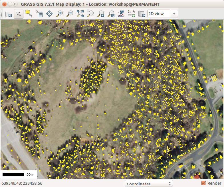
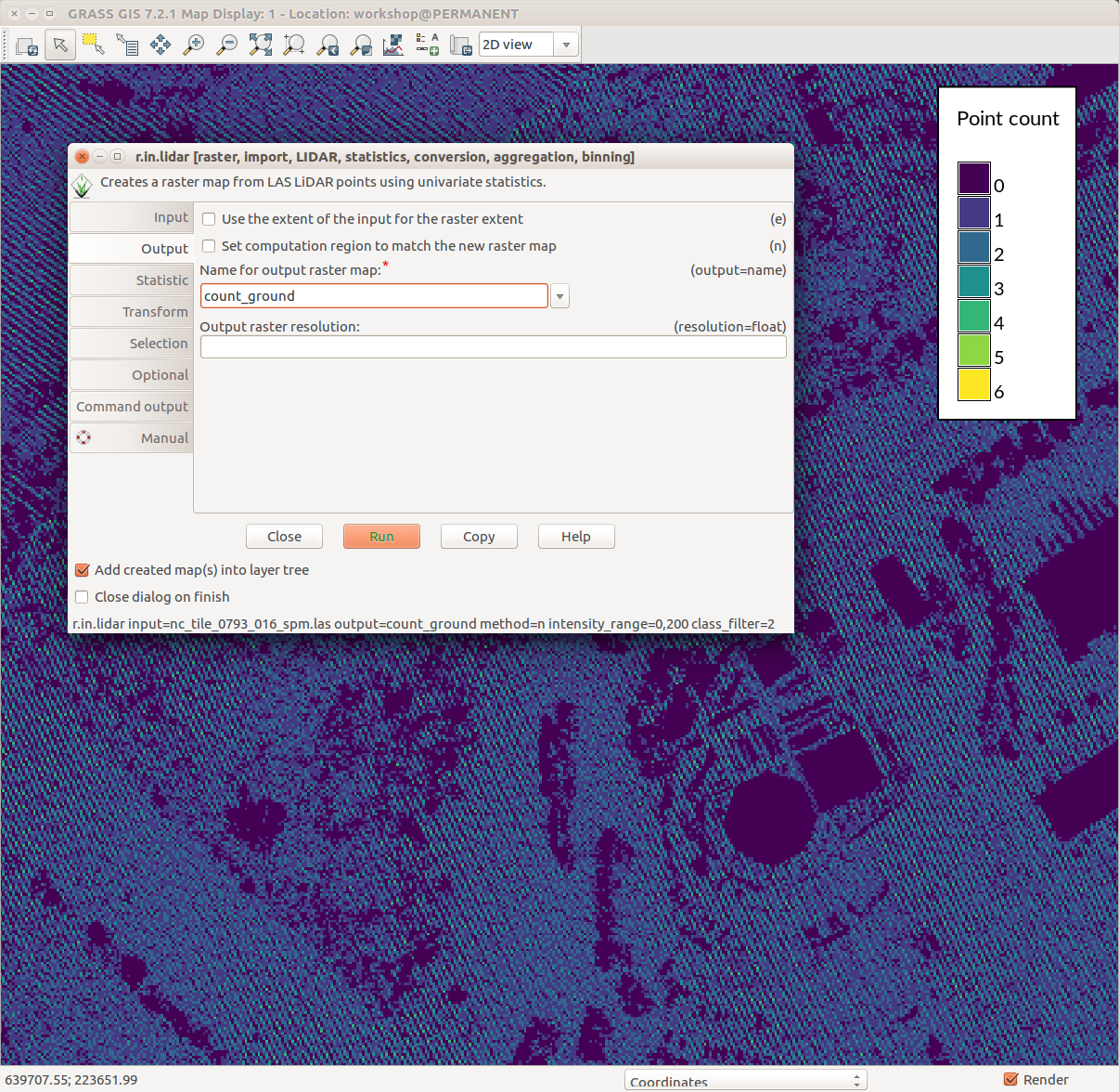
| 19:16, 1 August 2017 | Counting ground points per cell with r.in.lidar.png (file) |  |
231 KB | GRASS GIS 7.2 wxGUI Map Display, legend with d.legend, r.in.lidar dialog, ground point density pattern in the background | 1 |
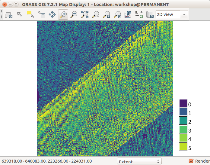
| 13:37, 1 August 2017 | Lidar point density with fine resolution showing swath overlap.png (file) |  |
246 KB | r.in.lidar with method=n using fine resolution GRASS GIS 7.2 Map Display | 1 |
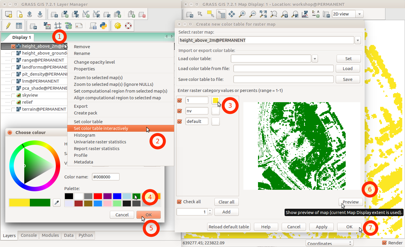
| 02:46, 1 August 2017 | Change color table interactively with menu and labels.png (file) |  |
231 KB | GRASS GIS 7.2 wxGUI dialog ''Create new color table for raster map'' started from layer context menu using ''Set color table interactively'' | 1 |
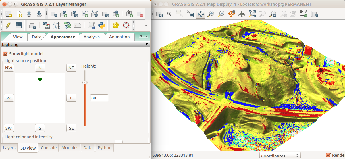
| 02:20, 1 August 2017 | Geomorphons in 3D view Appearance tab.png (file) |  |
535 KB | GRASS GIS 7.2 wxGUI NVIZ Appearance tab to change the light source position | 1 |
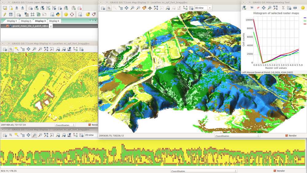
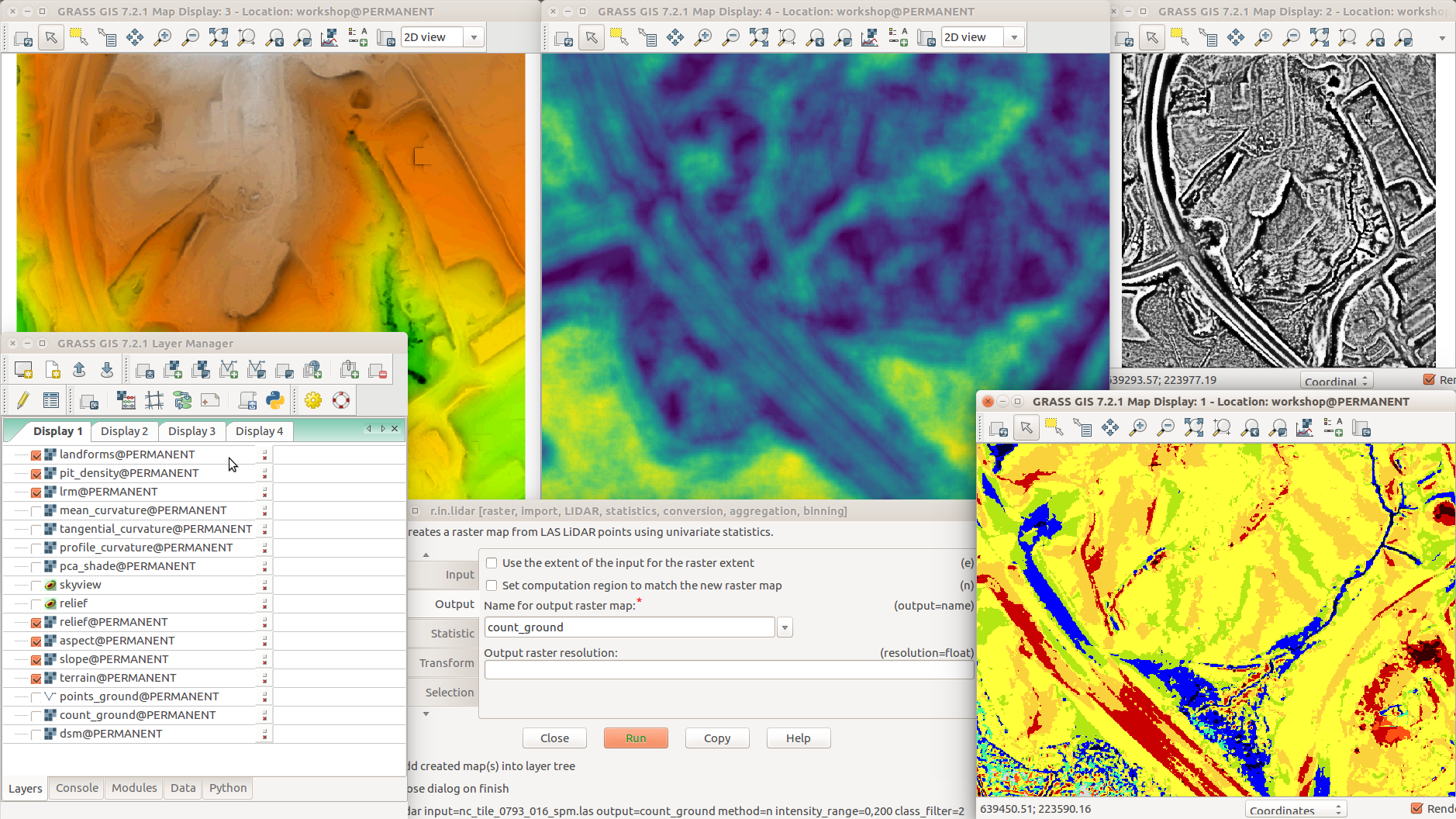
| 02:05, 1 August 2017 | Different terrain analyses and visualizations in multiple Map Displays.png (file) |  |
1,014 KB | GRASS GIS 7.2 with various addons r.skyview + d.shade (top left) r.terrain.texture (pit density, top middle) r.local.relief (LRM, top right) Layer Manager, Layers tab (bottom left) r.in.lidar (dialog, bottom middle) r.geomorphon (landforms, bottom right) | 1 |
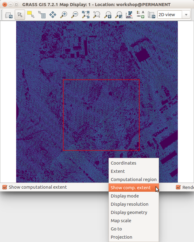
| 01:58, 1 August 2017 | Show computational extent in Map Display.png (file) |  |
239 KB | GRASS GIS 7.2 wxGUI Map Display | 1 |
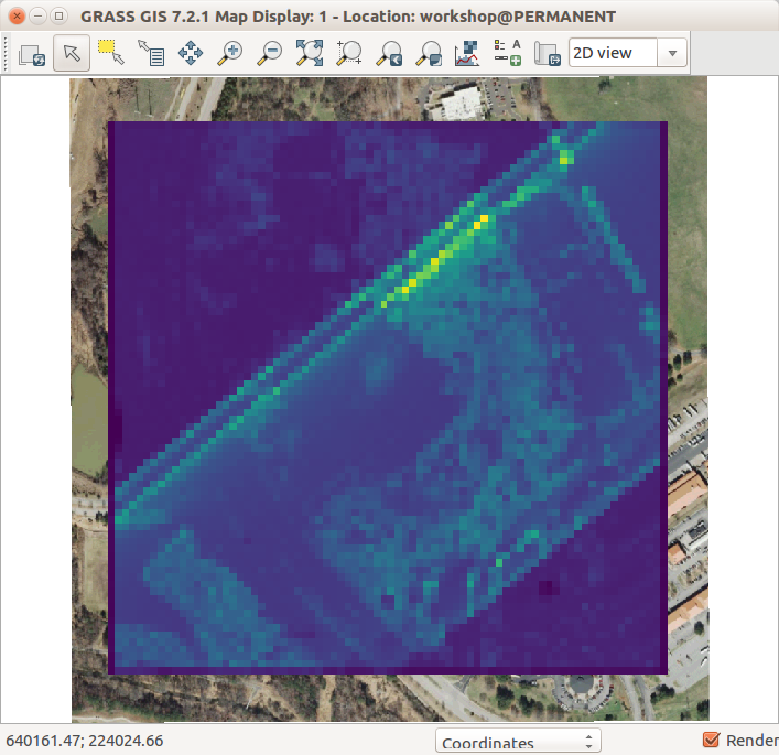
| 01:48, 1 August 2017 | Lidar point density with coarse resolution and ortho in the background.png (file) |  |
143 KB | r.in.lidar res=10 -e | 1 |
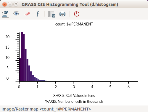
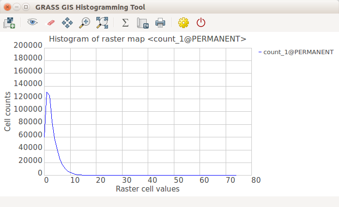
| 01:41, 1 August 2017 | GRASS GIS Histogramming Tool d.histogram - count of point.png (file) |  |
24 KB | d.histogram powered histogram in GRASS GIS 7.2 Count of points per cell | 1 |
| 01:41, 1 August 2017 | GRASS GIS Histogramming Tool wxPython - count of point.png (file) |  |
33 KB | wxPython powered histogram in GRASS GIS 7.2 | 1 |
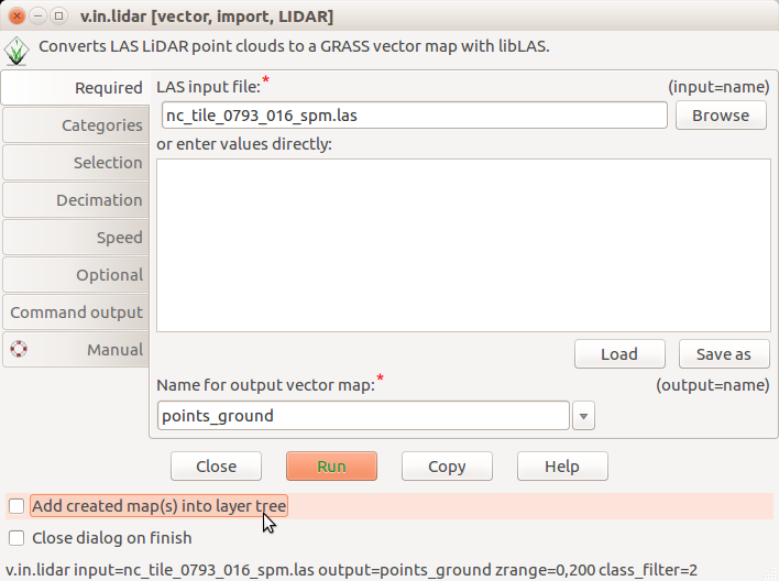
| 20:55, 31 July 2017 | V.in.lidar dialog do not add into layer tree.png (file) |  |
59 KB | Unchecked ''Add created map(s) into layer tree'' in v.in.lidar | 1 |
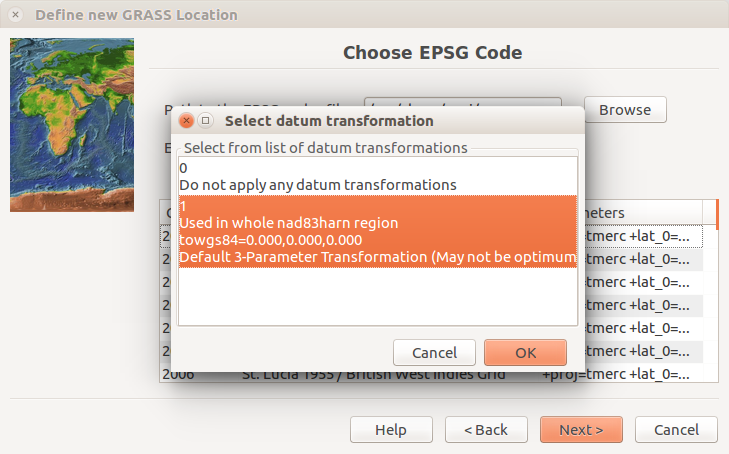
| 15:28, 21 July 2017 | Location wizard epsg datum transformation.png (file) | 116 KB | Choose EPSG page of the Location Wizard after pressing Next with a dialog for selecting datum transformation with the default selection. EPSG is 3358. Screenshot from GRASS GIS 7.2.1. | 1 | |
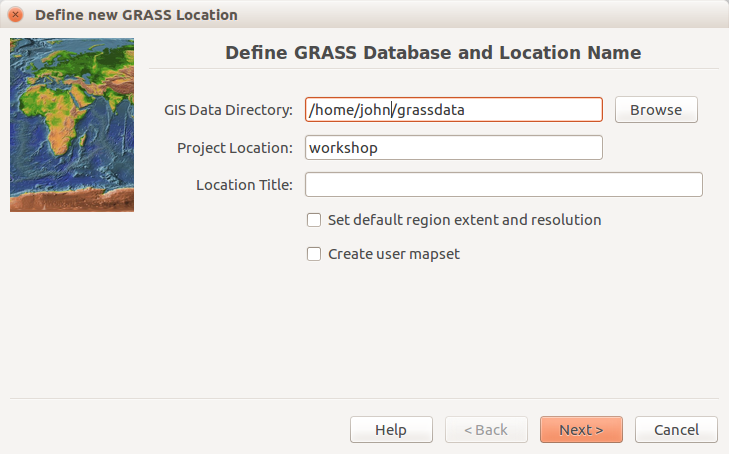
| 15:25, 21 July 2017 | Location wizard define.png (file) |  |
83 KB | Initial (define path and names) page of the Location Wizard. The user name is john. The location name workshop. Database is in /home/john/grassdata. Screenshot from GRASS GIS 7.2.1. | 1 |
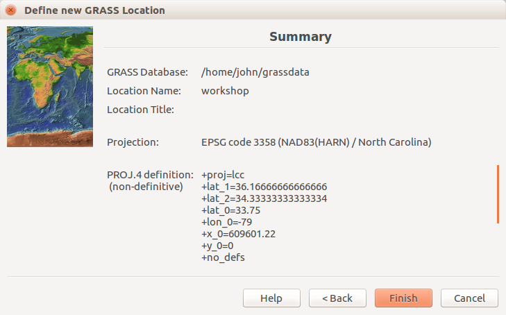
| 15:22, 21 July 2017 | Location wizard summary 7.2.1.png (file) |  |
88 KB | Summary page of the Location Wizard. The user name is john. The location name workshop. Database is in /home/john/grassdata. EPSG is 3358. | 1 |
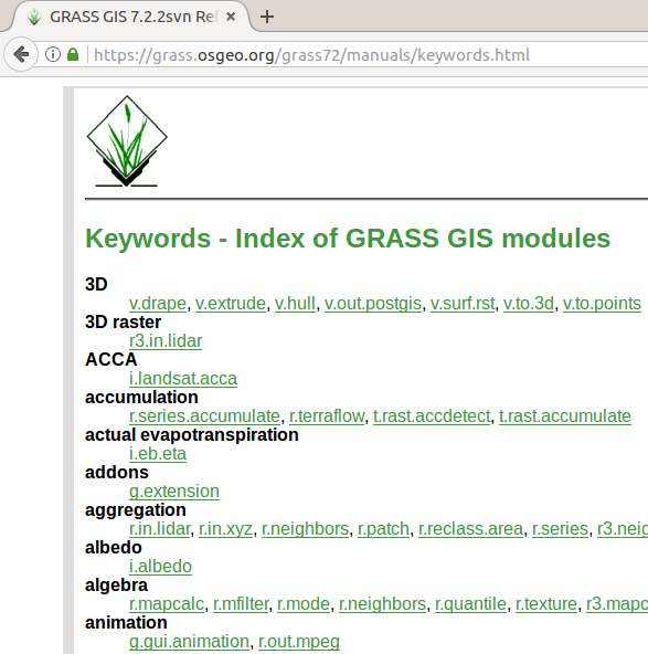
| 15:19, 21 July 2017 | Manual pages online keywords 7.2.png (file) |  |
51 KB | https://grass.osgeo.org/grass72/manuals/keywords.html for 7.2.2svn showing web browser tab and part of the page | 1 |
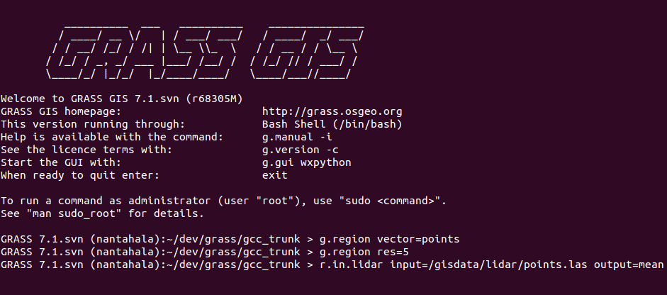
| 18:12, 19 July 2017 | Grass gis cli ubuntu purple r.in.lidar.png (file) |  |
52 KB | GRASS GIS command line interface (CLI) in Ubuntu terminal (purple/violet) Commands: g.region vector=points g.region res=5 r.in.lidar input=/gisdata/lidar/points.las output=mean | 1 |
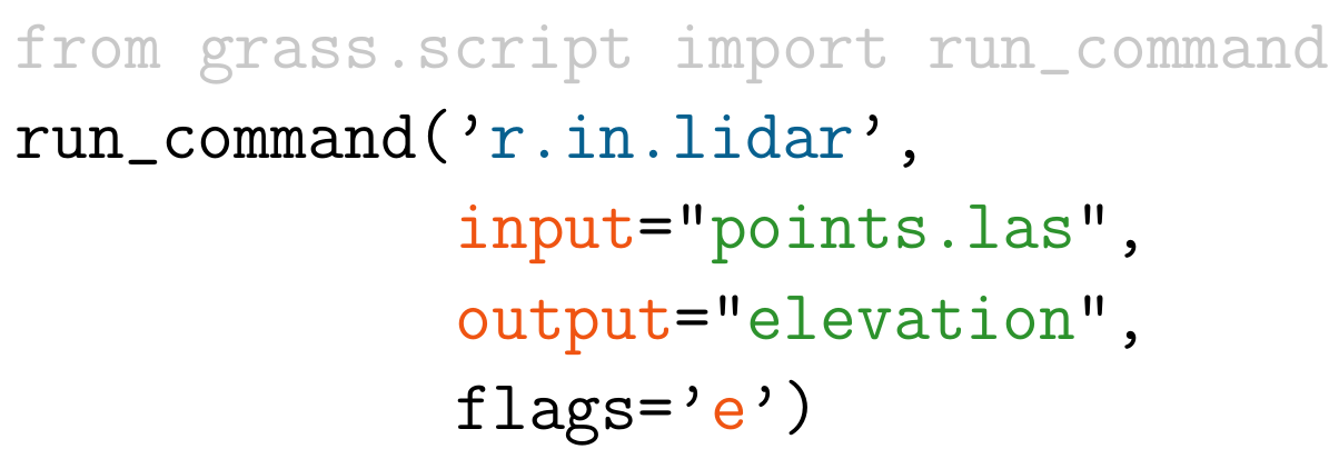
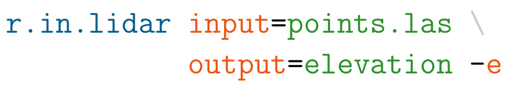
| 17:44, 19 July 2017 | Example r.in.lidar command in Python.png (file) |  |
47 KB | Example r.in.lidar command in Python with highlighted module name (blue), options and flags (red) and option values (green) and import (grey) | 1 |
| 17:42, 19 July 2017 | Example r.in.lidar command in Bash.png (file) | 23 KB | Example r.in.lidar command in Bash with highlighted module name (blue), options and flags (red) and option values (green) | 1 | |
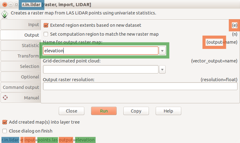
| 17:38, 19 July 2017 | R in lidar dialog.png (file) |  |
58 KB | r.in.lidar dialog with Output tab active and highlighted module name (blue), options and flags (red) and option values (green) | 1 |
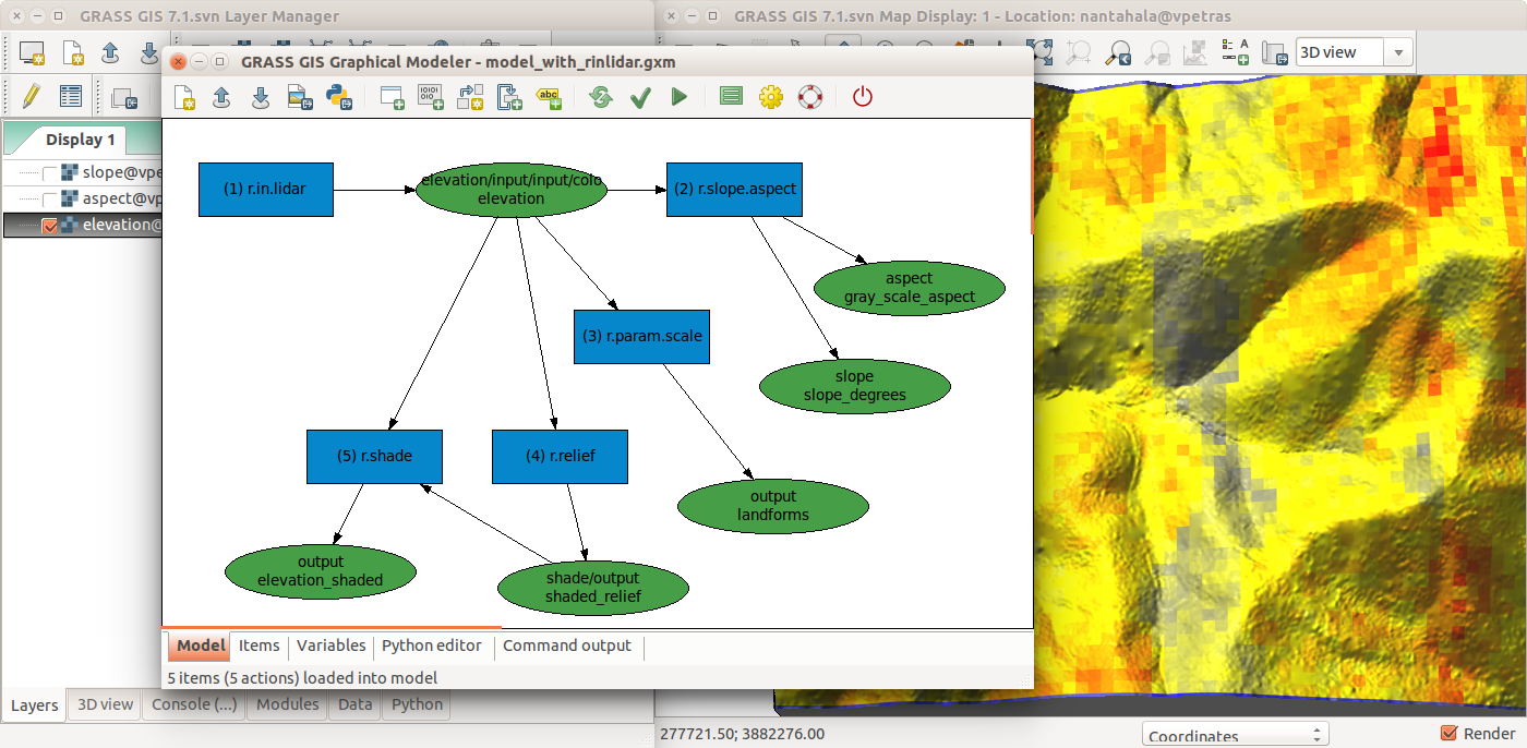
| 17:35, 19 July 2017 | Graphical Modeler with r.in.lidar and terrain analysis.png (file) |  |
457 KB | r.in.lidar followed by r.slope.aspect, r.param.scale, r.relief with r.shade in GRASS GIS Graphical Modeler with the main GUI in the background | 1 |
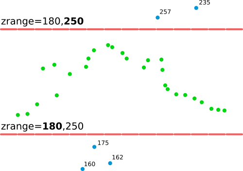
| 15:52, 19 July 2017 | R in lidar explanation of zrange option.png (file) |  |
14 KB | Explanation of zrange option applicable to v.in.lidar or r.in.lidar | 1 |