GRASS 6 Tutorial/Vector data management: Difference between revisions
(+figure explaining layers) |
|||
| (32 intermediate revisions by 2 users not shown) | |||
| Line 1: | Line 1: | ||
==Vector data management== | ==Vector data management== | ||
=== | ===Importing Vector data=== | ||
The GRASS modules ''<code>v.in.*</code>'' and '''<code>v.out.*</code>''' handle the importing and exporting of Vector datasets. | |||
The GRASS modules <code>v.in.*</code> and <code>v.out.*</code> handle the importing and exporting of Vector datasets. | |||
<code>v.in.ogr</code> is widely used and has simplified the import of vector data; [http://www.gdal.org/ogr/ogr_formats.html OGR] itself support a wide range of formats. | <code>v.in.ogr</code> is widely used and has simplified the import of vector data; [http://www.gdal.org/ogr/ogr_formats.html OGR] itself support a wide range of formats. | ||
<code>v.out.ogr</code> always exports the entire vector map | <code>v.out.ogr</code> always exports the entire vector map | ||
====Importing an ESRI Shapefile==== | ====Importing an ESRI Shapefile==== | ||
The following code snippet is a simple usage of <code>v.in.ogr</code>, which imports an ESRI Shapefile | The following code snippet is a simple usage of <code>v.in.ogr</code>, which imports an ESRI Shapefile into the native vector format: | ||
v.in.ogr dsn=boundary_county.shp out=boundary_county | v.in.ogr dsn=boundary_county.shp out=boundary_county | ||
| Line 38: | Line 17: | ||
[[File:Vector_layer_import.png|400px]] | [[File:Vector_layer_import.png|400px]] | ||
You can easily import a '''subset''' of your data by specifying the spatial extent or an SQL query defined within the <code>where</code> command line argument: | |||
v.in.ogr --o dsn=./ output=subset layer=boundary_county where="NAME = 'DUPLIN' OR NAME = 'WAKE'" | |||
+----------------------------------------------------------------------------+ | |||
| Layer: subset | | |||
| Mapset: PERMANENT | | |||
| Location: nc_spm_08_geostat | | |||
| Database: /home/daniel/GRASSWiki/data | | |||
| Title: | | |||
| Map scale: 1:1 | | |||
| Map format: native | | |||
| Name of creator: daniel | | |||
| Organization: | | |||
| Source date: Wed Nov 7 16:10:01 2012 | | |||
|----------------------------------------------------------------------------| | |||
| Type of Map: vector (level: 2) | | |||
| | | |||
| Number of points: 0 Number of areas: 2 | | |||
| Number of lines: 0 Number of islands: 2 | | |||
| Number of boundaries: 2 Number of faces: 0 | | |||
| Number of centroids: 2 Number of kernels: 0 | | |||
| | | |||
| Map is 3D: No | | |||
| Number of dblinks: 1 | | |||
| | | |||
| Projection: Lambert Conformal Conic | | |||
| N: 258121.97732598 S: 106860.16001618 | | |||
| E: 732841.78315847 W: 610047.98051883 | | |||
| | | |||
| Digitization threshold: 0 | | |||
| Comments: | | |||
| | | |||
+----------------------------------------------------------------------------+ | |||
====Virtual link an ESRI Shapefile==== | |||
If you prefer not to import your vector datasets into the native GRASS vector format, you can create a virtual link to it using <code>v.external</code> | |||
This can be done as follows: | |||
v.external dsn=./ output=boundary_county layer=boundary_county | |||
Building topology for vector map <boundary_county>... | |||
Number of nodes: 1707 | |||
Number of primitives: 1981 | |||
Number of points: 0 | |||
Number of lines: 0 | |||
Number of boundaries: 1055 | |||
Number of centroids: 926 | |||
Number of areas: 1055 | |||
Number of isles: 1055 | |||
Number of areas without centroid: 129 | |||
====Import an XY/XYZ ASCII file==== | |||
You can easily generate a GRASS point vector file from a text file containing X,Y coordinates. | |||
642934|95324 | |||
675695|139878 | |||
623277|158224 | |||
716318|138568 | |||
742527|164776 | |||
735975|196227 | |||
755631|200158 | |||
Pipe the coordinates to the module <code>v.in.ascii</code> | |||
cat coords.txt | v.in.ascii out=points | |||
Add the categories to the vector points to facilitate attribute joins: | |||
v.category in=points out=points_final op=add | |||
v.category points_final op=report | |||
You can then add a new attribute table to the vector file using <code>v.db.addtable</code> | |||
v.db.addtable map=points | |||
You can replicate the above procedure for three dimensional data (XYZ), by modifying the <code>v.in.ascii</code> argument list | |||
You can easily generate a GRASS point vector file from a text file containing X,Y coordinates. | |||
642934|95324|212 | |||
675695|139878|233 | |||
623277|158224|211 | |||
716318|138568|219 | |||
742527|164776|240 | |||
735975|196227|221 | |||
755631|200158|210 | |||
cat coords.txt | v.in.ascii -z out=points | |||
====Import an XY table from a DBMS or Spreadsheet==== | |||
If you have a list of coordinates (x,y) with associated attributes stored in a spreadsheet table (DBF, CSV, Excel, etc). It's fairly easy to generate a map from them using <code>v.in.db</code>. In the following example, we import the table, meteostations that has the columns 'east', 'north', 'quota' (z) and some attribute columns. | |||
v.in.db driver=pg database="host=myserver.itc.it,dbname=mydb,user=name" table=meteostations x=east y=north z=quota key=id output=meteostations | |||
This command creates the new vector map (native format) with attributes table in a DBF file. | |||
We can display these points in a display monitor and query them as follows: | |||
d.mon start=x0 | |||
d.vect meteostations | |||
d.what.vect | |||
====Importing a DXF file==== | |||
Both 2D and 3D DXF files can be imported into GRASS using the module <code><b>v.in.dxf</b></code>. This can be done very simply from the command-line as follows | |||
v.in.dxf -1 Masterplanxy.dxf | |||
100% | |||
Following DXF layers found: | |||
Layer 1: line | |||
Building topology for vector map <Masterplanxy>... | |||
Registering primitives... | |||
64302 primitives registered | |||
405521 vertices registered | |||
Building areas... | |||
100% | |||
0 areas built | |||
0 isles built | |||
Attaching islands... | |||
Attaching centroids... | |||
100% | |||
Number of nodes: 71142 | |||
Number of primitives: 64302 | |||
Number of points: 0 | |||
Number of lines: 64302 | |||
Number of boundaries: 0 | |||
Number of centroids: 0 | |||
Number of areas: 0 | |||
Number of isles: 0 | |||
This can also be done using the GUI interface | |||
[[File:import_dxf.png|400px]] | |||
And then visualised within the map display | |||
[[File:dxf_display.png|400px]] | |||
===Exporting Vector data=== | |||
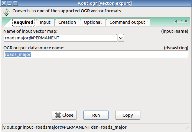
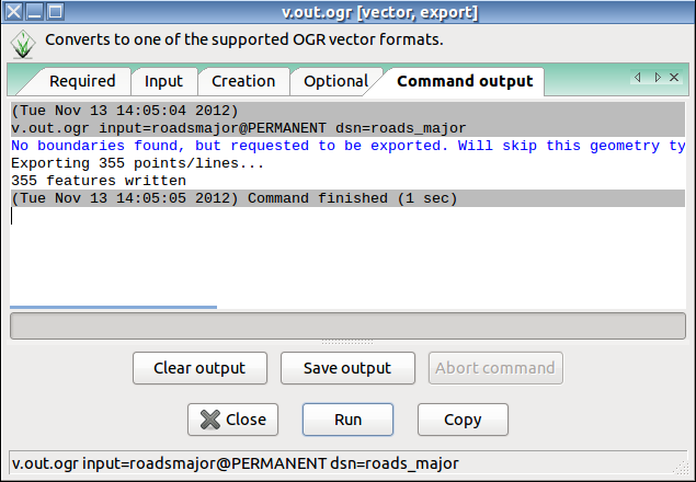
Using the module <code>v.out.ogr</code> it is possible to export native GRASS Vector data to a range of formats: | |||
ESRI_Shapefile,MapInfo_File,TIGER,S57,DGN,Memory,BNA,CSV,GML,GPX,KML,GeoJSON,GMT,SQLite,ODBC,MSSQLSpatial, | |||
PostgreSQL,MySQL,PCIDSK,DXF,Geoconcept,GeoRSS,GPSTrackMaker,PGDump,GPSBabel, | |||
[[File:Vector_out_ogr.png|400px]] | |||
[[File:Vector_layer_export.png|400px]] | |||
Introductory information on [http://grass.ibiblio.org/grass63/manuals/html63_user/vectorintro.html vector data processing] is available from the help manual. | |||
http://grass. | |||
===[[Grass Six Tutorial Attribute Management]]=== | ===[[Grass Six Tutorial Attribute Management]]=== | ||
| Line 58: | Line 168: | ||
management; Managing the default settings; Examples; | management; Managing the default settings; Examples; | ||
Database Schema | Database Schema | ||
[[File:Catsnlayers.png|800px|thumb|alt=cats and layers in GRASS GIS|center|Figure 1 from [[Vector Database Management]]]] | |||
[[Category: Tutorial]] | |||
Latest revision as of 21:41, 24 March 2014
Vector data management
Importing Vector data
The GRASS modules v.in.* and v.out.* handle the importing and exporting of Vector datasets.
v.in.ogr is widely used and has simplified the import of vector data; OGR itself support a wide range of formats.
v.out.ogr always exports the entire vector map
Importing an ESRI Shapefile
The following code snippet is a simple usage of v.in.ogr, which imports an ESRI Shapefile into the native vector format:
v.in.ogr dsn=boundary_county.shp out=boundary_county
However, v.in.ogr has many options to import subsets (defined spatially or by SQL) and vector types
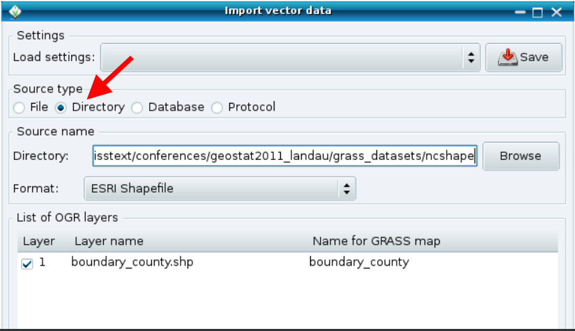
The same can be achieved using the GRASS Graphical Interface. The Vector import interface can be accessed through the vector layer manager:
You can easily import a subset of your data by specifying the spatial extent or an SQL query defined within the where command line argument:
v.in.ogr --o dsn=./ output=subset layer=boundary_county where="NAME = 'DUPLIN' OR NAME = 'WAKE'"
 +----------------------------------------------------------------------------+
| Layer:           subset                                                    |
| Mapset:          PERMANENT                                                 |
| Location:        nc_spm_08_geostat                                         |
| Database:        /home/daniel/GRASSWiki/data                               |
| Title:                                                                     |
| Map scale:       1:1                                                       |
| Map format:      native                                                    |
| Name of creator: daniel                                                    |
| Organization:                                                              |
| Source date:     Wed Nov  7 16:10:01 2012                                  |
|----------------------------------------------------------------------------|
|   Type of Map:  vector (level: 2)                                          |
|                                                                            |
|   Number of points:       0               Number of areas:      2          |
|   Number of lines:        0               Number of islands:    2          |
|   Number of boundaries:   2               Number of faces:      0          |
|   Number of centroids:    2               Number of kernels:    0          |
|                                                                            |
|   Map is 3D:              No                                               |
|   Number of dblinks:      1                                                |
|                                                                            |
|         Projection: Lambert Conformal Conic                                |
|               N:   258121.97732598    S:   106860.16001618                 |
|               E:   732841.78315847    W:   610047.98051883                 |
|                                                                            |
|   Digitization threshold: 0                                                |
|   Comments:                                                                |
|                                                                            |
+----------------------------------------------------------------------------+
Virtual link an ESRI Shapefile
If you prefer not to import your vector datasets into the native GRASS vector format, you can create a virtual link to it using v.external
This can be done as follows:
v.external dsn=./ output=boundary_county layer=boundary_county
Building topology for vector map <boundary_county>...
Number of nodes: 1707
Number of primitives: 1981
Number of points: 0
Number of lines: 0
Number of boundaries: 1055
Number of centroids: 926
Number of areas: 1055
Number of isles: 1055
Number of areas without centroid: 129
Import an XY/XYZ ASCII file
You can easily generate a GRASS point vector file from a text file containing X,Y coordinates.
642934|95324
675695|139878
623277|158224
716318|138568
742527|164776
735975|196227
755631|200158
Pipe the coordinates to the module v.in.ascii
cat coords.txt | v.in.ascii out=points
Add the categories to the vector points to facilitate attribute joins:
v.category in=points out=points_final op=add
v.category points_final op=report
You can then add a new attribute table to the vector file using v.db.addtable
v.db.addtable map=points
You can replicate the above procedure for three dimensional data (XYZ), by modifying the v.in.ascii argument list
You can easily generate a GRASS point vector file from a text file containing X,Y coordinates.
642934|95324|212
675695|139878|233
623277|158224|211
716318|138568|219
742527|164776|240
735975|196227|221
755631|200158|210
cat coords.txt | v.in.ascii -z out=points
Import an XY table from a DBMS or Spreadsheet
If you have a list of coordinates (x,y) with associated attributes stored in a spreadsheet table (DBF, CSV, Excel, etc). It's fairly easy to generate a map from them using v.in.db. In the following example, we import the table, meteostations that has the columns 'east', 'north', 'quota' (z) and some attribute columns.
v.in.db driver=pg database="host=myserver.itc.it,dbname=mydb,user=name" table=meteostations x=east y=north z=quota key=id output=meteostations
This command creates the new vector map (native format) with attributes table in a DBF file.
We can display these points in a display monitor and query them as follows:
d.mon start=x0
d.vect meteostations
d.what.vect
Importing a DXF file
Both 2D and 3D DXF files can be imported into GRASS using the module v.in.dxf. This can be done very simply from the command-line as follows
v.in.dxf -1 Masterplanxy.dxf
 100%
Following DXF layers found:
Layer 1: line
Building topology for vector map <Masterplanxy>...
Registering primitives...
64302 primitives registered
405521 vertices registered
Building areas...
 100%
0 areas built
0 isles built
Attaching islands...
Attaching centroids...
 100%
Number of nodes: 71142
Number of primitives: 64302
Number of points: 0
Number of lines: 64302
Number of boundaries: 0
Number of centroids: 0
Number of areas: 0
Number of isles: 0
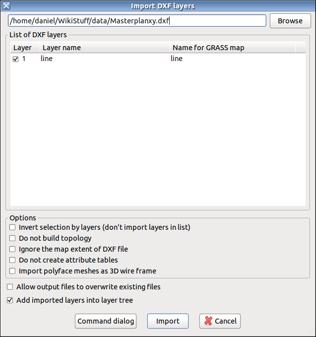
This can also be done using the GUI interface
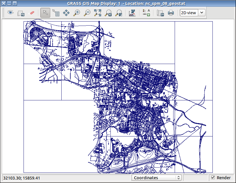
And then visualised within the map display
Exporting Vector data
Using the module v.out.ogr it is possible to export native GRASS Vector data to a range of formats:
  ESRI_Shapefile,MapInfo_File,TIGER,S57,DGN,Memory,BNA,CSV,GML,GPX,KML,GeoJSON,GMT,SQLite,ODBC,MSSQLSpatial,
  PostgreSQL,MySQL,PCIDSK,DXF,Geoconcept,GeoRSS,GPSTrackMaker,PGDump,GPSBabel,
Introductory information on vector data processing is available from the help manual.
Grass Six Tutorial Attribute Management
http://grass.osgeo.org/grass57/tutorial/attrib_storage.html
       - General notes on Attribute
         management; Managing the default settings; Examples;
         Database Schema
