WCS: Difference between revisions
Jump to navigation
Jump to search
(added some WCS endpoints and info about EuroGEOSS brokder) |
m (remove hardcoded version specific urls, use latest version) |
||
| Line 11: | Line 11: | ||
== Using WCS in GRASS GIS == | == Using WCS in GRASS GIS == | ||
One option is to register the WCS service via {{cmd|r.external | One option is to register the WCS service via {{cmd|r.external}}. | ||
First create ASCII file with this content, named e.g. "wcs_geoserver_LL.wcs": | First create ASCII file with this content, named e.g. "wcs_geoserver_LL.wcs": | ||
Latest revision as of 10:08, 4 December 2018
This page OGC Web Coverage Services (WCS) support in GRASS GIS.
Metasites and collections of WCS servers
- US Daily NDVI WCS 2011
- Global Drought WCS
- More WCS endpoints can be obtained by searching the EuroGEOSS Broker and by specifying Web Coverage Service in the Keyword section.
Using WCS in GRASS GIS
One option is to register the WCS service via r.external.
First create ASCII file with this content, named e.g. "wcs_geoserver_LL.wcs":
<WCS_GDAL>
  <ServiceURL>http://demo.opengeo.org/geoserver/wcs?</ServiceURL>
  <CoverageName>Img_Sample</CoverageName>
</WCS_GDAL>
or simply download this file from here.
Start GRASS in a latlong location (EPSG 4326), then register the WCS file:
r.external input=wcs_geoserver_LL.wcs output=wcs_data
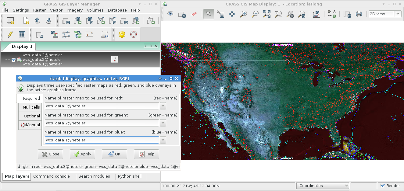
Then you can look at the map in the wxGUI map display:

In order to limit the WCS to a bounding box (e.g. from current region) a GDAL vrt file can be created from the WCS ASCII file using gdalbuildvrt:
gdalbuildvrt wcs_geoserver_LL_BB.vrt wcs_geoserver_LL.wcs -te xmin ymin xmax ymax