Performance comparison GRASS vs. ArcGIS: Difference between revisions
Jump to navigation
Jump to search
⚠️Wenzeslaus (talk | contribs) (add see also section) |
m (remove under construction notice) |
||
| (2 intermediate revisions by 2 users not shown) | |||
| Line 1: | Line 1: | ||
[[Category:ArcGIS]] | [[Category:ArcGIS]] | ||
== Longest flow path == | |||
''The r.accumulate module implements a fast longest flow path algorithm for hydrologic modeling.'' ([https://twitter.com/HuidaeCho/status/1279868419119210497 Quote: Twitter], [https://doi.org/10.1016/j.envsoft.2020.104774 Test: Paper]) | |||
== Vector buffer (special case) == | == Vector buffer (special case) == | ||
| Line 11: | Line 14: | ||
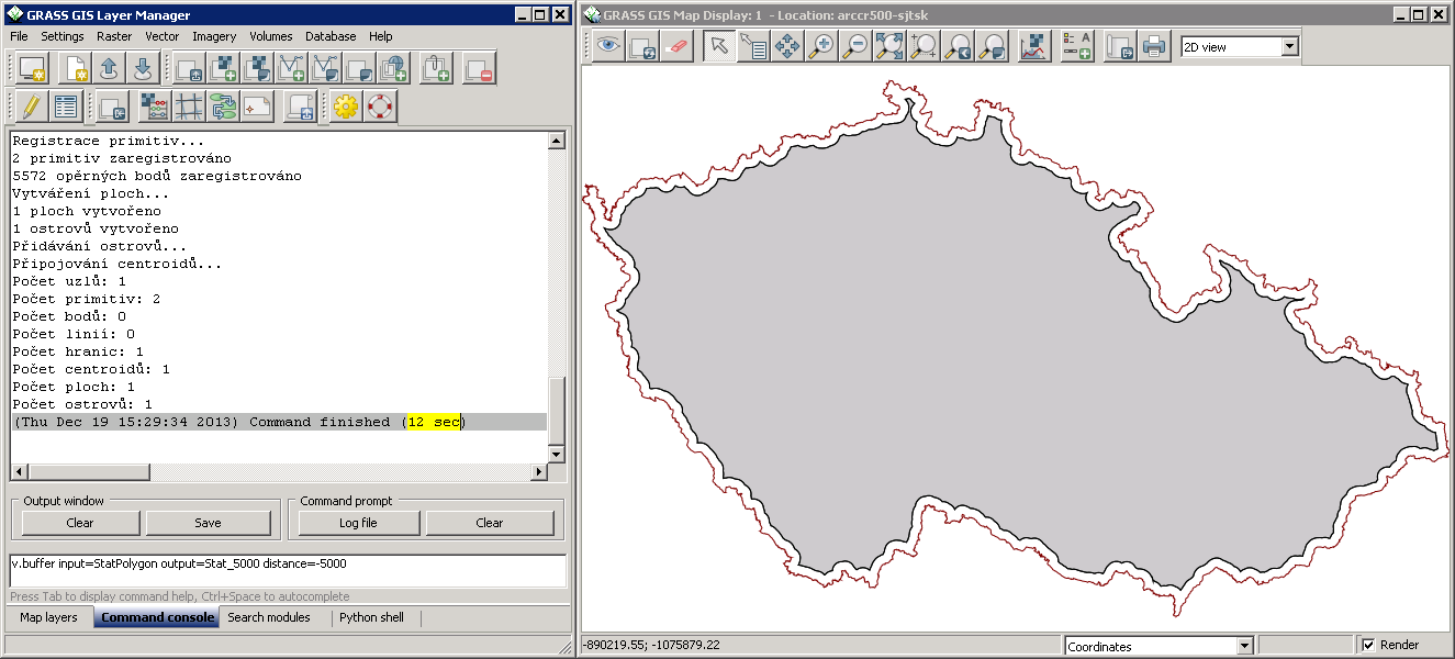
{{fig|buffer-negative-distance|Vector buffer with negative distance (GRASS)|size=640}} | {{fig|buffer-negative-distance|Vector buffer with negative distance (GRASS)|size=640}} | ||
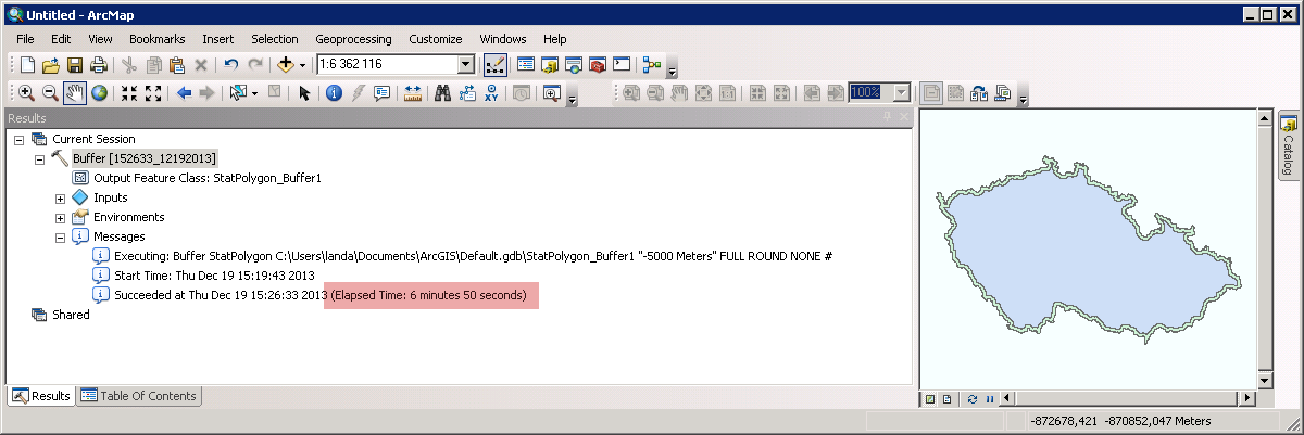
{{fig|arcgis-buffer-negative-distance|Vector buffer with negative distance (ArcGIS)|size=640}} | {{fig|arcgis-buffer-negative-distance|Vector buffer with negative distance (ArcGIS)|size=640}} | ||
== Clipping Contest Benchmark == | |||
ContourClipTest with ArcGIS, QGIS, GlobalMapper, Manifold, JGRASS ... (tests done in 2011): | |||
https://courses.neteler.org/arcgis-vs-qgis-etc-clipping-contest-rematch-revisited/ | |||
== See also == | == See also == | ||
* [[GRASS GIS Performance]] | * [[GRASS GIS Performance]] | ||
Latest revision as of 03:12, 3 February 2025
Longest flow path
The r.accumulate module implements a fast longest flow path algorithm for hydrologic modeling. (Quote: Twitter, Test: Paper)
Vector buffer (special case)
- Task: Create buffer around vector polygon with negative distance
- Input data: Vector layer 'StatPolygon' from ArcCR500 dataset
- Comparison: Windows Server Enterprise • Intel Xeon CPU E5520 2.27GHz 2.26GHz (2 processors) • 8GB • 64bit OS
- GRASS 7:
v.buffer input=StatPolygon output=Stat_5000 distance=-5000→ 12sec - ArcGIS 10.2.0:
Buffer StatPolygon Stat_5000 "-5000 Meters" FULL ROUND NONE→ 6min 50sec
- GRASS 7:


Clipping Contest Benchmark
ContourClipTest with ArcGIS, QGIS, GlobalMapper, Manifold, JGRASS ... (tests done in 2011):
https://courses.neteler.org/arcgis-vs-qgis-etc-clipping-contest-rematch-revisited/