Planetary mapping: Difference between revisions
Jump to navigation
Jump to search
(+ Further references) |
No edit summary |
||
| Line 87: | Line 87: | ||
* Deuchlera, C., Wählischa, M., Gehrkeb, S., Haubera, E., Obersta, J., Jaumanna, R. (2004): Combining Mars Data in GRASS GIS for Geological Mapping. Conference: XXth Congress ISPRS, Istanbul, Turkey, 12-23 July 2004 [ [https://misc.gis.tu-berlin.de/igg/htdocs-kw/fileadmin/user_upload/Gehrke/Papers/0407_ISPRS_Istanbul_GRASS.pdf PDF] ] | * Deuchlera, C., Wählischa, M., Gehrkeb, S., Haubera, E., Obersta, J., Jaumanna, R. (2004): Combining Mars Data in GRASS GIS for Geological Mapping. Conference: XXth Congress ISPRS, Istanbul, Turkey, 12-23 July 2004 [ [https://misc.gis.tu-berlin.de/igg/htdocs-kw/fileadmin/user_upload/Gehrke/Papers/0407_ISPRS_Istanbul_GRASS.pdf PDF] ] | ||
* Fonte, S., Frigeri, A., De Sanctis, M. C., Ammannito, E., Palomba, E., Magni, G., Capria, M. T., Capaccioni, F., Carraro, F., Tosi, F., Zambon, F., Turrini, D., Federico, C., Farina, M. (2012): Using GRASS GIS as a planning tool for VIR instrument onboard Dawn mission. European Planetary Science Congress 2012, held 23-28 September, 2012 in Madrid, Spain. https://ui.adsabs.harvard.edu/abs/2012epsc.conf..810F/abstract, id. EPSC2012-810 [ [https://meetingorganizer.copernicus.org/EPSC2014/EPSC2014-451.pdf PDF] ] | * Fonte, S., Frigeri, A., De Sanctis, M. C., Ammannito, E., Palomba, E., Magni, G., Capria, M. T., Capaccioni, F., Carraro, F., Tosi, F., Zambon, F., Turrini, D., Federico, C., Farina, M. (2012): Using GRASS GIS as a planning tool for VIR instrument onboard Dawn mission. European Planetary Science Congress 2012, held 23-28 September, 2012 in Madrid, Spain. https://ui.adsabs.harvard.edu/abs/2012epsc.conf..810F/abstract, id. EPSC2012-810 [ [https://meetingorganizer.copernicus.org/EPSC2014/EPSC2014-451.pdf PDF] ] | ||
* Frigeri, A., Federico, C., Pauselli, C. and Minelli, G., 2004. Identifying Wrinkle Ridges from Mars MGS and Viking Mission Data: Using GRASS GIS in Planetary Geology. Transactions in GIS, 8(2), pp.255-262. [ [https://www.academia.edu/download/51323283/j.1467-9671.2004.00180.x20170112-19963-1c6dbu8.pdf PDF] ] | |||
[[Category:Applications]] | [[Category:Applications]] | ||
[[Category:Documentation]] | [[Category:Documentation]] | ||
Latest revision as of 18:51, 6 May 2024
GIS Support
- GRASS lat/lon regions may be used as 0-360 longitude, not just 180 east+west.
- In GRASS 6 you can set and add custom ellipsoids, see the g.setproj module. Permanently adding custom ellipsoids can be done by hand, the config tables for that are plain self-documenting text files, so reasonably easy to edit. An ellipse table with planetary spheroids (to put as $GISBASE/etc/*.table files) is available here.
- GRASS 7 now includes the planetary ellipsoid tables and support is present in the wxGUI location wizard.
- GRASS 7 now includes the IAU2009 IAU2000 Key support in the wxGUI location wizard.
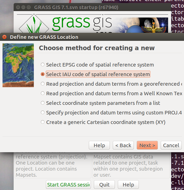
Getting Started with both ISIS3 & GRASS
- GRASS 7 now recognizes ISIS3.x installation and runs automatically the ISIS-GRASS bridge, CLI prompt is set to ISIS-GRASS. ISIS commands are available through the ISIS-GRASS command prompt, more details in GRASS Location Wizard.
Getting Started with using ISIS3 data in GRASS
- You can create a GRASS Location based on ISIS3 .cub raster directly
- r.external can read natively the .cub rasters inside ISIS3 data directory (no need import)
- If you want to import into GRASS any .cub from ISIS3 use r.in.gdal
Open Issues
- r.external complains about 'Mars' datum unknown
- r.out.gdal exports 'unknown' ellipsoids / datums, and also the reference meridian is named 'Greenwich'
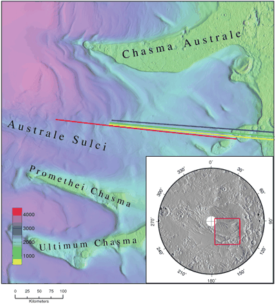
Example of the use of GRASS GIS in Planetary Research
GRASS ps.map output as published in an article in the journal Science.
Data
Data summary (1999):
http://publish.uwo.ca/~pjstooke/mapsummy.txt
Modules
- r.in.gdal will handle HDF and netCDF and many many more formats
- r.in.bin will load raw binary data
- see also the GRASS and GMT wiki page for interfacing with GMT Mapping Tools
- r.crater is an addon module for GRASS 7 which estimates the size of a gravity dominated impact crater, or alternatively works backwards to estimate the size of the projectile that made it.
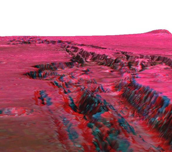
- d.anaglyph is an addon module for creating 3D stereo images. (see Stereoscopic analysis and Stereo anaglyphs wiki pages)
- Isis2grass is a set of tools to make Isis > 3.3.1 and GRASS work together.
- g.isis3mt: will output an ISIS3 Maptemplate according to the one currently used in the GRASS Location.
- isis-grass: a startup script that will setup a common command line interface from which both ISIS3 and GRASS commands may be called.
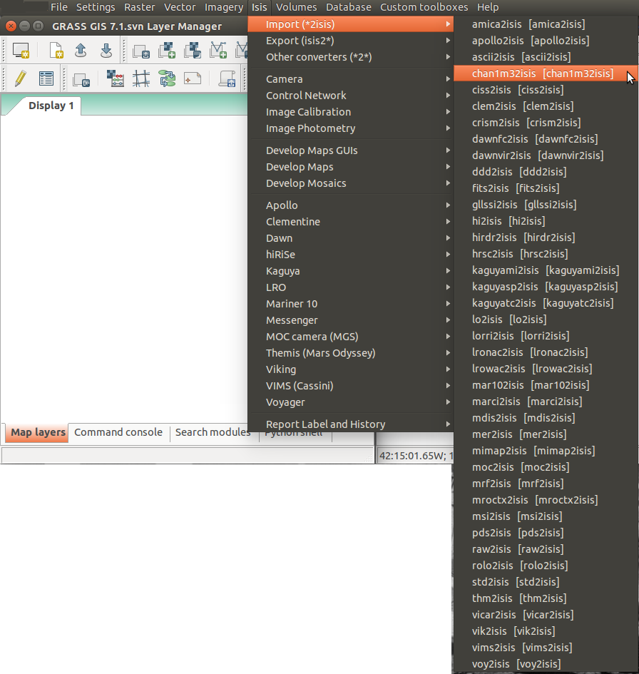
A script can generate on-the-fly an Isis Menu using the Toolboxes from wxGUI
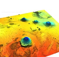
Mars topography
See tutorial in GRASSNews volume 1:
- Global dataset of bathymetry and topography. GRASS Newsletter, 1:8-11, August 2004. ISSN 1614-8746.
Screenshots
See also
- Frigeri, A, Hare, T, Neteler, M., Coradini, A, Federico, C, Orosei, R. (2011). A working environment for digital planetary data processing and mapping using ISIS and GRASS GIS. Planetary and Space Science, 59(11-12), pp.1265-1272 [ DOI | PDF ]
- these just define the simple reference ellipsoids, so dx=dy=dz=0.
- GRASS currently uses the IAU2000 definitions in the ellipse.table.solar.system file.
- iau2wkt: generates on the fly WKT descriptions from planetary bodies info
Further references
- Deuchlera, C., Wählischa, M., Gehrkeb, S., Haubera, E., Obersta, J., Jaumanna, R. (2004): Combining Mars Data in GRASS GIS for Geological Mapping. Conference: XXth Congress ISPRS, Istanbul, Turkey, 12-23 July 2004 [ PDF ]
- Fonte, S., Frigeri, A., De Sanctis, M. C., Ammannito, E., Palomba, E., Magni, G., Capria, M. T., Capaccioni, F., Carraro, F., Tosi, F., Zambon, F., Turrini, D., Federico, C., Farina, M. (2012): Using GRASS GIS as a planning tool for VIR instrument onboard Dawn mission. European Planetary Science Congress 2012, held 23-28 September, 2012 in Madrid, Spain. https://ui.adsabs.harvard.edu/abs/2012epsc.conf..810F/abstract, id. EPSC2012-810 [ PDF ]
- Frigeri, A., Federico, C., Pauselli, C. and Minelli, G., 2004. Identifying Wrinkle Ridges from Mars MGS and Viking Mission Data: Using GRASS GIS in Planetary Geology. Transactions in GIS, 8(2), pp.255-262. [ PDF ]