IconSymbols: Difference between revisions
(→Modules: rotate) |
|||
| (74 intermediate revisions by 3 users not shown) | |||
| Line 7: | Line 7: | ||
''Note that starting with GRASS 6.3 many modules can rotate a symbol by a given angle.'' | ''Note that starting with GRASS 6.3 many modules can rotate a symbol by a given angle.'' | ||
* | * {{cmd|ps.map}} ''point'' command | ||
* {{cmd|ps.map}} ''vpoints'' command | |||
* | * {{cmd|d.graph}} (Icon support was added for GRASS 6.1) | ||
* | * {{cmd|d.vect}} ''rot_column'' option in GRASS 6.4.1 and newer | ||
== Existing symbols == | == Existing symbols == | ||
* Browse built in symbol files in the [http:// | * Browse built in symbol files in the [http://trac.osgeo.org/grass/browser/grass/trunk/lib/symbol/symbol/ SVN Web interface] | ||
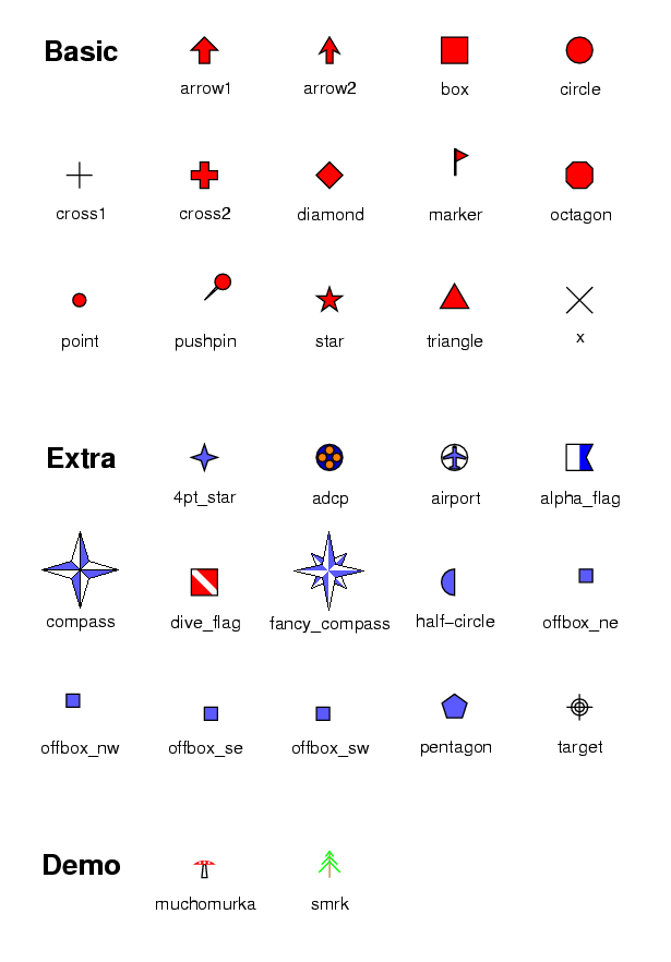
[[image:Symbols.png]] | [[image:Symbols.png]] | ||
* <tt>extra/bridge</tt> ''(picture not available)'' | === ''New'' === | ||
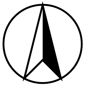
* <tt>extra/n_arrow1</tt>: [[image:Symb-n_arrow1.png]] and <tt>extra/n_arrow1b</tt>: [[image:Symb-n_arrow1b.png|60px]] | |||
* <tt>extra/n_arrow2</tt>: [[image:Symb-n_arrow2.png|30px]] | |||
* <tt>extra/n_arrow3</tt>: [[image:Symb-n_arrow3.png|30px]] | |||
* <tt>extra/n_arrow4</tt>: [[image:Symb-n_arrow4_with_N.png|60px]] (shown with a "N" text element placed above it) | |||
* <tt>extra/n_arrow5</tt>: [[image:Symb-n_arrow5.png|60px]] | |||
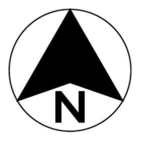
* <tt>extra/n_arrow6</tt>: [[image:Symb-n_arrow6.png|60px]] | |||
* <tt>extra/n_arrow7a</tt>: [[image:Symb-n_arrow7a.png|30px]] and <tt>extra/n_arrow7b</tt>: [[image:Symb-n_arrow7b.png|30px]] | |||
* <tt>extra/n_arrow8a</tt>: [[image:Symb-n_arrow8.png|60px]] and <tt>extra/n_arrow8b</tt>: [[image:Symb-n_arrow8b.png|60px]] | |||
* <tt>extra/n_arrow9</tt>: [[image:Symb-n_arrow9.png|30px]] | |||
* <tt>extra/fiducial</tt>: [[image:Fiducial_125.png]] (use 45 degree symbol rotation if you wish to align ticks with grid lines) | |||
* <tt>extra/simple_zia</tt>: [[image:Symb-simple_zia.png|45px]] | |||
* <tt>extra/ping</tt>: [[image:Symb-ping.png|23px]] | |||
* <tt>extra/half-box</tt>: [[image:Half-box.png|23px]] | |||
* <tt>extra/bridge</tt>: [[image:Symb-bridge.png]] | |||
* <tt>[[Symb-fish|extra/fish]]</tt>: [[Image:Symb-fish.png|42px]] | |||
* <tt>geology/strike_line,box,triangle,circle</tt>: [[Image:Symb-geo.png|300px]] | |||
* <tt>geology/strike_half-bowtie</tt>: [[Image:Symb-geo_bowtie.png|100px]] | |||
* <tt>geology/strike_cleavage, strike_parallel</tt> and <tt>circle_cross</tt>: [[Image:Symb-geol2.png| 200px]] | |||
:: <font size="-1">''second symbol above is <tt>strike_cleavage</tt> rotated four times''</font> | |||
: (ps.map can take rotation angle from an attribute column for each site with the '''''vpoints''' rotatecolumn'' instruction; to make open symbols set the fill color to 'none'; to make a double sided dip symbol draw the same symbol twice with 180 rotation between the two commands, or four times with 0,90,180,270 degree rotation) | |||
* <tt>geology/half-arrow_left,right</tt>: [[Image:Half_arrow_x2.png]] (two left-side half-arrows shown, one of which has been rotated 180 degrees) | |||
* <tt>extra/ring</tt>: <span style="color:#000090"><font size="+2">Ο</font></span> | |||
* <tt>extra/dim_arrow</tt>: [[image:Symb-dim_arrow.png|60px]] | |||
<!-- * <tt>extra/newsymb</tt>: ''(picture not available)'' --> | |||
== Combinations == | |||
You can overlay and rotate symbols to create combinations or color codes. For example: | |||
: [[Image:Circross-overlay.png|40px]][[Image:Half-overlay.png|120px]] | |||
== Contributions == | == Contributions == | ||
| Line 180: | Line 213: | ||
==== Example of a BUS ==== | ==== Example of a BUS ==== | ||
by Michael ODonovan | |||
bus.png: | bus.png: | ||
[[Image:bus.png]] | [[Image:bus.png]] | ||
| Line 250: | Line 283: | ||
</pre> | </pre> | ||
==== Thinner filled arrow ==== | |||
by H.Bowman [[Image:Thinner_arrow_symbol.png]] ''(basic/arrow2 in newer versions of GRASS)'' | |||
VERSION 1.0 | |||
BOX -0.75 -0.75 0.75 0.75 | |||
POLYGON | |||
RING | |||
LINE | |||
0 1 | |||
0.55 0 | |||
0.2 0 | |||
0.2 -1 | |||
-0.2 -1 | |||
-0.2 0 | |||
-0.55 0 | |||
0 1 | |||
END | |||
END | |||
END | |||
==== Thinner filled cross ==== | |||
by H.Bowman [[Image:Thinner_cross_symbol.png]] ''(basic/cross2 in newer versions of GRASS)'' | |||
VERSION 1.0 | |||
BOX -1.3 -1.3 1.3 1.3 | |||
POLYGON | |||
RING | |||
LINE | |||
-0.3 1.3 | |||
0.3 1.3 | |||
0.3 0.3 | |||
1.3 0.3 | |||
1.3 -0.3 | |||
0.3 -0.3 | |||
0.3 -1.3 | |||
-0.3 -1.3 | |||
-0.3 -0.3 | |||
-1.3 -0.3 | |||
-1.3 0.3 | |||
-0.3 0.3 | |||
END | |||
END | |||
END | |||
==== Zig-zag ==== | |||
by H.Bowman | |||
VERSION 1.0 | |||
BOX -1.5 -1.5 1.5 1.5 | |||
POLYGON | |||
RING | |||
LINE | |||
-1.5 1.5 | |||
-0.5 1.5 | |||
-0.5 0.5 | |||
1.5 0.5 | |||
1.5 -1.5 | |||
0.5 -1.5 | |||
0.5 -0.5 | |||
-1.5 -0.5 | |||
END | |||
END | |||
END | |||
=== More simple symbols === | |||
Some circle, triangle, diamond and box variations by Martin Povolny: http://github.com/martinpovolny/grass-symbols-simple | |||
Available for any use by anyone. | |||
Very nice: http://mapicons.nicolasmollet.com/ (Creative Commons 3.0 BY-SA, Author : Nicolas Mollet) | |||
== | == Other contributions == | ||
=== Symbol families === | === Symbol families === | ||
Add-on symbol packages for download | Add-on symbol packages for download | ||
* Convert SVG to EPS format (for use with ps.map) with the following command: | |||
: (requires [http://www.inkscape.org Inkscape]) | |||
inkscape -z -T -E outputfile.eps inputfile.svg | |||
* If Inkscape chokes on a large SVG file: try opening it in Firefox, then go into Print Setup and turn off page number and URL decorations, and Print → To File. This will save a PostScript file, which can be converted to .eps with the [http://www.tm.uka.de/~bless/ps2eps ps2eps] program (at least on Linux and Macs). As of Feb 2011, this method works much better than using recent versions of Scribus, Karbon, or Adobe Illustrator (all of which did a terrible job). | |||
* We still need someone to write a little script to convert EPS images into GRASS's display symbol format. It would be nice if the same converter could create {{cmd|d.graph}} drawing commands as well. This would go nicely as a [[GRASS_SoC_Ideas_2012#Cartography and display|Google Summer of Code]] project. | |||
==== North Arrows ==== | |||
* http://www.gfoss.it/download/ (Free Italian Symbol set in SVG from [http://www.gfoss.it/drupal/simboli GFOSS.it]) | |||
* A collection of EPS [http://www.esf.edu/la/resources/GOL/north/2D_vector/default.htm North Arrows] from [http://www.esf.edu/la/resources/GOL/GOL_main.htm SUNY ESF] | |||
==== Hydrology symbols ==== | ==== Hydrology symbols ==== | ||
| Line 262: | Line 378: | ||
==== Geology symbols ==== | ==== Geology symbols ==== | ||
* http://www.gfoss.it/download/ (Free Italian Symbol set in | * http://www.gfoss.it/download/ (Free Italian Symbol set in SVG from [http://www.gfoss.it/drupal/simboli GFOSS.it]) | ||
==== National Park Service symbols ==== | |||
* Set of National Park Service symbols in EPS format from [http://www.trailgraphics.com/2009/03/trail-graphics-symbols-parksymbol-as-epspng/ trailgraphics.com] | |||
==== Tree symbols ==== | |||
* Alberi: http://www.gfoss.it/download/ (Free Italian Symbol set in SVG from [http://www.gfoss.it/drupal/simboli GFOSS.it]) | |||
* A collection of EPS [http://www.esf.edu/la/resources/GOL/trees/2D_vector/plan/index.htm plan-view trees] from [http://www.esf.edu/la/resources/GOL/GOL_main.htm SUNY ESF] | |||
==== Weather symbols ==== | ==== Weather symbols ==== | ||
''See also the [[Meteorology]] wiki page.'' | |||
* http://www.gfoss.it/download/ (Free Italian Symbol set in SVG from [http://www.gfoss.it/drupal/simboli GFOSS.it]) | |||
some ideas here: | some ideas here: | ||
| Line 271: | Line 400: | ||
* <nowiki>http://weatheroffice.ec.gc.ca/data/analysis/jac00_100.gif</nowiki> | * <nowiki>http://weatheroffice.ec.gc.ca/data/analysis/jac00_100.gif</nowiki> | ||
* http://ows.public.sembach.af.mil/index.cfm?section=SFCAnal | * http://ows.public.sembach.af.mil/index.cfm?section=SFCAnal | ||
* ''In progress'': The new {{AddonCmd|d.barb}} module to draw wind barbs. | |||
: Choice of arrows, ping symbol, stick, or classic wind barb | |||
: Choice of starting points from sparse vector map points (like {{cmd|d.vect}}) or regularly sampled from a raster grid (e.g. {{cmd|d.rast.arrow}} or Euler's method vector plot). | |||
==== Miscellaneous symbols ==== | |||
* SVG from [https://trac.osgeo.org/qgis/browser/trunk/qgis/images/svg QGIS's Subversion code repository] (see above for instructions on how to convert to .eps) | |||
* See a [http://thread.gmane.org/gmane.comp.gis.qgis.devel/17295 number of links to Free to use SVG symbols from the QGIS mailing list, Feb 2011] | |||
* TODO: convert to/from [http://gmt.soest.hawaii.edu/gmt/doc/gmt/html/GMT_Docs/node139.html GMT symbol format] (look in /usr/share/gmt/custom/*.def) | |||
[[Category:ps.map]] | |||
[[Category: Hydrology]] | |||
Latest revision as of 05:17, 11 July 2018
Authoring instructions
Modules
Note that starting with GRASS 6.3 many modules can rotate a symbol by a given angle.
- ps.map point command
- ps.map vpoints command
- d.graph (Icon support was added for GRASS 6.1)
- d.vect rot_column option in GRASS 6.4.1 and newer
Existing symbols
- Browse built in symbol files in the SVN Web interface
New
- extra/n_arrow1:
 and extra/n_arrow1b:
- extra/n_arrow2:

- extra/n_arrow3:

- extra/n_arrow4:
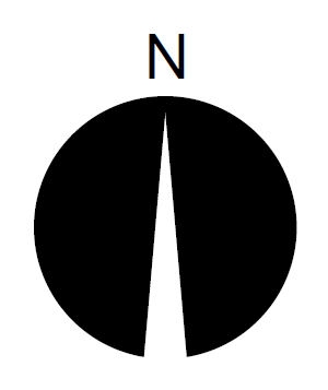 (shown with a "N" text element placed above it)
 - extra/n_arrow5:

- extra/n_arrow6:
- extra/n_arrow7a:
 and extra/n_arrow7b:
- extra/n_arrow8a:
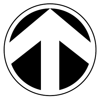 and extra/n_arrow8b:
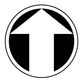
- extra/n_arrow9:
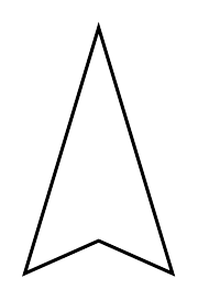
- extra/fiducial:
 (use 45 degree symbol rotation if you wish to align ticks with grid lines)
 - extra/simple_zia:
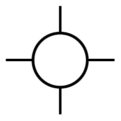
- extra/ping:

- extra/half-box:

- extra/bridge:

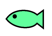
- extra/fish:
- geology/strike_line,box,triangle,circle:

- geology/strike_half-bowtie:

- geology/strike_cleavage, strike_parallel and circle_cross:

- second symbol above is strike_cleavage rotated four times
- (ps.map can take rotation angle from an attribute column for each site with the vpoints rotatecolumn instruction; to make open symbols set the fill color to 'none'; to make a double sided dip symbol draw the same symbol twice with 180 rotation between the two commands, or four times with 0,90,180,270 degree rotation)
- geology/half-arrow_left,right:
 (two left-side half-arrows shown, one of which has been rotated 180 degrees)
 - extra/ring: Ο
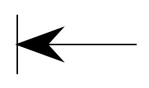
- extra/dim_arrow:
Combinations
You can overlay and rotate symbols to create combinations or color codes. For example:
Contributions
Please include a small example graphic.
Also please include your name and some sort of license information.
e.g. "(c) 2005 Sara Grassuser, released into the public domain without restriction". This way others may freely improve and further distribute your work (e. g. it can be added to the official GRASS release).
Install in $GISBASE/etc/symbol/custom/ or $MAPSET/symbol/group/
(c) Examples released by Michael O'Donovan into public domain without restriction
Example of a BANK
VERSION 1.0
BOX -1 -1 1 1
POLYGON
  RING
         LINE
         -1      -1
         -1       0.5
          0       1
          1       0.5
         1      -1
          0.75  -1
          0.75  -0.20
          0.25  -0.2
          0.25  -1
        -0.25    -1
        -0.25    -0.2
        -0.75    -0.20
        -0.75     -1
                END
        END
END
Example of a SHACK
VERSION 1.0
BOX -1 -1 1 1
POLYGON
  RING
         LINE
         1      -1
         0      -1
         0       0
        -0.5     0
        -0.5     -1
        -1      -1
        -1       0.5
         1       0.5
        END
END
RING
  LINE
         0.3  -0.25
         0.85 -0.25
         0.85  0.3
         0.3    0.3
        END
 END
END
Example of TRAIN
VERSION 1.0
BOX -1 -1 1 1
POLYGON
 FCOLOR 0 0 0
  RING
        ARC 0.85 -0.7 0.2 360 0 C        END
          END
        ARC 0.45 -0.7 0.2 360 0 C        END
          END
        ARC -0.45 -0.7 0.2 360 0 C       END
          END
        RING
         ARC -0.85 -0.7 0.2 360 0 C      END
        END
END
POLYGON
RING
         LINE
         1 -0.5
        -1 -0.5
        -1  0.45
         1  0.45
        END
END
RING
  LINE
         0.99 0
         0.99 0.4
         0.7  0.4
         0.7  0
        END
  END
END
RING
 FCOLOR 255 255 255
 POLYGON
  LINE
         0.65  0.55
         0.95  0.75
         0.65  1
         0.25  0.75
        END
 END
END
Example of a FACTORY
by MichaelODonovan
factory.png:

VERSION 1.0
BOX -1 -1 1 1
POLYGON
  RING
         LINE
         1 -1
        -1 -1
        -1  0.2
         -0.23 -0.3
         -0.23 0.2
         0.7 -0.3
         0.7 .5
         1 .5
        END
 END
END
POLYGON
RING
        FCOLOR 0 0 0
        ARC 0.85 0.7 0.1 360 0 C         END
        ARC 0.85 0.92 0.15 360 0 C       END
  END
END
Example of a BUS
VERSION 1.0
BOX -1 -1 1 1
POLYGON
 FCOLOR 0 0 0
  RING
        ARC 0.65 -0.7 0.28 360 0 C       END
          END
        RING
         ARC -0.65 -0.7 0.28 360 0 C     END
        END
END
POLYGON
RING
FCOLOR 255 0 0
         LINE
         1 -0.5
        -1 -0.5
        -1  0.55
        0.8 0.55
         1  0
        END
END
RING
  LINE
         0.95 0
        -0.75 0
        -0.75 0.48
        0.8 0.48
        END
 END
END
Example of a HEADGEAR
by MichaelODonovan
headger.png:

VERSION 1.0
BOX -1 -1 1 1
POLYGON
  RING
        ARC 0.5 0.5 0.3 360 0 C  END
        END
RING
FCOLOR 255 0 0
ARC 0.5 0.5 0.4 360 0 C  END
END
RING
LINE
        0 -1
        0.5 0.5
        .7 0.5
        1 -1
        END
        END
RING
         LINE
          0.15 0.75
         -1 -1
        END
END
Thinner filled arrow
by H.Bowman ![]() (basic/arrow2 in newer versions of GRASS)
(basic/arrow2 in newer versions of GRASS)
VERSION 1.0
BOX -0.75 -0.75 0.75 0.75
POLYGON
  RING
    LINE
      0 1
      0.55 0
      0.2 0
      0.2 -1
      -0.2 -1
      -0.2 0
      -0.55 0
      0 1
    END
  END
END
Thinner filled cross
by H.Bowman ![]() (basic/cross2 in newer versions of GRASS)
(basic/cross2 in newer versions of GRASS)
VERSION 1.0
BOX -1.3 -1.3 1.3 1.3
POLYGON
  RING
    LINE
     -0.3 1.3
     0.3 1.3
     0.3 0.3
     1.3 0.3
     1.3 -0.3
     0.3 -0.3
     0.3 -1.3
     -0.3 -1.3
     -0.3 -0.3
     -1.3 -0.3
     -1.3 0.3
     -0.3 0.3
    END
  END
END
Zig-zag
by H.Bowman
VERSION 1.0
BOX -1.5 -1.5 1.5 1.5
POLYGON
  RING
    LINE
     -1.5 1.5
     -0.5 1.5
     -0.5 0.5
     1.5 0.5
     1.5 -1.5
     0.5 -1.5
     0.5 -0.5
     -1.5 -0.5
    END
  END
END
More simple symbols
Some circle, triangle, diamond and box variations by Martin Povolny: http://github.com/martinpovolny/grass-symbols-simple Available for any use by anyone.
Very nice: http://mapicons.nicolasmollet.com/ (Creative Commons 3.0 BY-SA, Author : Nicolas Mollet)
Other contributions
Symbol families
Add-on symbol packages for download
- Convert SVG to EPS format (for use with ps.map) with the following command:
- (requires Inkscape)
inkscape -z -T -E outputfile.eps inputfile.svg
- If Inkscape chokes on a large SVG file: try opening it in Firefox, then go into Print Setup and turn off page number and URL decorations, and Print → To File. This will save a PostScript file, which can be converted to .eps with the ps2eps program (at least on Linux and Macs). As of Feb 2011, this method works much better than using recent versions of Scribus, Karbon, or Adobe Illustrator (all of which did a terrible job).
- We still need someone to write a little script to convert EPS images into GRASS's display symbol format. It would be nice if the same converter could create d.graph drawing commands as well. This would go nicely as a Google Summer of Code project.
North Arrows
- http://www.gfoss.it/download/ (Free Italian Symbol set in SVG from GFOSS.it)
- A collection of EPS North Arrows from SUNY ESF
Hydrology symbols
-
Geology symbols
- http://www.gfoss.it/download/ (Free Italian Symbol set in SVG from GFOSS.it)
National Park Service symbols
- Set of National Park Service symbols in EPS format from trailgraphics.com
Tree symbols
- Alberi: http://www.gfoss.it/download/ (Free Italian Symbol set in SVG from GFOSS.it)
- A collection of EPS plan-view trees from SUNY ESF
Weather symbols
See also the Meteorology wiki page.
- http://www.gfoss.it/download/ (Free Italian Symbol set in SVG from GFOSS.it)
some ideas here:
- http://www.meteor.wisc.edu/~hopkins/aos100/sfc-anl.htm
- http://www.weather.org.uk/resource/wwsymbol.htm
- http://weatheroffice.ec.gc.ca/data/analysis/jac00_100.gif
- http://ows.public.sembach.af.mil/index.cfm?section=SFCAnal
- In progress: The new d.barb module to draw wind barbs.
- Choice of arrows, ping symbol, stick, or classic wind barb
- Choice of starting points from sparse vector map points (like d.vect) or regularly sampled from a raster grid (e.g. d.rast.arrow or Euler's method vector plot).
Miscellaneous symbols
- SVG from QGIS's Subversion code repository (see above for instructions on how to convert to .eps)
- See a number of links to Free to use SVG symbols from the QGIS mailing list, Feb 2011
- TODO: convert to/from GMT symbol format (look in /usr/share/gmt/custom/*.def)
