Working with external data in GRASS 7: Difference between revisions
Jump to navigation
Jump to search
| Line 30: | Line 30: | ||
{{cmd|v.external}} dsn="PG:dbname=grass" layer=obce_b output=obce_b | {{cmd|v.external}} dsn="PG:dbname=grass" layer=obce_b output=obce_b | ||
{{cmd|v.out.ascii}} input=obce_b | head | {{cmd|v.out.ascii}} input=obce_b | head | ||
Revision as of 15:19, 20 January 2011
This page explains how to work with external data in GRASS 7.
- (to be expanded)
Raster data
External raster data can be linked via r.external. List of supported formats can be determined by
r.external -f
To link file-based data formats, eg. GeoTiff
r.external input=ncrast/urban.tif output=urban
Vector data
External vector data can be linked via v.external. List of supported formats can be determined by
v.external -f
To link file-based data formats, eg. ESRI Shapefile
v.external dsn=ncshape/ layer=railroads output=railroads
Assuming that 'railroads.shp' is located in directory 'ncshape'.
Write access
The module also supports write access to the external data (currently only geometry can be edited). Showcase bellow:
v.external dsn="PG:dbname=grass" layer=obce_b output=obce_b
v.out.ascii input=obce_b | head
-742600|-1043000|0
-728486|-1079285|1
-698411|-1095121|2
-716384|-1083350|3
-694125|-1101920|4
-706726|-1097059|5
-732348|-1074146|6
-730615|-1084553|7
-713628|-1086298|8
-717184|-1075855|9
Using wxGUI
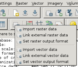
From menu
File -> Link external formats

or from toolbar in Layer Manager.

