WxGUI WMS service rendering GSoC 2011: Difference between revisions
| Line 4: | Line 4: | ||
== State of the art == | == State of the art == | ||
The project uses WMS service to fetch images of the maps. The Get Feature service of WMS services provides a GML based interface to access the information about various layers available. The WMS layer knowledge is used to update the GUI of the GRASS according to the available features for a particular layer. Thw WX-GUI is to be modified and to be integrated with the WMS services. | |||
== Bulletin Board == | == Bulletin Board == | ||
Revision as of 18:11, 24 May 2011
Aim of the project
This project aims to introduce several features that make WXGUI more user-friendly. These include adding WMS layer support for WXGUI. The selection features will be displayed as per the based on service GetCapabilities response. The parameters and the layers are to be displayed are extracted out of the xml response.
State of the art
The project uses WMS service to fetch images of the maps. The Get Feature service of WMS services provides a GML based interface to access the information about various layers available. The WMS layer knowledge is used to update the GUI of the GRASS according to the available features for a particular layer. Thw WX-GUI is to be modified and to be integrated with the WMS services.
Bulletin Board
Documentation
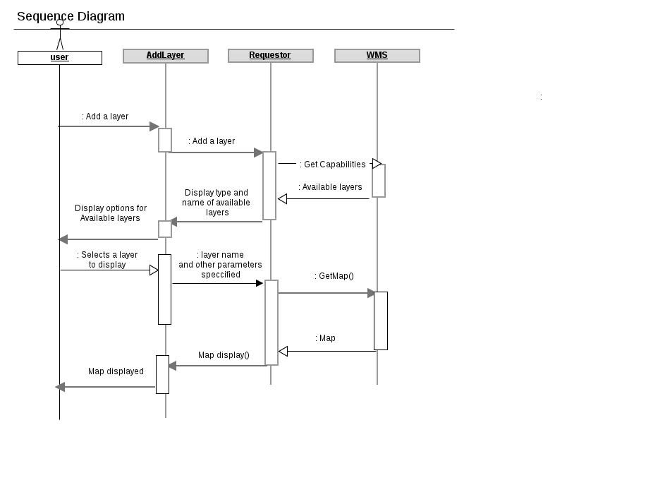
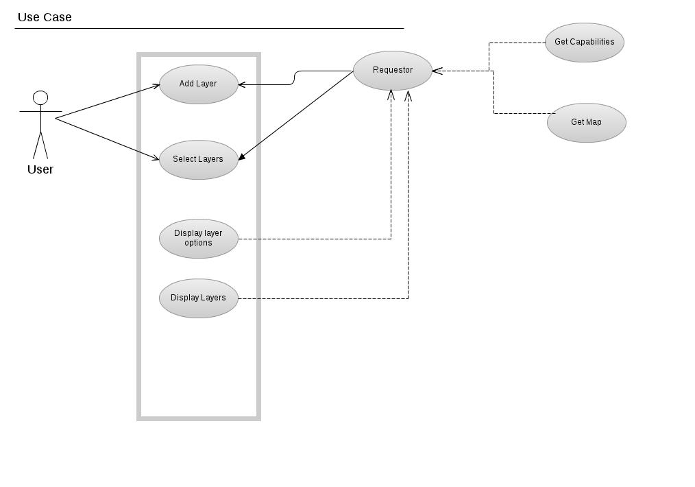
The sequence diagram and use case diagram for the proposed Gsoc project are shown below

