Talk:GRASS Community Sprint Prague 2012: Difference between revisions
| Line 179: | Line 179: | ||
=== Signal handling === | === Signal handling === | ||
* The Python based scripts should catch CTRL-C to avoid that clutter is left behind | * The Python based scripts should catch CTRL-C to avoid that clutter is left behind & that ugly traceback messages are printed to the terminal. | ||
Suggestion by Anne Ghisla (yet not working... ): | Suggestion by Anne Ghisla (yet not working... ): | ||
Revision as of 23:35, 26 May 2012
Reports
Martin Landa
- OSGeo4W GRASS package configuration: added libLAS support (http://liblas.org/osgeo4w.html) - r51677 & r51679
- various wxGUI fixes
Markus Metz
- R-tree made n-dimensional (from 3D) for temporal GIS support - esp. r51799
Markus Neteler
- Fundraising for this Community Sprint (with great help from Arnulf Christl)
- PSC composition discussion
- fix r.lake segfault for seed map (r51752) together with Markus Metz
- backport of wxGUI language selector (.bat file update yet missing for Windows) - together with Luca Delucchi
- Lidar DEM based example added to r.lake
- Testing QGIS-Sextante-GRASS integration:
- Location is generated on the fly, excellent
- v.buffer works
- r.terraflow works but result is not shown
- Parameter descriptions are lacking in the internal control files (params/flags are duplicated), reported as http://hub.qgis.org/issues/5645
- GRASS integration should use private, not user's .grassrc6 file, reported as http://hub.qgis.org/issues/5644
Anna Kratochvilova
- wxGUI/digitizer: add help button to digitizer toolbar (r51742)
- wxGUI: fix histogram tool (the one using the d.histogram) (r51753)
- wxNviz: revert changes in zexag and improve its behaviour for latlon projections (r51695)
Milena Nowotarska
- WinGRASS bug hunting
- translation
Wishes for the Community Sprint
- Visual Guide to GRASS GIS modules: scratch a collection of per-module dedicated||or tutorial/task oriented, simple, minimalistic yet attractive, bullet-proof visual examples
- exemplify what GRASS modules do rather than how they do it, thus different than the manuals -- rephrase title?
- make use of existing grass modules list(s), like (this old) GRASS GIS 6.3 Command list (PDF document)
- visuals should clearly refer to both commands (CLI) and (their) respective menu entry (in GUI)
- ignore modules which cannot be visualised?
- check if (and some-how) task-oriented visual examples could be build out of per-modules examples
- setup specific styling rules (?)
- only one descriptive sentence per module or task
- visuals clearly refer to both commands (CLI) and (their) respective menu entry (in GUI)
- limited caption(s) describing visuals
- end-up with some independent and beautiful TeXy PDF
- visually enrich existing manuals and/or grass-wiki
- or consider Sphinx
- Random examples
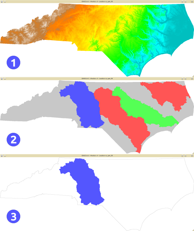
- Important concepts in GRASS-GIS' raster processing workflow
- exemplify what GRASS modules do rather than how they do it, thus different than the manuals -- rephrase title?
- Review of the python + ctypes example scripts.
- The examples given in the code for doc/python/raster_example_ctypes.py, vector_example_ctypes.py and on the Ctypes wiki page have so far for me all been broken in some way or another. Either grass7 API in grass6 example, typos, incomplete, etc. have made almost all of them fail out of the box. As this is teaching code we should make sure it's perfect :-). See also bug in trac about possible memory leak in r.example.
- Extend r.colors documentation by an example for a user-generated logarithmic color table.
- + 'r.colors -e' example may be of more interest, even if many people don't know about it.
- + an example of the 'd.legend use=0.001,0.01,0.1,1,10,100' trick with log scale color rules
- I (Hamish) recently added support for Alessandro Frigeri's Planetary ellipsoid list (trunk/lib/gis/ellipse.table.solar.system) to the wx location wizard, but it is still buggy, and I think I broke e.g. "airy" too. any python experts able to help? tx.
- In the wiki, Template:AddonCmd could use an update for GRASS 7 entries. The page layout is a bit different (different pages for different groups), so either a new Template:AddonCmd7 is needed, or a bunch of fancy logic added to e.g. the way than man pages can have their version added as a "|version=" with Template:Cmd.
- Enhance Template:wikipedia so that alternate names can be given (like with Template:Cmd), mainly to avoid having to use "_" for spaces in the presented link-text.
Testing by power users
(Power) users from all over the world are kindly invited to assist with testing of new and existing functionality. To collect results and notes, we set up an interactive, collaborative editing tool which works in real-time:
Please check http://titanpad.com/I51nq1SrNc
Non-Technical
Discuss role and current composition of GRASS-PSC
Discussion about GRASS PSC:
- Every year members are requested to confirm to continue their work in the PSC.
- After the Community Sprint 2012, the Chair will request updates to the RFC1 from the PSC members.
- Answer within five business days needed.
- In case of no continuation/no answer, a member is replaced in order to refresh the PSC.
- To be eligible for PSC membership, a person should have a demonstrated and substantial involvement in GRASS GIS (operation of the PSC is defined at RFC1).
Misc
- Discuss Google Summer of Code (two students are here)
- Discuss GRASS 6.4.3 and 7.0 release schedule
- Define make a manual test procedure for users to simplify testing before new releases, write this up in the wiki (example)
Semi-Technical
Improve Web site or use CMS
- Discussion about CMS
- Prototype site: http://grass.fem-environment.eu/
- Problem: enormous job
- Involvement of people, see nice example at http://www.mageia.org/en/contribute/
Misc
- Document tips & tricks for GRASS compilation with the wxGUI
- there is Compilation on MS-Windows
- Discuss new GRASS Book 4th edition in conjunction with the GRASS GIS 7.0 release in early 2013
Technical
OSGeo4W
- [ √ (martinl) - r51677 & r51679] GRASS package configuration: add liblas support (http://liblas.org/osgeo4w.html) (download)
Android
- continue the Android compilation (needs especially the elimination of XDR in rast and rast3d)
QGIS-Sextante-GRASS interface
- work on new integration with QGIS-Sextante
Update the GDAL-GRASS interface to GRASS 7
- see http://trac.osgeo.org/gdal/ticket/2953
- LGPL grass IO code written from scratch?
Rules Based programming and Agent Based Modelling
- Tutorial/Documentation on g.infer
- r.agent in GRASS 7
Time series
- √ Seminar on Temporal GIS framework demo and discussion: by Soeren Gebbert
- Add content to http://grass.osgeo.org/grass70/manuals/html70_user/temporalintro.html from Soeren's tutorial
- Discuss temporal GIS wxGUI and WPS integration
- Discuss massive parallel computation of spatio-temporal datasets
Automated command use statistics
- modify g.parser to write out the list of used commands (without parameters) into a text file for simple, automated command use statistics
- HB: I've already written a script to do this. (a while ago, I'll have to dig it out)
Mobile: inventory of mobile and touch implementations
- [ √ (lucadelu) r51791 & r51792] Geopaparazzi, v.in.geopaparazzi
- GRASS on Android (patches by MN)
Cloud computing
- g.cloud
- cluster usage best practices
GSoC 2012
- v.net.* front end, WMS
- Python API
- Image Segmentation
GRASS 7
- PostGIS Topology support
- New features for vector engine
- Discuss Toolbox concept
- Discuss how to implement GRASS Metadata Management
- [ √ (lucadelu) - r51735] Fix category in v.in.mapgen
- [ √ ] New addons module r.massmov
Model integration
- GRASS and Caesar model
GRASS modules fixes
- i.atcorr debugging
- Figure out how to get visibility/aerosol depth at 550nm (perhaps from MODIS atmosphere?)
- Under certain circumstances i.atcorr produces NULL data
- GRASS 6.4.3 - Release critical issues to be fixed
Signal handling
- The Python based scripts should catch CTRL-C to avoid that clutter is left behind & that ugly traceback messages are printed to the terminal.
Suggestion by Anne Ghisla (yet not working... ):
Index: lib/init/grass.py
===================================================================
--- lib/init/grass.py   (revision 51604)
+++ lib/init/grass.py   (working copy)
@@ -30,7 +30,12 @@
 import subprocess
 import re
 import platform
+import signal

+# catch user-sent CTRL-C
+signal.signal(signal.SIGINT, lambda a,b:cleanup())
+signal.siginterrupt(signal.SIGINT, False)
+
 # Variables substituted during build process
 if os.environ.has_key('GISBASE'):
     gisbase = os.environ['GISBASE']
- Currently if vector creation modules fail to create/import they still leave behind the empty skeleton of a map, so you need to use --o for the next time. It would be nice if cleanup could occur. This doesn't happen (visibly) with raster maps as they are composed in $MAPSET/.tmp/ and only moved into the main $MAPSET elements once everything is finished. Vector maps on the otherhand write to the MAPSET in-place.
Fix wxGUI problems
Add a "change language" option in GRASS GUI
Implement the diff provided here: http://trac.osgeo.org/grass/ticket/879
Fix several issues
A. Clerici: please fix:
- ticket https://trac.osgeo.org/grass/ticket/1564
- ticket https://trac.osgeo.org/grass/ticket/1570
- wxGUI bugs (GRASS6.4.2RC3 under Fedora 16):
- [ √ ( Anna Kratochvilova) - r51753, r51772, r51773] In the 'Create histogram of raster map' function, the style pie and the Color for text and axes options are not working. The options run fine on the tcltk GUI and in command line mode.
- In the 'Add scalebar and north arrow', the scale can be modified only once and the option can't be re-entered nor the scale can't be deleted. Also in this case there are no problems with the tcltk GUI.
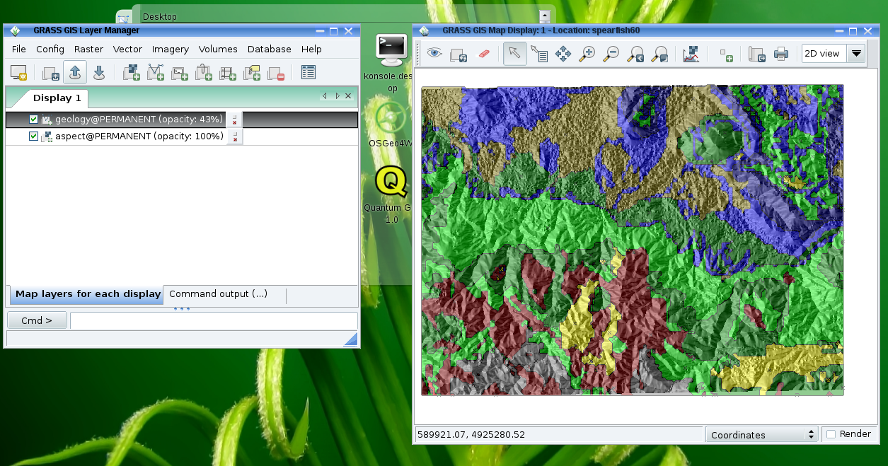
- the option 'Add raster cell arrows' seems not to work properly. It seems that the arrows in the Map Display cannot zoomed in. It can be checked by the following steps:
- Load and display the aspect (Spearfish) map.
- Open the d.rast.arrows panel through the GUI button and choose the same map aspect. Click Apply: the Map Display appears green as expected for the very high resolution.
- Choose 10 for the 'Draw arrow every Nth grid cell:' option and none as 'Color for drawing grid or “none”' option. The arrows are displayed on the cells of aspect map.
- To make the arrows visible choose slope as 'Raster map containing values used for arrow length:' and 10.0 as 'Scale factor for arrows'. Zoom in a very small area: the cells of aspect map are enlarged, but the density of arrows remains the same
- The direction is correctly the same for all arrows inside the same cell but it seems that instead of having an arrow each 10 aspect cells, there is an arrow each 10 pixel of the screen (with tcltk GUI the procedure works fine)
- Fix wx0..6 monitors
Layout
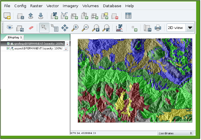
Optionally, have all-in-one GUI window (requested by many new users!):
 |
 |
Proposed solution: wxLayoutAlgorithm(), see WxGUI#What_others_do
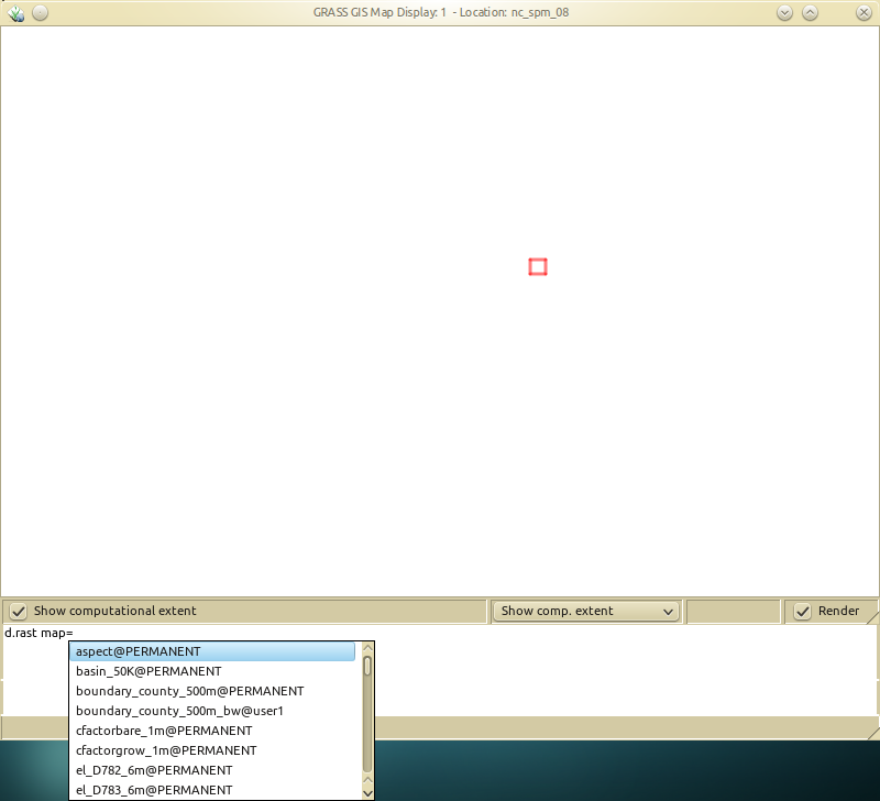
Optionally, a minimalistic cointegration of a map display and the command console. See also this post in grass-user Re: [GRASS-user] replacement for d.mon in GRASS 7.0?
 |
r.li.setup
work on r.li.setup for GRASS7
Saving History
- when using the wxGUI, it needs to write back to the shell history
- `cat wxgui_history.log >> $MAPSET/.bash_history`
- Since the wxGUI shell quoting is not perfect, maybe it is better not to write directly to real shell history, but maintain its own in ~/.grass7/history.
Digitizing toolbar
- missing string "Select vector map" from the drop-down widget on digitizing toolbar
- on winGRASS, nightly build of 24th May
- after editing vector objects and saving, the changes are not applied on the map. Must be some refresh problem.
- Highlighting problem
- objects selected in the attribute table are not highlighted on the map
- objects selected ton the map are not highlighted in the attribute table.
- Bounding box of a layer broken after deletion of some objects with broken geometry, also displaying of the attribute table broken with a message that the map layer is not a vector one,
- closing the layer from the layer tree also not possible
- after closing GRASS6.4.3 and reopening the project, the layer is restored with all the changes applayed.
Attribute manager
- Editing attribute table broken
- cannot delete a row, permission denied
- different than selected row dissapears after not succesful row deletion but is back after refreshing the table.
- Not able to insert a value into a table, permision to the temp file denied.
- Too small area for displaying the table data after connecting a table to the vector map.
- Add a table to the vector layer in wxGUI GRASS6.4.3 with: Show attribute table > Manage layers tab.
- Go to Browse data tab, the area to thisplay the attributes is extreemly small and cannot be stretched.
- After closing the table manager and reopening, the area is normal wide again.
Map Display
- Clicking with a Query tool on a vector object randomly not able to find an object to display its attributes.
I18N
- Solve module description string duplication in both grassmods.po and grasswxpy.po files.
- Before fixing this problem in code, please find a way to automagically copy the translated strings to the proper .po files for all the languages.
Project file
- Find a way to succesfully open a project file made in GRASS6.4 in GRASS7.
- Due to changes (e.g. removal of some flags), the project file is not opened in a correct way. The user can see the layers in the layer tree, but they cannot be displayed in the map canvas. A warning would help.
Not to forget about the next time
First day:
- presentation of participants
First or second day:
- group photo
