Cartography: Difference between revisions
Jump to navigation
Jump to search
⚠️Wenzeslaus (talk | contribs) (→Using ps.map as cartographic engine: link to WxGUI Cartographic Composer) |
(d.barscale options) |
||
| Line 29: | Line 29: | ||
[[File:Forestgaps_Moseltal_Germany.png|thumb|center|400px]] | [[File:Forestgaps_Moseltal_Germany.png|thumb|center|400px]] | ||
=== Display monitors === | |||
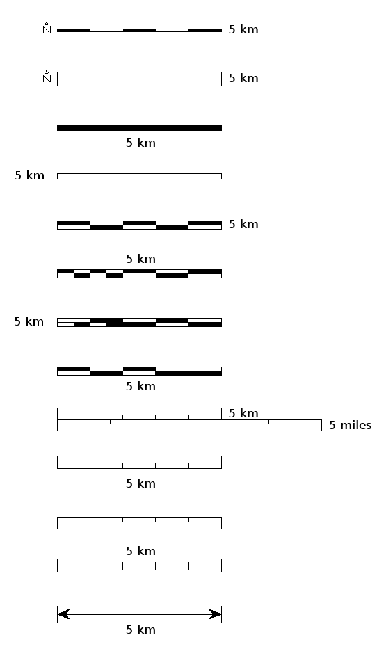
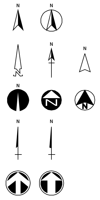
In GRASS 7 the {{cmd|d.barscale|version=7}} module can draw a number of styles of bar scale and north arrows directly in the GIS monitor: | |||
[[Image:barscales7.png]] [[Image:n_arrows7.png]] | |||
=== Using GMT === | === Using GMT === | ||
Revision as of 10:30, 26 June 2013
GRASS GIS and Cartography
- For graphical examples, see the cartography screenshots page
Using ps.map as cartographic engine
- WxGUI Cartographic Composer is an graphical user interface to ps.map.
- Example showing all standard vareas fill pattern hatches. (Spearfish dataset)
- ps.map example demonstrating a scripted flood risk map
- Thematic maps of Belgium
- Create graph paper ready for printing.
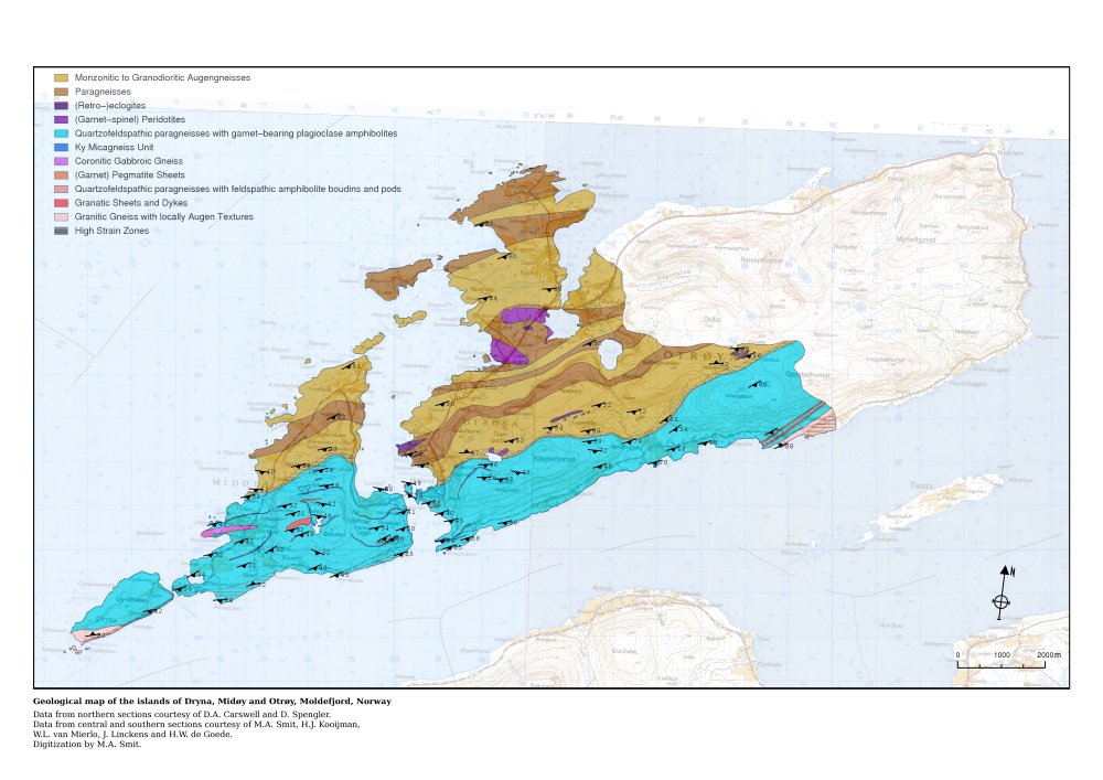
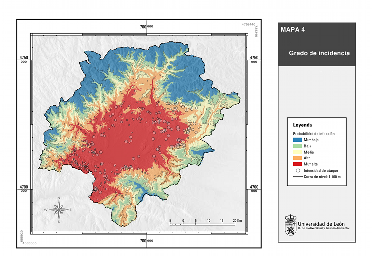
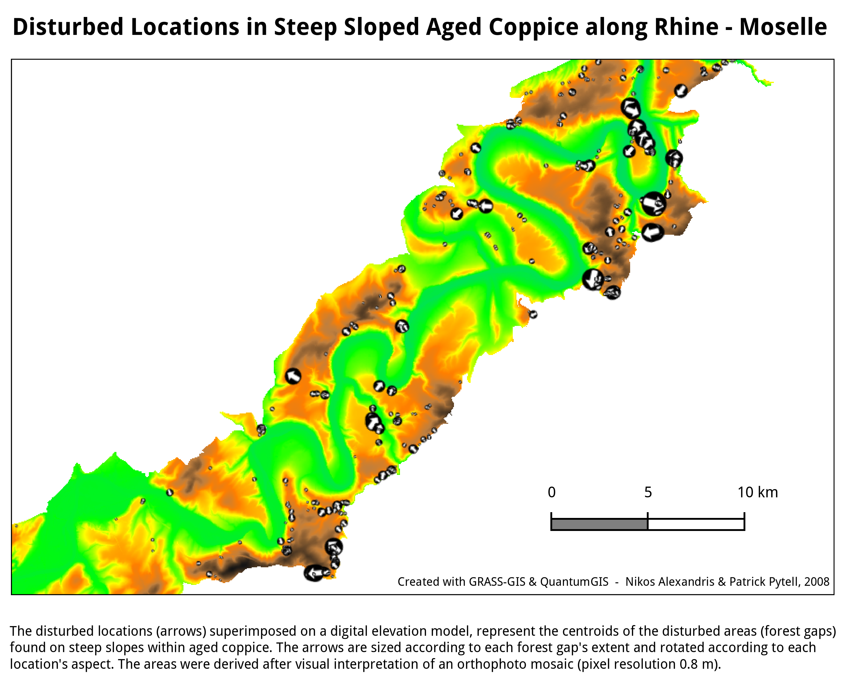
- Some screenshots:
Display monitors
In GRASS 7 the d.barscale module can draw a number of styles of bar scale and north arrows directly in the GIS monitor:
Using GMT
See also
- GIS_Concepts#Geodesy_and_Cartography
- Marine_Science#Mapping_and_Cartography
- Getting Real: Reflecting on the New Look of National Park Service Maps - nice paper about realistic cartography
