Cartography: Difference between revisions
Jump to navigation
Jump to search
| Line 32: | Line 32: | ||
=== Display monitors === | === Display monitors === | ||
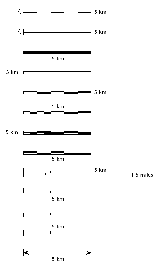
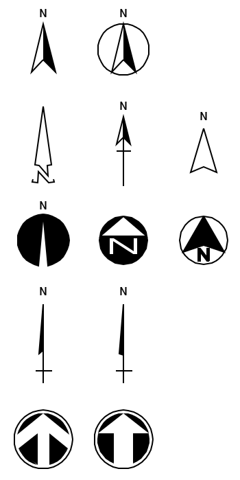
In GRASS 7 the {{cmd|d.barscale|version=70}} module can draw a number of styles of bar scale and north arrows directly in the GIS monitor; in GRASS 6.4.3+ the north arrows can be drawn on the monitor with the {{cmd|d.graph}} module or the {{AddonCmd|d.mark}} addon module and the appropriate [[IconSymbols|symbol]]. Style, text placement (or none), distance units, color, font, and fontsize can be controlled. Here are some examples: | In addition to the hardcopy plots you can make with the {{cmd|ps.map}} command and its [[wxGUI]] [[Cartographic Composer]]), in GRASS 7 the {{cmd|d.barscale|version=70}} module can draw a number of styles of bar scale and north arrows directly in the live GIS display monitor; in GRASS 6.4.3+ the north arrows can be drawn on the monitor with the {{cmd|d.graph}} module or the {{AddonCmd|d.mark}} addon module and the appropriate [[IconSymbols|symbol]]. Style, text placement (or none), distance units, color, font, and fontsize can be controlled. Here are some examples: | ||
[[Image:barscales7.png]] [[Image:n_arrows7.png]] | [[Image:barscales7.png]] [[Image:n_arrows7.png]] | ||
Revision as of 10:42, 26 June 2013
GRASS GIS and Cartography
- For graphical examples, see the cartography screenshots page
Using ps.map as cartographic engine
- WxGUI Cartographic Composer is an graphical user interface to ps.map.
- Example showing all standard vareas fill pattern hatches. (Spearfish dataset)
- ps.map example demonstrating a scripted flood risk map
- Thematic maps of Belgium
- Create graph paper ready for printing.
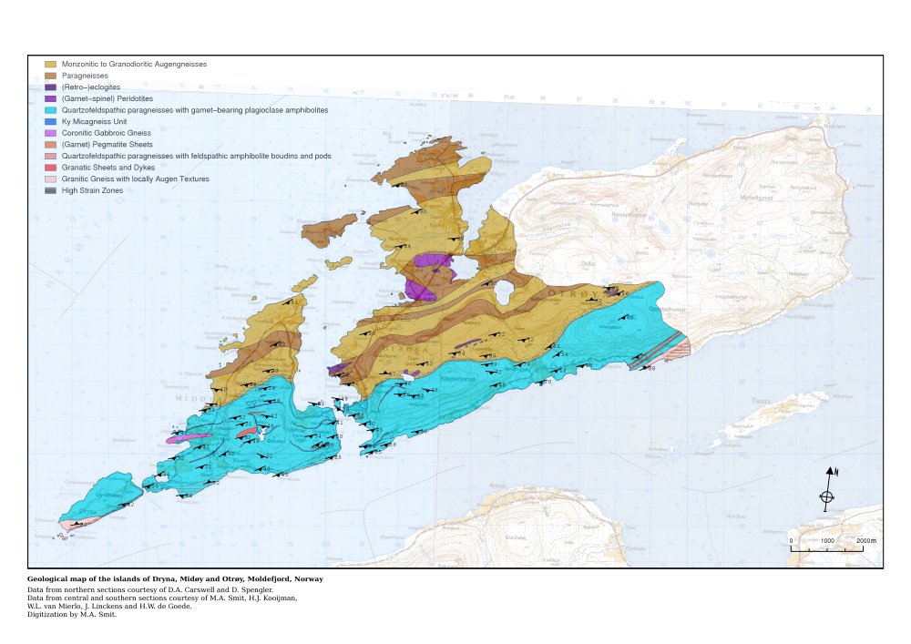
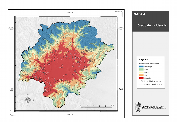
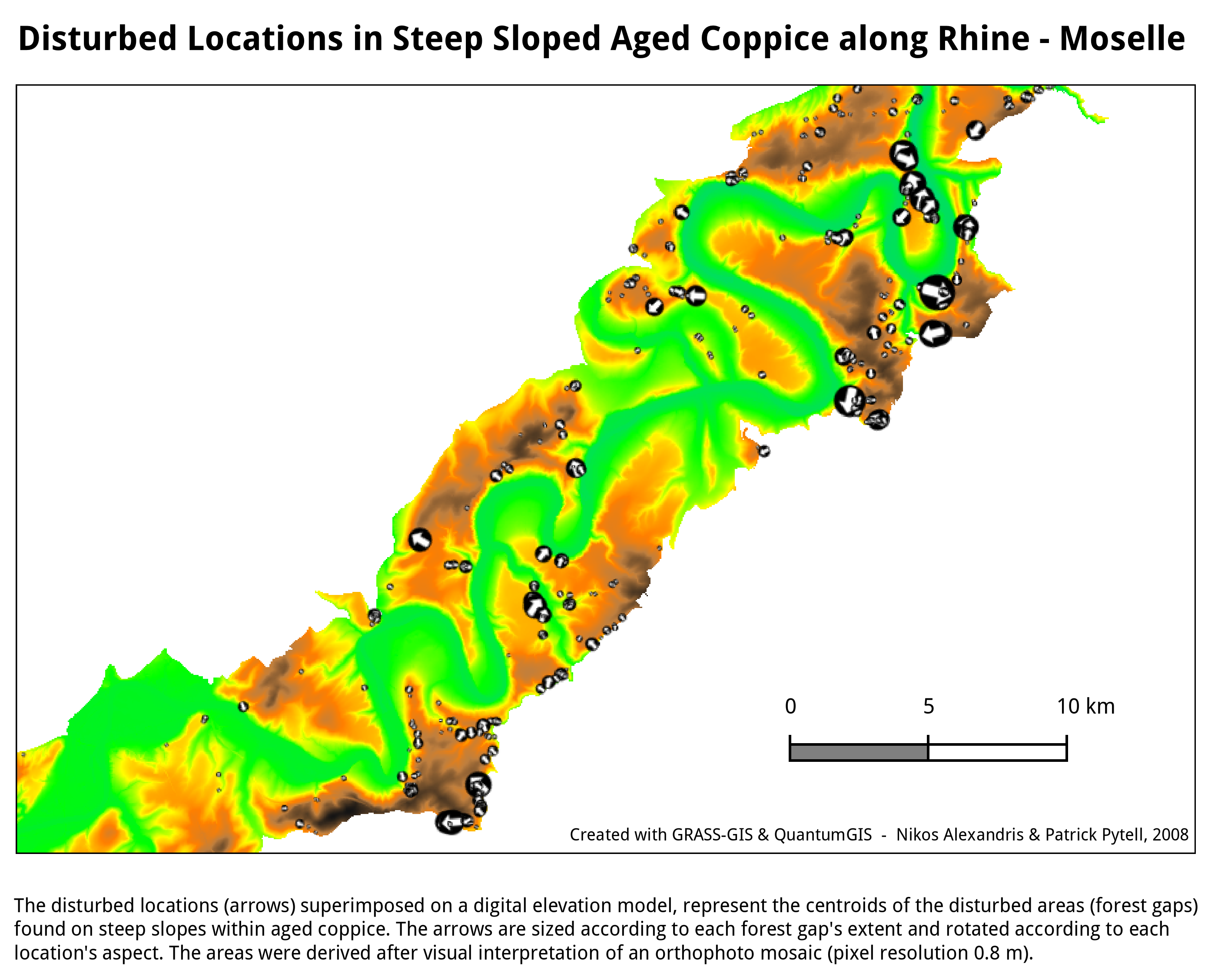
- Some screenshots:
Display monitors
In addition to the hardcopy plots you can make with the ps.map command and its wxGUI Cartographic Composer), in GRASS 7 the d.barscale module can draw a number of styles of bar scale and north arrows directly in the live GIS display monitor; in GRASS 6.4.3+ the north arrows can be drawn on the monitor with the d.graph module or the d.mark addon module and the appropriate symbol. Style, text placement (or none), distance units, color, font, and fontsize can be controlled. Here are some examples:
Using GMT
See also
- GIS_Concepts#Geodesy_and_Cartography
- Marine_Science#Mapping_and_Cartography
- Getting Real: Reflecting on the New Look of National Park Service Maps - nice paper about realistic cartography
