Global datasets
Raster data
Elevation data
ASTER topography (GDEM V1)
Improved ASTER GDEM 1 from 2009:
GDEM global 30m elevation calculated from stereo-pair images collected by the Terra satellite. "This is the most complete, consistent global digital elevation data yet made available to the world." This is a very new dataset, at version 1 (treat as experimental). Accuracy will be improved in forthcoming versions (validation with SRTM, etc.; see assessment here and here).
- pre-release announcement
- NASA press release
- Warehouse Inventory Search Tool or Easy search tool (Data download)
Tutorial: ASTER topography.
- To order and download data: http://digitalelevation.blogspot.com/2009/07/aster-gdem-download-tutorial.html
ASTER topography (GDEM V2)
Improved ASTER GDEM 2 from 2011:
Notes: this DEM can be rather well filtered and smoothed with the Sun's denoising algorithm (using GDAL and free / open source program <mdenoise> or simply GRASS add-on r.denoise.
Experiments showed that the best smoothing of ASTER GDEM 2 is reached with such parameters of <mdenoise>:
- threshold = 0.8
- iterations = 10-20
Also filtering with r.neighbors by "average" method and window size >=5 is quite useful to remove some noise from DEM.
See also: ASTER GDEM 30m quality assessment
ACE2
The ACE2 Global Digital Elevation Model is available at 3", 30" and 5' spatial resolutions.
Import example:
 r.in.bin -f input="00N105E_3S.ACE2" output="ACE2_00N105E" bytes=4 \
          order="native" north=15 south=0 east=120 west=105 \
          rows=18000 cols=18000
ETOPO (DEM)
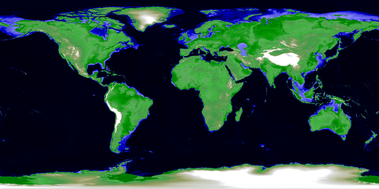
The ETOPO datasets provide global topography and bathymetry at 1', 2', and 5' per-cell resolutions.
ETOPO1 (DEM)
The cell registered version can be loaded directly into a lat/lon region. GRASS raster data is cell registered (see the GRASS raster semantics page)
The grid registered version must be loaded into a simple XY location using the parameters found in the .hdr file, and needs to have the 90deg N,S rows cropped away:
# grid registered version only: create a new simple XY location and mapset

# Import grid registered binary float
r.in.bin -f in=etopo1_bed_g.flt out=etopo1_bed_g \
   n=90.008333333335 s=-90.008333333335 e=180.00833333334 \
   w=-180.00833333334 rows=10801 cols=21601 anull=-9999
r.colors out=etopo1_bed_g color=etopo2

# reduce region by 1 cell
g.region rast=etopo1_bed_g
eval `g.region -g`
g.region n=n-$nsres s=s+$nsres e=e-$ewres -p

# save smaller raster and remove original
r.mapcalc "etopo1_bed_g.crop = etopo1_bed_g"
g.remove etopo1_bed_g

# change the location to lat/lon by restarting GRASS
#  in the PERMANENT mapset and running g.setproj
#  or move the entire mapset into a lat/lon location
#  and manually edit the $MAPSET/cellhd/ files (dirty!)
ETOPO2 (DEM)
- See the ETOPO2 (2' global) article by M.H. Bowman in the GRASS Newsletter, 1:8-11, August 2004.
- ETOPO2v2 data download (take for example the ETOPO2v2g_f4_LSB.flt file)
GTOPO30 (DEM)
Note: To avoid that the GTOPO30 data are read incorrectly, you can add a new line "PIXELTYPE SIGNEDINT" in the .HDR to force interpretation of the file as signed rather than unsigned integers. Then the .DEM file can be imported. Finally, e.g. the 'terrain' color table can be assigned to the imported map with r.colors.
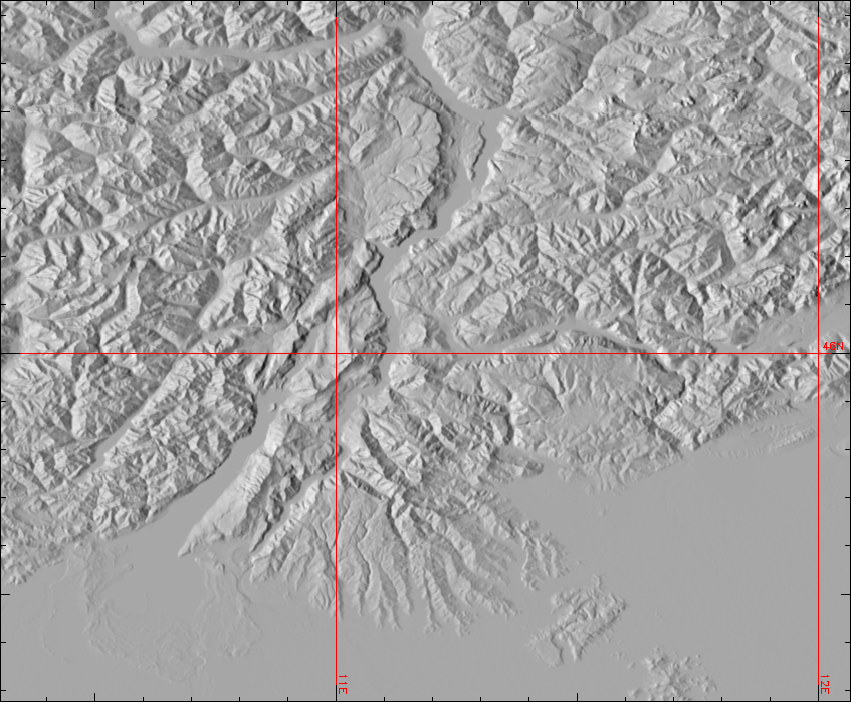
Global Multi-resolution Terrain Elevation Data 2010 (GMTED2010)
Import of GMTED2010 tiles in GRASS GIS:
 r.in.gdal 30N000E_20101117_gmted_mea075.tif out=gmted2010_30N000E_20101117
 r.colors gmted2010_30N000E_20101117 color=elevation
 g.region rast=gmted2010_30N000E_20101117
 r.shaded.relief gmted2010_30N000E_20101117 units=meters
 d.mon x0
 d.rast gmted2010_30N000E_20101117.shade
 d.grid 1 color=red textcolor=red

CleanTOPO2 (DEM)
- CleanTOPO2 download: Edited SRTM30 Plus World Elevation Data
Import in GRASS:
 r.in.gdal CleanTOPO2.tif out=cleanTOPO2.tmp -l -o
 g.region rast=cleanTOPO2  -p -g
 # rescale from odd integer values to true world values
 r.rescale cleanTOPO2.tmp out=cleanTOPO2 to=-10701,8248
 r.colors cleanTOPO2_final col=terrain

GEBCO Bathymetric Chart
- The General Bathymetric Chart of the Oceans (original 1' release 2003, new 1' and 30" releases 2008)
- http://www.gebco.net/data_and_products/gridded_bathymetry_data/
- http://www.bodc.ac.uk/data/online_delivery/gebco/
r.in.gdal can be used to import the GMT netCDF files directly, or if that doesn't work you can use GMT tools to convert to an old-style native GMT format and import that with r.in.bin.
- example: (GEBCO 2003 1' data)
# convert to an old style GMT binary .grd using grdreformat
$ grdreformat 3n24s47w14w.grd 3n24s47w14w_Native.grd=bs

# then import into GRASS,
GRASS> r.in.bin -h -s bytes=2 in=3n24s47w14w_Native.grd out=3n24s47w14w

# and set some nice colors
GRASS> r.colors 3n24s47w14w rules=- << EOF
nv magenta
0% black
-7740 0:0:168
0 84:176:248
0 40:124:0
522 68:148:24
1407 148:228:108
1929 232:228:108
2028 232:228:92
2550 228:160:32
2724 216:116:8
2730 grey
2754 grey
2760 252:252:252
2874 252:252:252
2883 192:192:192
2913 192:192:192
100% 252:252:252
EOF
Global Multi-Resolution Topography (GMRT DEM)
- Global ~1 arc-second (~90 m) topography using multi-beam and satellite data in the oceans combined with SRTM on land.
- Full information at: http://www.marine-geo.org/portals/gmrt/
- Accessible via GeoMapApp or Virtual Ocean software.
- Very convenient to download into GRASS via wget:
 export `g.region -g`
 wget "http://www.marine-geo.org/cgi-bin/getgridB?west=${w}&east=${e}&south=${s}&north=${n}&resolution=1" -O /tmp/test.grd
 r.in.gdal /tmp/test.grd output=GMRT -o
 rm /tmp/test.grd
- Note: Downloaded file contains no projection information, but is EPSG:4326 (WGS84 Geographic). The file size is limited, but lower resolution (resolution=2,4,8) data can be downloaded for larger areas.
Smith and Sandwell DEM
- Merge info here from the Marine Science wiki page
SRTM DEM
Space Shuttle Radar Topography Mission
SRTM30plus data DEM
SRTM30plus data consists of 33 files of global topography in the same format as the SRTM30 products distributed by the USGS EROS data center. The grid resolution is 30 second which is roughly one kilometer.
Land data are based on the 1-km averages of topography derived from the USGS SRTM30 grided DEM data product created with data from the NASA Shuttle Radar Topography Mission. GTOPO30 data are used for high latitudes where SRTM data are not available.
Ocean data are based on the Smith and Sandwell global 2-minute grid between latitudes +/- 72 degrees. Higher resolution grids have been added from the LDEO Ridge Multibeam Synthesis Project and the NGDC Coastal Relief Model. Arctic bathymetry is from the International Bathymetric Chart of the Oceans (IBCAO).
All data are derived from public domain sources and these data are also in the public domain.
GRASS 6 script r.in.srtm described in GRASSNews vol. 3 won't work with this dataset (as it was made for the original SRTM HGT files). But you can import SRTM30plus tiles into GRASS this way:
r.in.bin -sb input=e020n40.Bathmetry.srtm output=e020n40_topex bytes=2 north=40 south=-10 east=60 west=20 r=6000 c=4800
r.colors e020n40_topex rules=etopo2
- Source
- GRASS Users Mailing List http://lists.osgeo.org/pipermail/grass-user/2005-August/030063.html
- Getting as SRTM30plus tiles
- ftp://topex.ucsd.edu/pub/srtm30_plus/srtm30/data/
- Getting as SRTM30plus huge file
- ftp://topex.ucsd.edu/pub/srtm30_plus/topo30/
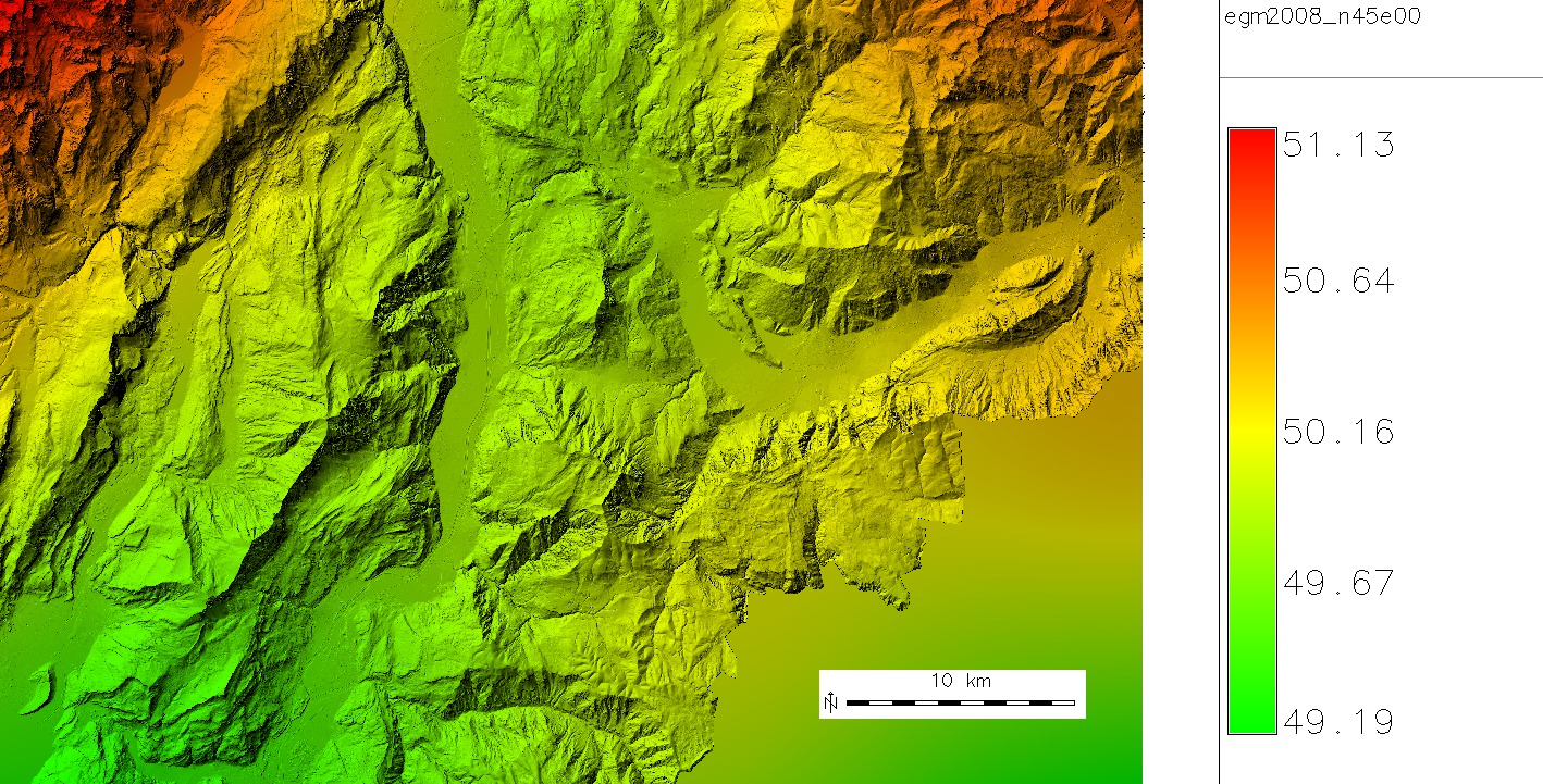
EGM2008 Geoid Data (Earth Gravitational Model)
Global 2.5 Minute Geoid Undulations:
- download GIS Format at http://earth-info.nga.mil/GandG/wgs84/gravitymod/egm2008/egm08_gis.html

Verifications of points can be done with the http://geographiclib.sourceforge.net/cgi-bin/GeoidEval
Imagery
AVHRR
- see the AVHRR wiki page
Blue Marble imagery
NASA's Blue Marble is a 500m-8 degree per-cell world wide visual image of the Earth from space, with the clouds removed.
- see the Blue Marble wiki page
Natural Earth imagery
- Natural Earth II: World environment map in natural color. GeoTIFF (use the r.in.gdal module)
- see also 1:10 million, 1:50 million and 1:110million scale maps from http://www.naturalearthdata.com/
Orthoimagery
True Marble imagery
- True Marble: 250m world wide visual image of the Earth from space, with the clouds removed. GeoTIFF (use the r.in.gdal module)
EO-1 imagery
(Earth Observing-1)
- "Advanced Land Imager (ALI) provides image data from ten spectral bands (band designations). The instrument operates in a pushbroom fashion, with a spatial resolution of 30 meters for the multispectral bands and 10 meters for the panchromatic band."
- On-board Atmospheric Corrections
Miscellaneous
Data sources
- Some datasource links: http://www.ruf.rice.edu/~ben/gmt.html
- Geotorrent.org
Import Modules
- The r.in.gdal modules may be used to import data of many formats, including GMT netCDF
- The r.in.bin module may be used to import raw binary files
LANDSAT imagery
Since October 1, 2008 all Landsat 7 ETM+ scenes held in the USGS EROS archive are available for download at no charge.
- Download via the Glovis online search tool (req. Java)
- Download via the USGS's EarthExplorer interface
Import Modules
- r.in.gdal - Main import tool for complete multiband scenes
- r.in.wms - Download data covering current map region via WMS server
- r.in.onearth - WMS frontend for NASA's OnEarth Global Landsat Mosaic
- i.landsat.rgb - Color balancing/enhancement tool
See also
- Processing tips can be found on the LANDSAT wiki page
MODIS imagery
- see the MODIS wiki page
Pathfinder AVHRR SST imagery
- see the Pathfinder AVHRR SST wiki page
QuickBird imagery
- See the QuickBird wiki page
SeaWiFS imagery
- see the SeaWiFS wiki page
SPOT Vegetation imagery
SPOT Vegetation (1km) global: NDVI data sets
- SPOT Vegetation (1km, global) NDVI data set server
- for import, see i.in.spotvgt
Climatic data
WorldClim maps
WorldClim is a set of global climate layers (climate grids) with a spatial resolution of a square kilometer.
- Load into a Lat/Lon WGS84 location (EPSG:4326)
- Import with r.in.bin or r.in.gdal
- r.in.gdal will read .BIL format, see the r.in.srtm shell script for hints
- binary format is 2 byte integer. Multiply by 10 using r.mapcalc to convert units. See http://www.worldclim.org/format.htm for more information and the MODIS help page for example of converting raw to data units.
OGC WCS - Albedo example
GRASS imports OGC Web Coverage Service data. Example server (please suggest a better one!)
 <WCS_GDAL>
 <ServiceURL>http://laits.gmu.edu/cgi-bin/NWGISS/NWGISS?</ServiceURL>
 <CoverageName>AUTUMN.hdf</CoverageName>
 <Timeout>90</Timeout>
 <Resample>nearest</Resample>
 </WCS_GDAL>
Save this as albedo.xml. Import into a LatLong WGS84 location:
r.in.gdal albedo.xml out=albedo
Unfortunately this server sends out the map shifted by 0.5 pixel. This requires a fix to the map boundary coordinates:
r.region albedo n=90 s=-90 w=-180 e=180
Now apply color table and look at the map:
 r.colors albedo color=byr
 d.mon x0
 d.rast albedo
SNODAS maps
Snow Data Assimilation System data that support hydrological modeling and analysis. First download the data, and untar them (once for each month, and once for each day), and you should get pairs of “.dat” and “.Hdr” files. The data files are stored in flat 16-bit binary format, so assuming that “snowdas_in.dat” is the name of the input file, at the GRASS prompt:
  r.in.bin -bs bytes=2 rows=3351 cols=6935 north=52.874583333332339 \
  south=24.949583333333454 east=-66.942083333334011 west=-124.733749999998366 \
  anull=-9999 input=snowdas_input.dat output=snowdas
Population maps
Gridded Population of the World
Import with r.in.gdal, assign population color table with r.colors
Topographic maps
Soviet topographic maps
- Soviet topographic maps as geocoded GeoTIFFs
Vector data
CDC Geographic Boundary and Public Health Maps
Global Administrative Areas
- GADM is a database of the location of the world's administrative areas (boundaries) available in shapefiles.
- http://gadm.org (extracted by country here)
- World Borders Dataset including ISO 3166-1 Country codes available in shapefiles.
- Free GIS data from Mapping Hacks
GSHHS World Coastline
GSHHS is a high resolution shoreline dataset. It is derived from data in the public domain and licensed as GPL. The shorelines are constructed entirely from hierarchically arranged closed polygons. It is closely linked to the GMT project.
- Download original data from http://www.soest.hawaii.edu/wessel/gshhs/gshhs.html
- Import with the v.in.gshhs GRASS Add-on module.
- Download data from NOAA's shoreline extractor site.
- For GRASS 6 you can download 1:250,000 shoreline data from NOAA's site in Mapgen format, which can be imported with the v.in.mapgen module.
- Shapefiles for the 1.6 version are available from ftp://ftp.ihg.uni-duisburg.de/GIS/GISData/GSHHS/
OpenStreetMap
See the OpenStreetMap wiki page.
SALB
Second Administrative Level Boundaries: "The SALB dataset is a global digital dataset consisting of digital maps and codes that can be downloaded on a country by country basis."
VMap0
1:1 million vector data. Formerly known as Digital Chart of the World
- see the two articles in GRASS Newsletter vol. 3 (June 2005)
Check the Wikipedia page on VMAP, see the links at the bottom of that article to shapefile versions of VMAP0 and VMAP1. Those look like the versions that were, several years ago, on a NIMA (predecessor to NGA, and successor to the Defense Mapping Agency that managed the Digital Chart of the World and VMAP project) Website. Many GRASS users may prefer the shapefiles to the original Vector Product Format data.
See also
- Global datasets list by T. Hengl (with dataset download)
- The FreeGIS.org database: http://www.freegis.org/database/
- http://finder.geocommons.com/
- http://wiki.openstreetmap.org/wiki/Potential_Datasources
- http://www.geonames.org/data-sources.html
- Open Knowledge Foundation link collection
National datasets
- Australian Spatial Data Directory
- Italian Geodata collection
- New Zealand data from Koordinates.com
- United States from NOAA/USGSs data portal (FIXME: link?)
- Greek Public Geodata (in Greek)
European datasets
Various datasets worldwide