WxPython-based GUI for GRASS
See also GRASS GUI and GRASS and Python.
Overview
- A nice summary of the progress to date, written by Jachym Cepicky:
- Martin Landa: New GUI for GRASS GIS based on wxPython (GIS Ostrava 2008, January 27-30, 2008, Ostrava, Czech Republic)
Requirements
Development
Do you want to help with the development?
- basic Python programming ability required
- GUI programming experience welcomed (especially wxPython)
- GRASS user (or better developer) experience
Write access to the GRASS SVN repository is managed by Markus Neteler.
Screenshots
GNU/Linux
 |
 |
 |
 |
Mac OS
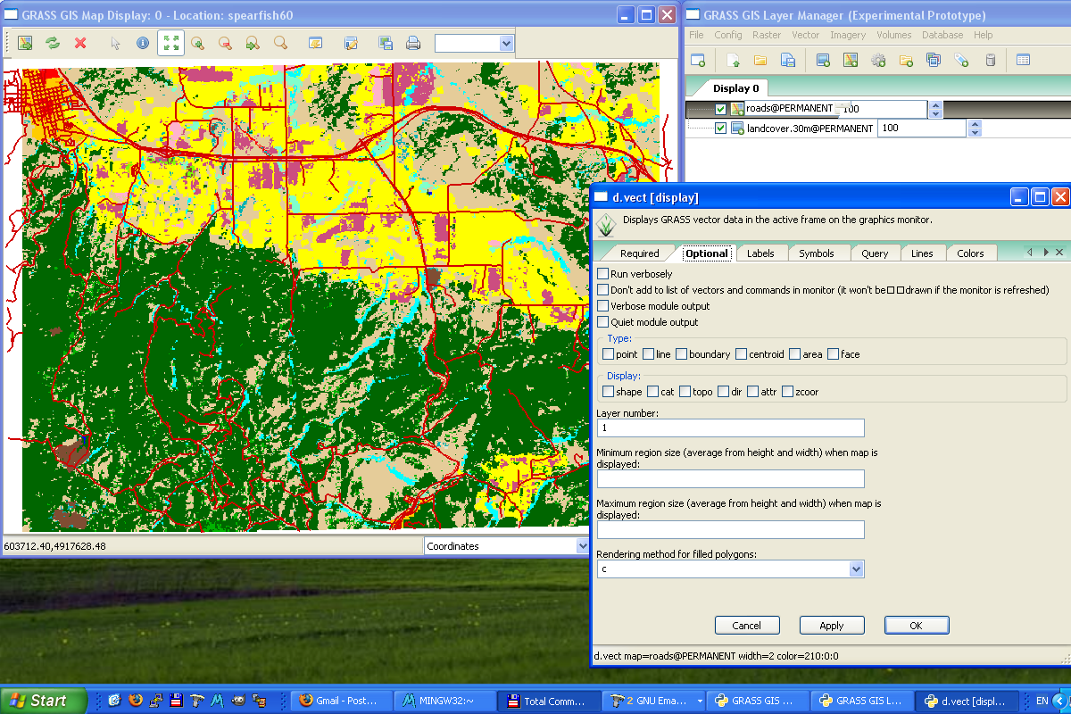
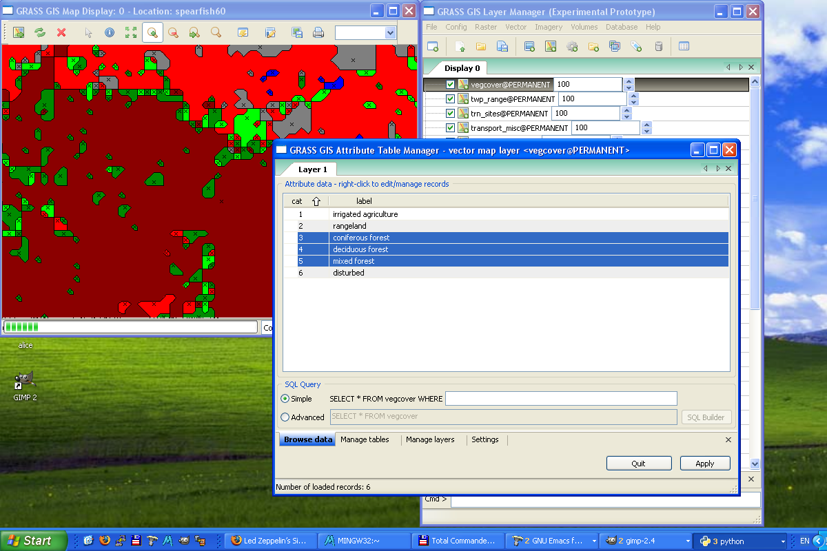
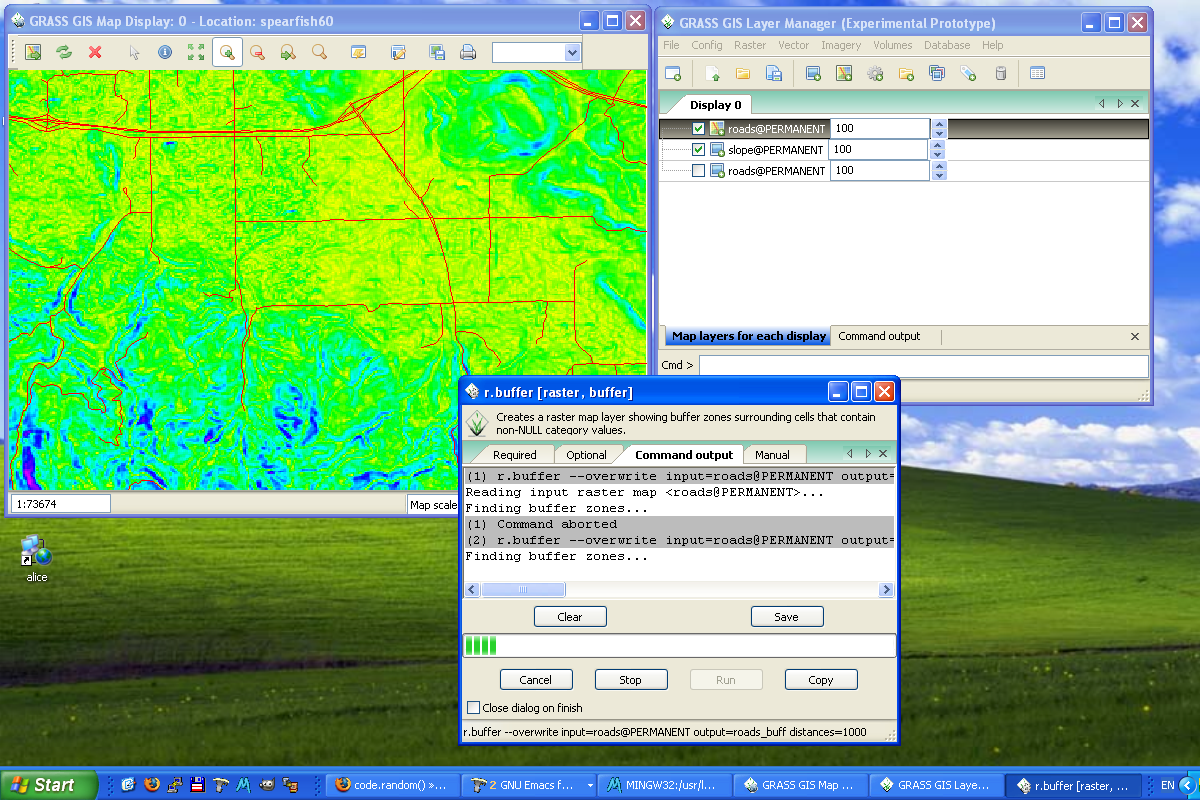
MS Windows
 |
 |
 |
 |
Components
Layer Manager
Status: prototype implemented.
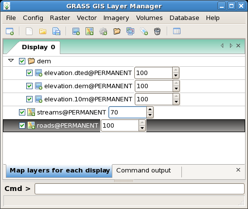
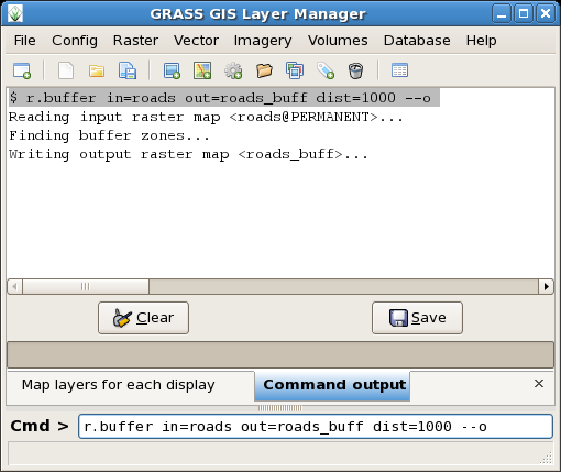
The GRASS GIS Layer Manager provides an interactive graphical interface to GRASS commands. The Layer Manager includes a set of pull-down menus for all GRASS GIS functions (analysis, file I/O, GIS configuration and management), toolbar that manage display map layers in map display windows, layer tree in which map layers to display are organized, command output window and integrated command line prompt.
Roadmap
- Implement fully-featured command prompt (search engine based on keywords, module groups, automated adding for module names, map names, etc.)
Map display window
Status: prototype implemented.
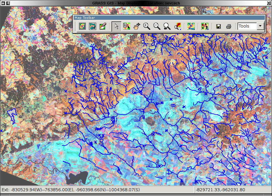
Each Map display window has a unique set of layers to display and region setting (zoom). The map display window includes main toolbar with basic tools including zooming, panning, data querying, simple analyse functions (measure, profile, histogram, etc.), overlay management, etc. From main toolbar are accessible additional toolbars, currently only Digitization tool is available. Under development is Georectification tool.
Roadmap
- 3D map display window based on PyOpenGL, integrate NVIZ features to the current map display map windows structure
Module GUIs
Status: prototype implemented.
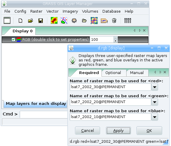
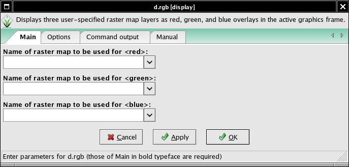
Generated from XML using --interface-description.
E.g. for d.rgb
Description:
 Displays three user-specified raster map layers as red, green, and blue overlays in the active graphics frame.

Keywords:
 display

Usage:
 d.rgb [-ox] red=name green=name blue=name [--verbose] [--quiet]

Flags:
  -o   Overlay (non-null values only)
  -x   Don't add to list of commands in monitor
 --v   Verbose module output
 --q   Quiet module output

Parameters:
    red   Name of raster map to be used for <red>
  green   Name of raster map to be used for <green>
   blue   Name of raster map to be used for <blue>
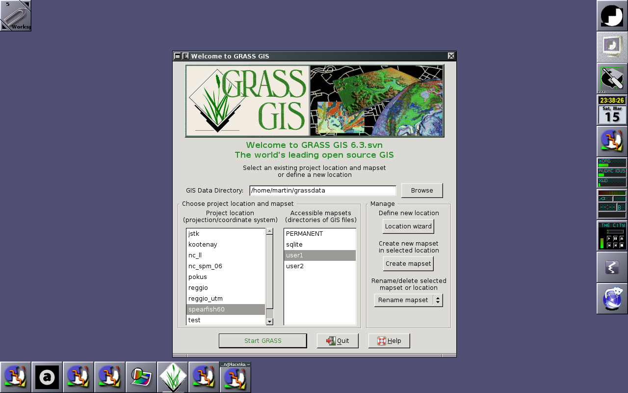
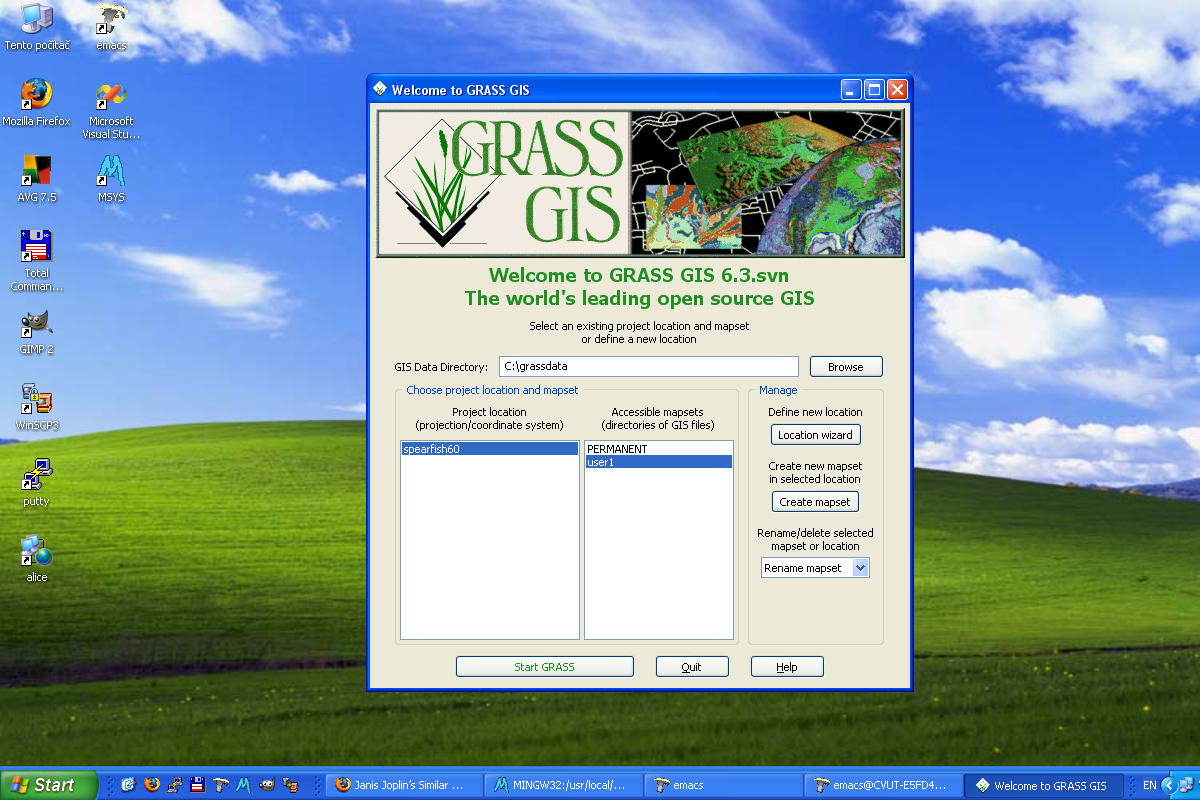
Startup GUI
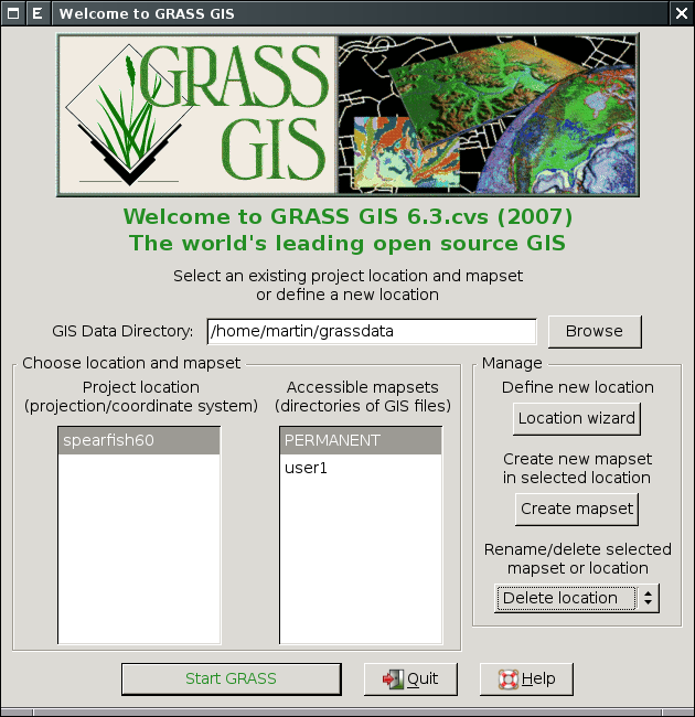
Status: prototype implemented.
Start new GRASS session with
grass -wxpython
Location wizard
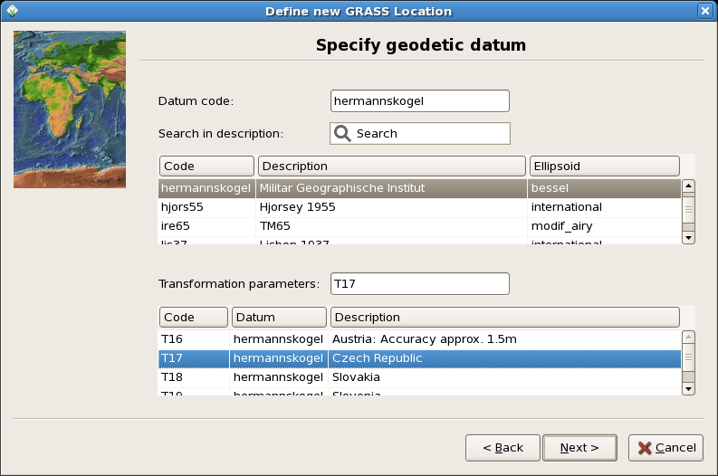
Status: prototype implemented.
Wizard for creating new GRASS project location based on:
- Coordinate system
- EPSG code
- Georeferenced file
- PROJ.4 string
- XY
See also GRASS Location Wizard.
Cartography tools
Status: nothing implemented.
GUI for ps.map
- ps.map is a cartographic composer, intended to be a stand-alone hardcopy plot generator. It is not meant to be a Print button for the maps currently displayed in the map canvas, that will need it own controls.
- The GUI will prepare a semi-WYSIWYG + tree menu controls which can write a ps.map control file, and then run ps.map to create PostScript and PDF output directly. Loading a ps.map control file is harder and can happen later.
- For a start at a Tcl/Tk composer see gui/tcltk/d.m/print.tcl
- see also these discussions and pyGTK prototype by Jachym Cepicky
- Start with most important mapping instructions
- paper
- scale
- maploc
- rast
- vects
- grids
- scalebar
- mapinfo
- text labels
Outputs
- ps.map instructions file
- PostScript file [ps.map instructions tmp file]
- lpr [PostScript tmp file]
- PDF File (pstopdf? ps2pdf? GNU Ghostscript?) [PostScript tmp file]
Inputs
- Ability to load in saved ps.map scripts. I consider this to be a low priority, deal with it after map creation is fully functional. Start with scripts saved using the GUI, after that is working expand to load any ps.map instructions file.
Prototype g-ps.map
Direct printing
Implement direct printing of map canvas content using GRASS PS driver or Cairo driver.
- Python Cartographic Lab
- OSGeo Cartographic Library
- OSGeo Map Symbol Set
- OGR - Feature Style Specification
- MapGuide RFC 14 - Cartographic Stylization Engine
- S-52 standard for nautical chart (ENC) symbology and cartography from the International Hydrographic Bureau
Georectifier
Status: under development.
Currently under development (Michael Barton)
Vector digitizer
Status: prototype implemented.
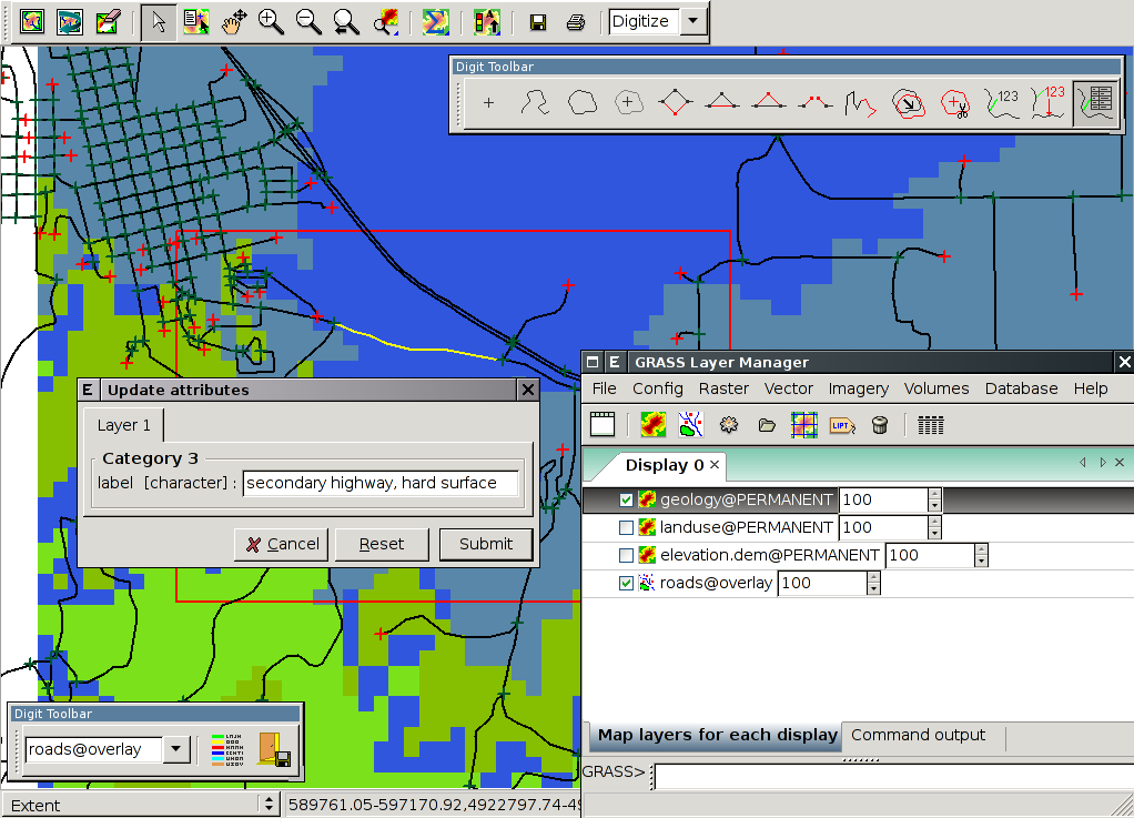
See also GRASS Digitizing tool.
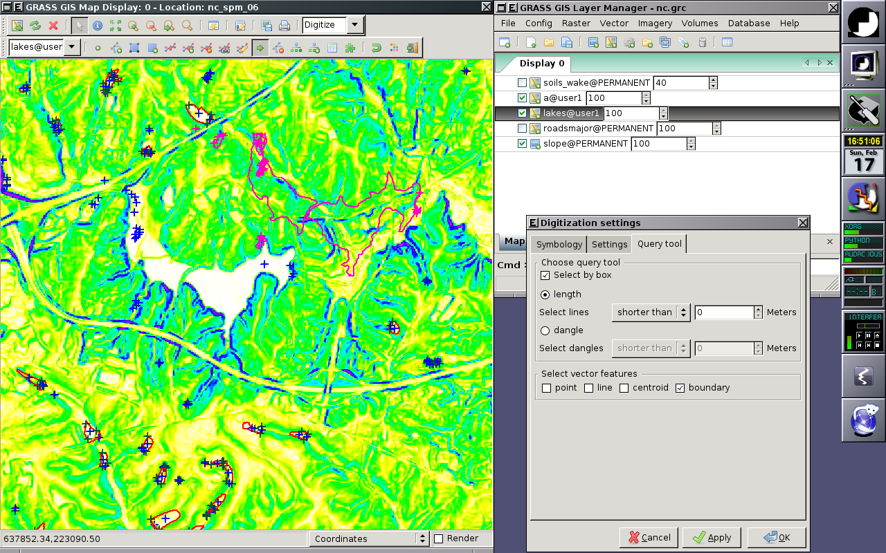
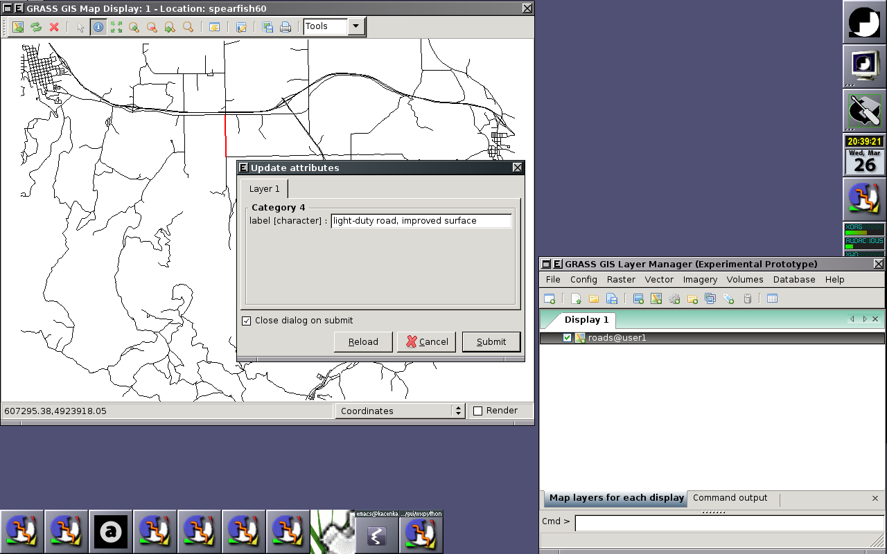
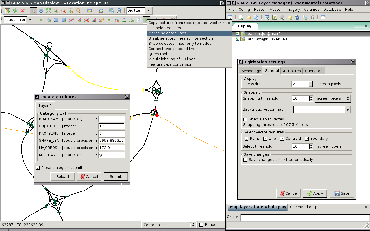
Replacement of v.digit module integrated to Map display window (Screenshots).
Roadmap
- Implement all features available in v.digit √
- Back-end
- v.edit (slow) √
- digit library √
- Implement new requested features
- display vertices √
- animate moving vector objects by mouse √
- snap to vertex (v.edit tool=add/move/vertexmove snap=vertex) √
- snap to vector objects of background map(s) (v.edit tool=add/move/vertexmove snap=node/vertex bgmap=map) √
- unsplit (remove pseudo nodes, v.build.polylines functionality) (v.edit tool=merge) v.edit tool=merge) √
- copy features from background map (v.edit tool=copy bgmap=map) √
- query tool
- select lines according their length (v.edit tool=select query=length thresh=value) √
- select dangles (v.edit tool=select query=dangle thresh=value) √
- z bulk-labeling (automated assignment of z coordinate to 3D lines) (v.edit tool=bulk) √
- undo
- personalized menu
- exit without save
Raster digitizer
Status: development not started yet.
- r.digit (merge with v.digit?)
- Probably write a front end for r.in.poly, that's all the old r.digit is.
- d.rast.edit
- Idea: get cell center coords and new values from GUI interaction, then pass those through r.in.xyz, and r.patch the new values over the top of the old map.
- merge with Georectifier? (i.points, i.vpoints)
Category Labels
- Write with new r.category import tool
- Back-end component complete: r.category module is now updated to handle a rules= file and other goodies like dynamic labels
- Read with one of r.category, r.describe, r.report, r.stats, ???
- probably need to add a new flag to one of those to print flat "%d %s", cat, label
- or read the cats/ file directly, it's already flat ascii.
- how to deal with FP maps & cats?
Ortho photos
- To replace i.ortho.photo and friends
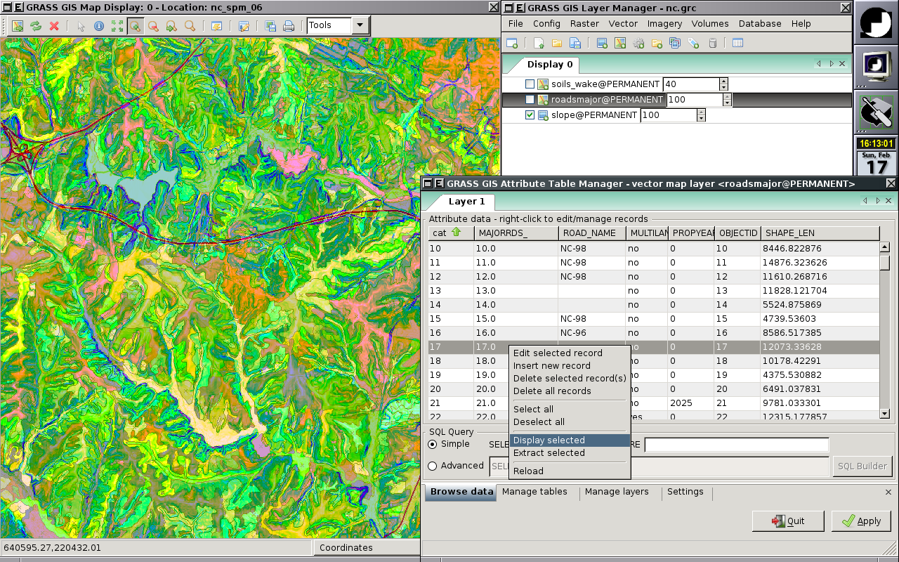
Attribute table manager
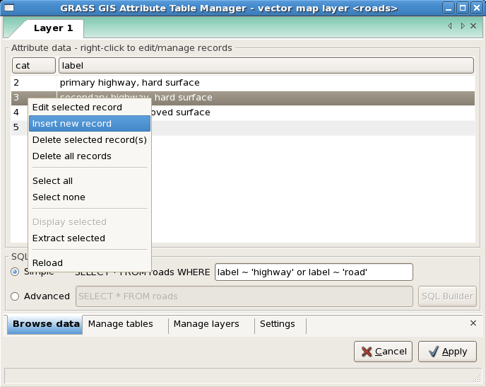
Allows:
- To browse attribute data, perform SQL select statements
- Modify attribute data, insert new records to attribute table, delete existing records
- Highlight selected items in Map Display Window
- Extract selected items into new vector map layer
- Modify attribute table - add, drop, rename columns
- Modify vector map layer DB connestion settings - add, remove or modify layers
Roadmap
- Rewrite and extent GRASS SQL Builder (sqlbuiler.py) -- as an extension for Attribute Table Manager
- Implement some fancy features (ideas?)
NVIZ replacement
Detailed information wxNVIZ.
Imagery tools
TODO
General GUI Design
Layout
See also
Useful links
- 10 minutes Python tutorial for programmers of other languages
References
- Martin Landa: New GUI for GRASS GIS based on wxPython (GIS Ostrava 2008, January 27-30, 2008, Ostrava, Czech Republic)
- Martin Landa: wxPython GUI per GRASS (IX Meeting degli Utenti Italiani di GRASS - GFOSS, February 20-22, Perugia, Italy)
