Working with external data in GRASS 7
This page explains how to work with external data in GRASS 7.
- (to be expanded)
Raster data
External raster data can be linked via r.external. List of supported formats can be determined by
r.external -f
To link file-based data formats, eg. GeoTiff
r.external input=ncrast/urban.tif output=urban
Vector data
External vector data can be linked via v.external. List of supported formats can be determined by
v.external -f
To link file-based data formats, eg. ESRI Shapefile
v.external dsn=ncshape/ layer=railroads output=railroads
Assuming that 'railroads.shp' is located in directory 'ncshape'.
Using wxGUI
From menu
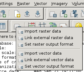
File -> Link external formats

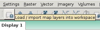
or from toolbar in Layer Manager.

