HOWTO import SRTM elevation data
Background: Space Shuttle Radar Topography Mission
Download
- http://www2.jpl.nasa.gov/srtm/ (SRTM home page)
- http://dds.cr.usgs.gov/srtm/ (data download)
GRASS GIS installations usually contain a location 'demolocation' which is in Latitude-Longitude, suitable for SRTM import.
Which SRTM tile to take?
SRTM tiles are of 1 degree by 1 degree size. The SRTM filename contains the coordinates which refer to the center of the lower left pixel (e.g., N51E010: lower left cell center at 10E, 51N). To identify a tile name, a grid can be easily visualized in the GRASS monitor:
d.grid size=1
Import of original SRTM tiles in HGT format
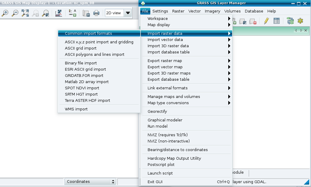
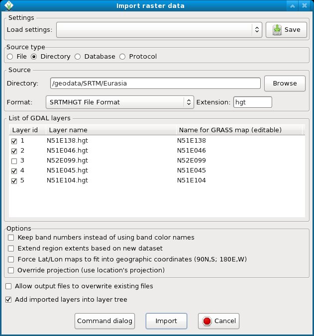
You can easily import many SRTM files in one step:
 |
 |
This menu function calls internally the SRTM driver of GDAL.
Importing multiple SRTM files via command line
Use the r.in.srtm module for automated import into a Latitude-Longitude location.
See:
- M.H. Bowman. Mapping freely available high resolution global elevation and vector data in GRASS. GRASS Newsletter, Vol.3, pp 7-10, June 2005. [ PDF ]
Import of CGIAR SRTM void-filled tiles
- SRTM 90 data in GeoTIFF format are available from http://srtm.csi.cgiar.org/. These come in 5 degree by 5 degree tiles. Horizontal resolution: 3 arc second (90 m at equator). Coverage: world. Import with r.in.gdal
Import of multiple SRTM tiles in one step (mosaiking)
To simplify the import of multiple SRTM tiles, the tiles can be mosaicked first with gdalwarp:
Original SRTM tiles:
 # unzip all
 for i in *.hgt.zip ; do unzip  $i ; done
 # create mosaik (optionally reproject on the fly with -t_srs)
 gdalwarp *.hgt srtm_mosaik.tif
 # import
 r.in.gdal input=srtm_mosaik output=srtm_mosaik
CGIAR SRTM tiles:
 # create mosaik (optionally reproject on the fly with -t_srs)
 gdalwarp *.tif srtm_mosaik.tif
 # import
 r.in.gdal input=srtm_mosaik output=srtm_mosaik
Void filling of original SRTM tiles
The module r.fillnulls can be used. See screenshot
See:
- M. Neteler, 2005. SRTM and VMAP0 data in OGR and GRASS. GRASS Newsletter, Vol.3, pp 2-6, June 2005. [ PDF | Erratum 1/2006 (txt) ]
See also
- SRTM in Wikipedia