Working with external data in GRASS 7
This page explains how to work with external data in GRASS 7.
Raster data
External raster data can be linked via r.external. List of supported formats can be determined by
r.external -f
To link file-based data formats, eg. GeoTiff
r.external input=ncrast/urban.tif output=urban
Vector data
External vector data can be linked via v.external. List of supported formats can be determined by
v.external -f
To link file-based data formats, eg. ESRI Shapefile
v.external dsn=ncshape/ layer=railroads output=railroads
Assuming that 'railroads.shp' is located in directory 'ncshape'.
Write access
The module also supports write access to the external data (currently only geometry can be edited). Showcase bellow:
v.external dsn="PG:dbname=grass" layer=obce_b output=obce_b
v.out.ascii input=obce_b where="cat < 10" --q
-742600|-1043000|1
-728486|-1079285|2
-698411|-1095121|3
-716384|-1083350|4
-694125|-1101920|5
-706726|-1097059|6
-732348|-1074146|7
-730615|-1084553|8
-713628|-1086298|9
v.external.out dsn="PG:dbname=grass" format=PostgreSQL
v.transform -w input=obce_b output=obce_b_jtsk xscale=-1 yscale=-1
v.external dsn="PG:dbname=grass" -l
...
obce_b
obce_b_jtsk
...
v.out.ascii input=obce_b_jtsk where="cat < 10" --q
1043000|742600|1
1079285|728486|2
1095121|698411|3
1083350|716384|4
1101920|694125|5
1097059|706726|6
1074146|732348|7
1084553|730615|8
1086298|713628|9
Using wxGUI
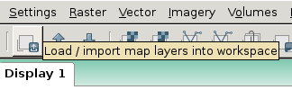
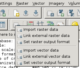
From menu
File -> Link external formats

or from toolbar in Layer Manager.

