WxGUI WMS service rendering GSoC 2011
Aim of the project
This project aims to introduce several features that make WXGUI more user-friendly. These include adding WMS layer support for WXGUI. The selection features will be displayed as per the based on service GetCapabilities response. The parameters and the layers are to be displayed are extracted out of the xml response.
State of the art
The project uses WMS service to fetch images of the maps. The Get Feature service of WMS services provides a GML based interface to access the information about various layers available. The WMS layer knowledge is used to update the GUI of the GRASS according to the available features for a particular layer. Thw WX-GUI is to be modified and to be integrated with the WMS services.
Bulletin Board
Documentation
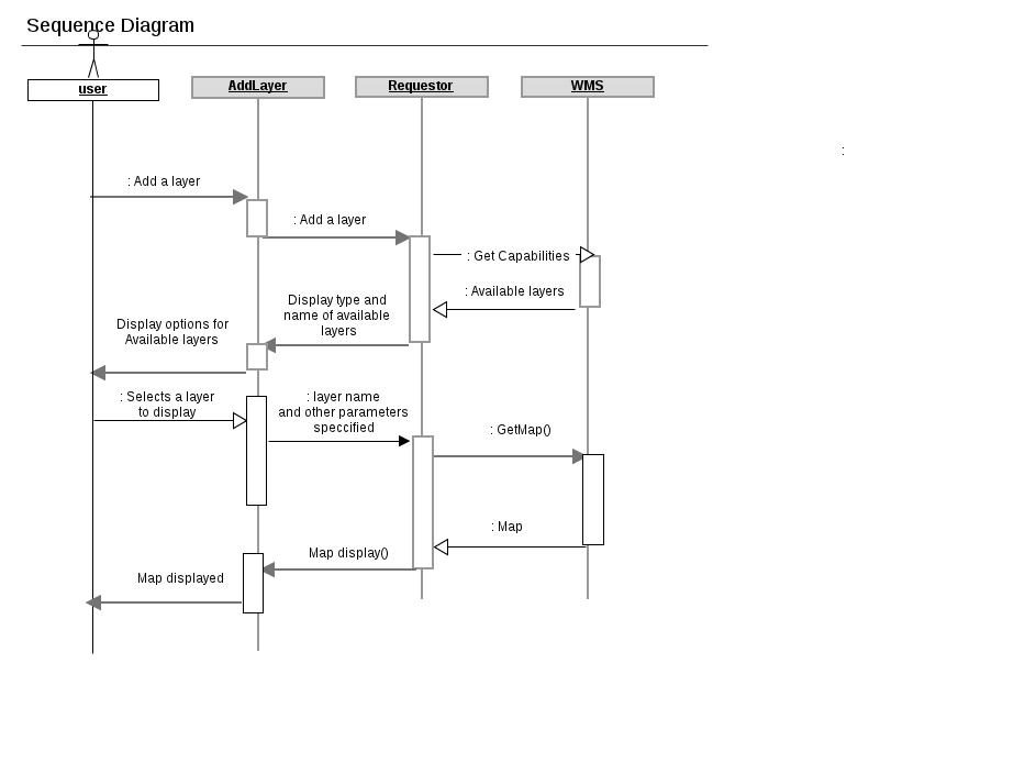
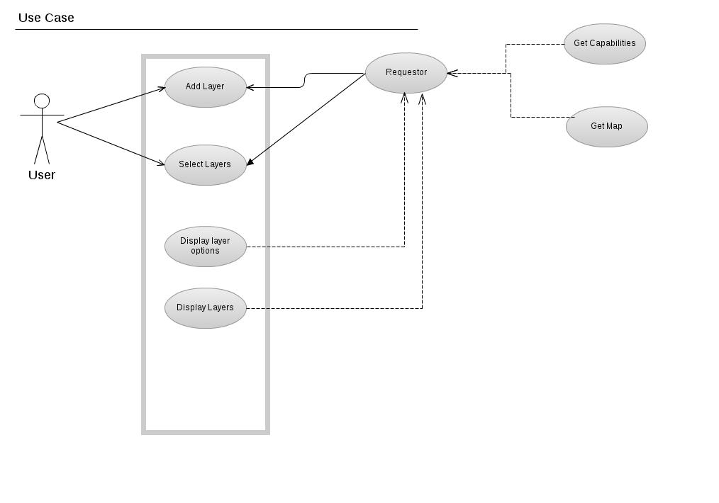
The sequence diagram and use case diagram for the proposed Gsoc project are shown below


Planned Timeline
Weekly Reports, from SoC mailing list
May 29 , 2011 Report [0]
Done
I have completed creating the uml diagrams (sequence and use case) for the planned architecture of the project.I have uploaded them to wiki. I have read GUI documentation from the programmer's manual [0]. I have gone through the source file structuring to better get into the work. I have setup the system, compiled the source and successfully installed it.
Planned for next week
I plan to introduce some toy changes in the source code, like print statements. I will try to familiarize myself with the wxPython.
Bottleneck(s)
No major bottlenecks till now.
[0] http://grass.osgeo.org/programming6/