Search results
Jump to navigation
Jump to search
Page title matches
 (537 × 399 (20 KB)) - 13:33, 15 December 2020
 (618 × 150 (12 KB)) - 15:08, 5 February 2015
 (543 × 402 (20 KB)) - 13:32, 15 December 2020
 (488 × 316 (77 KB)) - 15:14, 24 March 2017


Page text matches
- === Proposal 2 === ...243 bytes (22 words) - 11:32, 27 August 2022
- ...nstein", database_layer_2: 42 ). If a new VARCHAR column is added to layer 2 by {{cmd|v.db.addcol}}, how can the names from layer 1 be copied into it?'' # add new column on layer 2 (replace SIZE with the desired length): ...1 KB (179 words) - 09:50, 23 April 2015
- v.category option=add layer=2 cat=1 step=1 type=line ... Then add a new table to layer 2 ...1,016 bytes (164 words) - 09:24, 3 October 2016
- ...s.osgeo.org/grass-stable/manuals/libpython/{{{1}}}.html#{{{2}}}.{{{3}}} {{{2}}}.{{{3}}}()]</span><noinclude> ...510 bytes (58 words) - 08:41, 28 August 2020
 ...eigh, Marine, Earth and Atmospheric Sciences, Raleigh, NC, United States, (2)North Carolina State University at Raleigh, Raleigh, NC, United States, (3) ...(999 × 562 (752 KB)) - 10:41, 3 January 2019
- 599505|4921010|2 v.category triple_simple out=triple_simple_multi layer=2 ...2 KB (268 words) - 15:37, 16 June 2013
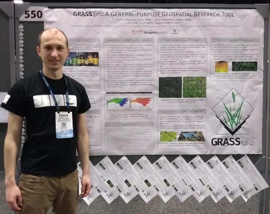 ...eigh, Marine, Earth and Atmospheric Sciences, Raleigh, NC, United States, (2)North Carolina State University at Raleigh, Raleigh, NC, United States, (3) ...(915 × 724 (201 KB)) - 07:42, 3 January 2019
- VOLUME = {2}, PAGES = {2-16}, ...912 bytes (105 words) - 08:58, 5 February 2013
 North arrow type 2 ...(100 × 100 (3 KB)) - 16:58, 8 October 2010
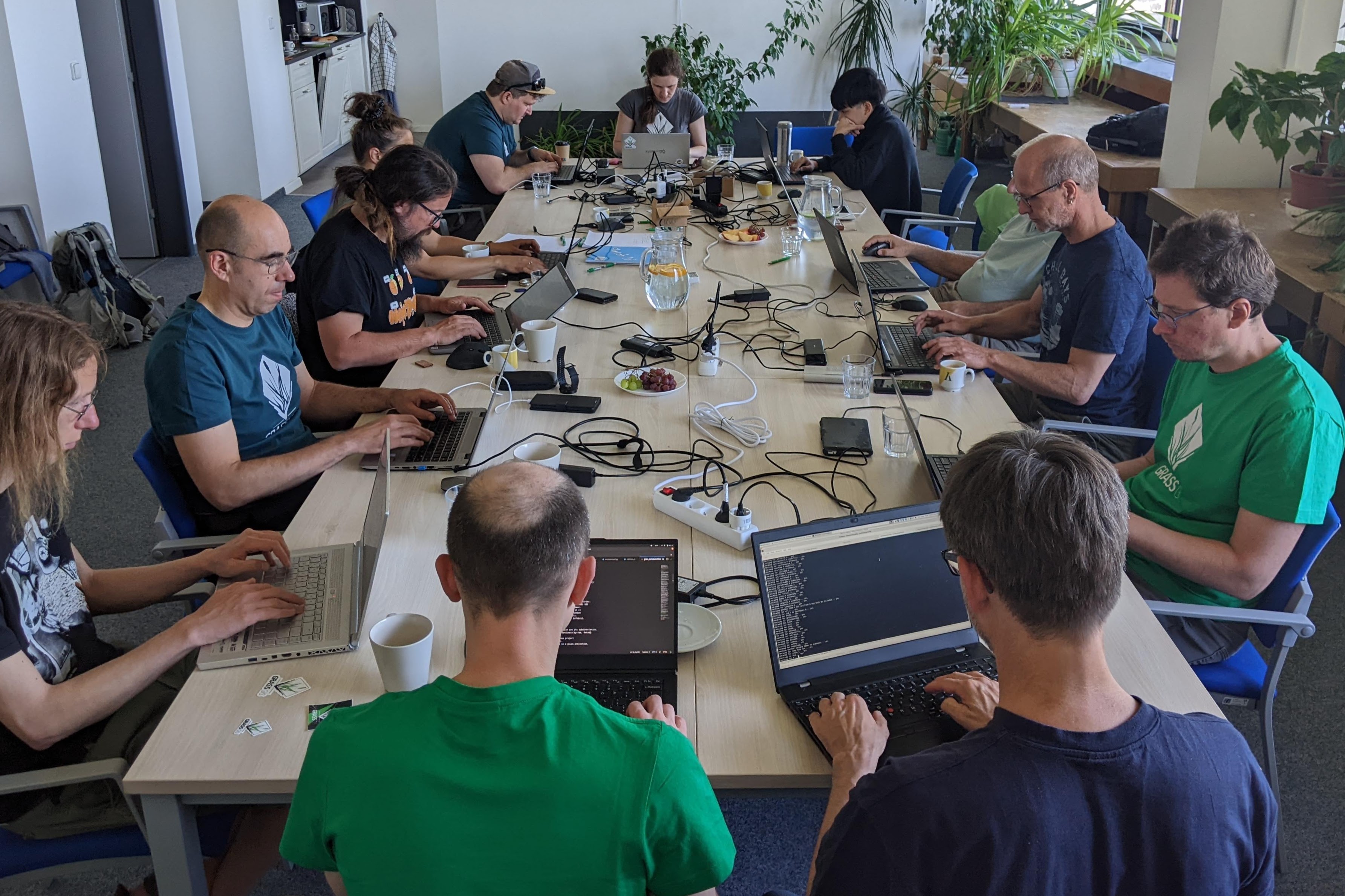 Full table on day 2 ...(3,569 × 2,378 (1.11 MB)) - 08:49, 4 June 2023
 Proposal #2 for "mapped with..." sticker ...(1,196 × 438 (69 KB)) - 07:46, 23 May 2016
 how to use transifex 2 ...(535 × 149 (22 KB)) - 07:28, 10 March 2010
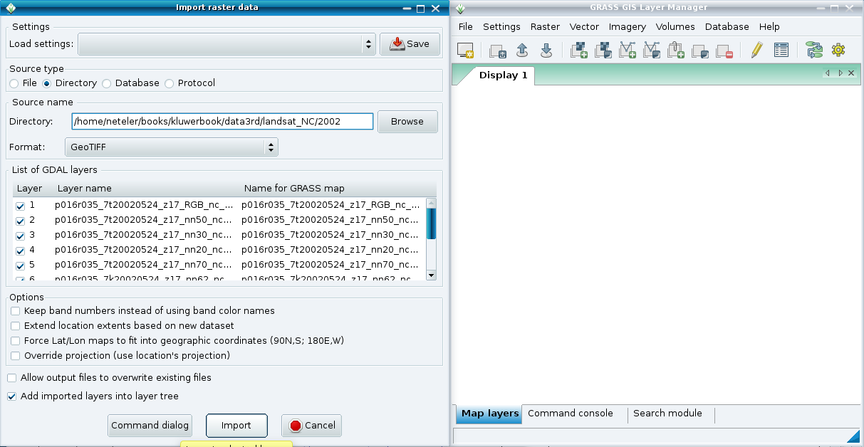 Bulk import of GeoTIFF 2 ...(1,213 × 628 (74 KB)) - 08:53, 1 May 2011
 Proposal #2 for "powered by..." sticker ...(338 × 493 (41 KB)) - 07:41, 23 May 2016
- === Idea 2: ... === ...544 bytes (78 words) - 11:31, 28 August 2022
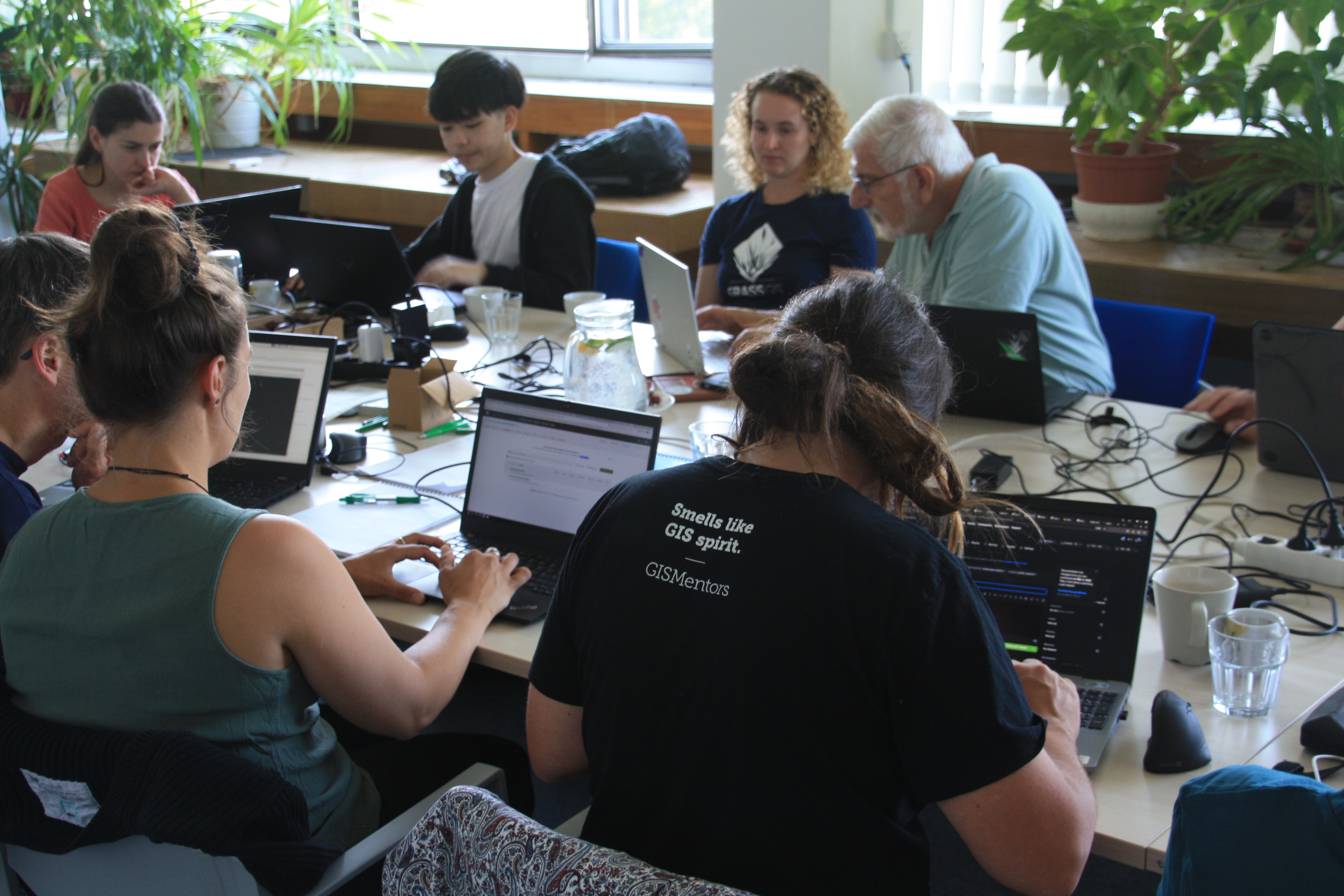 day 2 of 2023 community meeting collaboration ...(4,272 × 2,848 (3.53 MB)) - 09:07, 4 June 2023
- v.category sids_nc out=sids_nc2 layer=2 type=boundary option=add ...t from each boundary and store it into the attribute table linked to layer 2. In general: ...2 KB (341 words) - 20:10, 16 November 2020
- ...geo.org/grass/browser/grass-addons/grass{{{version|6}}}/{{{1}}}/{{{2}}} {{{2}}} (src)]</span></includeonly><noinclude> ...578 bytes (71 words) - 21:03, 9 August 2015
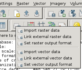 Link external data - Layer Manager toolbar (2) ...(270 × 232 (17 KB)) - 17:24, 21 September 2011
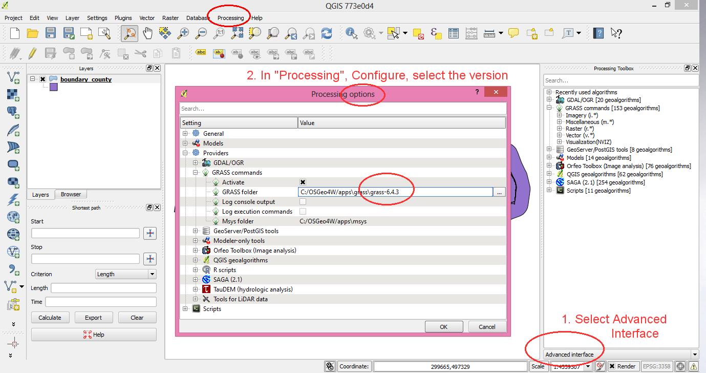 QGIS 2 with GRASS GIS support in "Processing" (former Sextante) ...(1,379 × 728 (150 KB)) - 19:11, 2 October 2013


