File:Binning and decimation workflow schema for point clouds.png: Difference between revisions
Jump to navigation
Jump to search
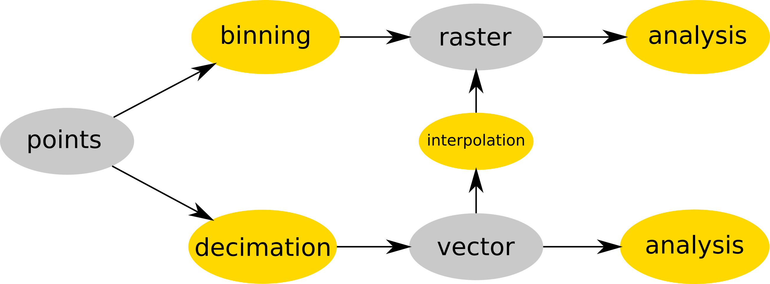
⚠️Wenzeslaus (talk | contribs) (Point cloud is either binned into a raster map (e.g. r.in.lidar) and then analyzed (as raster) or (optionally) decimated (e.g. v.in.lidar), converted to vector map and then interpolated (e.g. v.surf.rst) into raster or analyzed as vector map (e.g. v.ve...) |
(No difference)
|
Latest revision as of 15:17, 19 July 2017
Point cloud is either binned into a raster map (e.g. r.in.lidar) and then analyzed (as raster) or (optionally) decimated (e.g. v.in.lidar), converted to vector map and then interpolated (e.g. v.surf.rst) into raster or analyzed as vector map (e.g. v.vect.stats).
File history
Click on a date/time to view the file as it appeared at that time.
| Date/Time | Thumbnail | Dimensions | User | Comment | |
|---|---|---|---|---|---|
| current | 15:17, 19 July 2017 | 2,613 × 966 (127 KB) | ⚠️Wenzeslaus (talk | contribs) | Point cloud is either binned into a raster map (e.g. r.in.lidar) and then analyzed (as raster) or (optionally) decimated (e.g. v.in.lidar), converted to vector map and then interpolated (e.g. v.surf.rst) into raster or analyzed as vector map (e.g. v.ve... |
You cannot overwrite this file.
File usage
The following 2 pages use this file: