WxGUI Graphical Modeler: Difference between revisions
m (→External links) |
|||
| Line 73: | Line 73: | ||
* [http://www.clarklabs.org/products/product-features.cfm IDRISI Taiga Product Features] | * [http://www.clarklabs.org/products/product-features.cfm IDRISI Taiga Product Features] | ||
* [http://webhelp.esri.com/arcgisdesktop/9.3/index.cfm?TopicName=An_overview_of_ModelBuilder ArcGIS Model Builder] | * [http://webhelp.esri.com/arcgisdesktop/9.3/index.cfm?TopicName=An_overview_of_ModelBuilder ArcGIS Model Builder] | ||
* [http://blog.orfeo-toolbox.org/uncategorized/otb-inside-sextante-inside-qgis Sextante Modeler] | |||
{{WxGUI}} | {{WxGUI}} | ||
Revision as of 11:53, 29 April 2012
Graphical modeler is a wxGUI extension which allows the user to create, edit, and manage models. It's available from the menu
File -> Graphical modeler
Graphical modeler comes with GRASS 6.4.2+.
Note: the tool is currently under development and distributed as experimental prototype. See also wiki page for developers.
The modeler currently allows to:
|
|
See also manual page.
Models
For user-defined models, check http://svn.osgeo.org/grass/grass-addons/models
Gallery
-
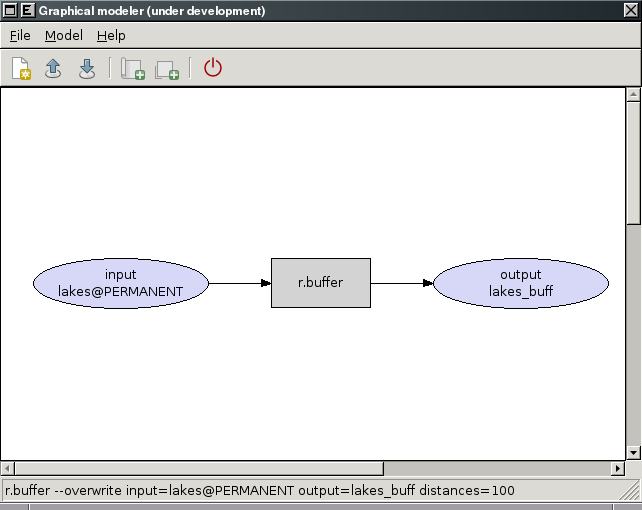
Experimental prototype of Graphical Modeler
-
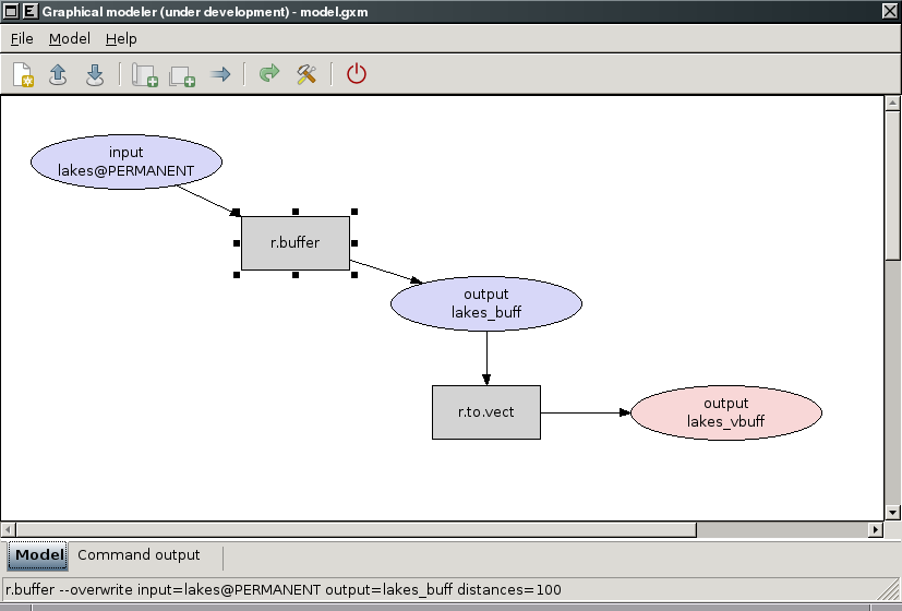
Experimental prototype of Graphical Modeler
-
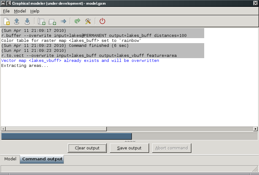
Experimental prototype of Graphical Modeler
-
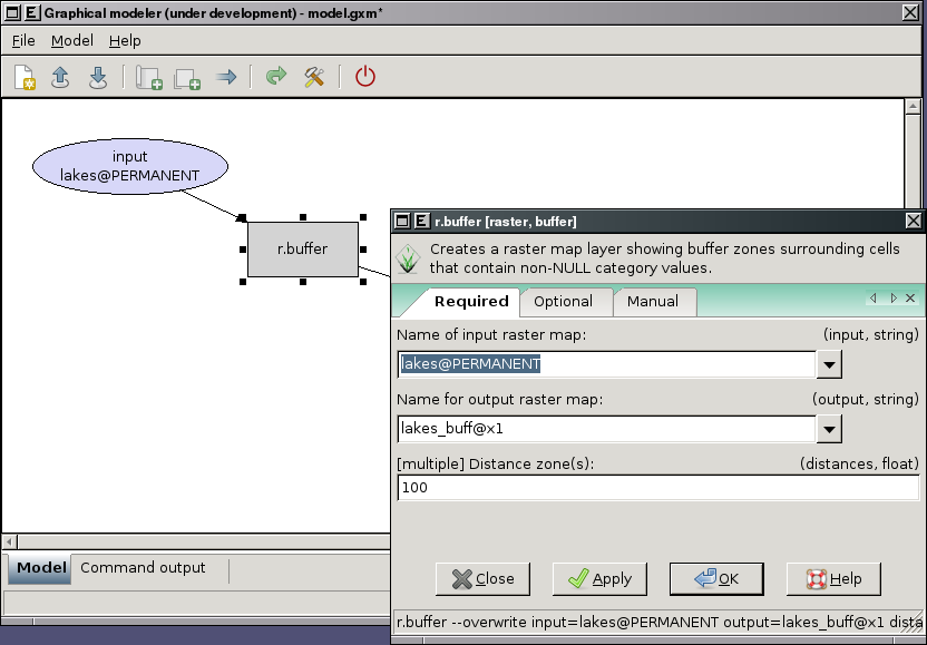
Experimental prototype of Graphical Modeler
-
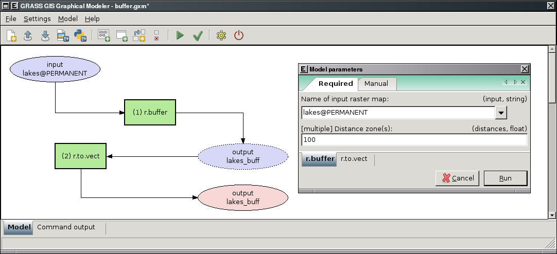
Graphical Modeler: run parametrized model
-
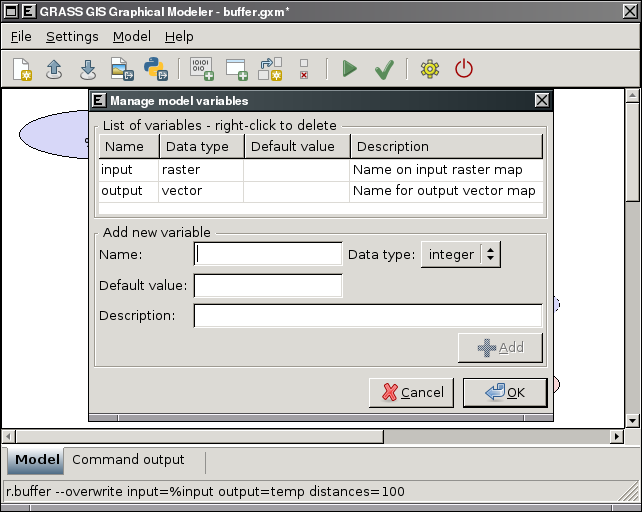
Graphical Modeler: define model variables
-
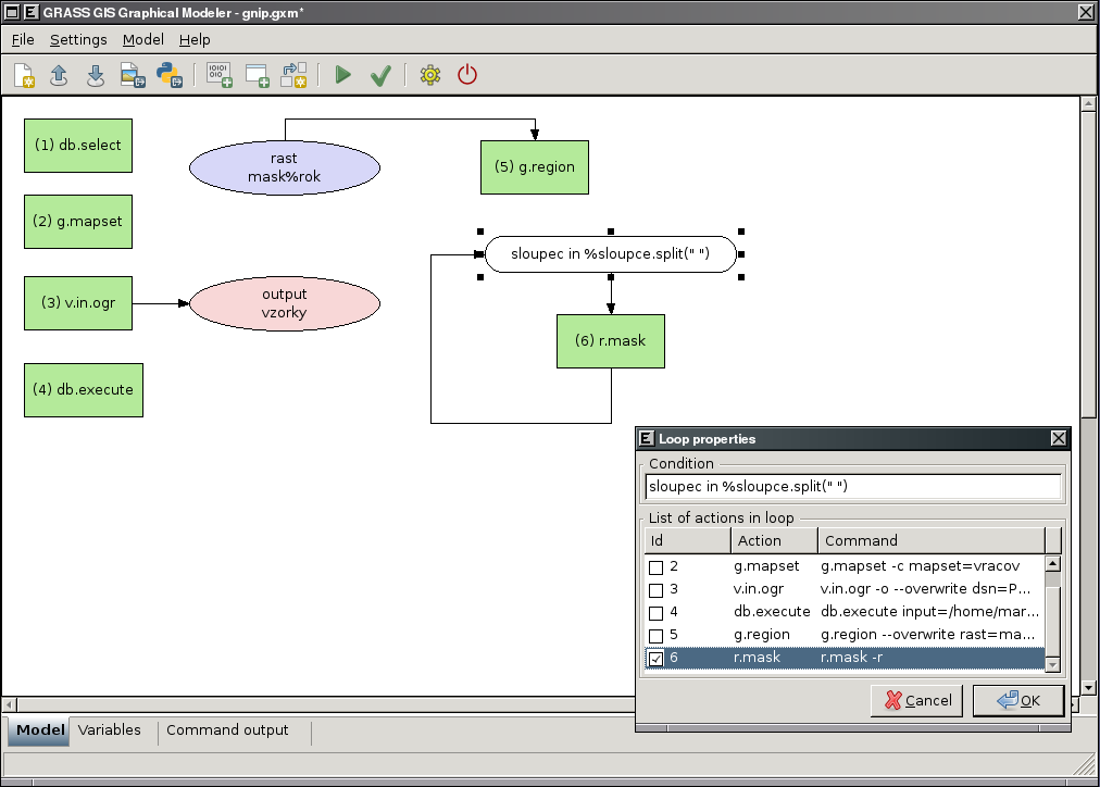
Graphical Modeler: define loops in the model
-
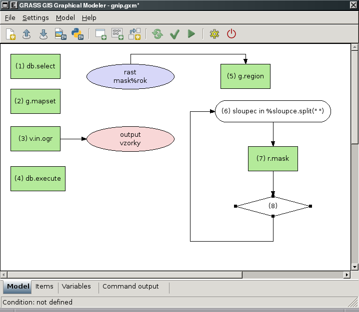
Graphical Modeler: define if/else statements in the model
-
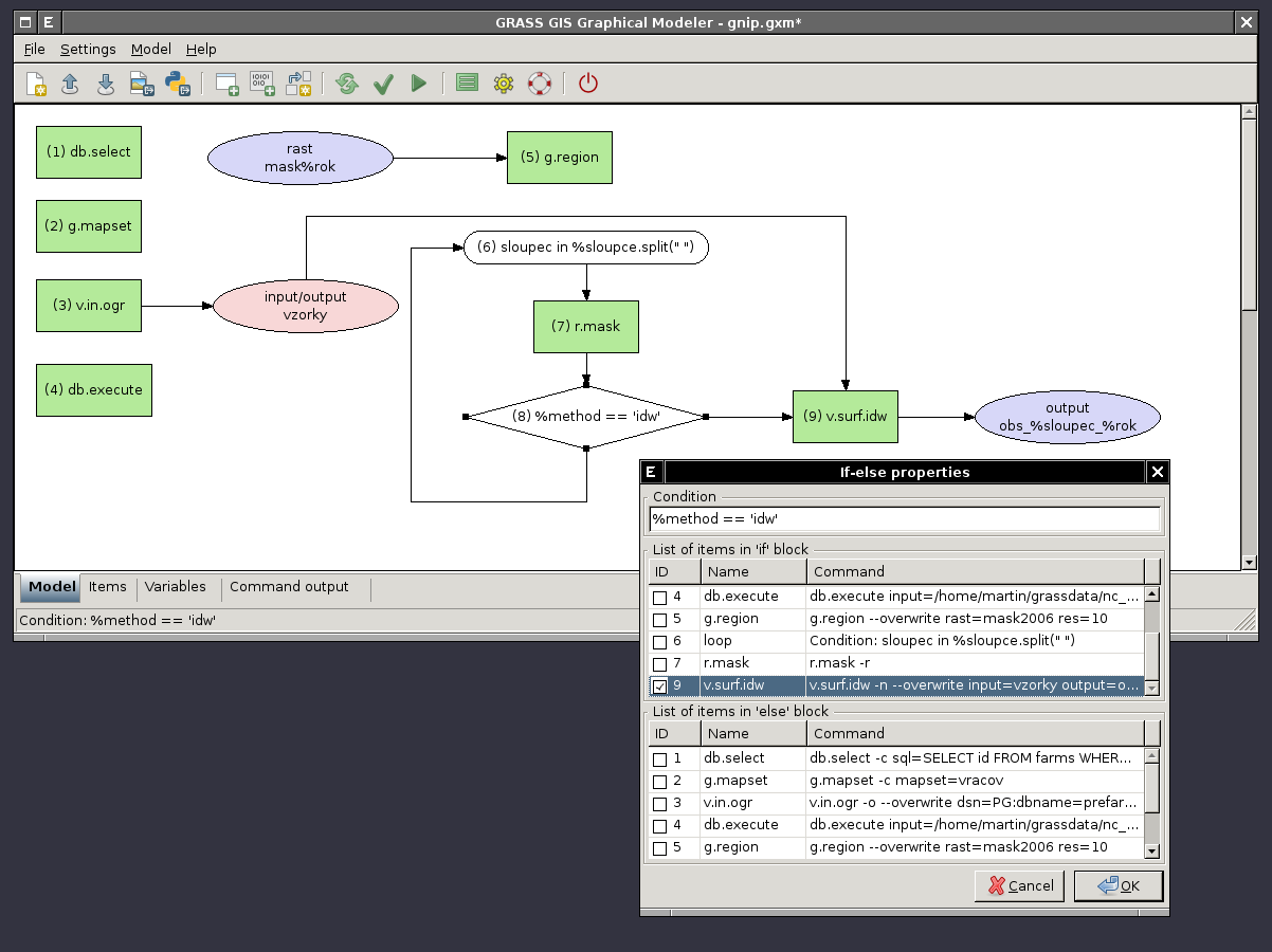
Graphical Modeler: define if/else statements in the model - show properties
-
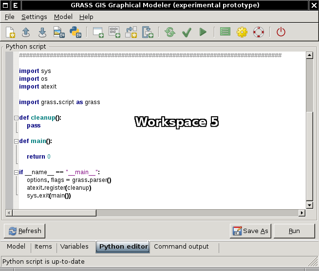
Graphical Modeler: Python editor


Video tutorials
1) create schema with name of input mapset
2) copy vector maps from selected mapset to the current and stores their attributes in SQLite database
3) exports GRASS vector maps to the selected PostGIS database