WxGUI Graphical Modeler: Difference between revisions
mNo edit summary |
mNo edit summary |
||
| Line 1: | Line 1: | ||
'''Graphical modeler''' is a [[wxGUI]] extension which allows the user to create, edit, and manage models. It's available from the menu | '''Graphical modeler''' is a [[wxGUI]] extension which allows the user to create, edit, and manage models. It's available in GRASS 6.4.2+ from the menu | ||
File → Graphical modeler | File → Graphical modeler | ||
See also {{cmd|wxGUI.Modeler|desc=manual}} page and [http://trac.osgeo.org/grass/wiki/wxGUIDevelopment/Modeler wiki page] for development issues. | See also {{cmd|wxGUI.Modeler|desc=manual}} page and [http://trac.osgeo.org/grass/wiki/wxGUIDevelopment/Modeler wiki page] for development issues. | ||
Revision as of 21:51, 30 October 2012
Graphical modeler is a wxGUI extension which allows the user to create, edit, and manage models. It's available in GRASS 6.4.2+ from the menu
File → Graphical modeler
See also manual page and wiki page for development issues.
The modeler currently allows to:
- define actions (GRASS commands)
- define data items (raster, vector, 3D raster)
- define relations between data and action items
- define loops (series), conditions
- validate model
- run model
- store model settings to the file (GRASS Model File|*.gxm)
- export model settings to Python script
- export model to image
See also manual page.
Models
For user-defined models, check http://svn.osgeo.org/grass/grass-addons/models
Gallery
-
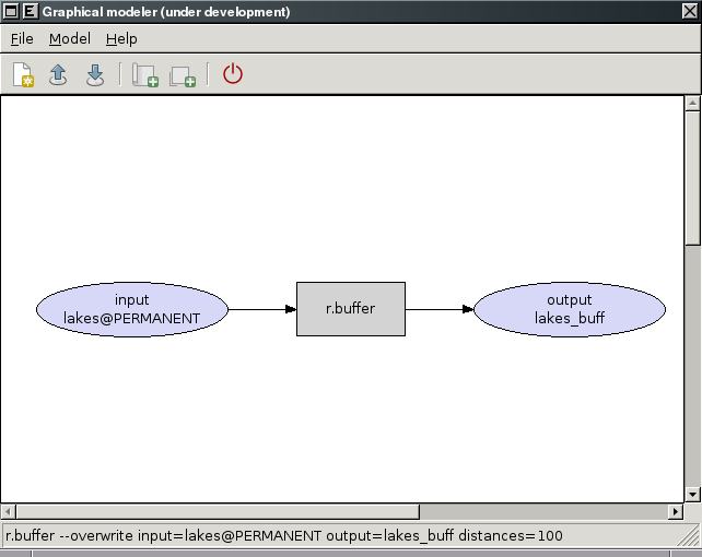
Experimental prototype of Graphical Modeler
-
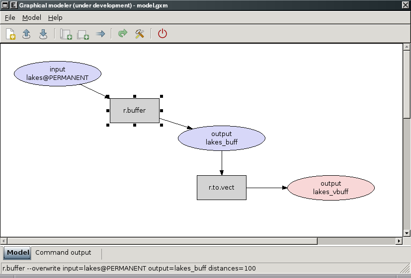
Experimental prototype of Graphical Modeler
-
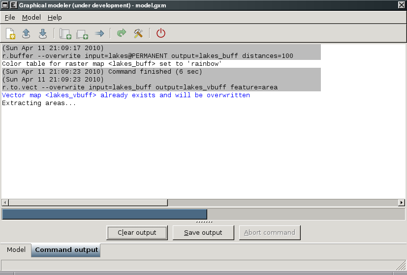
Experimental prototype of Graphical Modeler
-
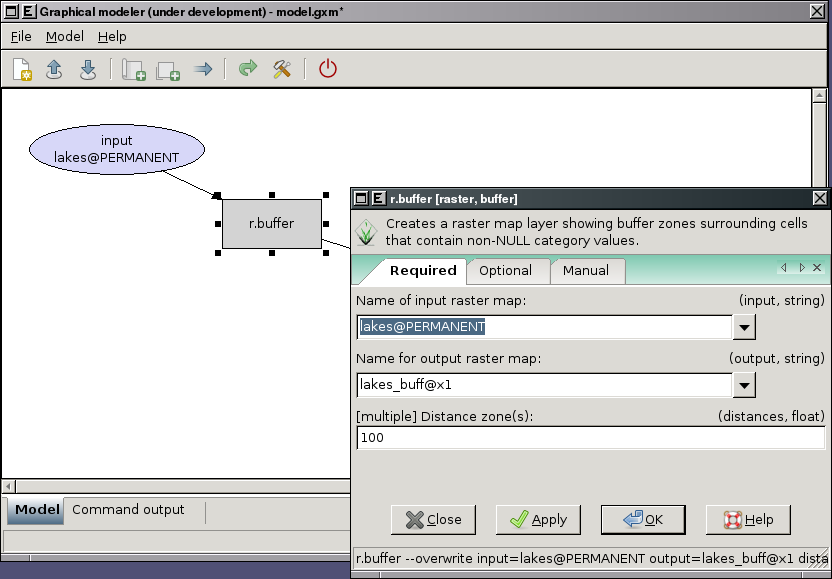
Experimental prototype of Graphical Modeler
-
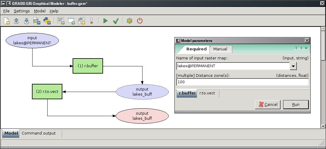
Graphical Modeler: run parametrized model
-
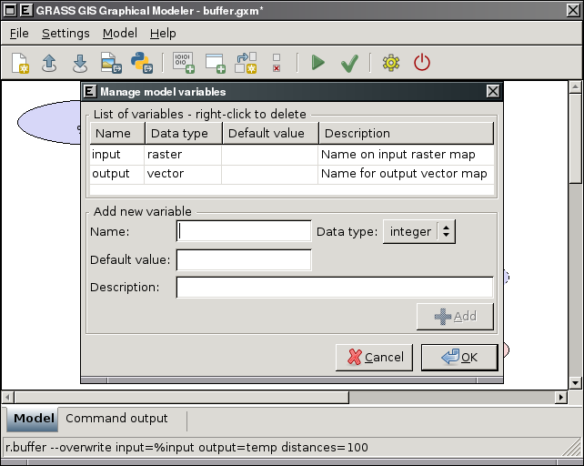
Graphical Modeler: define model variables
-
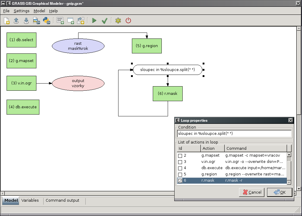
Graphical Modeler: define loops in the model
-
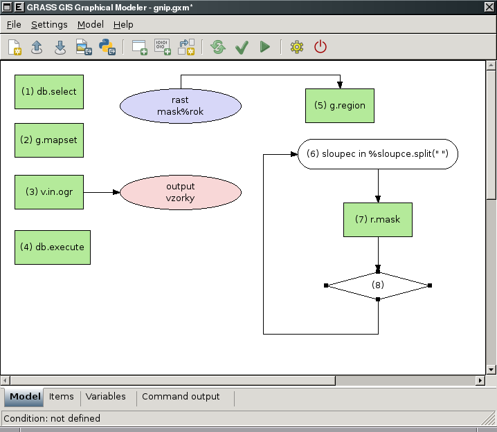
Graphical Modeler: define if/else statements in the model
-
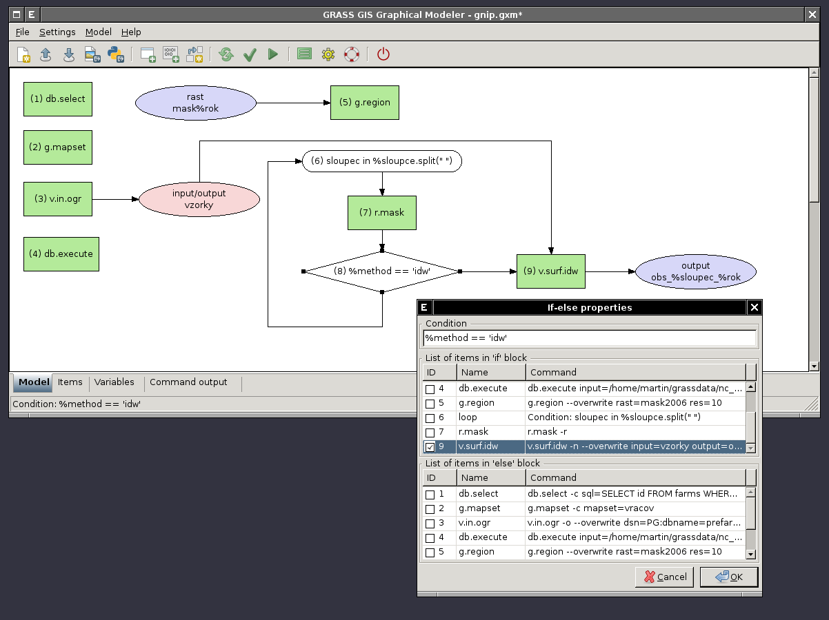
Graphical Modeler: define if/else statements in the model - show properties
-
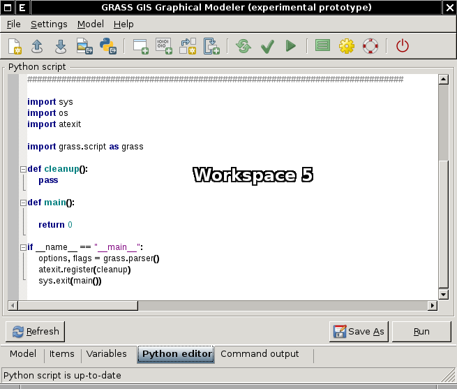
Graphical Modeler: Python editor


Video tutorials
1) create schema with name of input mapset
2) copy vector maps from selected mapset to the current and stores their attributes in SQLite database
3) exports GRASS vector maps to the selected PostGIS database
External links
Graphical modeller in action:
- Brief description GRASS Graphical Modeler (in Russian)
Other products: