Create concave hull: Difference between revisions
Jump to navigation
Jump to search
(cosmetics) |
m (finetuning) |
||
| Line 3: | Line 3: | ||
A: You can approximate a concave hull through the following steps: | A: You can approximate a concave hull through the following steps: | ||
=== GRASS 6 === | === GRASS GIS 6 === | ||
* create map of lines connecting all points (I find it easier to do this with {{cmd|v.net.visibility}}, but {{cmd|v.distance}} works also) | * create map of lines connecting all points (I find it easier to do this with {{cmd|v.net.visibility}}, but {{cmd|v.distance}} works also) | ||
* add a table with a column 'cat' and a column 'length double precision' and categories to these lines ({{cmd|v.db.addtable}}, {{cmd|v.category}}) | * add a table with a column 'cat' and a column 'length double precision' and categories to these lines ({{cmd|v.db.addtable}}, {{cmd|v.category}}) | ||
| Line 14: | Line 14: | ||
* dissolve the areas into one ({{cmd|v.dissolve}}) | * dissolve the areas into one ({{cmd|v.dissolve}}) | ||
=== GRASS 7 === | === GRASS GIS 7 === | ||
The addon {{AddonSrc|vector|v.concave.hull|version=7}} creates a concave hull using Delaunay triangulation. | The addon {{AddonCmd|v.concave.hull}} ({{AddonSrc|vector|v.concave.hull|version=7}}) creates a concave hull using Delaunay triangulation. | ||
The image shows the results: | The image shows the results: | ||
Latest revision as of 13:45, 3 June 2015
Q: I have a set of points and would like to compute the concave hull of it (this is not the convex hull as done by v.hull):
A: You can approximate a concave hull through the following steps:
GRASS GIS 6
- create map of lines connecting all points (I find it easier to do this with v.net.visibility, but v.distance works also)
- add a table with a column 'cat' and a column 'length double precision' and categories to these lines (v.db.addtable, v.category)
- upload the length of each line to the table (v.to.db)
- visually identify a length threshold above which the lines should not be used
- extract only those lines below that threshold (v.extract where="length<MAXLENGTH)
- convert the lines to boundaries (v.type)
- break overlapping lines (v.clean tool=break, there shouldn't be any duplicate lines, but just in case you can also use rmdupl)
- add centroids with the same category value to the boundaries (v.centroids step=0)
- dissolve the areas into one (v.dissolve)
GRASS GIS 7
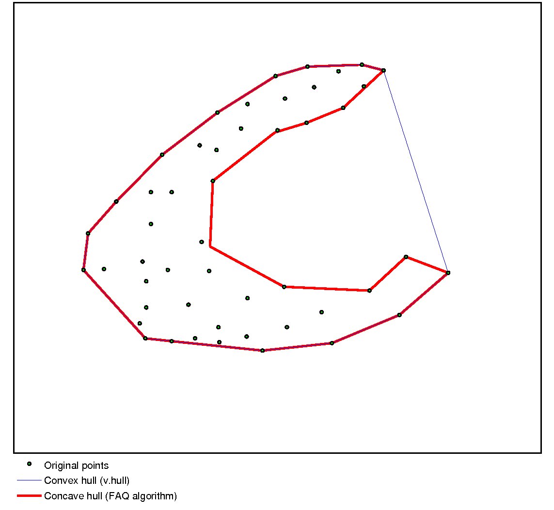
The addon v.concave.hull (v.concave.hull (src)) creates a concave hull using Delaunay triangulation.
The image shows the results:
