User:NikosA
Nikos Alexandris
Other userpages
Contact
nik at nikosalexandris dot net
To Do
Convert shell scripts to Python
- convert ASTER L1B Digital Numbers to Radiances/Reflectances (see below)
http://grasswiki.osgeo.org/wiki/IKONOS#Automatising_Conversionsi.ikonos.toar (Python script for G7)- http://grasswiki.osgeo.org/wiki/QuickBird#Automatising_Conversions
- http://grasswiki.osgeo.org/wiki/WorldView#Automatising_Conversions
- GeoEye?
Remote Sensing Stuff
High Pass Filter Additive Image Fusion
ASTER L1B
Shell script to convert ASTER L1B Digital Numbers to Radiances/Reflectances
#!/bin/bash

# Trikala, Greece | 27/28. Oct. 2013

# Converting ASTER L1B VNIR & SWIR DNs to Radiances/Reflectances
  # Note, conversion for TIRs not implemented!


# HardCoded MetaData! ### Adjust as Required #################################
                                                                             #

  # π, first 11 decimals
  PI=3.14159265358
                                                                             #
  # Acquisition's Day of Year and estimated Earth-Sun Distance
  DOY=44; ESD=0.98735
                                                                             #
  # Sun Zenith Angle based on the acquisition's Sun Elevation Angle
  SEA=59.993192; SZA=$(echo "90 - ${SEA}" | bc )
                                                                             #
  # some echo
  echo "Acquisition-specific parameters"
  echo "Day of Year: ${DOY}, Earth-Sun Distance: ${ESD}, Sun Zenith Angle: ${SZA}"
  echo -e "\n"

                                                                             #
#
######################################################## HardCoded MetaData! #


# Product Description ########################################################
                                                                             #

# # This Level 1B product contains radiometrically calibrated and geometrically
# # coregistered data for all ASTER channels. This product is created by applying
# # the radiometric and geometric coefficients to the Level 1A data. The bands have
# # been coregistered both between and within telescopes, and the data have been
# # resampled to apply the geometric corrections. As for the Level 1A product, these
# # Level 1B radiances are generated at 15m, 30m, and 90m resolutions corresponding
# # to the VNIR, SWIR, and TIR channels. Calibrated, at-sensor radiances are given
# # in W/(m 2 ・ mm ・ sr). This product serves as input to derived geophysical
# # products.

# Products Summary

# # Resolution : 15, 30, 90 m (VNIR, SWIR, TIR, respectively)
# # Input Band: VNIR, SWIR, TIR
# # Production : 310 scenes per day
# # Science Team Contact : H. Fujisada

#
##############################################################################


# Variables and Constants ####################################################

# check command line parameters
if [ -z "${2}" ] ;
then
echo "List the acquisition's Gain States for the VNIR & SWIR spectral bands, i.e. one of the \"High, Normal, L1 and L2\" separated by space."
echo "Usage: $0 [High High Normal Normal Normal Normal Normal Normal Normal Normal] "
exit 1
fi

# read Gain States
GAINSTATE_1=${1}
GAINSTATE_2=${2}
GAINSTATE_3N=${3}
GAINSTATE_3B=${4}
GAINSTATE_4=${5}
GAINSTATE_5=${6}
GAINSTATE_6=${7}
GAINSTATE_7=${8}
GAINSTATE_8=${9}
GAINSTATE_9=${10}


# Calculated Unit Conversion Coefficients ( W / m^2 / sr / um ) ##############
                                                                             #
# Source: "How to calculate reflectance and temperature using ASTER data",
  # 	Prepared by Abduwasit Ghulam, September 2009
# Source (2):
  #	<http://www.gis.slu.edu/RS/ASTER_Reflectance_Temperature_Calculation.php>
# Source (3):
  #	<http://www.science.aster.ersdac.jspacesystems.or.jp/en/documnts/users_guide/part2/05_03.html>

# VNIR Bands
B1_High=0.676	;	B1_Normal=1.688	;	B1_Low1=2.25
B2_High=0.708	;	B2_Normal=1.415	;	B2_Low1=1.89
B3N_High=0.423	;	B3N_Normal=0.862 ;	B3N_Low1=1.15
B3B_High=0.423	;	B3B_Normal=0.862 ;	B3B_Lo1=1.15

# SWIR Bands
B4_High=0.1087	;	B4_Normal=0.2174	;	B4_Low1=0.290	;	B4_Low2=0.290
B5_High=0.0348	;	B5_Normal=0.0696	;	B5_Low1=0.0925	;	B5_Low2=0.409
B6_High=0.0313	;	B6_Normal=0.0625	;	B6_Low1=0.0830	;	B6_Low2=0.390
B7_High=0.0299	;	B7_Normal=0.0597	;	B7_Low1=0.0795	;	B7_Low2=0.332
B8_High=0.0209	;	B8_Normal=0.0417	;	B8_Low1=0.0556	;	B8_Low2=0.245
B9_High=0.0159	;	B9_Normal=0.0318	;	B9_Low1=0.0424	;	B9_Low2=0.265

# TIR Bands
B10_Normal=0.006822
B11_Normal=0.006780
B12_Normal=0.006590
B13_Normal=0.005693
B14_Normal=0.005225

#
##############################################################################


# Missing: Spectral Band Effective Bandwidth, Δλ #############################
                                                                             #
#
# Some Effective Wavelengths required for the TIRs conversions... ToDo!
#

#
##############################################################################


# Band-Averaged Solar Spectral Irradiance [W/sq.m./micro-m] ( Esun ) #########
                                                                             #

# Commented Columns: 1st: Band #, 2nd: Smith, 3rd: Thome (A), 4th: Thome (B)

B1_Esun=1845.99	#	1	;	1845.99	;	1847	;	1848
B2_Esun=1555.74	#	2	;	1555.74	;	1553	;	1549
B3N_Esun=1119.47#	3N	;	1119.47	;	1118	;	1114
B3B_Esun=1119.47#	3B	;	1119.47	;	1118	;	1114

B4_Esun=231.25	#	4	;	231.25	;	232.5	;	225.4
B5_Esun=79.81	#	5	;	79.81	;	80.32	;	86.63
B6_Esun=74.99	#	6	;	74.99	;	74.92	;	81.85
B7_Esun=68.66	#	7	;	68.66	;	69.20	;	74.85
B8_Esun=59.74	#	8	;	59.74	;	59.82	;	66.49
B9_Esun=56.92	#	9	;	56.92	;	57.32	;	59.85

# 10
# 11
# 12
# 13
# 14

#
##################################################################### Esun ###


# loop over VNIR & SWIR bands
for BAND in 1 2 3N 3B 4 5 6 7 8 9 ; do

  # some echo
  echo -e "Processing spectral band \"${BAND}\""

  # set band parameters as variables
  eval GAINSTATE=GAINSTATE_${BAND}
  eval CUCC="B${BAND}_${!GAINSTATE}"

  echo "* Instructed Gain State: ${!GAINSTATE} // Corresponding Conversion Coefficient: ${!CUCC}"

  # set region
#   echo "* Region matching the ${BAND} spectral band."
  g.region rast=${BAND}_DNs

  # conversion of ASTER L1B DNs to Radiance (32-bit calculations)
  echo "* Converting Digital Numbers to Spectral Radiances..." | tr -d "\n"
  r.mapcalc "${BAND}_Radiance = ( ${BAND}_DNs - 1 ) * double(${!CUCC})"

  # report range
  echo "* Range of calculated Spectral Radiances: " | tr -d "\n"
  # r.info -r "${BAND}_Radiance"
  r.info -r "${BAND}_Radiance" | tr "\n" "," | cut -d"," -f1,2 | sed 's/,/,\ /'
  echo

  # add info
  r.support map=${BAND}_Radiance \
  title="" \
  units="W / sq.m. / μm / ster" \
  description="Band `echo ${BAND}` Top-of-Atmosphere Spectral Radiance [W/m^2/sr/μm]" \
  source1='Update This Field...'

  # Esun
  eval BAND_Esun="B${BAND}_Esun"

  # some echo
  echo -e "* Esun= ${!BAND_Esun} // Earth Sun Distance= ${ESD} // Solar Zenith Angle= ${SZA}"

  # calculate ToAR
  echo "* Converting Radiances to Top of Atmosphere Reflectances..." | tr -d "\n"
  r.mapcalc "${BAND}_ToAR = \
	( ${PI} * ${BAND}_Radiance * ${ESD}^2 ) / ( ${!BAND_Esun} * cos(${SZA}) )"

  # report range
  echo "* Range of calculated Reflectances: " | tr -d "\n"
  r.info -r ${BAND}_ToAR | tr "\n" "," | cut -d"," -f1,2 | sed 's/,/,\ /'

  # add some metadata
  r.support map=${BAND}_ToAR \
  title="echo Band ${BAND} (Top of Atmosphere Reflectance)" \
  units="Unitless Reflectance" \
  description="Top of Atmosphere band `echo ${BAND}` spectral Reflectance (unitless)" \
  source1='"Update This Field...' \
  source2="Update This Field..." \
  history="Pi=3.14159265358; Gain=${!GAINSTATE}; CUCC= ${!CUCC}; ESD=${ESD}; Esun=${!BAND_Esun}; SZA=${SZA}"

  echo -e "\n"

done
Screenshots
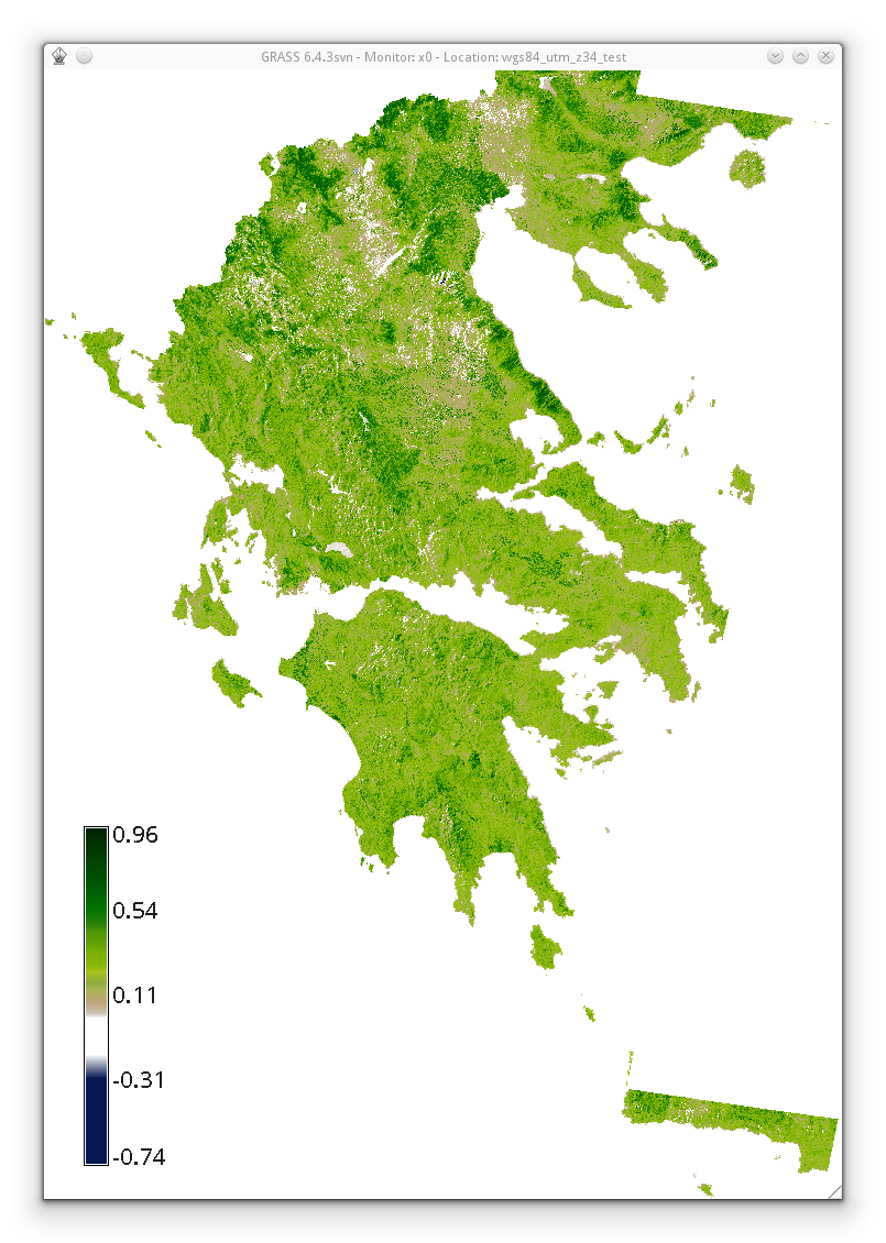
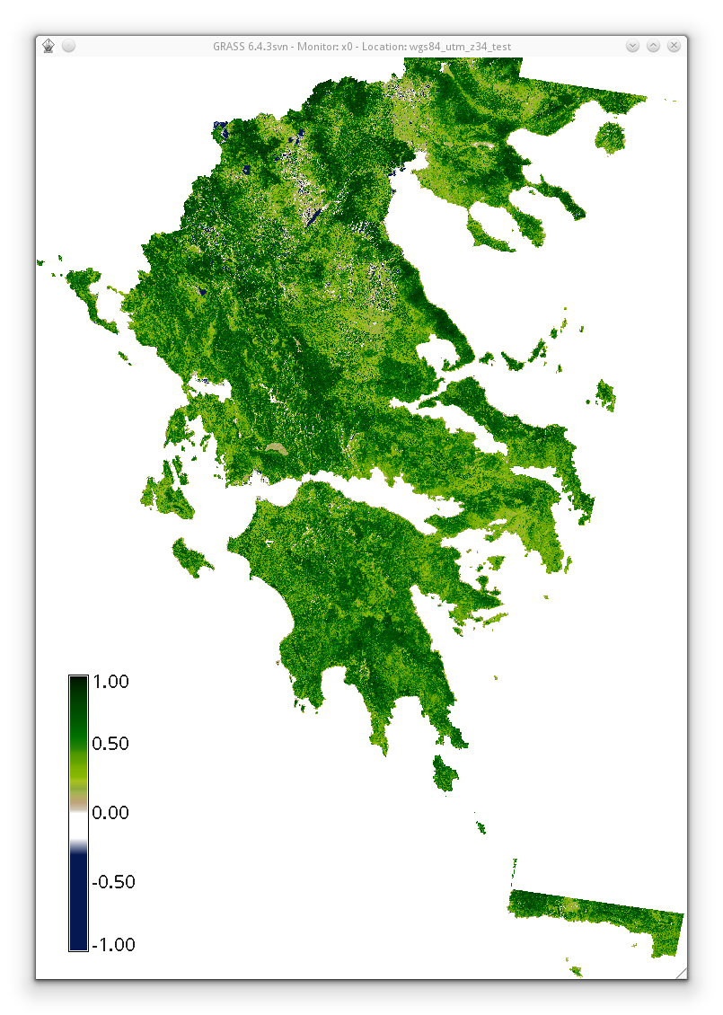
EVI2 vs NDVI
EVI2 vs. NDVI
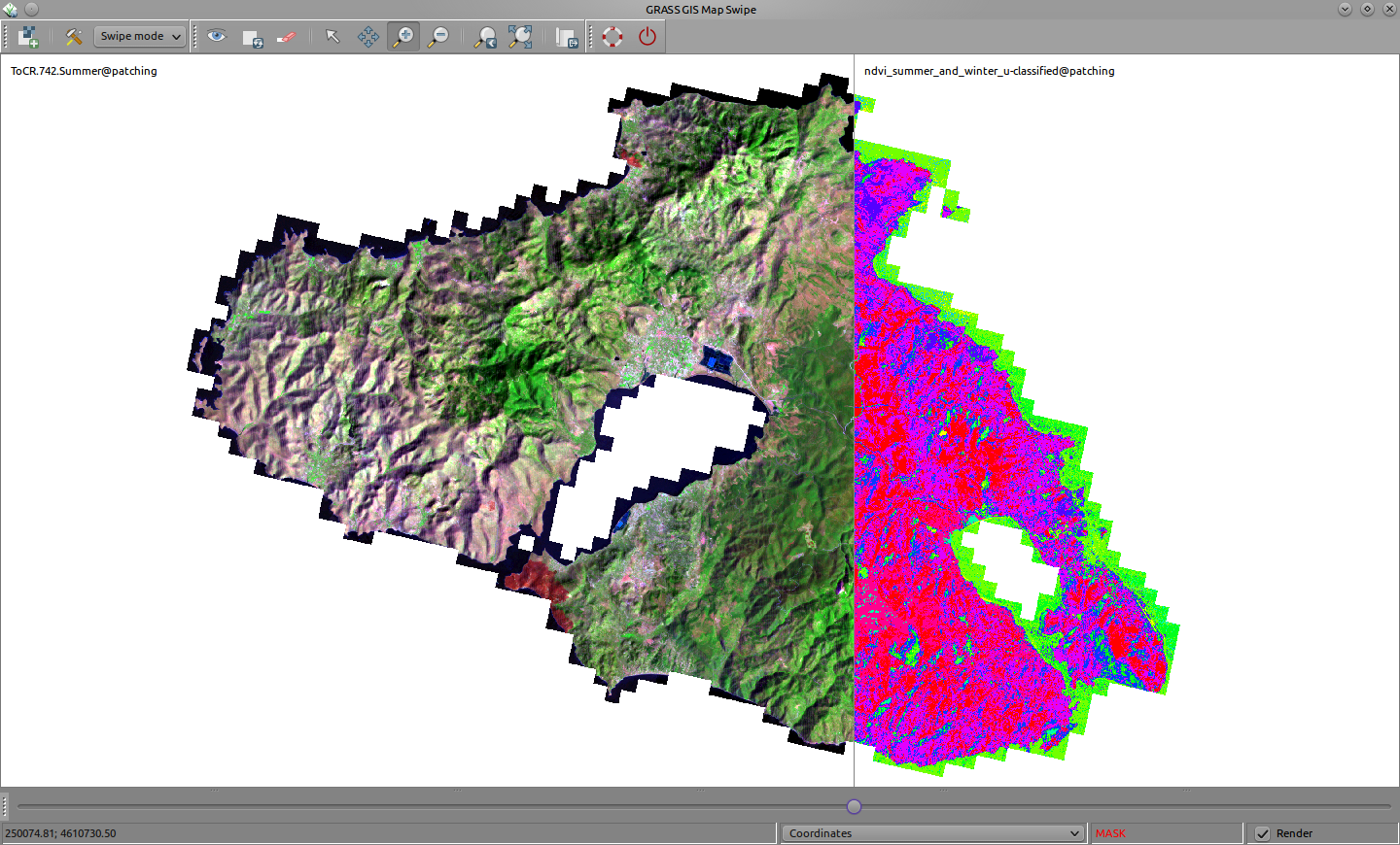
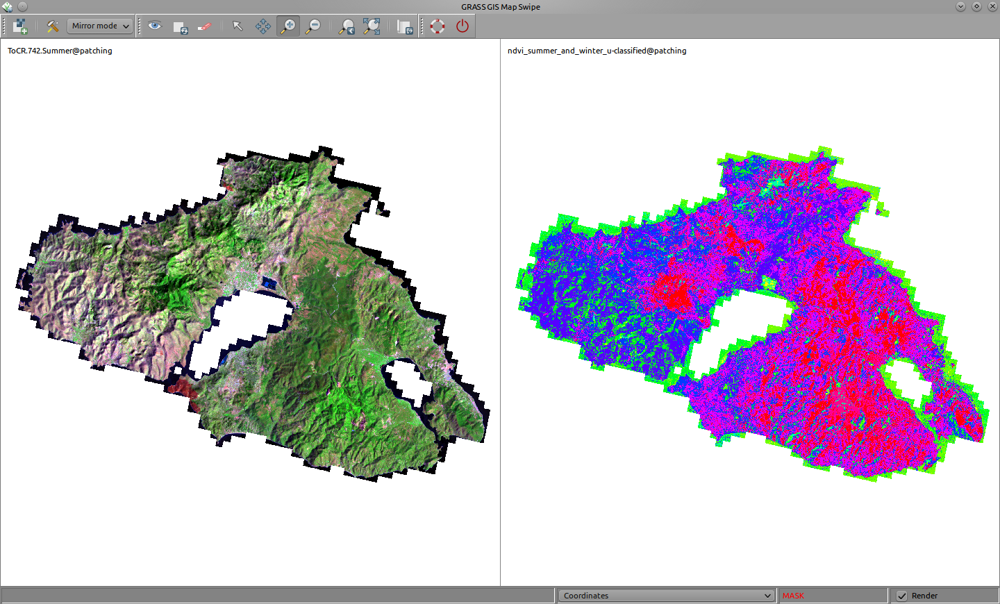
Map Swipe (g.gui.mapswipe)
Recent addition in GRASS 70: http://grasswiki.osgeo.org/wiki/WxGUI_Map_Swipe
Scratching ideas for the GRASS-wiki
Various ideas discussed with <http://archi.tect.gr/>
Testing on http://grasswiki.osgeo.org/wiki/User:NikosA/common.css
GRASS-Wiki content maintainance
Various issues
To list...
Upon the use of Templates =
True, content is the foremost essence. In order to ease off content reviewing and management, WikiMedia, upon which the GRASS-Wiki relies, has the Special Pages section. Still, there is a significant need for user input to control the content. Towards a better and easier maintainance mechanism, it might be useful to setup as much as possible Templates which can be used easily across the entire GRASS-Wiki to mark pages and notify readers.
For example, it is not always easy to discriminate between truely OutDated content or simply content that refers to an older version of GRASS. In this case, a notification indicating that the content refers to an older version of GRASS (be it GRASS 5.x) would be, perhaps, a smarter solution than simly marking the page as old. Alternatively, or in addition to a Template, a corresponding Category should be created.
There is, in my opinion, a natural need for some concrete, short, useful set of basic Templates. There are already several Templates. However, the influence in organising the content will be more effective, if the Templates adhere to a basic set of universal rules (think of appearance that invites to get involved) and delivers in a concrete way the "message" (think of short, rational, meaningful notification and/or explanations).
Towards this scope, I support the creation and collection of Templates to cover, if not all, at least the very basic needs to help tag the content.
GRASS-Wiki styling
- style the tab-bar to approach the grass-gis website?
Ideas for an alternative GRASS-Wiki logogram
 |
 |
 |
 |
GRASS-Wiki native colors
Should GRASS-Wiki pages wear GRASS' native colors?
Or else... ?
Some random example: light grey font-color (#dcdcdc), green border (#4da948)
Better typography
Review and possibly alter:
- linespacing (between hierarchy elements!)
- indentation of code blocks -- might improve readability
- (non-code) text wrapping -- narrower body text column, easier to read
- move ToC on the right, make it fixed! This will "save" some long pages!
- move Categories right below the ToC -- also useful inside long pages
Some proof-of-clean-typography screenshots
First impressions of a custom css designed by <http://archi.tect.gr/>
Holistic Look & Feel
GRASS-Wiki, better typography!
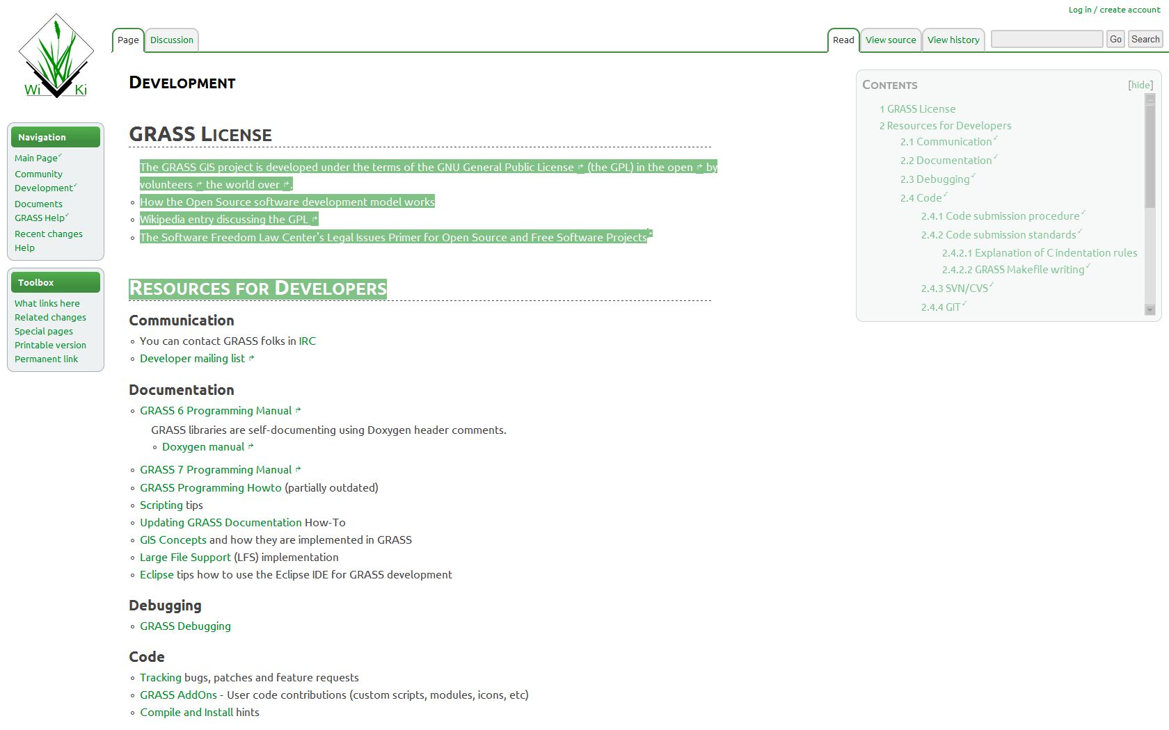
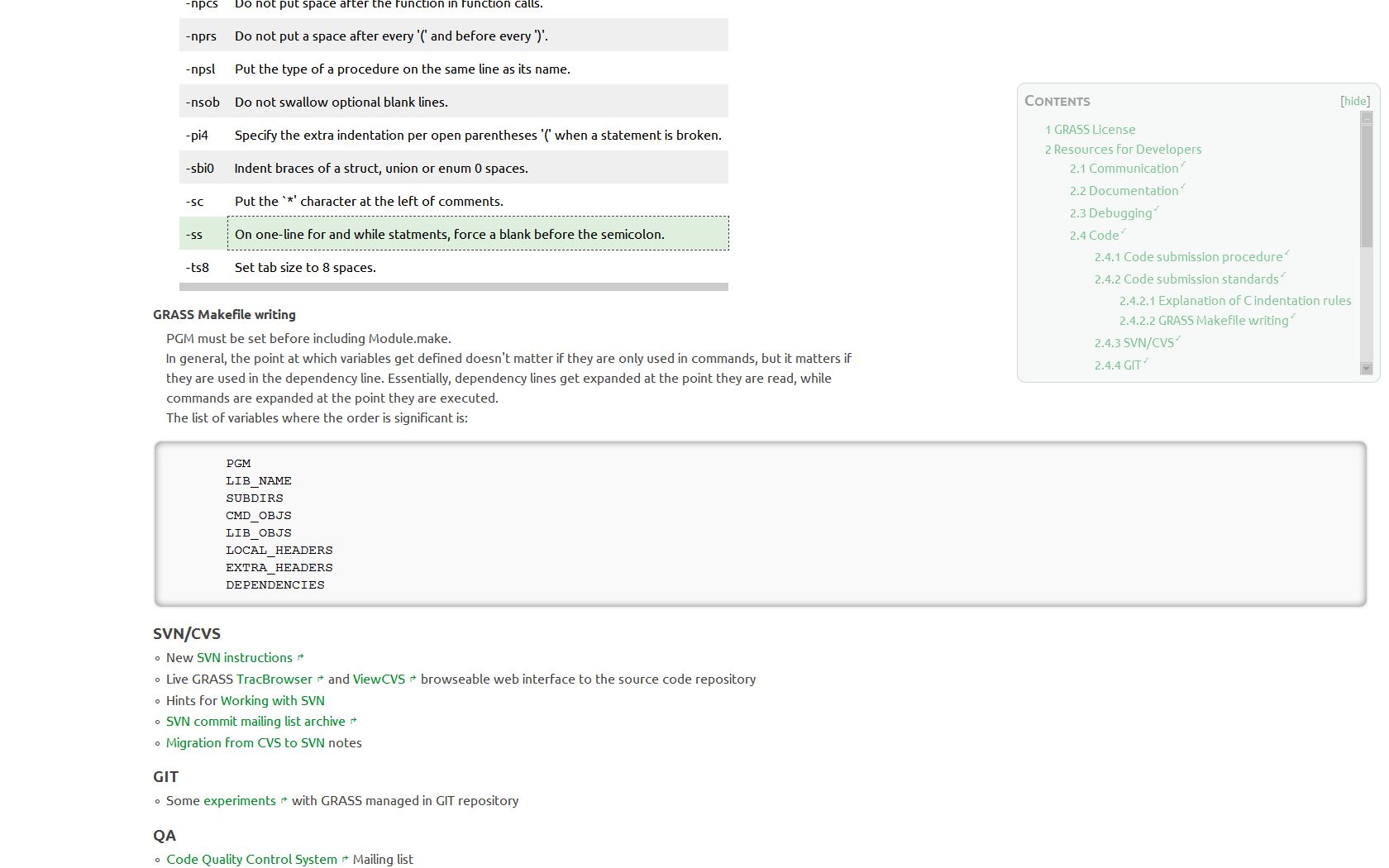
Elements
The very left column is like a Wiki's connection terminal -- it should look and act like that for the user. It should also clearly state GRASS-GIS' identity.
 |
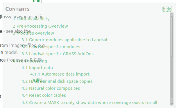
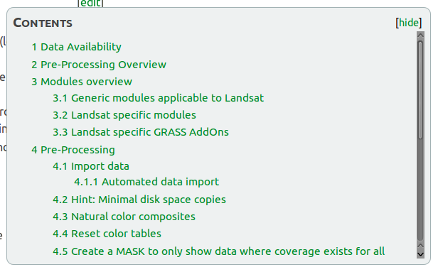
Better typography is not only about aesthetics. It's about readability and making things easier to study. The screenshot below speaks for itself. Hint: the ToC is always accessible, following the user's eyes!
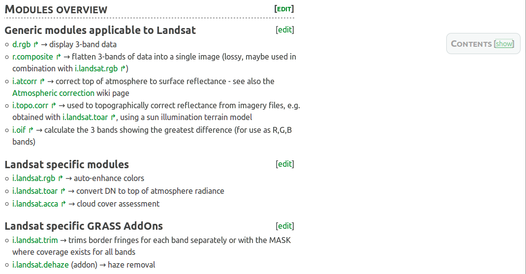
The Table of Contents is a must have for page-content organisation and navigation. Can it be *always* accessible while not distracting the user from reading when not required? Yes, it can.
 |
 |
The Categories bar, finally can receive the attention it deserves!

Related sources:
Distance between ToC and 1st Section
Match Media-Wiki's bigger distance from ToC to 1st Section!
 |
 |
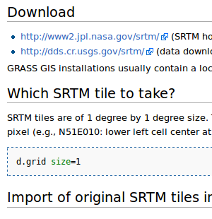
Distance between Sections
Seems to be the same, for some reason, anyhow, some lengthy GRASS-pages look overfilled/noisy!
 |
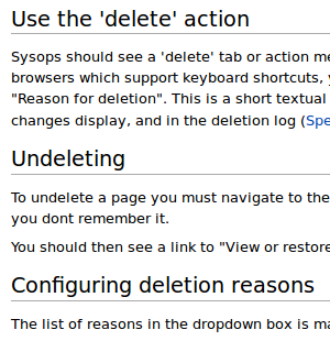 |
The GRASS-Wiki Special Pages are nicely structured, easy to read. Is there, and what exactly, a formatting difference with the "dafault" GRASS-Wiki pages?
