ISPRS XXIII Congress 2016: GRASS related workshops and presentations
Jump to navigation
Jump to search
Introduction
ISPRS XXIII Congress 2016 (International Society for Photogrammetry and Remote Sensing), Prague, Czech Republic, July 12-19, 2016, http://www.isprs2016-prague.com/
Presentations
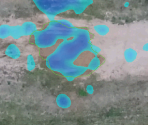
Overland flow analysis using time series of sUAS-derived elevation models

- Justyna Jeziorska, Helena Mitasova, Anna Petrasova, Vaclav Petras, Darshan Divakaran, Thomas Zajkowski (2016): Overland flow analysis using time series of sUAS-derived elevation models, ISPRS
- Short Abstract: We propose applying the robust overland flow algorithm based on the path sampling technique for mapping flow paths in the arable land on a small test site in Raleigh, North Carolina. By comparing a time series of five flights in 2015 with the results of a simulation based on the most recent lidar derived DEM (2013), we show that the sUAS based data is suitable for overland flow predictions and has several advantages over the lidar data.
- Abstract: With the advent of the innovative techniques for generating high temporal and spatial resolution terrain models from Unmanned Aerial Systems (UAS) imagery, it has become possible to precisely map overland flow patterns. Furthermore, the process has become more affordable and efficient through the coupling of small UAS (sUAS) that are easily deployed with Structure from Motion (SfM) algorithms that can efficiently derive 3D data from RGB imagery captured with consumer grade cameras. We propose applying the robust overland flow algorithm based on the path sampling technique for mapping flow paths in the arable land on a small test site in Raleigh, North Carolina. By comparing a time series of five flights in 2015 with the results of a simulation based on the most recent lidar derived DEM (2013), we show that the sUAS based data is suitable for overland flow predictions and has several advantages over the lidar data. The sUAS based data captures preferential flow along tillage and more accurately represents gullies. Furthermore the simulated water flow patterns over the sUAS based terrain models are consistent throughout the year. When terrain models are reconstructed only from sUAS captured RGB imagery, however, water flow modeling is only appropriate in areas with sparse or no vegetation cover.
- Keywords: UAS, UAV, sUAS, lidar, digital elevation model, overland flow modeling, path sampling
- Part of ThS 2 - Operational Remote Sensing Application Services
- Full Paper for ISPRS Annals of the Photogrammetry, Remote Sensing and Spatial Information Sciences (ISPRS Annals): ISPRS Annals, ResearchGate
- Related modules: v.in.lidar, v.surf.rst, r.sim.water
Tangible Landscape: Cognitively grasping the flow of water

- Brendan Alexander Harmon, Anna Petrasova, Vaclav Petras, Helena Mitasova, Ross K. Meentemeyer (2016): Spatial cognition in tangible computing, ISPRS
- Short Abstract: We have designed Tangible Landscape, a tangible interface powered by an open source geographic information system (GRASS GIS), that physically manifests data so that users can naturally shape topography and interact with simulated processes with their hands in order to make observations, generate and test hypotheses, and make inferences about scientific phenomena in a rapid, iterative process. We ran a terrain modeling experiment with 39 participants and found that tangible interfaces like this can effectively enhance spatial performance by offloading cognitive processes onto computers and our bodies.
- Abstract: Complex spatial forms like topography can be challenging to understand, much less intentionally shape, given the heavy cognitive load of visualizing and manipulating 3D form. This cognitive work can be offloaded onto computers through 3D geospatial modeling, analysis, and simulation. Interacting with computers, however, can also be challenging requiring training and highly abstract thinking that adds a new cognitive burden. Tangible computing – an emerging paradigm of human-computer interaction in which data is physically manifested so that users can feel it and directly manipulate it – aims to offload this added cognitive work onto the body. We have designed Tangible Landscape, a tangible interface powered by an open source geographic information system (GRASS GIS), so that users can naturally shape topography and interact with simulated processes with their hands in order to make observations, generate and test hypotheses, and make inferences about scientific phenomena in a rapid, iterative process. Conceptually Tangible Landscape couples a malleable physical model with a digital model of a landscape through an continuous cycle of 3D scanning, geospatial modeling, and projection. We ran a terrain modeling experiment with 39 participants to test whether tangible interfaces like this can effectively enhance spatial performance by offloading cognitive processes onto computers and our bodies. We used topographic and morphometric parameters, differencing, hydrological simulation, and spatial statistics to quantitatively assess spatial performance. We found that Tangible Landscape generally enhanced 3D spatial performance, but future work is need to understand the role of cognition, affect, motivation, and metacognition in tangible computing.
- Keywords: Embodied cognition, spatial thinking, spatial performance, tangible user interfaces, user experiment, 3D
- Part of ThS 16 - Perceptual and cognitive experiments with imagery and 3D models
- Website: http://tangible-landscape.github.io/
- Paper: ISPRS Archives, ResearchGate
Open source approach to urban growth simulation

- Anna Petrasova, Vaclav Petras, Derek Van Berkel, Brendan A. Harmon, Helena Mitasova, Ross K. Meentemeyer (2016): Open source approach to urban growth simulation, ISPRS
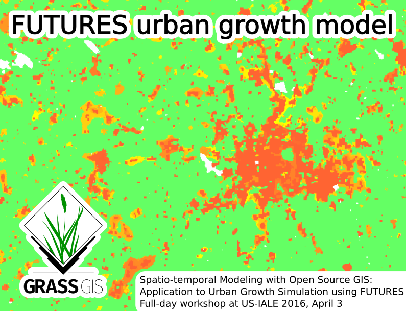
- Short Abstract: Urban growth scenario simulation is a powerful tool for exploring impacts of urbanization on the landscape and empowering planners to make informed decisions. We present FUTURES (FUTure Urban-Regional Environment Simulation) - a patch-based, stochastic, multi-level land change modeling framework as a case showing how an originally closed and inaccessible model can benefit from integration into open source GIS. We apply FUTURES to explore trade-offs of urban growth scenarios using Tangible Landscape, a collaborative modeling platform with tangible interaction coupling a physical model with GIS.
- Abstract: Spatial patterns of land use change due to urbanization and its impact on the landscape are the subject of ongoing research. Urban growth scenario simulation is a powerful tool for exploring these impacts and empowering planners to make informed decisions. We present FUTURES (FUTure Urban-Regional Environment Simulation) – a patch-based, stochastic, multi-level land change modeling framework as a case showing how an originally closed and inaccessible model can benefit from integration into open source GIS. We will describe our motivation for releasing this project as open source and the advantages of integrating it with GRASS GIS, a free, libre and open source GIS and research platform for geospatial domain. GRASS GIS provides efficient libraries for FUTURES model development as well as standard GIS tools and graphical user interface for model users. To support adoption of FUTURES, we developed a tutorial and a dataset for North Carolina, compatible with the official GRASS GIS sample dataset. Both tutorial and documentation leverage the existing GRASS GIS infrastructure. Releasing FUTURES as a GRASS GIS addon simplifies the distribution of FUTURES across all main operating systems and ensures the maintainability of our project in the future. By providing this simple-to-use model with documentation and the sample dataset, we enable researchers to experiment with the model, explore its potential or even modify the model for their applications. Open source FUTURES was applied in different contexts, including coupling with ecosystem services in mountainous parts of North Carolina, projection of urban spread in South Atlantic USA megaregion and most recently exploring the trade-offs of urban growth scenarios using Tangible Landscape, a collaborative modeling platform with tangible interaction coupling a physical model with GIS.
- Keywords: GRASS GIS, FUTURES, urbanization, open science, simulation
- Part of Special Session: SpS 10 - FOSS4G: FOSS4G Session (coorganized with OSGeo)
- Related modules: r.futures, r.futures.pga, ...
- Paper: ISPRS Archives, ResearchGate
Processing UAV and lidar point clouds in GRASS GIS

- Vaclav Petras, Anna Petrasova, Justyna Jeziorska, Helena Mitasova (2016): Processing UAV and lidar point clouds in GRASS GIS, ISPRS
- Short Abstract: Current methods of acquiring Earth surface data, namely lidar and UAV imagery, are generating large point clouds which vary in their properties such as density or quality. We present a set of tools with applications including but not limited to using lidar data and 3D rasters to support vegetation classification, obtaining digital surface model from UAV data, and measuring small physical models using low-cost 3D scanner. The tools are open source and implemented in a well-established open source project GRASS GIS.
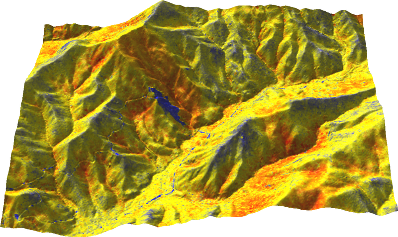
- Abstract: Today’s methods of acquiring Earth surface data, namely lidar and unmanned aerial vehicle (UAV) imagery, are non-selectively collecting or generating large amounts of points. Point clouds from different sources vary in their properties such as number of returns, density, or quality. We present a set of tools with applications for different types of points clouds obtained by a lidar scanner, structure from motion technique (SfM), and a low-cost 3D scanner. To take advantage of vertical structure of multiple return lidar point clouds, we demonstrate tools to process them using 3D raster techniques which allow, for example, developing custom vegetation classification methods. Dense point clouds obtained from UAV imagery, often containing redundant points, can be decimated using various techniques before further processing. We implemented and compared several decimation techniques in regard to their performance and the final digital surface model (DSM). Finally, we will describe processing of a point cloud from a low-cost 3D scanner, namely Microsoft Kinect, and its application for interaction with physical models. All the presented tools are open source and integrated in GRASS GIS, a multi-purpose open source GIS with remote sensing capabilities. The tools integrate with other open source projects, specifically Point Data Abstraction Library (PDAL), Point Cloud Library (PCL), and OpenKinect libfreenect2 library to benefit from the open source point cloud ecosystem. The implementation in GRASS GIS ensures long term maintenance and reproducibility by the scientific community but also by the original authors themselves.
- Keywords: 3D rasters, decimation, LAS, PDAL, PCL, Kinect
- Part of Special Session: SpS 10 - FOSS4G: FOSS4G Session (coorganized with OSGeo)
- Related modules: r.in.lidar, v.in.lidar, r3.in.lidar, v.surf.rst
- Paper: ISPRS Archives, ResearchGate
An Automated GRASS-Based Procedure to Assess the Geometrical Accuracy of the OpenStreetMap Paris Road Network

- Maria Antonia Brovelli, Marco Minghini, Monia Elisa Molinari (2016): An Automated GRASS-Based Procedure to Assess the Geometrical Accuracy of the OpenStreetMap Paris Road Network, ISPRS
- Short Abstract: OpenStreetMap (OSM) is an excellent example of an open-license spatial database. But what is the quality of OSM road network datasets compared to authoritative counterparts? We present a set of GRASS GIS modules which allow users : i) a preliminary comparison between OSM and authoritative datasets, ii) a geometric preprocessing of OSM dataset and iii) the evaluation of OSM spatial accuracy using a grid-based approach. We propose also the results of the application of this set of modules to the case study of Paris road network.
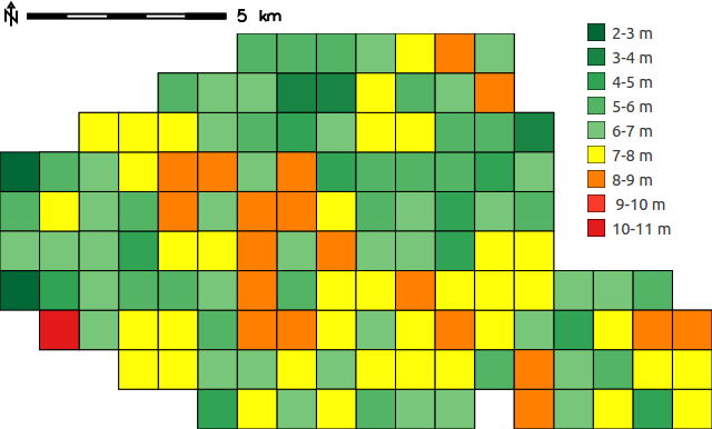
- Abstract: OpenStreetMap (OSM) is the largest spatial database of the world. One of the most frequently occurring geospatial elements within this database is the road network, whose quality is crucial for applications such as routing and navigation. Several methods have been proposed for the assessment of OSM road network quality, however they are often tightly coupled to the characteristics of the authoritative dataset involved in the comparison. This makes it hard to replicate and extend these methods. This study relies on an automated procedure which was recently developed for comparing OSM with any road network dataset. It is based on three Python modules for the open source GRASS GIS software and provides measures of OSM road network spatial accuracy and completeness. Provided that the user is familiar with the authoritative dataset used, he can adjust the values of the parameters involved thanks to the flexibility of the procedure. The method is applied to assess the quality of the Paris OSM road network dataset through a comparison against the French official dataset provided by the French National Institute of Geographic and Forest Information (IGN). The results show that the Paris OSM road network has both a high completeness and spatial accuracy. It has a greater length than the IGN road network, and is found to be suitable for applications requiring spatial accuracies up to 5-6 m. Also, the results confirm the flexibility of the procedure for supporting users in carrying out their own comparisons between OSM and reference road datasets.
- Keywords: Accuracy, FOSS4G, GRASS, Open data, OpenStreetMap, Road network, Volunteered Geographic Information
- Part of Special Session: SpS 10 - FOSS4G: FOSS4G Session (coorganized with OSGeo)
- Related modules: v.osm.precomp, v.osm.preproc, v.osm.acc
- Paper: ISPRS Archives, ResearchGate