File:GRASS FUTURES wxGUI display.png: Difference between revisions
Jump to navigation
Jump to search
(Layer Manager and Map Display overview. Annotations show how to add raster layer, query, add legend.) |
(No difference)
|
Latest revision as of 15:00, 16 March 2016
Layer Manager and Map Display overview. Annotations show how to add raster layer, query, add legend.
File history
Click on a date/time to view the file as it appeared at that time.
| Date/Time | Thumbnail | Dimensions | User | Comment | |
|---|---|---|---|---|---|
| current | 15:00, 16 March 2016 | 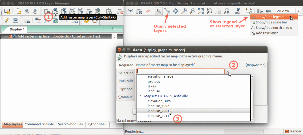 | 1,290 × 576 (138 KB) | Annakrat (talk | contribs) | Layer Manager and Map Display overview. Annotations show how to add raster layer, query, add legend. |
You cannot overwrite this file.
File usage
The following 7 pages use this file:
- Analytical data visualizations at ICC 2017
- Analytical data visualizations at ICC 2017/es
- FUTURES land-change modeling for evaluating innovative conservation scenarios
- From GRASS GIS novice to power user (workshop at FOSS4G Boston 2017)
- Unleash the power of GRASS GIS at US-IALE 2017
- Unleash the power of GRASS GIS at US-IALE 2017/es
- Workshop on urban growth modeling with FUTURES