File:Range on ground from north.png: Difference between revisions
Jump to navigation
Jump to search
⚠️Wenzeslaus (talk | contribs) (Range of z coordinates displayed on ground Author: Vaclav Petras http://wenzeslaus.github.io/grass-lidar-talks/ Dataset: Nantahala NF, NC: Forest Leaf Structure, Terrain and Hydrophysiology http://dx.doi.org/10.5069/G9HT2M76) |
(No difference)
|
Latest revision as of 16:49, 29 February 2016
Range of z coordinates displayed on ground
Author: Vaclav Petras
http://wenzeslaus.github.io/grass-lidar-talks/
Dataset: Nantahala NF, NC: Forest Leaf Structure, Terrain and Hydrophysiology
File history
Click on a date/time to view the file as it appeared at that time.
| Date/Time | Thumbnail | Dimensions | User | Comment | |
|---|---|---|---|---|---|
| current | 16:49, 29 February 2016 | 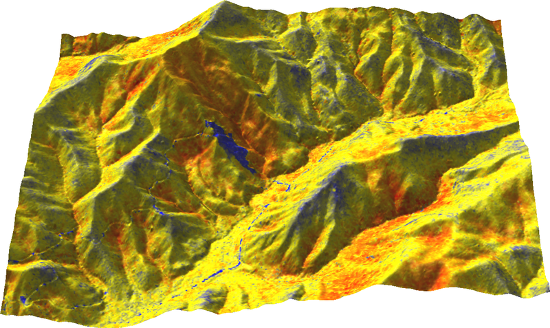 | 800 × 477 (578 KB) | ⚠️Wenzeslaus (talk | contribs) | Range of z coordinates displayed on ground Author: Vaclav Petras http://wenzeslaus.github.io/grass-lidar-talks/ Dataset: Nantahala NF, NC: Forest Leaf Structure, Terrain and Hydrophysiology http://dx.doi.org/10.5069/G9HT2M76 |
You cannot overwrite this file.
File usage
The following 4 pages use this file: